-
Tours
-
-
- Domestic Tours
-
-
- Resorts
- Car Rentals
- Destinations
- Getaways
- Hotels
- Tools
- * Workation
- * Tour Plans
- Blog
- List Property
- * Offers *


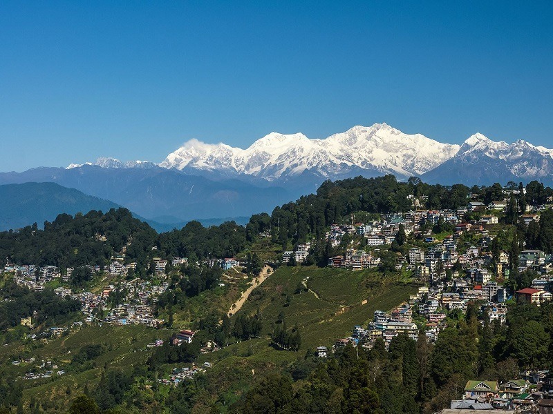
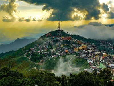
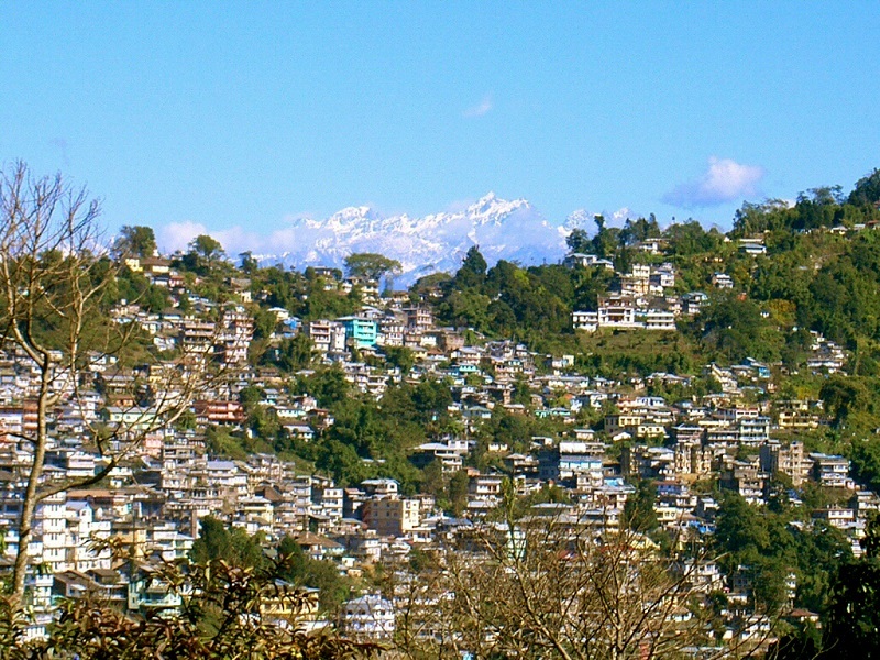
At a distance of 65 km from Siliguri, 98 km from Gangtok, 109 km from Jalpaiguri, 371 km from Manipur, 502 km from Guwahati, 503 km from Patna and 507 km from Kolkata, Darjeeling is a charming hill station located in the Shivalik hills of the lower Himalayas in West Bengal, India. Situated at an altitude of 6,700 feet, Darjeeling is one of the most popular tourist places in West Bengal and among the must include places in your honeymoon tour packages.
The name Darjeeling comes from two Tibetan words 'Dorje', meaning thunderbolt and 'ling', means a place or land. Before being invaded by the Gorkhas of Nepal in the 1790s, Darjeeling was largely under the Kingdom of Sikkim and native tribes named Lepchas were the original inhabitants of the place. Under the Sugauli Treaty of 1815 CE, Nepal yielded one-third of their lands to the British, who established Darjeeling as the summer capital of Bengal Presidency. During 19th century AD, they set up a sanatorium and a military depot in Darjeeling. Later, extensive tea plantations were established in the region by the British. After independence, in 1947, Darjeeling was merged with West Bengal.
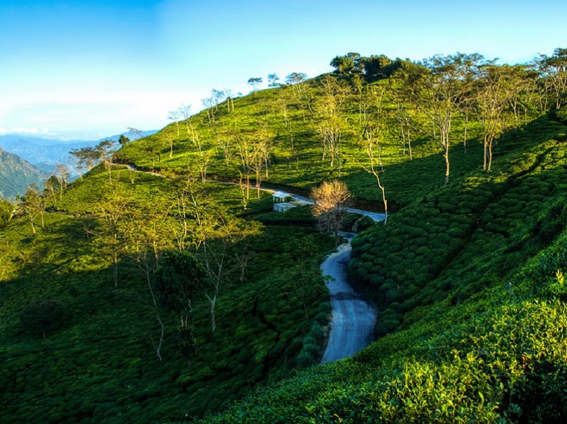
Amidst the backdrop of the mighty snow-clad Himalayan peaks, Darjeeling is famous for its tea plantations, spectacular views of snow-capped peaks and Darjeeling Himalayan Railway. The majestic Kanchenjunga, third highest ...
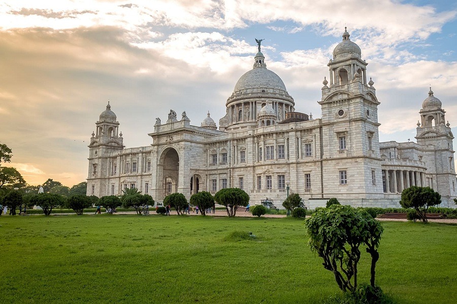
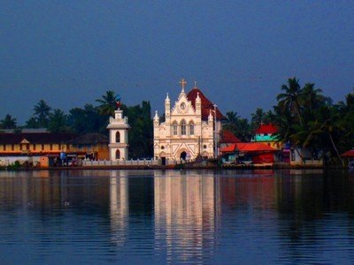
At a distance of 8 km from Howrah, 133 km from Kharagpur, 167 km from Durgapur, 251 km from Balasore, 270 km from Dhanbad, 289 km from Jamshedpur, 424 km from Cuttack, 449 km from Bhubaneswar, 480 km from Gaya, 550 km from Siliguri and 579 km from Patna, Kolkata is the capital city of the West Bengal, India. Formerly known as Calcutta, it is the second-largest city in India after Mumbai and among the most popular tourist places to visit in West Bengal.
Fondly called as the 'City of Joy', Kolkata is a vibrant 350-year-old metropolis located on India's Eastern Coast and has retained its quintessential charm despite modernization. It holds an important place in the economy, politics, and culture of India. The city is associated with some of the greatest thinkers, artists, filmmakers, and writers like Rabindranath Tagore, Bankim Chandra Chattopadhyay and Sarat Chandra Chattopadhyay and Satyajit Ray.
According to the historical evidence, the region in which the city stands has been inhabited for over two millennia. It is believed that Kalikata was the ancient name of the city and was derived from the Bengali word 'Kalikshetra', which means 'Ground of Goddess Kali.' Kolkata's recorded history began in 1690 when Job Charnock, an agent of East India Company came to the city and bought three villages (Sutanuti, Kolkata, Gobindapur) from the local landlord. In 1699, the East India Company started developing ...
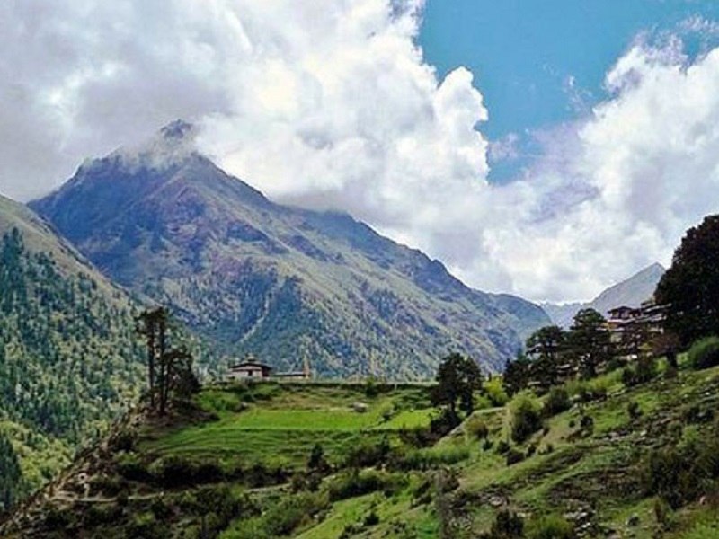
At a distance of 51 km from Darjeeling, 58 km from Namchi, 66 km from Siliguri, 72 km from New Jalpaiguri, 74 km from Gangtok, 89 km from Pelling, 358 km from Darbhanga, 445 km from Muzzafarpur, 490 km from Guwahati and 620 km from Kolkata, Kalimpong is a charming hill station in the Indian state of West Bengal. Placed at the foothills of Shivalik ranges, Kalimpong is the headquarters of Kalimpong district and among the most popular tourist destinations in West Bengal.
Perched at an altitude of 1250 m, Kalimpong is located in the northern part of the state of West Bengal close to the Bhutan - Tibet - Sikkim border. Kalimpong was an important trading center in earlier days, when the trade routes between Tibet, Bhutan and Sikkim were very much active. It was known as the silk route connecting Lhasa in Tibet with the rest of the subcontinent.
According to history, the area around Kalimpong was ruled by the Sikkimese Kings and was known as Dalingkot. In 1706, the Bhutan Empire took over the town and renamed it as Kalimpong. After the Anglo-Bhutan War in 1864, the Treaty of Sinchula was signed in which Bhutanese held territory east of the Teesta River was ceded to the British East India Company and merged into the present Indian state of West Bengal. After India's independence, Kalimpong became a subdivision of Darjeeling district and formed as a separate district in 2017.
Sits on a ridge overlooking ...
At a distance of 21 km from Kalimpong, 21 km from Lava, 70 km from Darjeeling, 73 km from Gangtok, 86 km from Siliguri, 488 km from Guwahati and 640 km from Kolkata, Pedong is a small picturesque hill town in Kalimpong district of West Bengal. Situated on a ridge and surrounded by pine forests, it is one of the great places to visit near Kalimpong.
Positioned at an altitude of 3,970 feet, Pedong lies between Lava and Kalimpong. The town, which is located on a ridge, commands a panoramic view of the Kanchenjunga and the surrounding mountains. Pedong gets its name from a 200 years old Pine Tree which is located at the heart of the town. In Bhutanese language 'Pe' means Pine and 'Dong' stands for Tree, i.e. Place of Pine Trees. The town is divided into two parts, Upper Pedong and Lower Pedong.
Pedong is one of the oldest towns in this region with significant historical importance. The town used to be a major transit hub on the ancient silk route that connects India to Lhasa via the Jelep La Pass. Today the same route has become common tourist attraction. Pedong witnessed the long standing dispute between Lepchas and Bhutias. After Anglo - Bhutanese war in 1865 CE, British took control over Pedong.
Pedong is blessed with abundant natural beauty and is a good place to relax for a few days amidst nature. Pine forests, lush green valleys and over viewing of Mt. Kanchenjunga and Mt. Siniolchu make beautification to this place. Nathula and Jelep La Pass are closely ...
At a distance of 21 km from Pedong, 30 km from Kalimpong, 80 km from Darjeeling, 82 km from Namchi, 87 km from Gangtok, 118 km from Pelling, 467 km from Guwahati and 650 km from Kolkata, Lava is a small hill town located in Kalimpong district of West Bengal. It is one of the popular tourist destinations near Kalimpong and among the pristine places in West Bengal.
Situated at an altitude of 7,016 feet, Lava is surrounded by dense forests of Berch, Pine, Fir and Juniper trees. It is one of the few places in West Bengal that sees snowfall in the winters. Untouched by modernity, Lava is the entry point to the Neora Valley National Park, an unexplored terrain in the Himalayas. The route to Lava is scenic with the change in vegetation from tropical deciduous to the wet alpine trees. Lava is known for the magnificent view of Mount Kanchenjunga.
Lava is well renowned for its natural beauty and it attracts large number of nature enthusiasts and adventure buffs. Lava Monastery or Kagyu Thekchen Ling Monastery is one of the main attraction of Lava, located closed to Lava local market. Built in Tibetan style of architecture, the monastery is serene and beautiful. Spread in 4 acres of land, it is home to hundreds of monks. Besides, Changey Falls, Neora valley National Park, Tiffin Dara View Point, and Nature Interpretation Center are the other popular places to visit in Lava.
Lava is said to be a haven for ...
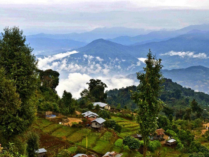
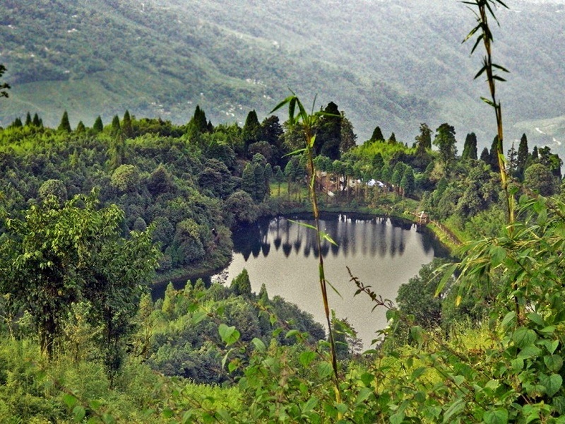
At a distance of 35 km from Kurseong, 44 km from Darjeeling, 50 km from Siliguri, 100 km from Kalimpong, 130 km from Pelling, 147 km from Gangtok, 517 km from Guwahati and 591 km from Kolkata, Mirik is a small hill town located in the Darjeeling district of West Bengal. Situated at an altitude of 4,905 feet, Mirik is one of the popular tourist places in West Bengal and among the best places to visit near Darjeeling.
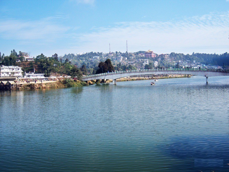
Nestled in the serene hills of Darjeeling district, Mirik is known for its pleasant climate, natural beauty and easy accessibility. The name Mirik comes from two Lepcha words Mir-Yok which means 'place burnt by fire'. The town is dominated by the large Sumendu Lake or Mirik Lake. The southern part of the lake is the tourist town where almost all the hotels are located while the northern part of the lake is more local and in the Northernmost fringe is the crowded Mirik market.
Like Darjeeling, Mirik also used to be a favourite place for the British in India. The open field on the eastern bank of the Mirik Lake was used as a polo field by the British. In 1969, the West Bengal tourism department began the process of acquiring 335 acres of land from the neighbouring Thurbo tea estate. The work of developing this land into a tourist spot began in 1974 when Siddhartha Shankar Ray was the chief minister of West Bengal. The tourist spot, which included the newly built lake and the Day Centre, was ...
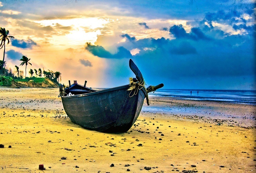
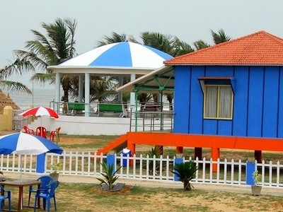
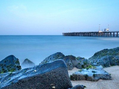
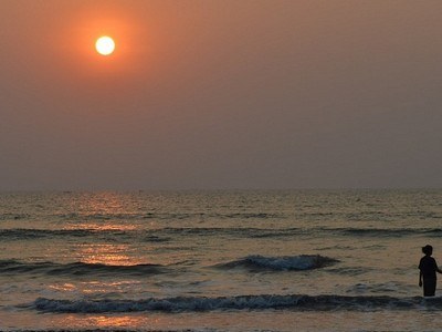
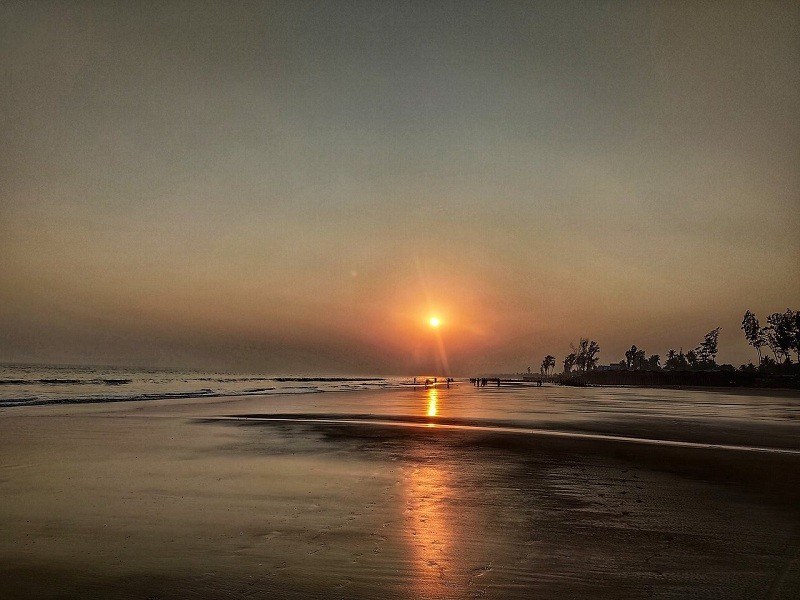
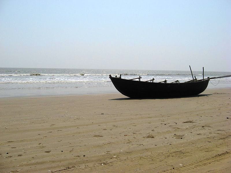
At a distance of 96 km from Haldia, 124 km from Midnapore, 164 km from Howrah, 171 km from Kolkata, 193 km from Barrackpore, 209 km from Hooghly, 228 km from Tatanagar, 289 km from Bhubaneshwar, 345 km from Puri, and 364 km from Ranchi, Digha is a seaside resort town located in Purba Medinipur (East Midnapur) district of West Bengal, India. It is one of the beautiful beach destinations in India and among the must include tourist places in West Bengal Tour Packages.
Situated on the shores of Bay of Bengal, Digha is a popular tourist destination known for its untouched beaches, scenic views, religious temples, and museums. Originally known as Beerkul, the town of Digha was discovered in the late 18th century by the British. It is mentioned as the 'Brighton of the East' by Warren Hastings, the first Governor-General of British India. However, the town started gaining fame when in 1923, John Frank Smith, an English tourist got so greatly allured by its charm that he started living here and writing about Digha. After the independence of India, he convinced Dr. Bidhan Chandra Roy, then the Chief Minister of West Bengal to develop this place as a sea beach resort.
For ages, Digha has been a one-stop destination for families looking forward to spending pleasurable holidays or at least a weekend together. Being a seaside resort town, Digha naturally boasts of a number of stunning beaches such as New Digha Beach, Udaipur Beach, Talseri Beach, Chandpur Beach, and Shankarpur ...
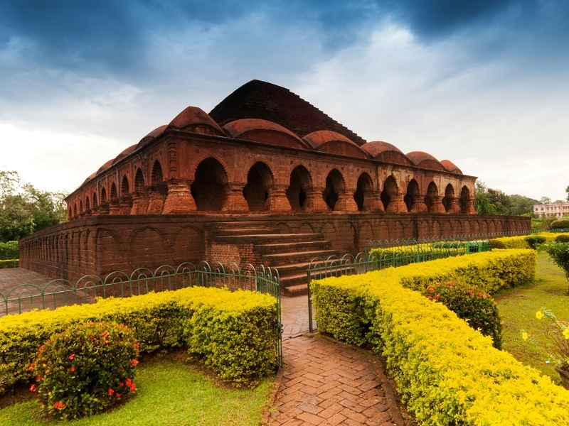
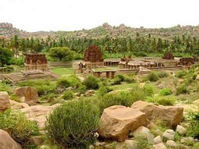
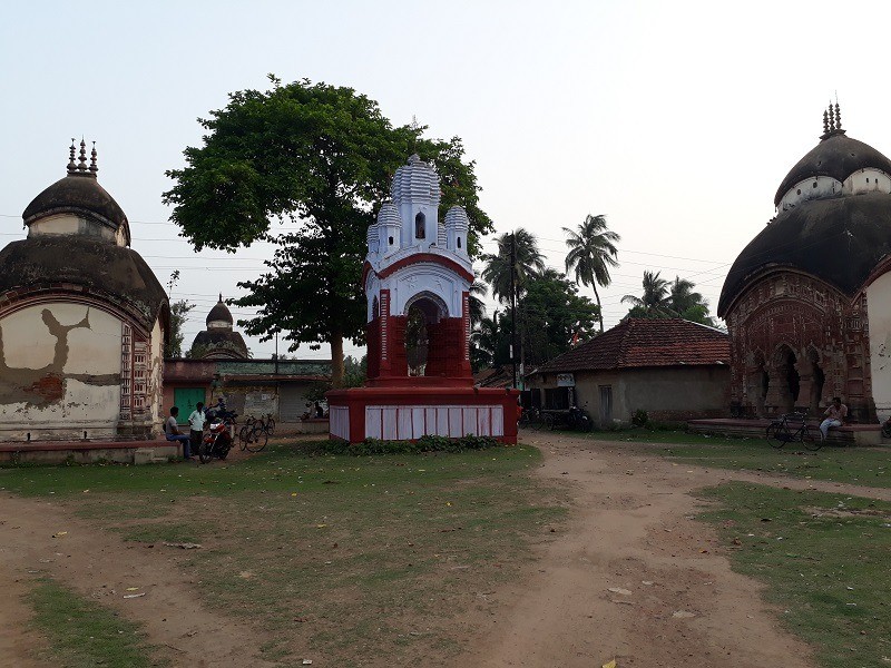
At a distance of 35 km from Bankura, 50 km from Chhatna, 85 km from Kharagpur, 113 km from Purulia, 119 km from Hooghly, 136 km from Kolkata, 143 km from Barrackpore, 149 km from Jamshedpur, 163 km from Dhanbad, 187 km from Haldia, 216 km from Murshidabad, 565 km from Kurseong, Bishnupur is a small town located in Bankura district of West Bengal. Also called Vishnupur, it is one of the beautiful tourist destinations in India and among the famous heritage places to visit in West Bengal.
Bishnupur is famous among tourists, especially for its rich culture including architecture, music, and handicrafts. The history of Bishnupur dates back to 694 AD when King Raghunath I founded the Malla dynasty. The town is also referred to as Mallabhum, after the Malla dynasty, who once ruled this region for almost a thousand years. Bishnupur was the administrative capital under the reign of the Malla kings. It is believed that the town derives its name from the Hindu God, Vishnu as the Malla rulers were Vaishnavites. The legends of Bipodtarini Devi are associated with Malla Kings of Bishnupur.
Bishnupur is most famous for its beautiful terracotta temples. The Malla kings built grand terracotta shrines to celebrate their love for Lord Krishna sometime between the 17th and the 18th century CE. Each and every temple in this region bespeak of excellent craftsmanship and intricate carvings. The distinctive architecture incorporated various styles from the neighboring regions. Crafted from ...
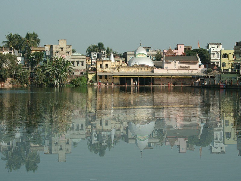
At a distance of 20 km from Barrackpore, 48 km from Howrah, 50 km from Kolkata, 150 km from Haldia, 155 km from Kharagpur, 158 km from Midnapore, 177 km from Murshidabad, 469 km from Bhubaneshwar, 478 km from Tatanagar, 526 km from Puri, 531 km from Siliguri, and 589 km from Darjeeling, Hooghly is a historical city & district located in the Indian state of West Bengal. Also known as Hugli or Hooghly-Chuchura, it is one of the popular places of heritage in India and among the must include tourist destinations in West Bengal Tour Packages.
The town of Hooghly got its name from the famous river that flows through it. The name of the place is also spelt as Hugli & Hoogli. It shares its borders with Howrah in South, Bardhaman in North, River Hooghly flows in its East, and Medinipur in West. Between the 13th-15th centuries, the Hooghly town used to be an important sea route for the trade carried between India & other countries. Hooghly port was the place where the 1st cross-trade began between India & Portugal.
Dotted with several small but important towns, the district of Hooghly is among the few places in India that features remnant culture-based influences of several civilizations like Portuguese, Dutch and British. The Portuguese were the first to settle here in 1537 but were defeated by the Mughal armies in 1632. Hooghly was regarded as the first English settlement in Lower Bengal after the British East India Company set up a factory here in 1651. Later, it was abandoned ...
At a distance of 9 km from Mirik, Tingling Viewpoint is a vantage point situated at Sourenee village near Mirik. Surrounded by three tea gardens, the Tingling View Point is one of the popular tourist attractions and among the best places to experience Mirik Tourism.
Also known as Kawlay Dara Viewpoint, Tingling Viewpoint gives an astounding view of the surrounding tea gardens, the Mirik Lake and also the beautiful Mirik Valley. The name Tingling comes from the nearby tea estate. The sprawling tea plantations form a stark contrast to the white snow and blue sky. It is an ideal place for both sunrise and sunset and also one can take some beautiful pictures of the plains as well as the snow-capped hills.
The village Sourenee can be seen from this point, and the pleasant atmosphere of this region is quite satisfying to the mind. The tea gardens themselves are quite the attraction to tourists and locals alike. There is a stall at the base of the viewing gallery where one can buy fresh packaged tea from Sourenee tea estate. There is also an eatery where you can take light snacks and some tea. Sourenee is also known for its juicy oranges.
Timings: 6 AM - 6 PM
At a distance of 6 km from Pashupati Market, 20 km from Mirik and 24 km from Darjeeling, Simana is a viewpoint situated at Simana Basti on Darjeeling - Mirik Road in West Bengal. Situated on Indo - Nepal border, it is one of the popular viewpoints in Mirik and among the must visit Tourist Places in Mirik.
Situated at an altitude of 7500 feet, Simana Viewpoint is a 60 feet by 40 feet plateau which offers breathtaking views of the surrounding plains, snow-capped peaks of Mount Kanchenjunga and the tiny hamlets of Nepal. Simana means border in Hindi. This is the Indo-Nepal border area, the road itself belongs to India and the viewing area falls in Nepal. But visitors can freely cross over to get the mesmerizing views.
Simana Viewpoint is famous for offering a splendid view of Maneybhanjan, Sandakphu trail and the lofty mountainous valley with the backdrop of Mount Kanchenjunga. The view point has become a pit stop while traveling to Darjeeling from Mirik or vice versa. From Simana for a long way towards Mirik, the road acts as the divider between India and Nepal. They are all mostly Nepalese. At Simana, you will find several small stalls - some selling tea, snacks, and chocolates.
Timings: 6 AM - 6 PM
At a distance of 6 km from Simana Viewpoint, 15 km from Mirik and 29 km from Darjeeling, Pashupati Market is a market situated at Pashupati Nagar near Mirik. Located on Darjeeling - Mirik Road, it is one of the best places to visit in Mirik.
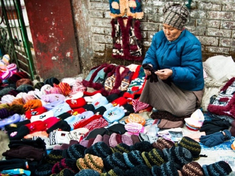
Situated on the India-Nepal border, Pashupati Market is a bustling place with lines of shops and street vendors displaying their wares. It is specifically known for cheap imported electronic gadgets, jackets, perfumes, cosmetics and clothes that are imported from Thailand. One can get a variety of colorful woolen caps, gloves, socks, jackets, other woolen clothing, footwear, artifacts, and household items. Electronic items are also available at reasonable prices. Many items sold here are too cheap to be good. Be careful about the fakes. One can also visit Gopaldhara Tea Estate near Pashupati Nagar. It is one of the highest tea estates which spread over an area of 320 hectares.
The market is about 1 km walk from the Darjeeling-Mirik Road and is in Nepal area. Visitors are required to show Photo ID card and enter the details in the register at the border Check Post in case you want to cross over the border and visit the shops. Note that only Indians and Nepalese are allowed to cross over the border area. Foreign nationals are not allowed to access the border. Cameras are not allowed inside.
Timings: 9 AM - 6 PM
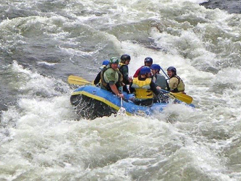
At a distance of 18 km from Kalimpong Bus Station, Teesta River Rafting is the most popular adventure sport activity in Kalimpong, West Bengal. Teesta River has become one of the most popular hotspots for White Water Rafting in eastern India and among the must include things during Kalimpong Tour.
Teesta River with its green surroundings is the best choice for Rafting in Kalimpong. The Teesta river rafting has carved out deep ravines and gorges in Sikkim meandering through the hills with Kalimpong lying just off the river. This makes for quite an exciting and enthralling rafting experience.
Ideally rafting can be done enroute, between Gangtok to Darjeeling, Gangtok to Kalimpong or Gangtok to Siliguri. The routes for non-swimmers are gentle and easy without much rapids involved. However for the swimmers and experienced clients, the routes are more adventurous with high grade rapids providing quite a thrill. The rafting trips for non-swimmers in Teesta River start mostly at Melli Bridge and culminate at Geil Khola in Kalimpong. This is a 12 km stretch which takes 1-2 hours.
The rafting trip for Swimmers and experience clients starts at Tarkhola and ends at Melli. It is a 20 km stretch and takes 2-3 Hours. Another way is to go down to Teesta Bazaar, which is the main hub for rafting. Here you will find the River Rafting Center of GTA Tourism. They organize the rafting on Teesta River.
The best time to raft on Teesta is from March to June and September ...
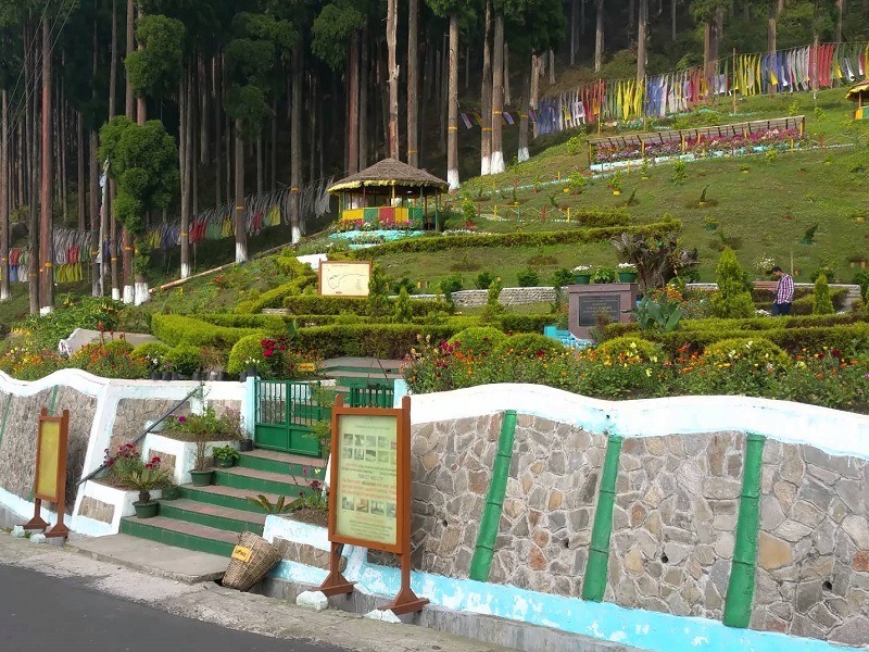
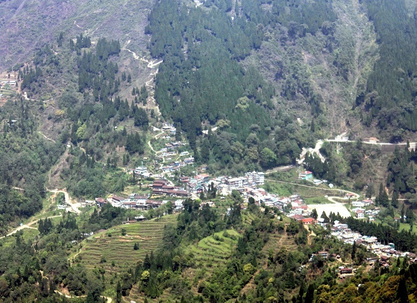
At a distance of 30 km from Kalimpong Bus Station, Lamahatta is a calm and picturesque mountain village situated near Kalimpong in the state of West Bengal. Perched at an altitude of 6800 feet, it is one of the serene getaways in West Bengal and among the best places to visit near Kalimpong.
Lamahatta is surrounded on all sides by pine forests and gardens with panoramic views of Mt. Kanchenjunga. Lama in Lamahatta stands for Buddhist monk and Hatta for hut - a monk's hermitage. It is an ideal holiday destination for tourists who wish to get away from the hustle and bustle of urban life and enjoy natural solitude. The main inhabitants here are tribes like Sherpas, Yalmos, Tamangs, Bhutias and Dukpas. They have all come together to join hands with the government to create Lamahatta as an eco-tourism place.
The major attraction is the Roadside Garden. This is an open garden surrounded by pine forests containing many seasonal flowers, as well as several rare and exotic species of orchids. Tourists can simply sit and relax in the wooden gazebos at the Roadside Garden and take in the view of the thick canopy and colorful prayer flags. There is also a wooden watch tower which helps visitors to enjoy panoramic views of Mt. Kanchenjunga as well as the Sikkim Hills, the River Teesta and the River Rangeet.
There are several tea estates to be visited in and around Lamahatta. Most famous among them is Runglee-Rungliot Tea Estate, world-famous for its fine blend, and awesome ...
At a distance of 30 km from Kalimpong and 50 km from Lava, Lolegaon is a small Lepcha village in Kalimpong district of West Bengal. Surrounded by dhupi and cypress forests, it is considered to be the tourism mascot of West Bengal and also one of the best places to visit near Kalimpong.
Nestled atop a flat hill on a forested ridge at an altitude of 5500 feet, Lolegaon or Loleygaon is a place of ethereal wilderness and tranquility. Basically a small Lepcha village also known as Kaffer, Lolegaon is a recent inclusion in tourism map of West Bengal for its magnificent view of Greater Himalayan snow ranges that spreads over the entire horizon. Viewing sunrise over the snow peaks from Jhandi Dara Viewpoint is perhaps the most treasured memory of being at Lolegaon. On a clear day all major peaks of Kanchenjunga massif can be seen from here. Even the glorious Mt Everest can be seen from Jhandi Dara.
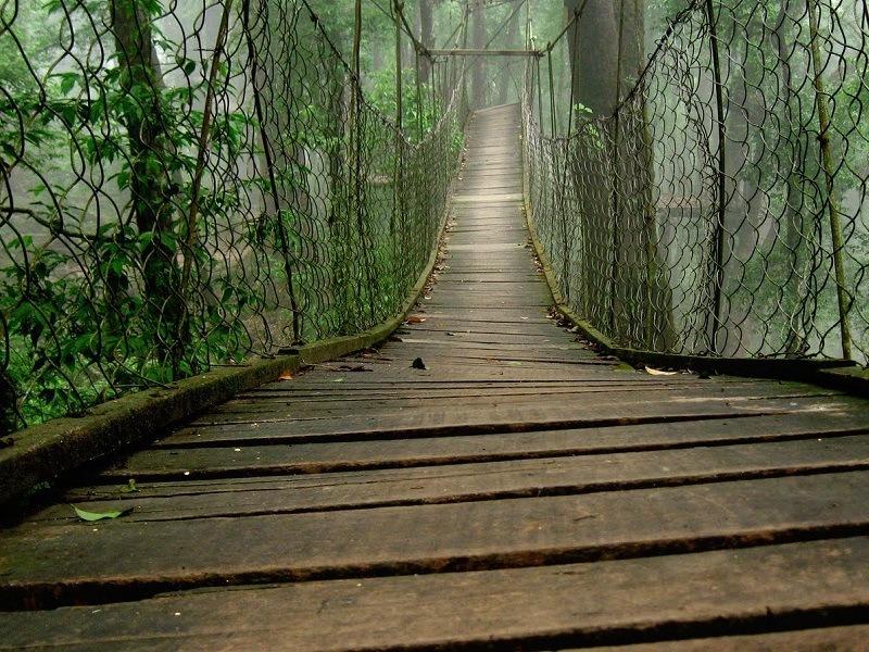
Lolegaon is a fabulous destination for the lovers of wildlife. The age-old forest of towering pine, cypress and oaks with their mossy trunk is an ideal place for watching endangered Himalayan species such as black bear, mountain goats, numerous birds and different varieties of species. The Heritage Forest at Lolegaon is the place to feel the exquisite wealth that nature has showered here. The hanging foot bridge over the canopy of huge trees is a special attraction. Popularly known as 'The Canopy Walk' it offers an unforgettable experience, which allows you to get close to the ...
At a distance of 32 km from Darjeeling, and 51 km from Kalimpong, Teesta Valley Tea Estate is a vast tea garden in Rangli Rangliot Tehsil of Darjeeling district in West Bengal, India. This is one of the popular tea estates in West Bengal and among the top places to experience Darjeeling Tourism.
Teesta Valley Tea Estate derives its name from mighty river Teesta. Established in the year 1841, it is one of the oldest tea gardens in Darjeeling and one of the gold medal winner for the production of the world's finest tea. Spread over an area of 850 hectare, the tea garden is situated in the cold sunny slopes with a widened stretching of almost 2500 to 6500 feet above from the sea level, with selected China tea bushes highly planted with infinite care. These fertile slopes are blessed by cool mists, bright sunshine and crisp winds of the Kanchenjunga, where the legendary flavor of pure Darjeeling tea was conceived.
This beautiful tea garden is capable to amuse the visitors by its magnificent scenery around. There is also a view point at Teesta from where one can get the mesmerizing views. One could easily be fascinated by the panoramic sight of the hills, mountains, forests and enchanting river Teesta in its serpentine form. On a clear day one can see some parts of Sikkim, Darjeeling, Kalimpong and the Siliguri.
You can also visit the estate factory and watch the tea processing (in winters the factories usually remain closed). Teesta Valley Tea Company Limited ...
At a distance of 3 km walk by Sillery Gaon and 17 km from Pedong, Ramitey Viewpoint is a picturesque viewpoint situated at Sillery Gaon near Pedong in Kalimpong district of West Bengal. It is one of the stunning vantage points in Pedong and among the best places to experience Pedong Tourism.
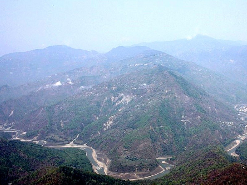
Situated at an altitude of about 6,400 feet, Ramitey Viewpoint offers some mesmerizing views of both Mount Kanchenjunga above and the Teesta River below. This viewpoint is also unique as it offers the longest view of river Teesta which is the biggest river of Sikkim & Darjeeling. Approximately 14 bends at a glance, this is by far the best view of the Teesta in this entire region. On a clear day the entire region from Teesta Bazar to Majhitar in Sikkim is clearly visible from Ramitey Viewpoint.
Ramitey Viewpoint is just 3 km away from Sillery Gaon and can be accessed by trekking. One can also visit Sillery Gaon, an Ideal mountain village on the way side to Ramitey. Must stop and interact with the villagers to get an idea of their life style and of course their hospitality will touch you.
Timings: 6 AM - 5 PM
At a distance of 30 km from Pedong, Aritar is a tiny hill town situated in Rongli Sub-Division of East Sikkim district. Known for its natural and landscaped beauty, Aritar is situated on the old silk route and is among the popular places to visit near Pedong.
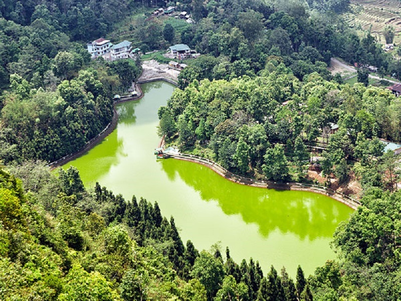
Isolated from the rest Sikkim, Aritar is characterized by lush green forests, sweeping hills of paddy fields and placid lakes. Lampokhari Lake and Kali Khola Falls are the two interesting places to visit in Aritar. Also known as Aritar Lake, Lampokhari Lake is one of the oldest lakes in Sikkim. It is a boot shaped lake where Pedal boating is the popular activity. At an altitude of 4600 feet, it is the only lake with boating facility in Sikkim. One can also visit a small shrine on the banks of the lake dedicated to Guru Padmasambhava.
Also known as Kuikhola falls and Lonely falls, Kali Khola is a natural spring originated from the foothills of the Himalayas. Falling down from a height of 100 m, the waterfall is blessed with immense natural beauty which makes it one of the most attractive waterfalls in this region. The spectacular view of its crystal clear water, crackling from the lush green hills and falling over the rugged pieces of mountains allures large number of tourists.
Mankhim Rai Temple is also known as Mankhim Dara and Maney Dara, is a famous temple in Aritar belonging to the Rai sect of Hindu origin. The most popular attraction of this temple is the celebration of Sakewa Puja, which starts ...
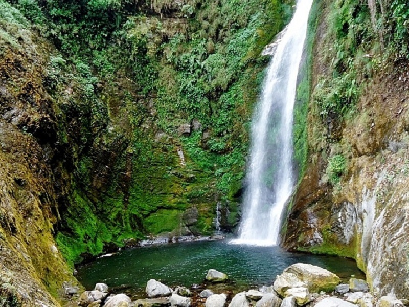
At a distance of 4 km from Kolakham and 10 km from Lava, Changey Falls is a mesmerizing waterfall situated near Kolakham in Kalimpong district of West Bengal. It is one of the gorgeous waterfalls in Kalimpong region and among the best places to visit in Lava.
Changey Falls is a small waterfall in the midst of hills and forests. Cascades down from a height of about 150 feet, the waterfall looks stunning with crystal clear water and thick green forest. Innumerous chirps of amazing Himalayan birds like White Capped Water Redstart, Verditer Flycatcher, Niltava, Blue Fronted Redstart, Grey Treepie, Indian Robin, Blue Whistling Thrush makes the atmosphere heaven like.
A four wheel drive of 1 hour from Lava will take you to Changey Falls. The distance from Changey Falls to Kolakham is around 4 km. One needs to trek 900 m from the last motorable point in order to reach the falls. Extreme calmness with huge waterfall sound makes a wonderful contrast. There is no public or private buses ply through this route. So, visitors need to hire a cab to visit the falls.
Timings: 6 AM - 5 PM
At a distance of 28 km from Bankura and 65 km from Bishnupur, Susunia hill is situated at Susunia village in Bankura district of West Bengal. It is one of the ideal picnic spots for the people residing in the surrounding areas.
Placed at an altitude of 1442 feet, Susunia is a part of the Eastern Ghats. The entire hill is covered with a rich flora of beautiful shrubbery, majestic trees, and rare medicinal plants. The hill is famous for rock climbing and trekking. During winters, trekking and camping activities are arranged on the Susunia Hill. Enveloped in the ranges of the Eastern Ghats and resting amidst the lush greenery, spending a day on this hill is the perfect way to escape the loud and polluted airs of the city.
Susunia hill is one of the well-known fossil and archaeological sites where thousands of years old fossils of animals like hyenas, Asiatic lions and giraffes have been found. Not just fossils, upon excavation, tools that were known to be used in the Stone Age were found here too. The history of Susunia hill dates back to the 4th century. The Stone inscriptions of King Chandravarman are found in the Susunia Hill, referring to the place was ancient Pushkarana, the modern-day Pakhanna. It is also believed that King Chandravarman had built a fort here but ruins could not be traced out.
There also stands an ancient but impeccably carved monolith structure on the Susunia Hill named as the Narasimha Stone. The carvings on the monolith call it the oldest ...
At a distance of 78 from Bankura and 95 km from Bishnupur, Jhilimili is a magnificent tourist place in Bankura district of West Bengal. Also known as Darjeeling of South Bengal, it is one of the unique spots in West Bengal and among the popular tourist places to experience Bishnupur tourism.
Jhilimili is famous for its dense forests and natural beauty. Jhilimili, in Bengali, means 'sparkle' and is said that the place partially derives its name from the 'sparkle' of the soil. The place is situated on a hillock and amidst thick, dense forests of varying heights. The Kangsabati River flows right through this forest and its banks are a perfect spot to have a picnic. There is a watchtower which offers an amazing view of the surroundings, including that of the descending elephants from the Dalma Hill during winters.
Jhilimili has a serene and peaceful climate, which makes it a perfect gateway for city dwellers in search of some peace from their hectic schedule. Small tribal villages are scattered in and around the forest. Those who wish to get a taste of tribal life can hike to one of the villages and spend some time with the inhabitants.
The annual Tusu Parab, a tribal festival worshiping Goddess Tusu is a major attraction in the region. The tribes in Jhilimili celebrate Tusu Parab during mid- January. The tribes from various places flock here to sell different items and enjoy the music and dance celebrations.
At a distance of 41 km from Bishnupur and 75 km from Bankura, Jayrambati is a religious and tourist destination located in Bankura district of West Bengal. It is one of the best places in West Bengal and among the important tourist places to visit near Bishnupur.
Jayrambati is the birthplace of Ma Sarada Devi, wife of Ramakrishna Paramhansa. She is worshipped as the Holy Mother by the followers of Sri Ramakrishna. Surrounded by lush green trees and shrubs, it is an offbeat but stunning tourist destination.
Jayrambati Math is the main attraction and a must-visit place, especially for the people who seek spirituality and wish to offer their prayers to Goddess. The other major attraction here is Matri Mandir, dedicated to Ma Sarada Devi. Built-in 1923, the temple houses a marble image of Sarada Devi along with the holy relics of Sarada Devi in the sanctum sanctorum.
The place has few other attractions such as Dharma Thakur Temple dedicated to Sundara Narayana Dharma Thakur and Singhabahini Temple, where Sarada Devi has taken on fasting in order to get healing from an acute disease. One can also visit Puratan Bari, the house of Ma Sarada Devi.
At a distance of 47 km from Bishnupur and 59.5 km from Bankura, Hadal & Narayanpur are the twin villages located in Bankura district of West Bengal. Situated on the banks of the Bodai River, it is one of the famous places to visit near Bishnupur.
Hadal and Narayanpur are situated side by side and belongs to the same administrative division. It is said that the village was first established by one 'Murokata' Chakraborty, who literally cut down trees to start up the village. The village is famous for the Mandal family terracotta temples that comprise of Barataraf, Mejotaraf, and the Chhototaraf temples.
The first temple that houses the idol of Bramhani Devi is not like the traditional structure. It was a modern flat-roofed structure with the entrance displaying a painting of Lord Shiva dancing with the body of Sati on his shoulder. Made of black 'Kasti Pathar', the idol of the goddess has four hands and surprisingly has a strong resemblance to south Indian idols. There are small female figures at the foot of the main idol. This statue is said to be from the Pal era of Bengal.
At Barataraf, there is a huge Rasmancha that resembles a 17 pinnacled terracotta structure near the entrance. One can find the sculptures depicting Durga and her family, Shiva's Marriage, Gaja Lakshmi and Lord Vishnu in Anantashyana pose here. The residence of the Barataraf of Mandal Family is painted yellow with a cylindrical shaped entrance. The windows at this entrance were like full-sized ...
At a distance of 20 km from Digha Railway Station, Tajpur Beach is another beautiful beach located near Digha, West Bengal. Situated between Chandpur Beach and Mandarmani Beach, it is one of the less commercialized beaches in Digha and among the best Digha Tourist Places.
Set on the tranquil shore of the Bay of Bengal, Tajpur Beach is one of the most hidden beaches in India. This virgin beach is still untouched by commercialization and tourism. Fringed by dense tamarisk, eucalyptus, and casuarina trees, the crescent shape of the beach here endows photographers an unusual panoramic view of the sea. The highlight of the pristine beach is the hundreds of red crabs that are found on the shores during the morning hours.
With pristine sea beach and tranquil environs make Tajpur a popular weekend getaway for the traveler who wants to laze on a hammock and spend some time in solitude amidst the sun, sea, and sand. The road that takes you to the beach passes through marshy land, large fishing lakes, or 'Bheris' on one side and the sandbanks by the sea on the other side. The coconut-tree clad beach is a favorite habitat of sea-gulls who spread their wings to the wind at the break of dawn.
Tajpur offers various adventure sports options like Surfing, Sun Bathing, Parasailing, Kayaking, Zorbing, Rock Climbing, Beach Football, Beach Volleyball, Beach Cricket, Long Drive, etc. The beach is also an ideal spot to watch sunrise and sunset.
Timings: 6 AM - 7 PM
Entry: ...
At a distance of 15 km from Tajpur, and 28 km from Digha, Mandarmani is a large and rapidly developing seaside resort village in the East Midnapur district of West Bengal. Situated at the northern end of the Bay of Bengal, it is one of the popular weekend getaways from Kolkata and among the must-visit places during your Digha Tour.
With great scenery, sandy beaches and an amazing aura of luxury, the coastal town of Mandarmani is a great place to relax, far away from the hustle and bustle of city life. Mandarmoni boasts of a 13 km long motorable beach, perhaps the longest motorable beach road in India. The drive-in beach is the primary attraction as a crazy high-speed ride on the beach at Mandarmani can give you the ultimate thrill. Red crabs crawling around the 13 km long beach is a special attraction of Mandarmani and the sight is incredible as the entire beach looks like it's filled with red crabs.
The beach, one of the cleanest of its kind, has a lot of lodging options available for tourists, with plenty of hotels and resorts lined up along the beach. Due to its top-notch facilities and luxuries, Mandarmani has a tremendous potential of becoming a world-class destination. There is also a string of local shops selling shells, handmade jewelry, and handicrafts. A few locals also offer groups to take a trip towards the Mohana (Estuary) during sunset.
Timing: 6 AM - 10 PM
Entry: Free
At a distance of 49 km from Hooghly, Taraknath Temple is a famous Hindu shrine situated at Tarkeshwar in the Hooghly district of West Bengal. It is one of the popular places of pilgrimage in West Bengal and among the must-include places in Hooghly Tour Packages.
Also known as Tarakeshwar Temple, the Taraknath Temple is dedicated to Lord Taraknath, a violent (Ugra) form of Lord Shiva who drank venom (Vish) during Samudra-Manthan. According to the legend, the temple was built after a dream which led the mendicant brother of Raja Vishnu Das to discover a Linga in the jungles near Tarakeswar. Later, a small temple was built around the swayambhu linga (self-manifested) by the villagers. The present structure of the temple was built in 1729 by Raja Bharamalla.
The temple is built in central West Bengal style of temple architecture with features such as 'atchala' and 'natmandir'. The temple has four roofs above the sanctum sanctorum and extended galleries for the congregation of the devotees. This temple also has minor shrines dedicated to Goddess Kali and Lord Lakshmi-Narayan. Dudhpukur, a tank to the north of the Shiva temple is believed to fulfill the prayers of the devotees those taking a dip in it.
Pilgrims visit the temple throughout the year, especially on Mondays. But thousands of pilgrims visit Tarakeswar on the occasions of 'Shivaratri' in Phalgun month and Gajan Mela in Chaitra (mid-April). Also, the month of Sravana (mid-July to mid-August) is auspicious ...
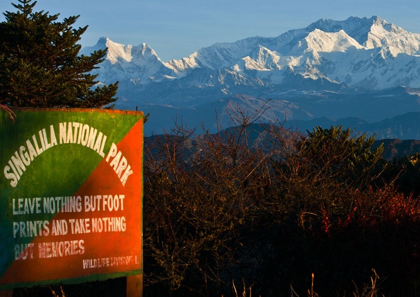
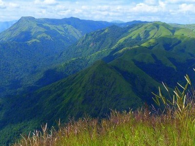
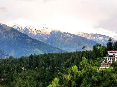
At a distance of 36 km from Darjeeling, Singalila National Park is a reserved forest area at the Singalila ridge in Darjeeling district of West Bengal. Situated at an altitude between 7900 feet to 12000 feet, it is the highest National Park in West Bengal and among the popular places to visit in Darjeeling.
The park was declared as a wildlife sanctuary in 1986, and got national park status in 1992. The park derives its name from the Singalila spur, which runs through the park, descending from Mount Kanchenjunga in the north and running south to the northern fringe of the Gangetic Plains. The park makes the border line with Nepal to the west and Sikkim to the North. The two highest peaks of West Bengal, Sandakphu (3630 m) and Phalut (3600 m) are located inside the park and the region had long been used as the trekking route from Maneybhanjang to Sandakphu and Phalut.
The park has an area of 78.60 Sq.km with mixed vegetation of Magnolia, Rhododendron, Oak, Pine Hemlock, Silver Fir, Juniper, Mailing Bamboo, Buk, Kawla, Bhujpatra etc. Singalila National Park is popular to the tourists from all over the world for its amazing flora and fauna. Exotic Red Panda and Himalayan Black Bear are the most important mammals found in Singalila National Park. Among the other major species found in the park are leopard, serow, pangolin, barking deer, boar etc. The park is also a delight for birdwatchers as more than 120 species of birds are seen, which includes many rare birds like ...
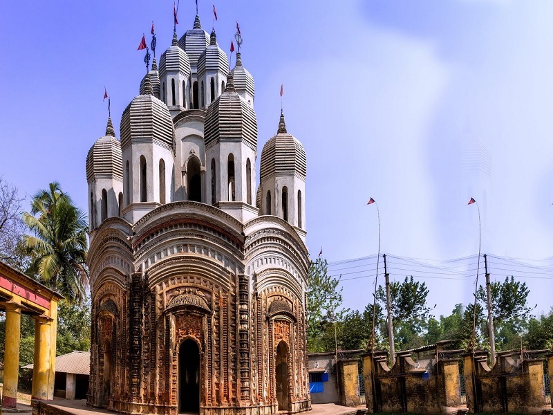
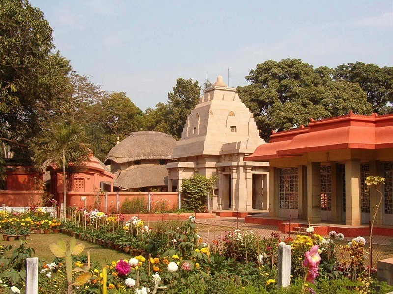
At a distance of 22 km from Tarakeshwar, and 50 km from Hooghly, Radha-Govind-Jiu Mandir is an ancient temple located at Antpur in Hooghly district of West Bengal. It is one of the beautiful terracotta temples in West Bengal and among the well-known Hooghly Tourist Places.
Sri Radhagovindjiu Temple is one of the Terracotta Temple in West Bengal and the most famous temple in Antpur. The temple was constructed in 1786 by Shri Krishna Ram Mitra, the Diwan of Bardhaman Raj. It has Chandi Mandap and Dol Mancha and both are beautifully crafted wood carvings and terracotta. The main sanctum sanctorum of the temple houses a black stone idol of Lord Krishna.
This 100 feet high temple has exquisite terracotta carvings depicting stories from all the 18 Puranas. While Radha and Krishna are predominant in the carvings, there is also the goddess Durga, whose worship had been revived in a big way by Nabakrishna Deb of Shovabazar Rajbari in 1757. Besides the main temple of Radhagovindjiu are the temples of Gangadhara, Fuleswara, Rameswara, Jaleswara, and Baneswara.
Antpur was the village home of Baburam Ghosh (later Swami Premananda). The Ramakrishna-Premananda Ashram of Antpur has built a temple on the birthplace of Swami Pramananda.
Antpur is also the place where Swami Vivekananda and eight other disciples of Sri Ramakrishna took their vow of 'sannyasa' on 24 December 1886.
Timings: 6 AM - 8 PM
Entry: Free
At a distance of 49 km from Bishnupur, and 90 km from Hooghly, Kamarpukur is a small hamlet in the Hooghly district of West Bengal. It is one of the popular religious places in West Bengal and among the prominent places to visit near Hooghly.
Kamarpukur is the birthplace of the great 19th-century Indian philosopher Sri Ramakrishna. He was born in 1836 in a poor Brahmin family. The holy hamlet attracts a massive number of devotees of Sri Ramakrishnan across the year and thus, over a period of time has become a site of pilgrimage. Kamarpukur Ramakrishna Math and temple was built in 1951 by the monks of Ramakrishna Mission and Ramakrishna Math. Designed by Nandala Basu, the opulent temple houses a marble statue of Sri Ramakrishna.
Apart from being a pilgrimage, the natural beauty and calmness of Kamarpukur attract thousands of solitude seeking tourists to this place round the year. Besides Ramakrishna Math, there are also many attractions in this place including the ancestral home of Sri Ramakrishna, and Gopeshwar Temple. Dedicated to Lord Shiva, Shri Gopeshwar temple is an ancient temple located towards the east of the ancestral house of Sri Ramakrishna.
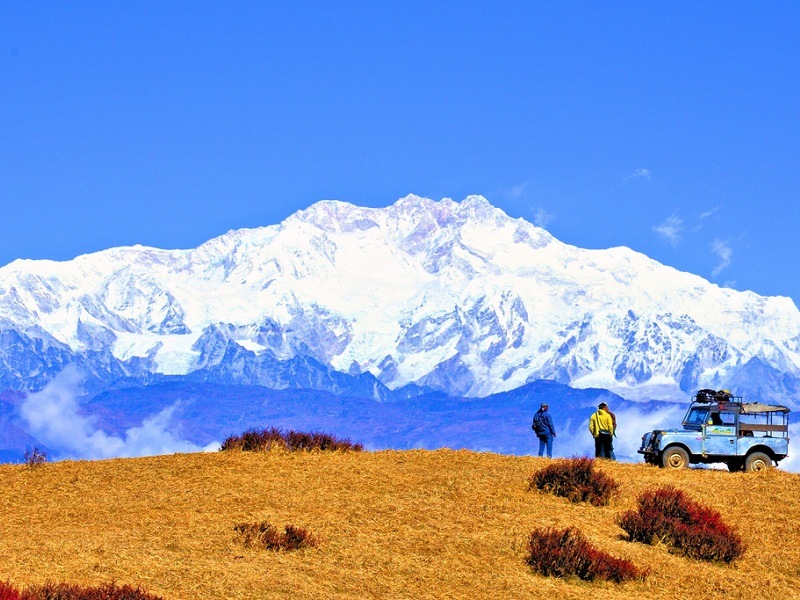
At a distance of 83 km from Darjeeling, Sandakfu or Sandakphu is the highest peak of West Bengal situated on the border of West Bengal of India and Nepal. Sandakphu is one of the wonderful places to experience Darjeeling Tourism and also among the best trekking places in Eastern Himalayas.
Situated at an altitude of 11,941 feet, Sandakphu is the summit or the highest point in Singalila range. Sandakphu means 'Height of the Poison Plant' derives its name from the poisonous plants that grow near the top. Popularly known as 'Trekkers Wonderland', the Sandakphu trek route goes all along the Singalila range and the border of India and Nepal. Also known as Singalila trek, it is considered as the highest trek in West Bengal.
A trek to Sandakphu is actually considered a soft or a light trek in trekker's world. However the altitude, weather conditions and various other factors do require that take adequate preparations, particularly first time trekkers. The Sandakphu trek starts from an altitude of 1,524 m and gradually climbs up through forests of rhododendron, giant magnolias, spruce and other trees of sub-alpine region and more than 600 varieties of orchids. One can get the magnificent views of the Mt. Everest, Kanchenjunga, Lhotse, and Makalu while trekking to Sandakphu.
The trek route to Sandakphu starts from Maneybhanjang, a small township located at an altitude of 7,054 feet. This is virtually the gateway to Singalila and Sandakphu. The distance from Darjeeling ...
At a distance of 10 km from Darjeeling, Senchal Wildlife Sanctuary is a protected sanctuary in Darjeeling district of West Bengal, India. It is one of the oldest wildlife sanctuaries of India and among the popular places to experience Darjeeling Tourism.
Covers an area of 38.6 Sq. km, Senchal Wildlife Sanctuary was set up in 1915 CE and is the south east extension of Singalila National Park. The elevation ranges from 1,500 to 2,600 m. High-altitude animals like barking deer, wild pig, Himalayan black bear, leopard, jungle cat, common rhesus monkey, Assam macaque, Himalayan flying squirrel, etc. are found in their natural habitats. The sanctuary is also rich in bird life.
Senchal wildlife sanctuary is a perfect combination of both man-made and natural jungles. The forest has different kinds of trees and plantation including oak, pines and birch. There are over 350 types of flowering plants in this area including Rhodendrons and Orchids. There are several villages surrounding the protected area.
Senchal Lake is a part of the Senchal Sanctuary which supplies drinking water to the town of Darjeeling. The lake is fed by a mountain spring and the water of this lake is clean and potable. The narrow longish Senchal Lake is surrounded by thick vegetation on all sides. However the main forest area is a bit far from the lake. Colourful flowers like rhododendrons and orchids on the lakeside enhance the overall beauty. A 9-hole golf course and club house are also present ...
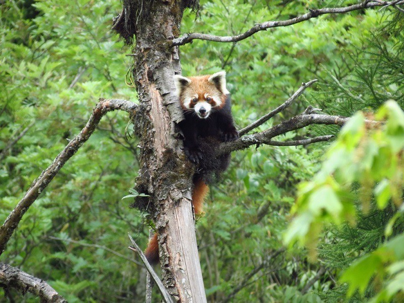
At a distance of 81 km from Darjeeling, Neora Valley National Park is a protected wildlife sanctuary located in Kalimpong district of West Bengal. It is one of the richest biological zones in the entire Eastern India and also one of the prominent places to visit in Darjeeling.
Spread over an area of 88 sq. km, Neora Valley National Park was established in 1986 CE. The National Park enjoys the distinction of being situated over one of the oldest Reserve Forests in India. With an elevation of 10,600 feet, Rachela Pass is the highest point of this park, where it forms a boundary with Sikkim in the North and Bhutan in the North East. The forests of Jalpaiguri form its southern boundary connecting it with Chapramari Wildlife Sanctuary and the Gorumara National Park.
The name Neora Valley is given after the river Neora flowing through it and is the main source of water for Kalimpong town. Neora Valley National Park is situated in the foothill of the Himalayas, so it has craggy inaccessible hilly terrain which makes the park wilder and adventures than others. This national park has luxuriant foliage of rhododendrons, endemic orchids and a mixed variety of forests. Somewhere the forests are very deep, even sunlight does not touch the ground.
The Neora Valley National Park is the land of the elegant red panda, one of the rare and endangered species in the world. The park is also home to Himalayan Tahr, Black Bear, Sambar, Barking Deer, Goral, Tiger, Leopard, Chinese ...
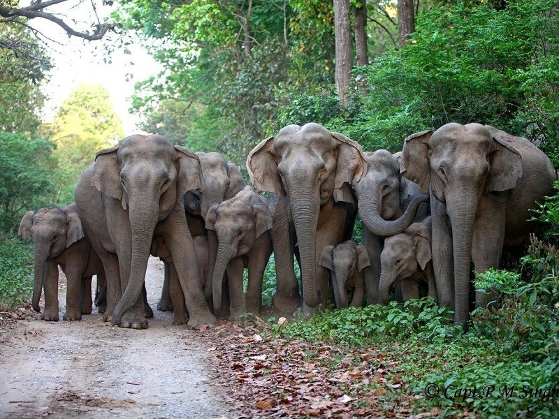
At a distance of 97 km from Darjeeling, Chapramari Wildlife Sanctuary is located in the foothills of Eastern Himalayas of Jalpaiguri district. Situated close to Gorumara National Park, it is one of the best wildlife sanctuaries in West Bengal and among the popular tourist places near Darjeeling.
Covered with an area of 96 Sq.km, Chapramari Wildlife Sanctuary was established in 1998. The name Chapramari derives from 'Chapra' means a variety of small fish and 'Mari' means abundant. According to history, in 1895, the area was declared as a reserve forest under the Indian Forest Act. Then, the Government of India declared it as a National Wildlife Sanctuary in 1998.
The main attraction of the sanctuary is the elephants that are found here in large numbers. The place is also home to various other animals like Gaur, Wild boar, Leopards, Royal Bengal Tiger, Himalayan Langoor, deer, reptiles etc. Also regarded as a bird watchers paradise as one can spot variety of birds like Peafowl, Green pigeon, Roller, Florican, Flinch, Bee-eater, Hornbill, Black partridges and many more here.
There are forest department cottages as well as private hotels available that provide food and accommodation.
Timings: 6 AM to 6 PM
Similar Getaways