-
Tours
-
-
- Domestic Tours
-
-
- Resorts
- Car Rentals
- Destinations
- Getaways
- Hotels
- Tools
- * Workation
- * Tour Plans
- Blog
- List Property
- * Offers *


Distance from Mangalore: 165 Kms
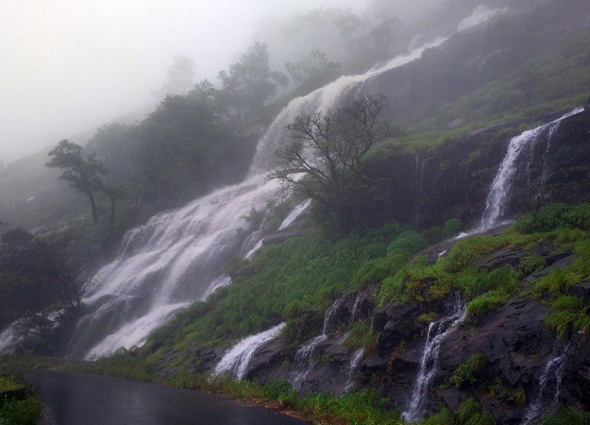
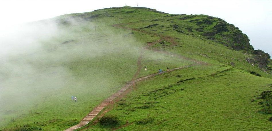
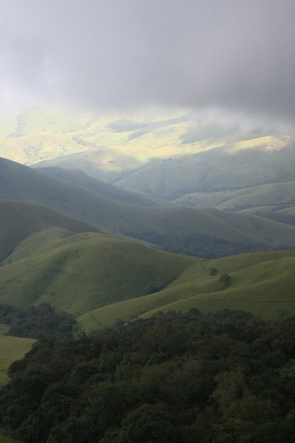
At a distance of 34 km from Belthangady and 57 km from Chikmagalur, Charmadi Ghat or Charmady is a Ghat in Belthangady taluk of Dakshina Kannada and Mudigere taluk of Chikmagalur. It is one of the popular ghat roads in Karnataka and among the must-visit places to visit as part of Chikmagalur Tour Packages.
Charmady Ghat is one of the most scenic and dangerous (to drive) Ghats of Karnataka. It is one of the points in Western ghats through which motorable road passes connecting Dakshina Kannada with Chikkamagaluru district. The 25 km stretch starting from Kottigehara and ends at Charmadi Village is awesome, calm, and peaceful. It lies on National Highway 73 that connects Mangaluru to Tumkuru. This ghat section has 12 Hairpin curves and receives very heavy rainfall of over 7000 mm during the monsoon.
Charmadi Ghat is known for its visual beauty as it is home to lush forests, evergreen shrubs, streams, and waterfalls. The roads in this ghat section are very narrow and very deep compared to the other Ghat sections of Karnataka. The Netravati River originates at Bangarabalike which lies between Charmadi and Kudremukh. One of the major attractions of Charmadi is Ballarayanadurga. It is an amazing fort located atop a hill at a distance of 10 km from Sunkasale, via the Kottigehara-Kalasa route. Charmadi Ghat is also blessed with a waterfall named Bandaje Arbi. It falls from a height of 200 feet creating a staggering sight to experience. On a usual note, Charmadi is always ...
Distance from Mangalore: 96 Kms
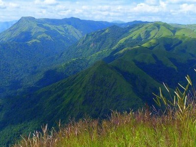
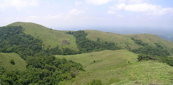
At a distance of 26 Km from Kudremukh Town, 67 Km from Sringeri, and 90 Km from Chikmagalur, Kudremukh is a mountain in the Chikmagalur district of Karnataka. It is one of the best trekking destinations in Karnataka, and among the must-include places in the Chikmagalur Adventure tour packages.
At an elevation of 1894 meters, Kudremukh stands as one of the tallest peaks in the Western Ghats and ranks as the second-highest peak in the state, following Mullayanagiri. The term Kuduremukha translates to "horse-faced" in Kannada, refering to a specific scenic view of the mountain that resembles the face of a horse. Historically, it was also known as 'Samseparvata' due to its accessibility from Samse village. This region is recognized as a biologically rich hotspot, showcasing a variety of wildlife and gaining popularity for trekking.
The peak is situated within the Kudremukh National Park, which boasts a wealth of flora and fauna. Established as a national park in 1987, this 600 square kilometer area in the Western Ghats is classified as one of the world's 38 'hottest hotspots' of biological diversity, a UNESCO World Heritage Site, and is the second-largest tropical wet evergreen forest in the Western Ghats zone. The Kudremukh National Park is adorned with natural splendor, featuring towering peaks interspersed with a multitude of flora and fauna, alongside picturesque trekking paths that overlook lush ...
Distance from Mangalore: 98 Kms
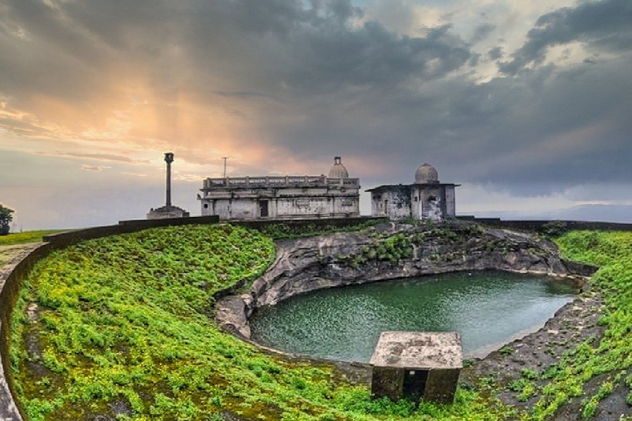
At a distance of 17 km from Agumbe, and 96 km from Shimoga, Kundadri is a beautiful hill top located near Agumbe in the Shimoga district of Karnataka, India. It is one of the top places of trekking in Karnataka, and among the must-visit places as part of Agumbe tour packages.
Rising at an altitude of 3,200 feet, the Kundadri hill is known for the 17th-century Jain temple dedicated to Parshwanath Tirthankara. The name Kundadri is believed to be derived from the name of Acharya Kundakunda, a popular 4th century Jain Monk, who is said to have taken shelter in these hills. The small temple, along with two small ponds form the only building on top of Kundadri hills. The Jain Temple is particularly crowded amid the season of Makara Sankranti in January.
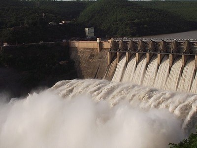
Boasting dense jungles of the Western Ghats, Kundadri is a trekker's haven and a paradise for nature lovers. A rough, 7 km rugged narrow path leads to the top of the hill and is a moderate trek. The trail can be a bit challenging at first but quickly becomes simpler and more rewarding as you take in the stunning scenery around you. One can also reach the top by driving your way up, except for the last fifty steps or so. However, the area is best explored whilst trekking in the surrounding jungles. From the top of the peak, you can have a panoramic view of the distant backwaters of the Varahi Dam. Camping in the ...
Distance from Mangalore: 115 Kms
At a distance of 85 km from Madikeri and 10 km from Irupu Falls, Brahmagiri Wildlife Sanctuary is a popular wildlife sanctuary situated in Kodagu district of Karnataka state and is part of the Western Ghats. It is situated on the border of Wayanad district of Kerala and Kodagu district in Karnataka. It is one of the famous sites for trekking in Karnataka and also one of the popular places of trekking in Coorg.
Brahmagiri Wildlife Sanctuary was established in 1974. Situated at an altitude of 5357 feet, the sanctuary is spread across 181 Sq. km. The sanctuary derives its name from the highest point, the Brahmagiri Peak, which lies at an altitude of about 1607 m. The vegetation in the low-lying areas is predominantly evergreen and semi-evergreen forests, while shola grasslands cover the higher altitudes. The undulating terrain is dotted with several steep valleys and hillocks.
Elephant, gaur, tiger, jungle cat, leopard cat, wild dog, sloth bear, wild pig, sambar, spotted deer, Nilgiri langur, Malabar giant squirrel, giant flying squirrel, Nilgiri marten, common otter, brown mongoose, civet, porcupine, and pangolin are the common wildlife spotted at the sanctuary. Python, cobra, king cobra, malabar pit viper are some of the reptiles found in the sanctuary. Birds in the sanctuary include emerald dove, black bulbul and Malabar trogon.
Brahmagiri Peak, towers over the sanctuary, is a major tourist attraction and is also ...
Distance from Mangalore: 121 Kms

At a distance of 45 Kms from Murudeshwar, 54 kms from Jog Falls, 95 Kms from Udupi & 20 Kms from Shiroor (on Udupi - Karwar road), Koosalli Waterfalls is a magnificent waterfall located in deep forest near Koosalli village. The waterfall is 20 Kms from Shiroor via Toodalli (also known as Soodalli) and 5 Kms from Koosalli village.
Koosalli Waterfalls is a 6 step cascading waterfall dropping from a height of 380 feet. One has to trek for 5 Kms from Koosalli through dense forest which also includes difficult rock climbing in order to reach the falls (2 Hrs trek from Koosalli village one-way). This place is highly dangerous during monsoons when the rocks become slippery. Nov - Dec is the best time to trek this place. Koosalli can be reached from Shiroor by Auto (very few buses are available till Toodalli - 5 Kms from before Koosalli).
First three falls are little smaller and remaining three falls are gorgeous. Especially, the sixth fall is awesome with a height of 150 feet.
Distance from Mangalore: 175 Kms
| Package | Duration | Starting Price | Details |
|---|---|---|---|
| Mysore - Coorg - Bangalore | 5D/4N | ₹ 14950 | View Details |
| Mangalore - Udipi - Murudeshwar - Gokarna | 5D/4N | ₹ 16250 | View Details |
| Hampi - Badami - Pattadakal | 4D/3N | ₹ 12750 | View Details |
| Coorg - Udipi - Murudeshwar - Gokarna | 6D/5N | ₹ 18100 | View Details |
| Ooty - Mysore - Coorg | 6D/5N | ₹ 18450 | View Details |
| Best of Karnataka in 8 Days | 8D/7N | ₹ 22450 | View Details |
Similar Getaways