-
Tours
-
-
- Domestic Tours
-
-
- Resorts
- Car Rentals
- Destinations
- Getaways
- Hotels
- Tools
- * Workation
- * Tour Plans
- Blog
- List Property
- * Offers *


Distance from Kochi: 239 Kms
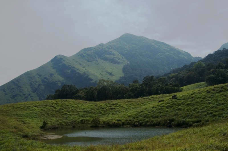
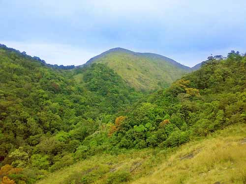
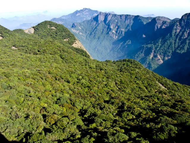
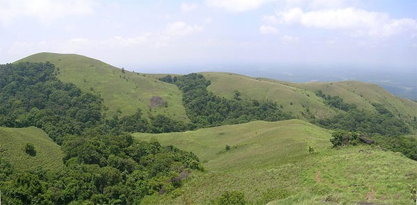
At a distance of 16 km from Munnar, Eravikulam National Park is a protected wildlife reserve located in Munnar. Situated on Munnar - Udumalpet Road, it is one of the popular national parks in Kerala, and among the must visit places during Munnar tour.
The Eravikulam National Park was established to protect the Nilgiri Tahr. Earlier, the area was managed as a game preserve by the Kanan Devan Hills Produce Company. The government of Kerala resumed control in 1971 and declared the Eravikulam-Rajamala Wildlife Sanctuary in 1975 and became a National Park in 1978.
The national park is spread across an area of 97sq. km and is a protected area. The park is extended into Tamil Nadu and is known as Annamalai Wildlife Sanctuary. This region is famous as the natural habitat of the endangered Nilgiri Tahr. Nearly half the world's population of this rare species is found in the area. Other faunal species found in the park are elephant Gaur, Giant Squirrel, Leopard, Lion-Tailed Macaque, Tiger, and Sambar. It is one of the beautiful places to see Neelkurnji flowers in South India as part of your wildlife tour in India.
The park is divided into 3 regions - the core area, the buffer area, and the tourism area. Visitors are allowed only to the tourism area, which is in the Rajamalai region. Tourists can take safari and trekking ...
Distance from Kochi: 145 Kms
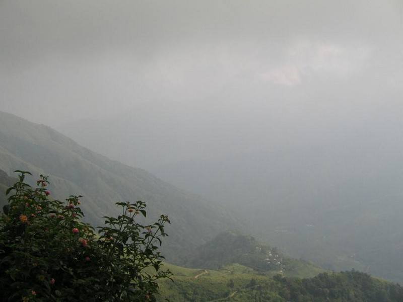
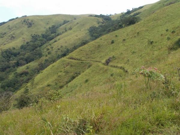
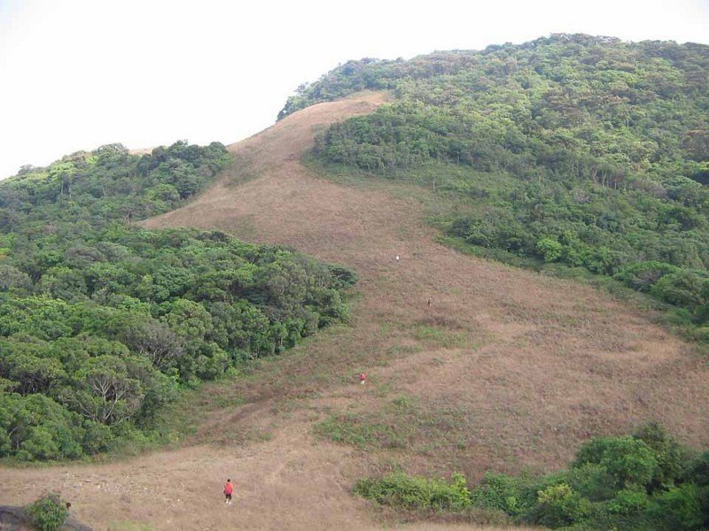
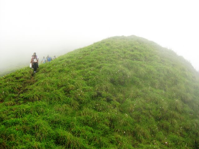
At a distance of 32 Kms from Munnar, Top Station is a breathtakingly beautiful place on Kerala - Tamilnadu boarder. From here, one can get 360 degrees view of the Western Ghats. This is one of the best Munnar tourist places and among the prime place to visit on a Munnar tour.
At an altitude of 2200 meters, this place is also known for the Neelakurunji Plant, which flowers only once every 12 years (next flowering year is 2018). The view point is at a distance of 2 kms from the road point and has to be trekked down. The trek path is very steep with deep valleys one side. One should be very careful while trekking to the view point, which offers lifetime memories. Top Station is the highest approachable road in South India.
The viewpoint at Top Station offers breathtakingly beautiful views of Kannan Devan Hills. The valleys all around, the misty mountains and distant waterfalls all make this place a must visit spot in Munnar.
Top Station is also a wonderful trekking destination in Munnar. There are multiple trekking routes in Top Station. The most popular route starts from Kurangani, a small village in Theni district of Tamilnadu. The total distance of Kurangani to Top Station is about 9 km and it usually takes around 6 hours to complete the trek. Camping is also allowed on the trail if overnight stay is preferred. This can also ...
Distance from Kochi: 146 Kms
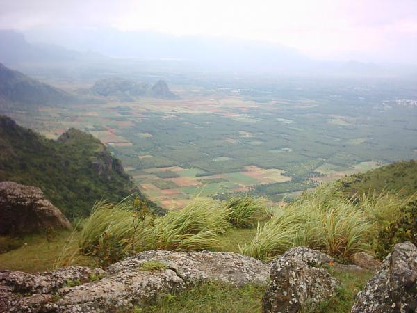
At a distance of 40 Kms from Idukki, 38 Kms from Kumily, 57 Kms from Munnar, 15 Kms from Nadumkandam & 18 Kms from Kambam (on NH220 towards Palani), Ramakkalmedu is a lovely tourist place with rolling green hills and the fresh mountain air.
The hilltop also offers a panoramic view of the picturesque villages of Kambam and surrounding places on the slope of the Western Ghats. Kerala Tourism Department has provided additional facilities for tourists with resting points & statues of Kuravan & Kurathi (local tribes) at Ramakkalmedu.
Ramakkalmedu is also a great trekking destination. The view point on top of the hill is the highest point in this area, which can be reached by 3-4 Kms trek from the Ramakkalmedu Junction.
This place is connected by bus service from Munnar, Kottayam and Ernakulam.
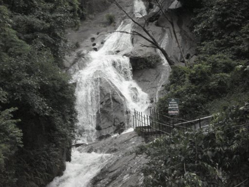
Distance from Kochi: 145 Kms
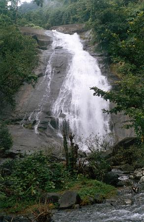
At a distance of 6 km from Kodencheri, 32 km from Kalpetta, & 48 km from Kozhikode, Thusharagiri Falls is a scenic waterfall located in the Kozhikode district of Kerala, India. This is one of the most beautiful waterfalls in Malabar region and among the most popular places of sightseeing in Wayanad.
Thusharagiri literally means 'snowcapped mountains'. Two streams originating from the Western Ghats meet here to form the Chalippuzha River. The river diverges into three waterfalls creating a snowy spray, which gives the name - Thusharagiri. The highest of the three falls is the Thenpara Fall dropping from a height of 75 meters. The first waterfall can be reached easily while the remaining two falls can be reached from the first one by trekking through thick forest. A 5 km upstream trek will take one to the origin of the stream.
Widely known as the 'trekker's paradise', the place offers challenging trekking and rock-climbing opportunities. Surrounding the magical waterfalls are the evergreen forests and soothing streams adding to the pristine beauty. There is a trek path from Thusharagiri to Vythiri in Wayanad and it is not for the faint heart. Starting from Thusharagiri Falls in the morning, and reached Vythiri by evening. An ideal destination for nature lovers and wildlife enthusiasts, this Kerala waterfall is also a great picnic spot as well as a nice romantic retreat.
Considered among ...
Distance from Kochi: 219 Kms
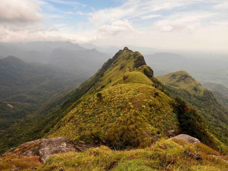
At a distance of 20 km from Munnar, Anamudi Peak is a mountain peak situated in the Western Ghats of Kerala near Munnar. It is the highest point in India outside the Himalaya-Karakoram, and among the popular places of trekking in Kerala.
Located at an altitude of 8842 feet, Anamudi Peak is the highest point in South India, and among the must-visit Munnar tourist places. Located inside the Eravikulam National Park, it is a famous trekking destination in Kerala which offers breathtaking views of the Western Ghats. Anamudi, together with the Eravikulam Park, is home to one of the largest surviving populations of Asian elephants, Gaurs, and Nilgiri Tahrs. Anamudi is also famous for Kurunji flowers that blossom once in 12 years.
The 2-3 days trekking programming starts at the foothill of Eravikulam with night halts at tribal hamlets inside the forest. Taking prior permission from Wildlife authorities is mandatory before starting the trek to Anamudi Peak during your Munnar tour. It is advisable to take guided tours from travel agents in Munnar, who will provide food, guide, accommodation, permissions, pick up / drop, and all other facilities.
In order to just view the Anamudi Peak from a distance, visitors can take the guided minibus tour of Eravikulam National Park which will take to the viewpoint that offers ...
Distance from Kochi: 145 Kms
At a distance of 12 km from Palakkad & 60 km from Coimbatore, Dhoni Hills is a famous picnic spot near Palakkad. It is one of the best places of sightseeing in Palakkad.
Adjacent to the Malampuzha Reservoir, Dhoni Hills is a wonderful destination for trekking. Dhoni is named after a boat-shaped rock on one of its hills, where thoni/dhoni means boat in Malayalam. It is famous for Dhoni Waterfalls and the Western Ghat forests. Visitors have to walk 4 km from the bottom of the hill to reach the waterfall.
Dhoni provides trekkers the opportunity to explore its hilly terrains. The trek from the base area to Malampuzha and Meenavallam and Dhoni waterfalls is very interesting. It is one of the famous trekking places near Coimbatore. One can encounter some rare species of flora and fauna on the trek here. Dhoni is also famous for its farmhouse, harboring hundreds of cattle of Swiss variety.
Timings: 6 AM - 6 PM
Entry: Rs. 100 for Person
Distance from Kochi: 137 Kms
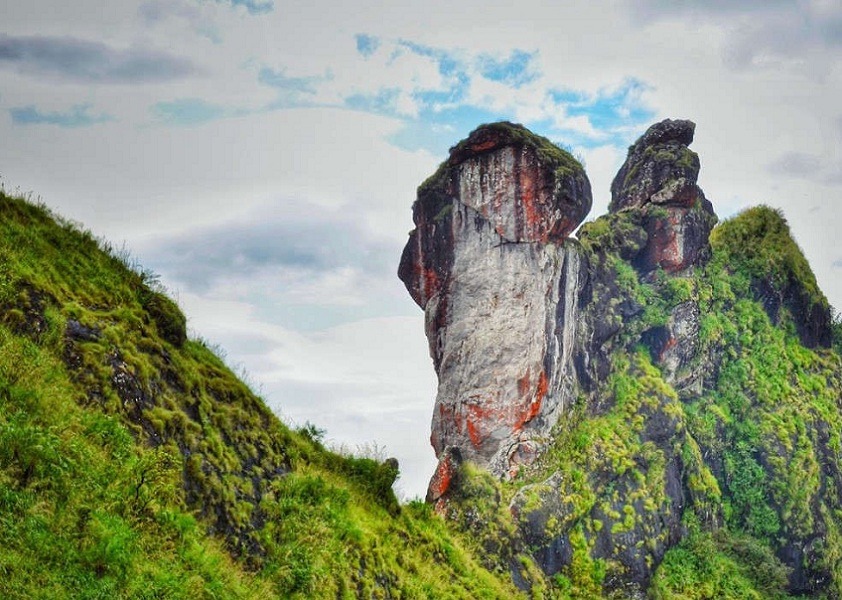
At a distance of 10 km from Marmala Waterfalls, 30 km from Vagamon, and 57 km from Kottayam, Illikkal Kallu is a monolith located on top of the Illickal Mala near Meladukkam village in the Kottayam district of Kerala, India. It is one of the scenic viewpoints in the Western Ghats, and among the top places to visit during Vagamon tour.
Situated at an altitude of 3400 feet, Illikkal Kallu is a major tourist attraction in Moonnilavu and Thalanadu village of Meenachil taluk. Illikkal Kallu is one of the three hills comprising of Illikkal Mala, one of the highest peaks in the Western Ghats. Each of the hills has a peculiar shape. One of them resembles a mushroom, which is why it is known as Kuda Kallu (umbrella-shaped rock). The second hill has a small hunch on the sides and is therefore referred to as Koonu Kallu (hunch back rock). There are two bridges connecting the hills, known as Naragapalam (Hell bridge) and Swargavathil (Entrance to Heaven). A new rope-way is proposed connecting Illikal Kallu and the nearby hill Ilaveezha Poonchira, as a part of Kerala Tourism.
The beauty and the landscape of Illikkal Kallu are similar to that of the Pillar Rocks in Kodaikanal. Only one-half of the original rock remains, as the other half of the rock has fallen off. The view from Illikal Kallu is mesmerizing with numerous hills rising to the clouds and the deep valleys. From the hilltop, the Arabian Sea can be seen on the far ...
Distance from Kochi: 90 Kms
At a distance of 48 km from Trivandrum and 33 km from Ponmudi Bus Station, Varayadu Motta is a mountain ridge located in Ponmudi, Kerala. It is one of the popular places of trekking in Ponmudi.
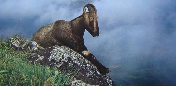
Situated at a height of 1100 m, Varayadumotta is the highest peak in the Ponmudi ranges. Also known as Varayadumudi and Varayattumutti, the place derived its name from Nilgiri tahr / Varayadu, as this place is a favorable home for mountain goats (Nilgiri Tahr) in acute population. Varying elevation and peculiar shape of this hill is unique in the world. It is a protected mountain ridge situated in between Ponmudi hills, Palode (Brimore) hills, and Kallar valley. It includes 13 peaks and the second peak is the highest in Varayadumotta.
Varayudu Motta is the third adventurous trekking in South India after Meesapulimala and Agastyarkoodam. The trekking level can be from moderate to tough. Tough for first-timers, but they will never forget the experience for a long time. The ridge is a protected site under the Palode reserve forest and prior permission is required for the trekking. The permission can be obtained from the ecotourism units of Mankayam or Ponmudi by paying a fee for the trekking team. A forest guide will accompany the trekking team. Usually, trekkers climb the mountain and return to either Mankayam or Ponmudi. It is also possible to cross the entire ridge and reach the Kallar valley along the Ponmudi main road. However, this is a much tougher trek trail.
There ...
Distance from Kochi: 199 Kms
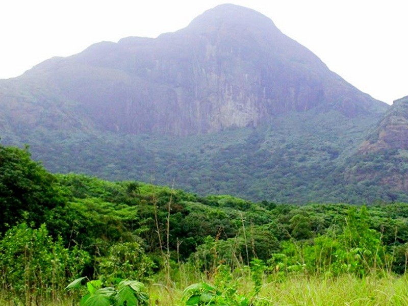
At a distance of 44 km from Ponmudi and 62 km from Trivandrum, Agasthyakoodam is a mountain peak situated near Ponmudi. It is one of the highest peaks in the Western Ghats and among the popular places of trekking in Kerala.
Perched at an altitude of 6201 feet, Agasthyarkoodam is the second highest peak in Kerala after Anamudi near Munnar (8842 feet), and among the best Ponmudi places to visit. The mountain is revered by both Buddhists and Hindus, as it is believed to be the abode of the Bodhisattva Avalokitesvara as well as of the sage Agastya, a disciple of Lord Shiva. There is a small shrine on the mountain top with an idol of Agasthya rishi and during the Agasthyarkoodam trekking season, people perform pujas here. The hill range is now declared as Agasthya Vanam Biological Park covering an area of 23 sq. km. Also, it is the source of River Kallar.
Apart from being a popular pilgrimage site, Agasthyakoodam is a paradise for ardent trekkers. It is a 20 km long trek which can be completed in 2-3 days. The trekking expedition starts from Bonocaud, a place situated around 30 km away from Ponumudi. The forest area of this trek is known for its remarkable flora and fauna, especially certain rare medicinal herbs which have been discovered here. Over 2000 species including lichens, orchids, mosses, and ferns have been recorded in the area. ...
Distance from Kochi: 228 Kms
At a distance of 13 km from Muthappanpuzha, 63 km from Kozhikode Railway Station and 33 km from Thiruvambady, Vellarimala is a mountain range in Kerala, spread across Thiruvambady Panchayat in Kozhikode district and Meppadi Panchayat in Wayanad district. It lies at an altitude of 2200 m and is a popular hill resort around Kozhikode.
Vellari Mala is part of the popular Camel's Hump Mountains of the Western Ghats. The tallest peak in this range is called Vavul Mala and is situated an altitude of 2339 m. The meandering flow of the River Chaliyar through the rocky terrain of the hill range adds to the mystic beauty of the place by creating many waterfalls and cascades. Vellari Mala is a trekker's paradise but it is also a great picnic spot for a relaxing experience with family and friends.
Trekking to Vellari Mala starts from Muthappanpuzha, 3 km from Anakkampoyil, which is about 50 km from Kozhikode. KSRTC Bus Services are available from Thiruvambady to Anakkampoyil and Muthappanpuzha. There are jeeps available to Vellari Mala base from Muthappanpuzha. From the base visitors need to trek 9 km through thick forest and rocky terrains. It will take one full day to climb this peak and one could return only on the next day.
Vellarimala trek is one of the toughest treks in the South. Except for the initial 4 km stretch, the entire trek is through dense forest, frequented by ...
Distance from Kochi: 208 Kms
At a distance of 7 km from Thirunelly Temple, 29 km from Mananthavady, 35 km from Irupu Falls & 52 km from Kalpetta, Pakshipathalam is an eco-tourist spot situated in the Brahmagiri hills of Wayanad district. Situated at an altitude of 1740 m, Pakshipathalam is one of the popular Wayanad tourist places and also one of the best places for trekking in Wayanad.
Pakshipathalam is the abode of large population of several species of birds. It is an ornithologist's paradise. The deep rock caves, formed among the thick blocks of rocks at the northern top end of the Brahmagiri, are the abode of various birds and wild beasts. The hill station of Pakshipathalam was once the meditating area for countless rishis or saints of ancient India. There is also a cave called Munikal Cave, where birds take shelter during night and early morning. The cave is also famous for the endangered species of birds known as 'Edible Nest Swift' which makes its nest with the help of its saliva. There is a small eagle shaped projection where the Garuda, the sacred vehicle of Lord Vishnu, was believed to have been landed.
Pakshipathalam is a challenging tourist spot for any adventure seeking tourist. This can be accessed only by trekking from Thirunelly Temple (about 8 km one way). The 3 hours trek to Pakshipathalam takes you through moist deciduous forests, rolling hillocks, open grasslands, slippery trails, and narrow rocky caves. There is also ...
Distance from Kochi: 291 Kms
Distance from Kochi: 378 Kms
At a distance of 26 Km from Kudremukh Town, 67 Km from Sringeri, and 90 Km from Chikmagalur, Kudremukh is a mountain in the Chikmagalur district of Karnataka. It is one of the best trekking destinations in Karnataka, and among the must-include places in the Chikmagalur Adventure tour packages.
At an elevation of 1894 meters, Kudremukh stands as one of the tallest peaks in the Western Ghats and ranks as the second-highest peak in the state, following Mullayanagiri. The term Kuduremukha translates to "horse-faced" in Kannada, refering to a specific scenic view of the mountain that resembles the face of a horse. Historically, it was also known as 'Samseparvata' due to its accessibility from Samse village. This region is recognized as a biologically rich hotspot, showcasing a variety of wildlife and gaining popularity for trekking.
The peak is situated within the Kudremukh National Park, which boasts a wealth of flora and fauna. Established as a national park in 1987, this 600 square kilometer area in the Western Ghats is classified as one of the world's 38 'hottest hotspots' of biological diversity, a UNESCO World Heritage Site, and is the second-largest tropical wet evergreen forest in the Western Ghats zone. The Kudremukh National Park is adorned with natural splendor, featuring towering peaks interspersed with a multitude of flora and fauna, alongside picturesque trekking paths that overlook lush ...
Distance from Kochi: 452 Kms

At a distance of 7 km from Nalaknad Palace and 41 km from Madikeri, Tadiyandamol Peak near Kakkabe is a tallest mountain peak in Kodagu. Tadiyandamol is one of the top things to do in Coorg and also a well-known destination for trekking in Karnataka. It is one of the top attractions you must include in Coorg package
Lies at an altitude of 5730 feet, Tadiyandamol is the second highest peak in Karnataka after Mulliyangiri in the Baba Budan Range. The name Tadiyandamol literally means tallest mount in Kodava. With gentle, velvety green slopes, Tadiyandamol is one of the most exquisite treks in Karnataka and one which is also known to a few.
It is a 14 km trek both ways, takes you through the vast expanse of the Shola forests, endless lush green grasslands and streams. The peak can be approached from the Nalakand Palace (7 km) which is at the base of the hill. It is of historic importance as it was built by Dodda Veerarajendra in 1792 to shelter his army against the British. It is a day trek which makes it even more doable for city folks- whether avid trekkers or beginners. The trek from Nalaknad Palace to top of the peak is moderate and takes around 3 - 4 hours one way.
September to May is the best time to trek Tadiyandamol. It is advisable to hire a guide to trek the ...
Distance from Kochi: 359 Kms
At a distance of 36 km from Coimbatore, and 50 km from Palakkad, Siruvani Waterfall is a scenic waterfall situated in the Siruvani Hills of Tamil Nadu. It is one of the popular waterfalls in Tamilnadu, and among the must-visit places during your Coimbatore trip.
Also called Kovai Kutralam Falls, the Siruvani Fall is formed by the Siruvani river. The reservoir at Siruvani was built for Tamil Nadu by the Kerala Government with funds collected by the Tamil Nadu government to meet the drinking water requirements of Coimbatore city. The water of the Dam is famous for its sweetness and it is typically known to be the second sweetest lake water in the world. It is one of the major tourist places in Coimbatore.
The visitors are not allowed to see the falls after 5 pm as it is located in the center part of a dense forest. With an outstanding panoramic view, the Siruvani dam is extremely beautiful and breathe taking. Tourists cannot make their visit to this falls anytime because only a few numbers of buses are available to visit the place.
Sadivayal Checkpost, where an entry fee Rs. 50 is charged, is at the gateway to the waterfalls. Private vehicles are not allowed beyond this point. However, vehicles arranged by the forest department can be used for the conveyance to the point where ...
Distance from Kochi: 181 Kms
At a distance of 35 Kms from Coimbatore Railway Station & 533 Kms from Chennai, Vaideki Falls are located near Narisipuram town.
The falls is very beautiful and has a naturally formed slope. It is located inside the forest and one must obtain permission before entering the forest. Visitors are only allowed by being escorted by a forest guard into the forest. This area of forest has lot of animal movements; especially elephants. There are lot of incidents of elephants attacking humans, so it is always advisable to obtain permission and get some guards accompanying while entering the forest.
About 5 Kms trek through forest is required to reach the falls from nearest road point. One can get private vehicles to reach forest trek point from Narisipuram town.
Distance from Kochi: 193 Kms
At a distance of 40 Kms from Kodaikanal & 485 Kms from Chennai, Thalaiyar Falls, also known as the Rat Tail Falls is the highest waterfalls in Tamil Nadu and third highest falls in India. It is also one of the popular sites for trekking near Kodaikanal.
With a height of 975 feet (297 meters), the falls is visible from a great distance on the ghat road towards Dindigul. This falls is considered inaccessible to the general public, as there is no access road to it. However, one can reach these falls with 6 kms trekking after 34 Kms of road journey on ghat road from kodaikanal. The trek duration is around 2-3 hours one way. The trek is considered to be of moderate difficulty.
The very edge at the top of the falls has a concrete wall. One can walk along the wall and get near the center of the falls. The water here is considered polluted and it's better to avoid bathing here.
One can catch Dindigal / Madurai buses from Kodaikanal, get down at the ghat road after 34 Kms and trek down to the falls from here. There are no sign boards but can get done at the mile stone which shows distance to Kodai as 34 km.
Distance from Kochi: 230 Kms
At a distance of 15 km from Kukke Subramanya, 30 km from Somwarpet, 65 km from Madikeri, 115 km from Mangalore, 260 km from Bangalore, Kumara Parvatha, also known as Pushpagiri, is a beautiful mountain peak located in Pushpagiri reserve forest near Kukke Subramanya town in Dakshina Kannada district of Karnataka. Situated at an elevation of 1712 m above sea level, Kumara Parvatha trek is one of the toughest treks and most popular trekking destinations in the Western Ghats of Karnataka. The trek distance is around 25 km (with return) and usually done in 2 days.
Kumara Parvatha is the third tallest peak in Karnataka, Mulliyangiri in Chikmagalur being the tallest and Thadiyandamol in Coorg being the second tallest. Kumara Parvatha trek is one among the most popular trekking trails in Karnataka. This peak has numerous white stones that are known as 'Saligramams'. The Shivalingas with six faces, also known as the 'Kumaralingas', can also be seen here.
There are two routes to trek Kumara Parvatha. First route starts from Kukke Subramanya Temple and goes through Girigadde (Bhattare Mane) & Mantapa. This route is moderate difficulty. Bhattare Mane is the only point along the trek where you can get food, water and rest�rooms. Camping can be done at Girigadde (Bhattare Mane) or Mantapa.
Second trek route is little hard and starts from Heggade Mane, which is about 5 km from Bidahalli (which is 15 km from ...
Distance from Kochi: 393 Kms
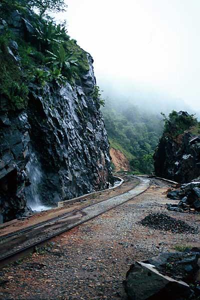
At a distance of 100 Kms from Mangalore, 30 Kms from Kukke Subramanya, 65 Kms from Hassan & 80 Kms from Chikmagalur, Yedakumeri is a beautiful place in the Western Ghats & a wonderful trekking destination.
A trekking along the abandoned meter gauge railway line between Donigal and Yedukumeri (17 Kms - 8 Hrs) is a unique experience and is popularly referred to as 'Yedakumeri Railway Trek' or 'Green Route Trek'. This route is nature lovers & photographers paradise.
The trek route has several curves, tunnels and bridges. The mountains stretch with more than 25 waterfalls and several small streams. Trekking usually starts from the Dhonigal (on Bangalore - Mangalore route) and run along the tracks to Yedakumeri. Camping can be done at Dhonigal & Yedakumeri stations. Trek can be extended till Kukke Subramanya (16 Kms extra).
Donigal can be reached by Bus/Cab from Sakleshpura (which is connected by Bus with Bangalore via Hassan) - 10 Kms away.
Pre & post monsoon is the best time.
Distance from Kochi: 456 Kms
At a distance of 18 Km from Sringeri, 20 Km from Agumbe & 65 Km from Udupi, Narasimha Parvatha is an excellent destination for trekking in Karnataka for a two day trip. It is situated at an altitude of 3780 feet. This is one of the popular moderate to difficult treks in Karnataka with overnight camping on the peak.
Most common trekking route starts from Malandur (6 Km from Agumbe) and ends at Kigga (10 Km from Sringeri) with overnight stay on Narasimha Parvatha. Malandur can be reached by private vehicle from Agumbe (walking takes 1.5 hrs). From Malandur, the trek distance to the peak is about 14 Km via Barkana Falls (6-7 Hrs trek). Camping is allowed on the peak. Kigga is about 8 Km from Narasimha Parvatha and takes about 3-4 Hrs (Sirimane Falls can be visited during this trek with 1-2 Hrs extra effort). Water filling can be done at Barkana Falls and there is also a small pond on the peak for emergency water. Sunrise from the peak offers a breathtaking experience.
Agumbe is the base station to start the trek to Narasimha Parvatha. Agumbe has direct bus connectivity with Bangalore and other major cities in Karnataka. There are a couple of small lodges and restaurants in Agumbe to fresh-up and pack food before starting the trek. Autos can be hired to Malandur where the actual trekking starts. It is mandatory to register the names at Agumbe police station before starting ...
Distance from Kochi: 500 Kms
At a distance of 85 km from Madikeri and 10 km from Irupu Falls, Brahmagiri Wildlife Sanctuary is a popular wildlife sanctuary situated in Kodagu district of Karnataka state and is part of the Western Ghats. It is situated on the border of Wayanad district of Kerala and Kodagu district in Karnataka. It is one of the famous sites for trekking in Karnataka and also one of the popular places of trekking in Coorg.
Brahmagiri Wildlife Sanctuary was established in 1974. Situated at an altitude of 5357 feet, the sanctuary is spread across 181 Sq. km. The sanctuary derives its name from the highest point, the Brahmagiri Peak, which lies at an altitude of about 1607 m. The vegetation in the low-lying areas is predominantly evergreen and semi-evergreen forests, while shola grasslands cover the higher altitudes. The undulating terrain is dotted with several steep valleys and hillocks.
Elephant, gaur, tiger, jungle cat, leopard cat, wild dog, sloth bear, wild pig, sambar, spotted deer, Nilgiri langur, Malabar giant squirrel, giant flying squirrel, Nilgiri marten, common otter, brown mongoose, civet, porcupine, and pangolin are the common wildlife spotted at the sanctuary. Python, cobra, king cobra, malabar pit viper are some of the reptiles found in the sanctuary. Birds in the sanctuary include emerald dove, black bulbul and Malabar trogon.
Brahmagiri Peak, towers over the sanctuary, is a major tourist attraction and is also ...
Distance from Kochi: 299 Kms
At a distance of 70 km from Madikeri, and 33 km from Somvarpet, Pushpagiri is a mountain peak situated in Kodagu district of Karnataka. Pushpagiri is one of the best places for trekking in Coorg and among the top Karnataka trekking places.
Pushpagiri is the highest peak in Pushpagiri Wildlife Sanctuary in the Western Ghats of Karnataka. Situated at an altitude of 5626 feet, Pushpagiri is the 6th highest peak in Karnataka and also 2nd highest peak in Coorg after Thadiyandamol. The Harangi River originates from the top of this hill. Covered by lush green forests, valleys, and hills, the area is perfect for hiking expeditions and it is one of the best places for trekking.
The trekking starts from the forest checkpoint at the base of Pushpagiri Hills, after Heggadamane village. The Pushpagiri peak is about 7 km from the Check Post and takes about 3-4 hours one way (moderate to difficult level) through thick forest, wet grasslands & some rocky terrain. There is a small temple at the peak dedicated to Kumara Swamy. It is possible to return on the same day if you wish to visit only Pushpagiri peak. But most of the trekkers continue to exit through the Kumara Parvatha (to Kukke) and camp at Girigadde which is 14 km from Pushpagiri Check Post (takes about 7 hours). There is very basic private accommodation available in Girigadde called Bhattara Mane and food is also served (need to carry sleeping bags).
Kukke is about ...
Distance from Kochi: 418 Kms
| Package | Duration | Starting Price | Details |
|---|---|---|---|
| Wayanad - Kozhikode | 4D/3N | ₹ 11875 | View Details |
| Munnar - Thekkady - Alleppey | 5D/4N | ₹ 11550 | View Details |
| Alleppey - Munnar - Thekkady - Kovalam | 6D/5N | ₹ 15050 | View Details |
| Athirapally - Munnar - Thekkady - Alleppey - Kovalam | 7D/6N | ₹ 17550 | View Details |
| Best of Kerala in 8 days | 8D/7N | ₹ 19050 | View Details |
Similar Getaways