-
Tours
-
-
- Domestic Tours
-
-
- Resorts
- Car Rentals
- Destinations
- Getaways
- Hotels
- Tools
- * Workation
- * Tour Plans
- Blog
- List Property
- * Offers *


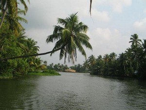
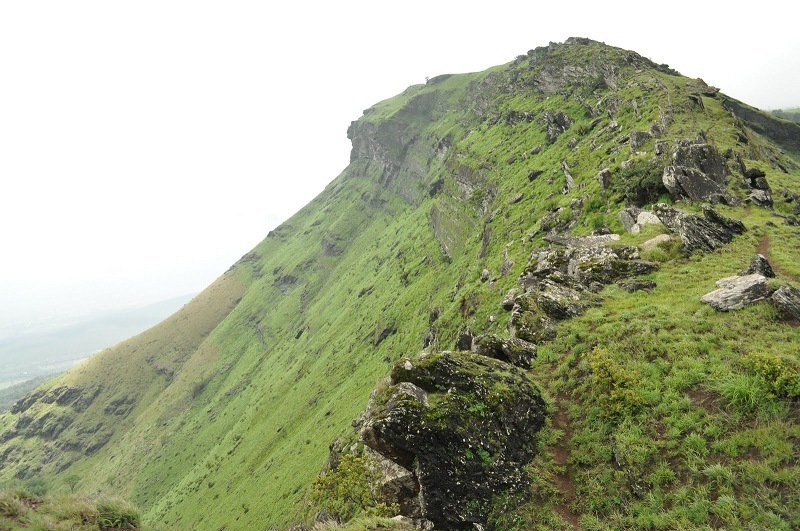
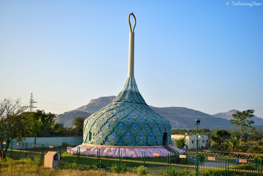
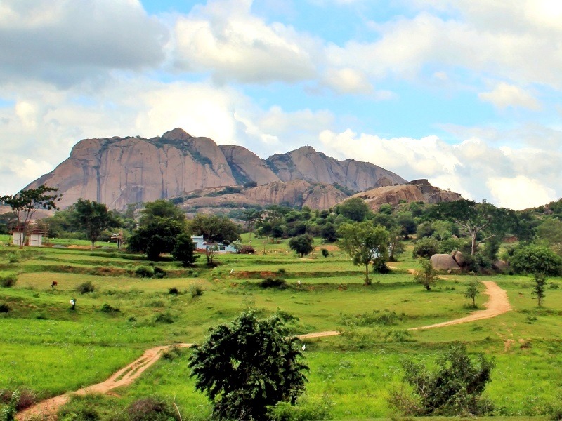
At a distance of 66 km from Nandyal, 137 km from Kurnool, 114 km from Kadapa, 348 km from Vijayawada, 350 km from Hyderabad and 407 km from Bangalore, Ahobilam or Ahobalam is an important pilgrimage center located in the Kurnool district of Andhra Pradesh. Ahobilam is one of the most famous pilgrimage sites in Andhra Pradesh and also one of the best Places to visit in Andhra Pradesh.
Ahobilam is the holy abode of Lord Narasimha, an incarnation of Lord Vishnu in man-lion form. According to legend, this is the place where Lord Narasimha killed Hiranyakasipu and saved Prahalada. Though the initial temples were built by Chalukyas in 8th century, most of the current structures were rebuilt by Vijayanagara kings around 15th century.
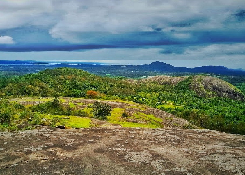
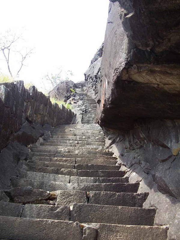
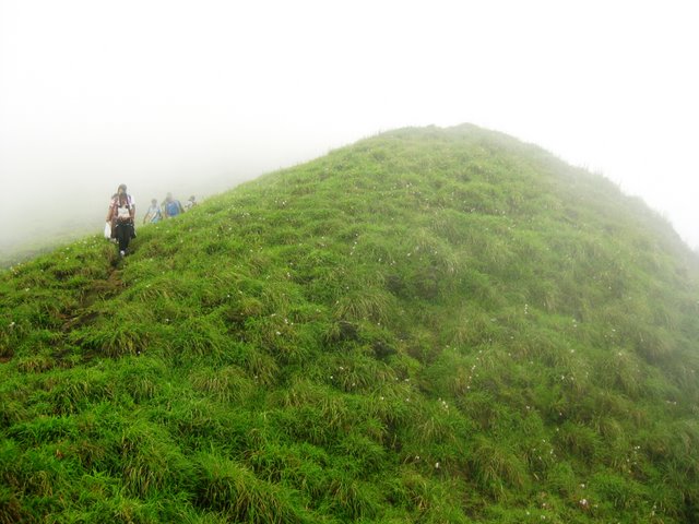
Situated amidst dense Nallamala Forest, Ahobilam is one of the 108 Divya Desams. This place is also called as Nava Narasimha Kshetra since Lord Narasimha is worshipped in 9 different forms and separate temples exist for all the forms within a radius of 5 km from the main temple. Jwala Narasimha, Ahobila Narasimha, Malola Narasimha, Kroda Narasimha, Kaaranja Narasimha, Bhargava Narasimha, Yaogananda Narasimha, Chathravata Narasimha and Paavana Narasimha are the nine forms of Lord Narasimha in Ahobilam. Few of these temples have easy access, but most of them have to be reached by difficult treks through thick forest and rocky paths.
The town is divided ...
Distance from Bangalore: 339 Kms
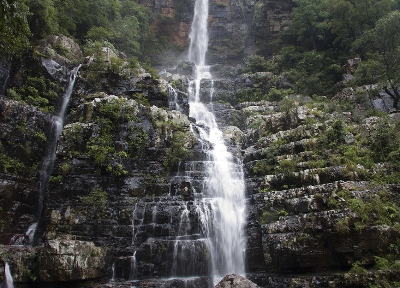
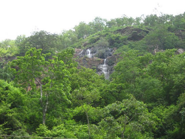
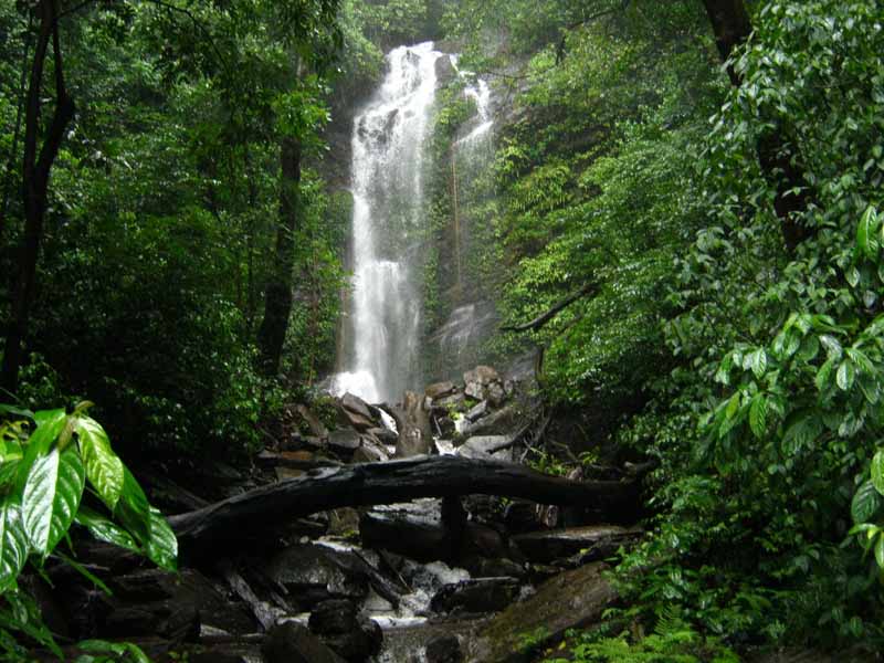
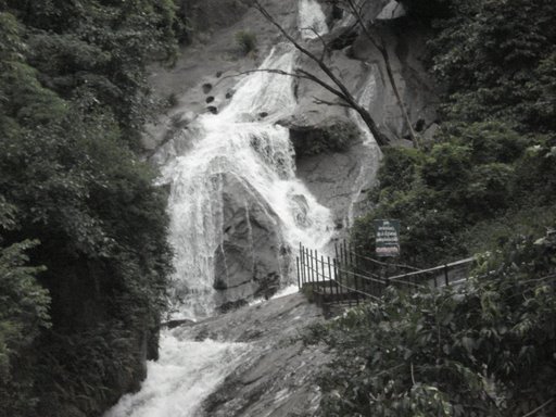
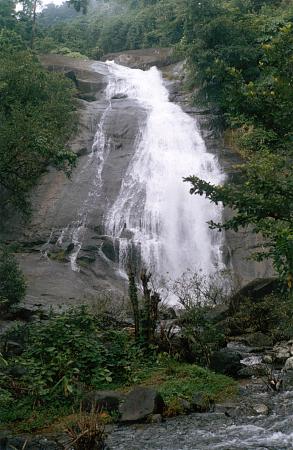
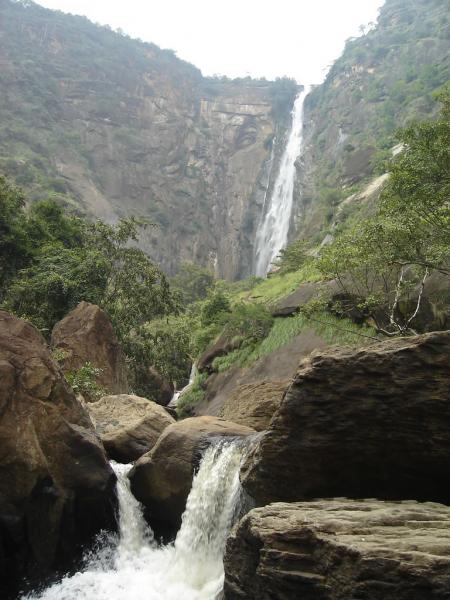
At a distance of 49 km from Bakarapet, 64 km from Tirupati, 120 km from Horsley Hills, 192 km from Chennai, 241 km from Bangalore and 89 km from Chittoor, Talakona Falls are situated in Sri Venkateswara National Park near Nerabailu Village of Yerravari Mandal of Chittoor district in Andhra Pradesh. The gorgeous waterfall falling deep into a valley from a height of around 270 feet makes it the highest waterfall in Andhra Pradesh and also one of the top Tourist places in Andhra Pradesh. It is also one of the popular waterfalls near Bangalore.
The waterfalls are placed amidst dense forest surrounded by natural beauty and greenery. It is believed that the water of Talakona Falls is enriched with herbs with healing powers. Talakona was declared as Bio-Sphere Reserve in 1990 because of wide variety of plant species present in the region. In this forest, one can find variety of endangered species like sambar, porcupine, cheetal, golden gecko, Indian giant squirrel, slender loris, panther and mouse deer etc. Talakona means 'head hill' in Telugu. This place is believed to be the starting point of Seshachalam Hills which are extended till Tirumala.
There is a 240 m long canopy rope walk, about 35 to 40 feet in height, giving a thrilling ...
Distance from Bangalore: 239 Kms
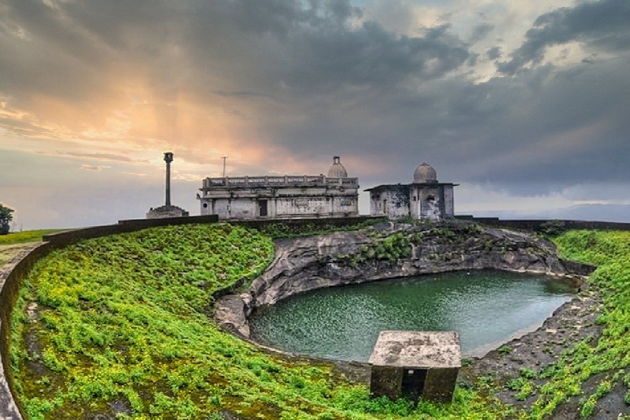
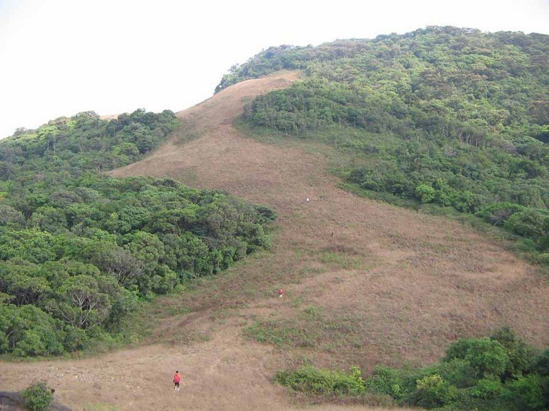
At a distance of 60 Kms from Bangalore situated close to Chikballapur, Nandi Hills or Nandidurga is a popular hill station near Bangalore. Located close to Skandagiri, Nandi hills is also one of the top trekkig destination and among the popular places to visit near Bangalore.
It gets its name from the ancient Nandi or bull which is meant to be the mount of Lord Shiva. These hills are the source of the rivers Palar, Arkavati and Pennar. It was one of the Tipu's summer retreats. There are about 1,200 steps laid from foot of the hill to reach the top of the hill. Bhoga Nandishwara Temple situated at the foot of the hills is a must see place which houses a 1000 year old sculpture of Nandi.
Tipu Sultan's Summer Palace and Tipu's Drop, a 600 ft cliff from where Tipu Sultan used to throw his prisoners, offers a spectacular view of the valley. Amrita Sarovar Lake, ruins of Tipu Sultan's fort are other places to visit. There are also three temples dedicated to Sri Ugra Narasimha, Sri Yoga Narasimha and Sri Bhoga Narasimha.
There are few accommodation options available on the peak for those who want to experience early morning sunrise, though trekking the peak early in the morning is the best option. Self camping on the peak is not safe.
Distance from Bangalore: 60 Kms
Distance from Bangalore: 262 Kms
Distance from Bangalore: 270 Kms
Distance from Bangalore: 217 Kms
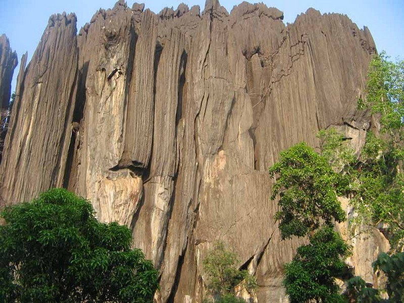
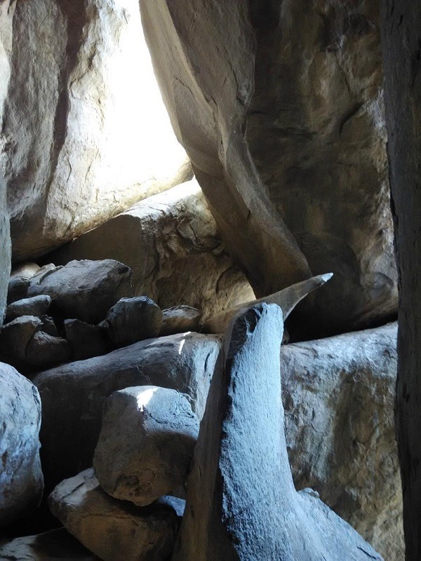
At a distance of 24 km from Benne Hole Falls, 30 km from Kumta, 55 km from Sirsi, 86 km from Karwar, and 103 km from Jog Falls, Yana is a village in Uttar Kannada district in Karnataka. It is well known for the unique rock formations in the Western Ghats.
Among the most prominent places to visit in Jog Falls, Yana is famous for two massive rock formations known as the Bhairaveshwara Shikhara and the Mohini Shikhara. The huge rocks are composed of solid black, crystalline Karst limestone. Bhairaveshwara Shikhara is 120 m (390 feet) in height, while the Mohini Shikhara, which is smaller, is 90 m (300 feet) in height. A cave temple dedicated to Lord Shiva is found at the base of the Bhairaveshwara Shikhara. Water drips from the projecting rocks over the Shiva lingam, and people call this water Gangodbhava. The idol of Goddess Parvathi is found at the base of the Mohini Shikhara. Yana can also be visited as part of Sirsi Tour Packages.
According to mythology, once the demon king Bhasmasura performed penance to acquire a boon from Lord Shiva. As per the boon, whatever he touched burnt into ashes. Bhasmasura chased Lord Shiva to destroy him, who found refuge in the Bhairaveshwara peak at Yana. It is also believed that the other peak called Mohini is dedicated to Lord Vishnu, who took the form ...
Distance from Bangalore: 461 Kms
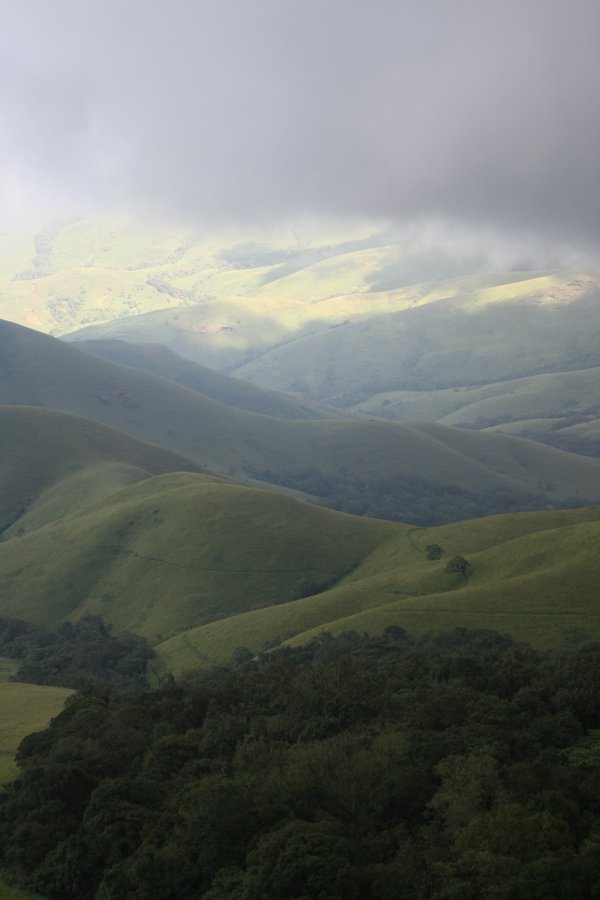
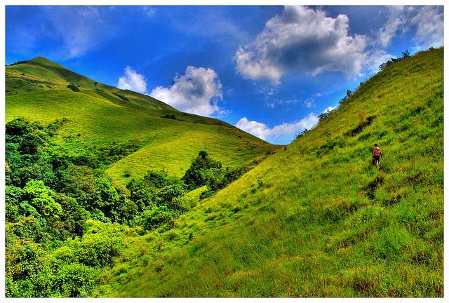
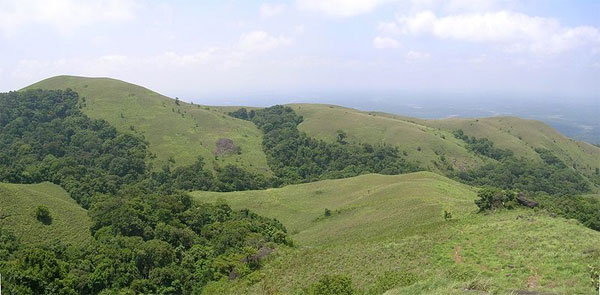
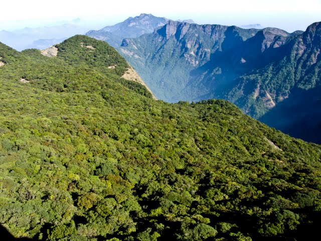
At a distance of 26 Km from Kudremukh Town, 67 Km from Sringeri, and 90 Km from Chikmagalur, Kudremukh is a mountain in the Chikmagalur district of Karnataka. It is one of the best trekking destinations in Karnataka, and among the must-include places in the Chikmagalur Adventure tour packages.
At an elevation of 1894 meters, Kudremukh stands as one of the tallest peaks in the Western Ghats and ranks as the second-highest peak in the state, following Mullayanagiri. The term Kuduremukha translates to "horse-faced" in Kannada, refering to a specific scenic view of the mountain that resembles the face of a horse. Historically, it was also known as 'Samseparvata' due to its accessibility from Samse village. This region is recognized as a biologically rich hotspot, showcasing a variety of wildlife and gaining popularity for trekking.
The peak is situated within the Kudremukh National Park, which boasts a wealth of flora and fauna. Established as a national park in 1987, this 600 square kilometer area in the Western Ghats is classified as one of the world's 38 'hottest hotspots' of biological diversity, a UNESCO World Heritage Site, and is the second-largest tropical wet evergreen forest in the Western Ghats zone. The Kudremukh National Park is adorned with natural splendor, featuring towering peaks interspersed with a multitude of flora and fauna, alongside picturesque trekking paths that overlook lush ...
Distance from Bangalore: 321 Kms
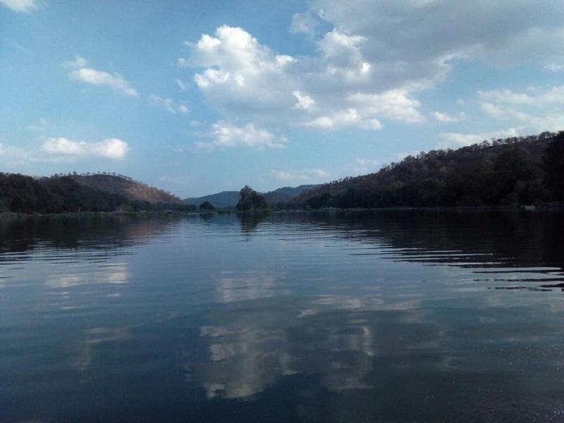
At a distance of 103 km from Bangalore City Junction and 58 km from Mandya and 84 km from Mysore Junction, Bheemeshwari is a small town in Mandya district of Karnataka. It is located between the Shivanasamudra Falls and Mekedatu on River Cauvery. This is one of the popular tourist places to visit near Bangalore and a well known place for the activities of trekking and adventure near Bangalore city, apart from being a famous Bangalore weekend getaway for one day trip.
Bheemeshwari is a great spot for eco-tourism and is a natural habitat for the Mahseer fish found in the waters of the Cauvery River. Mahseer is considered as one of the finest game fish in the world. A number of fishing camps have been developed here where professional and amateur anglers can catch mahseer. The surrounding lush forest cover is home to many animas like elephants, wild boars, monkeys, jackals, crocodiles, otters and leopards; as well as a variety of water birds like herons, ibis, cormorants and kingfisher.
Bheemeshwari is also a great place for trekking and boating. Tourists can participate in adventure activities like river rafting on the Cauvery, enjoy a coracle ride, take a nature walk to just sit back and indulge in bird watching.
Bheemeshwari is surrounded by lush green forests and lies in the midst of steep valleys, this place is ideal for trekking ...
Distance from Bangalore: 100 Kms

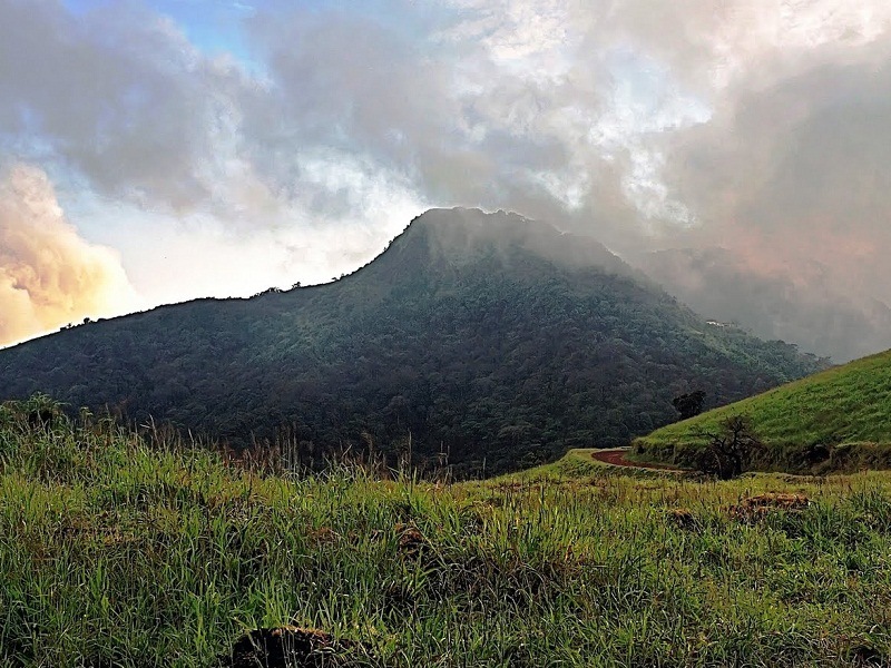
At a distance of 7 km from Nalaknad Palace and 41 km from Madikeri, Tadiyandamol Peak near Kakkabe is a tallest mountain peak in Kodagu. Tadiyandamol is one of the top things to do in Coorg and also a well-known destination for trekking in Karnataka. It is one of the top attractions you must include in Coorg package
Lies at an altitude of 5730 feet, Tadiyandamol is the second highest peak in Karnataka after Mulliyangiri in the Baba Budan Range. The name Tadiyandamol literally means tallest mount in Kodava. With gentle, velvety green slopes, Tadiyandamol is one of the most exquisite treks in Karnataka and one which is also known to a few.
It is a 14 km trek both ways, takes you through the vast expanse of the Shola forests, endless lush green grasslands and streams. The peak can be approached from the Nalakand Palace (7 km) which is at the base of the hill. It is of historic importance as it was built by Dodda Veerarajendra in 1792 to shelter his army against the British. It is a day trek which makes it even more doable for city folks- whether avid trekkers or beginners. The trek from Nalaknad Palace to top of the peak is moderate and takes around 3 - 4 hours one way.
September to May is the best time to trek Tadiyandamol. It is advisable to hire a guide to trek the ...
Distance from Bangalore: 273 Kms
At a distance of 20 Km from Kollur, 75 Km from Murudeshwar, 90 Km from Udupi, and 110 Km from Shimoga, Kodachadri is a mountain peak located in the Shimoga district of Karnataka. It is one of the most spoken-about trails for trekking in Karnataka.
Located at an elevation of 1343 meters in the Western Ghats, Kodachadri Peak is found in the center of the Mookambika Wildlife Sanctuary. It stands as the tallest peak in the Shivamogga district and ranks as the 13th highest peak in Karnataka. The Karnataka Government has designated it as a natural heritage site. This location is an excellent destination for trekking enthusiasts, particularly as part of Murudeshwar tour packages.
Kodachadri is a segment of the Western Ghats that provides a stunning backdrop to the renowned Kollur Mookambika Temple. The name Kodachadri is derived from the local terms "Kodacha" or "Kodashi," which refer to the Kutaja flowers (the hill's Jasmine), while "Adri" translates to mountain. The hilly area abundant with these "Jasmine of the hills" plants is known as "Kutajagiri." It is also referred to as "Kutachadri" and "Kodashi Parvatha." It is believed that Sage Adi Shankara visited this site and meditated here. At the summit of Kodachadri, there is a small stone temple named Sarvajnapeetha, which is dedicated to Adi Shankara.
Kodachadri offers an exhilarating trekking adventure. ...
Distance from Bangalore: 400 Kms
At a distance of 80 kms from Bangalore & 4 kms from Kolar, Anthargange is a wonderful tourist place near Bangalore with religious significance as well as a nature & trekking destination. The place is famous for Anthargange Caves and Temple and which are quite famous as ideal places for trekking from Bangalore city, particularly well known for night treks and camping. This is one of the popular pilgrimage sites to visit around Bangalore.
Anthargange literally means Inner Spring, named after a spring originated in the hill and water flows through a bull statue at the temple in middle of the Anthargange hill. The temple is situated amidst thick vegetation and a wonderful spot to experience natural beauty of the area. Motorable road is available close to the temple but vehicles need to be parked at the entrance of the hill and need to walk up hill for about 15 minutes to reach the temple.
The temple is very ancient and considered sacred. There is a water pool formed by the water sourced from the spring. The place is full of monkeys and they also attack pilgrims for food sometimes. Visitors are advised to be careful and also take care of kids.
The Anthargange Caves are located on the peak which is about an hour trek from the temple. There are several caves on the hill top that can be explored by foot. Some of the caves are quite big and good for camping. Several visitors trek up the hill to camp overnight on the hill.
There are no food options at Anthargange. ...
Distance from Bangalore: 80 Kms
At a distance of 5 km from Kemmanagundi, 67 km from Chikmagalur and 1 km from Shanti Falls, Z Point is a wonderful trekking spot and one of the prime places to visit in Kemmanagundi. Z Point is a beautiful spot with deep valleys all around amidst thick green surroundings. The cool breeze on the peak mesmerizes visitors. It is one of the best short treks in Karnataka with beautiful views of nature and valleys.
The 3 km trekking trail to Z Point starts from Kemmanagundi Raj Bhavan and runs through thick forest. Shanti Waterfalls is situated enroute to the Z Point. The trek is relatively easy till Shanti Hills and gets little tough afterwards. The later part of the trek runs through narrow path with deep gorges and steep hills. The trek route provides breathtaking views of the hills of Kemmanagundi. The wide and beautiful grasslands provide unique setting to the slopes.
The Z Point is a great sunset & sunrise point. The trek from Raj Bhavan to Z Point usually takes about 1 hour. Camping at the Z Point is possible.
Distance from Bangalore: 266 Kms
At a distance of 17 km from Agumbe, and 96 km from Shimoga, Kundadri is a beautiful hill top located near Agumbe in the Shimoga district of Karnataka, India. It is one of the top places of trekking in Karnataka, and among the must-visit places as part of Agumbe tour packages.
Rising at an altitude of 3,200 feet, the Kundadri hill is known for the 17th-century Jain temple dedicated to Parshwanath Tirthankara. The name Kundadri is believed to be derived from the name of Acharya Kundakunda, a popular 4th century Jain Monk, who is said to have taken shelter in these hills. The small temple, along with two small ponds form the only building on top of Kundadri hills. The Jain Temple is particularly crowded amid the season of Makara Sankranti in January.
Boasting dense jungles of the Western Ghats, Kundadri is a trekker's haven and a paradise for nature lovers. A rough, 7 km rugged narrow path leads to the top of the hill and is a moderate trek. The trail can be a bit challenging at first but quickly becomes simpler and more rewarding as you take in the stunning scenery around you. One can also reach the top by driving your way up, except for the last fifty steps or so. However, the area is best explored whilst trekking in the surrounding jungles. From the top of the peak, you can have a panoramic view of the distant backwaters of the Varahi Dam. Camping in the ...
Distance from Bangalore: 344 Kms

At a distance of 75 km from Bangalore City Junction, 16 km from Kanakapura & 112 km from Mysore Bilikal Rangaswamy Betta is a hill near Kanakapura town. It is one of the highest hills in the area, and also one of the popular places to visit near Bangalore.
Situated at an altitude of 3780 ft, Bilikal Rangaswamy Betta is also called Bilikal Betta that means white rocks. It is one of the popular places for trekking around Bangalore. There is a temple dedicated to Lord Rangaswamy at the peak of Bilikal Betta. This temple is located underneath a huge, white-colored rock. The temple priest lives near to the temple and the only person living at the peak. Every year, pilgrims from the surrounding area climb this hill to celebrate a festival at the Rangaswamy temple at the top.
The Trekking Trail starts from Konala Doddi (which is about 58 kms from Bangalore City Junction - Bilikal Betta is 6 kms from here). Bilikal Rangaswamy Trek is a moderate one with a well marked path up till the peak. The trekking takes 2.5 hrs uphill and about 1.5 hr downhill. The trail begins with a half kilometer walk on a relatively level path, after which the forest becomes denser and the gradient of slope increases drastically. The trail constantly winds uphill at an incline and includes slightly steep stretches.
Bilikal Rangaswamy Betta belongs to the Eastern Ghats ...
Distance from Bangalore: 75 Kms
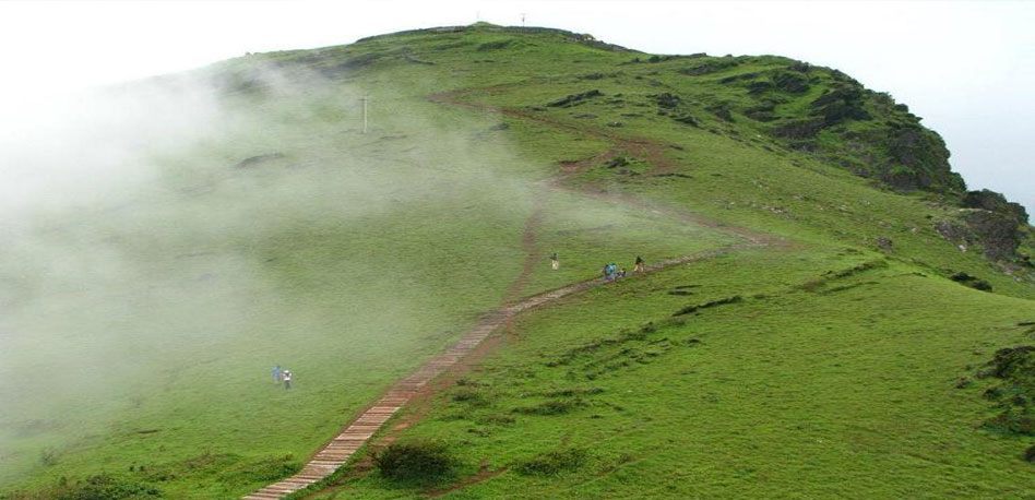
At a distance of 61 km from Bangalore City Junction and 5 km from Chikballapur, Skandagiri is an ancient mountain fortress lies at an altitude of about 1350 m. It is geographically located close to Nandi HIlls. This is among the best places for trekking near Bangalore especially famous for night treks, camping and bird watching.
Skandagiri is also known as Kalavara Durga. It has an ancient dilapidated fort that belonged to a local king and was later concurred and used by Tipu Sultan. After Tipu's downfall, the fort was ignored and laid in ruins. Today one can only see parts of the fort wall in some places.
The Skandagiri trek is a moderately difficult trek. There are two routes to reach the base of the hill. One is from Chikballapur town and the other as a detour from the road that leads to Nandi Hills. The trek starts from the Papagni Temple at the foot of the hill. This steep and fantastic trek through a maze of dense shrub is highly interesting. There are six series of stonewalls protecting an abandoned ancient temple on the hilltop.
Skandagiri is more famous for night trekking. Hundreds of people gather there on Saturday and Sunday mornings to watch the sunrise. It is best climbed very early in the morning or in a full moon night. Sunrise seen from the top is breathtaking. At the top of the hill is a stretch of flat area that has a temple and few stone pillars belonging to ancient houses. This 8 km trek comprises of ascending and descending through rugged ...
Distance from Bangalore: 61 Kms
At a distance of 72 Kms from Bangalore (near Tumkur), Devarayanadurga is a rocky hill situated in the midst of picturesque locality at an altitude of 3940 ft. The main attraction of Devarayanadurga is the temples of Yoga Narasimha & Bhoga Narasimha. The Bhoga Narasimha temple is located at the foothills while the Yoga Narasimha shrine is located at the top of the hill. This is one of the popular tourist places near Bangalore.
This is also an ideal place for trekking. Motorable road is available till the hill top. Many people trek the hill from the Bhoga Narasimha temple at foothill. One can driver further from Yoga Narasimha temple to the peak of the hill to capture a nice view of the valley and surrounding places.
Devarayanadurga is famous for the natural water spring called Namada Chilume which is considered as the source of Jayamangali River. There are two other springs known as Ramatirtha and Dhanushtirtha. There is a large cave nearby with figures of Rama, Sita and Lakshmana. The car festival of Sri Bhoga Narasimha Swamy is held during the month of March/April here.
Sri Lakshmi Narasimhaswamy Jayanthi, an annual celebration of Narasimha avathara day takes place here during the month of Chaitra (around May).
A diversion is required on NH4 before Tumkur at Kyathsandra to reach Devarayanadurga.
Distance from Bangalore: 72 Kms
At a distance of 21 km from Sakleshpura, and 33 km from Hassan, Parvathamma Betta is a scenic hill located at Dyathapura village in Karnataka. It is one of the popular places to visit near Hassan, and among the popular places for trekking in Karnataka.
Parvathamma Betta is well known amongst trekkers. The uneven and rough terrain of the attraction is deemed apt by many adventure seekers. There is a temple dedicated to Goddess Parvati, and Lord Shiva atop the hill hence the hill got its name Parvathamma Betta. The temple has some artistic stone carvings. The hill is visited by many travelers from Hassan, Bangalore, and nearby areas to get a fabulous view of the surroundings.
Climbing up this rocky hill is easy by foot and it is quite entertaining for all age groups. Usually, kids enjoy this climb immensely as it is an easy trek. The view is from the top is very scenic, can see a line of mountains of the Western Ghats from here. And, it is best to go here during sunset as it offers a panoramic view of the sun setting among the Western Ghats.
As there are no shops, one needs to carry their food, and water while trekking to Parvathamma Betta.
Timings: 6 AM - 6 PM
Entry: Free
Distance from Bangalore: 210 Kms
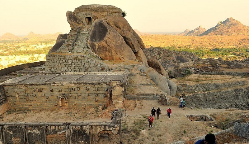
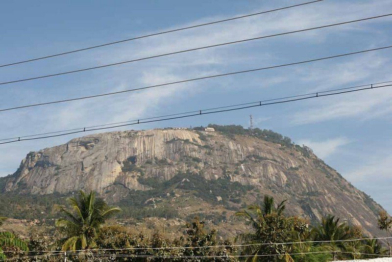
At a distance of 21 km from Koratagere, 48 km from Tumkur and 106 km from Bangalore, Madhugiri is a town in Tumkur district of Karnataka. Madhugiri is famous for a hill which is the second largest monolithic rock hill in Asia after Savandurga. It lies at an altitude of 3,930 feet and is becoming a famous destination for trekking from Bangalore.
There is a fort on the slopes of the hill which derives its name Madhugiri from the Honey bee colonies that were abundant during those days. Antaralada Bagilu, Diddibagilu, and Mysore Gate are the three gateways of the fort. A series of doorways lead to the hilltop. There is a temple of Gopalakrishna at the top of the hill. Both the temple and the fort stand in a ruined condition today due to lack of maintenance.
The construction of original mud fort was started around 1678 during the reign of Raja Heera Gowda and was finally completed around 1740 AD. Further fortification was carried out by Hyder Ali, who added huge arches, watch towers and large circular granaries. It was under the control of the British for a short duration. It was used by the British to jail the mutineers of the first India's Independence struggle in 1857.
There are four levels from the bottom to top and each level has a wall with circular bastions. The walls are about 6 feet tall with slits at regular intervals. Throughout the climb to the fort there are huge tanks used for the storage of rain water. The trek to Madhugiri is of moderate to difficult ...
Distance from Bangalore: 106 Kms
At a distance of 54 km from Mysore, Chikkadevvamma Hill is a sacred place situated at Kundur Village in the Mysore district of Karnataka State. It is one of the popular places of pilgrimage near Mysore and among the prominent trekking places in Karnataka.
There is a temple on the hilltop and is dedicated to Goddess Chikka Devamma, believed to be the sister of goddess Chamundeshwari. This old temple was constructed by Mysore Wodeyars. The hill derived its name from the goddess Chikka Devamma, who came from Kerala and settled in Chikkabetta. Devotees have a strong belief that the Goddess has fulfilled all their genuine demands.
Besides, Chikka Devammana Hill is well known for its mesmerizing surroundings. From the top, one can have a panoramic view of agricultural fields, villages & Nugu Reservoir. The hill is also surrounded by forest so one can find elephants, leopards deers and other animals here.
The journey to the hilltop is also a wonderful experience as there are many hairpin bends. Especially, in the last stretch, from the foothills to the top, one needs to climb around 200 m vertical height, in a length of 4 km. But interestingly, the condition of the hilly road is very good and within 15 minutes, one can climb the hill without much difficulty.
Temple Timings: 6 AM - 6 PM
Distance from Bangalore: 195 Kms
At a distance of 25 km from Chikballapur, and 91 km from Bangalore, Avalabetta is a hilltop situated in the Chikballapur district of Karnataka. It is one of the few trekking destinations near Bengaluru and among the popular one day trips from Bangalore.
Located amidst one of the minor hill ranges in the Deccan Plateau, Avalabetta is popular among the youth, especially trekking enthusiasts. The hillock offers a charming view of the countryside with hills, valleys, lakes, trees and is a green treat. The natural beauty and serenity of this place have earned it the name 'Nandi Hills without the Crowds'.
The primary attraction at Avalabetta is the protruding rock and the temple. The protruding rock is an almost unsupported cliff, projecting away from the main hillock. Youngsters who come here can be seen making poses and taking selfies at the rock. The temple here is dedicated to Lord Lakshmi Narasimha Temple which is a typical Dravidian-style temple with a pyramidal tower known as vimana above its sanctum. There is a small pond on the hilltop, where one can sit, chill, have a nice conversation and look at the greenery all around.
To reach the Avalabetta trek starting point, you need to drive to Chikkaballapur on National Highway 44. From the Chikkaballapur Exit, head to the town of Peresandra, where you exit the main road and enter the service road, to reach the hillock's base. From there, you ...
Distance from Bangalore: 91 Kms
At a distance of 12 km from Tumkur Bus Stand, and 60 km from Bangalore, Mandaragiri Hill or Basadi Betta is a small settlement in the Tumkur district of Karnataka. It is one of the famous places of pilgrimage in Karnataka, and among the top places to visit near Bangalore.
Mandaragiri Hill has evolved as a popular Jain pilgrimage center mainly because it houses four ancient Digambar Jain temples built between the 12th & 14th centuries and got restored recently. These small Jain temples belonged to Bhagwan Chandranatha, Bhagwan Parshwanatha, and Bhagwan Suparshwanatha. The first thing to notice at the base of the hill is the Manastambha, a beautifully carved pillar-like structure similar to the ones adorning the thousand pillars temple in Moodabidri.
There is a statue of Chandranatha Tirthankara to the right ahead of Manastambha. Close to it to the right, there is the Guru Mandir, built in the shape of a pinchi, a peacock feather fan carried by the Jain munis. The dome was used as a meditation center. Behind the hill is a beautiful lake known as Mydala Kere. The calm waters along with dense forest and mighty hills make for a perfect spot to sit and enjoy your serene morning.
There are about 450 steps carved on the rock and hardly takes 15 minutes to climb the hillock. While on top, you will be treated with a 360-degree view of the entire surrounding. The best thing about the hill is you can enjoy scenic sunset from the top of this hill.
Timings: 6 AM ...
Distance from Bangalore: 60 Kms

At a distance of 6 km from Ramanagara Bus Stand, and 49 km from Bangalore, Ramdevara Betta is a serene hill situated in the Ramanagara district of Karnataka. Located on Bangalore - Mysore Road, it is one of the popular places for trekking near Bangalore.
Standing tall at a height of 3800 feet, Ramadevara Betta is a good spot for a quick one-day trip. The place also has relevance in Hindu Mythology. On the top of the hill lies small temples dedicated to Lord Rama, Hanuman, Ganesh, and Shiva Parvati. It is believed that Sugreeva established the idol after Lord Rama helped him in killing Asura Sukasura. This idol later was identified and renovated by Kempegowda, founder of Bangalore. Kempegowda also built a fort here, the remains of the Fort wall can be seen at various points. There is another attraction called Sita's Pond. No one knows how deep it is and why it is called so.
Ramadevara Betta is also popularly known for the location of Bollywood's most iconic movie 'Sholay'. This is the place that was converted into Gabbar's hideout and the movie's best scenes and songs were shot here. For several decades, the place is also home to Eygptian and white-backed Vultures. Thus, the area was designated as Vulture Sanctuary by the Forest Department in 2012. But sadly, there are hardly any vulture sightings because of the temples and the number of people visiting. The forest is also home to leopards, bears, and peacocks. However, the wildlife is more active after sunset.
There ...
Distance from Bangalore: 49 Kms
At a distance of 24 km from Lepakshi, 33 km from Chikballapur, and 92 km from Bangalore, Gudibande Fort was is a historical fort situated at Gudibande town in the Chikkaballapur district of Karnataka. It is one of the popular places of heritage in Karnataka, and among the top places to visit near Bangalore.
Gudibande Fort was built in the 17th century, by Byre Gowda, a local chieftain who ruled the place for only three years. It was believed that he belonged to the Tuluva dynasty of the Vijayanagar empire. It can be said as a concise replica of the Madhugiri fort.
The fort has seven levels with interconnecting escape routes which would help soldiers to flee in case of emergency. The fort contains two temples dedicated to Lord Shiva and Goddess Parvathi. The Shiva temple is known as 'Sir Rameshwara Temple', and is believed to be established by Lord Rama. The nandisthambha in front of the shrine, which stands on a square base, has sculpted stone images of Nandi, Shanmukha, and Shiva Linga. Besides, there were around 19 rock ponds at different levels of the fort that are linked by dhones and they could hold nearly 3 lakhs liters of rainwater in all.
One can also visit the Lakshmi Venkataramana Swamy Temple in Gudibande town which was constructed by Cholas. The temple is sort of a cave temple hewn out a huge rock and the name Gudibande to the town came from this where Gudi means temple, and Bande means rock. One can also visit a pristine lake called Bhairasagara ...
Distance from Bangalore: 92 Kms
At a distance of 15 km from Ramanagara, and 61 km from Bangalore, Revana Siddeshwara Betta or SRS Hills is a sacred hill located at SRS Betta village in the Ramanagara district of Karnataka. It is one of the popular places of pilgrimage in Ramanagara, and among the best trekking places near Bangalore.
Situated at an altitude of 3,066 feet, Sri Revanna Siddeshwara Betta is famed for its arduous rock climbing spots and the Shiva temple. There are 3 temples on the hill, Renukamba temple at the base, Bemeshwari Temple at midway, and Reveanasiddeswara temple at the top. This elegant cave temple of Lord Siddeshwara is snuggled on the notch of a monolithic stone hill and is surrounded by the trails of natural wonders. Sri Revana Siddeshwara Swamy is considered as a reincarnation of the great Jagadguru Shri Renukacharya, who was one of the five acharyas who came to Kali Yuga to teach and preach Virasaivism.
One needs to climb around 300 steps to reach the top from the base of the hill. The climbing was not difficult since steps were craved and covered with a sheet on the top with also grills around. It will take 30-40 minutes to reach the hilltop. From the top, one can get the panoramic view of surrounding villages, a beautiful lake, and farms. Whether you are looking for solace or wish to add a rock climbing experience to your trip, then this is the best pick.
Timings: 8.30 AM to 5 PM
Entry: Free
Distance from Bangalore: 61 Kms
At a distance of 7 km from Pandavapura, 14 km from Srirangapatana, 30 km from Mysore and 122 km from Bangalore, Kunti Betta is a picturesque hill situated in Pandavapura Taluk of Mandya district in Karnataka. This place Pandavapura was named after the Pandavas who had been here during their exile days. Kunti Betta is one of the best places to visit near Bangalore for one day trip and also one of the popular places to visit in Mysore.
Kunti Betta is marked by the two rocky hills at an altitude of 2,882 feet. These rocky hills are surrounded by sugarcane, paddy fields & coconut trees. The Kunti Betta trail is a short but fairly challenging one. It includes steep ascents and descents. There is a temple with a pond at the foot of the hill which serves as a popular destination for pilgrims. There are rooms which are used by the pilgrimage for an overnight stay at the temple. The temple is situated between the two hills of Kunti Betta.
The Kunti Betta trek starts from the right side of the pond. The initial inclination for few meters is more than 60 degrees. One needs to be slow and careful on this slope. There is a rock on the edge of the hill top. The rock has a shear drop and an inclination on the other side and visitors must be very careful if they want to reach the edge of the rock. This gives a clear view of the paddy fields ...
Distance from Bangalore: 122 Kms
At a distance of 6 km from Belthangady, 61 km from Mangalore, 87 km from Kudremukh and 111 km from Chikmagalur, Jamalabad Fort is an old hilltop fortification in Jamalabad Village near Belthangady in Dakshina Kannada District of Karnataka. It is located in the Kudremukh range of hills. The fort lies at an altitude of 1700 ft.
The fort was formerly called Narasimha Ghada, which refers to the granite hill on which the fort is built. It is also referred locally as Jamalagadda or Gadaikallu. Originally a mud fort existed on the hilltop. The fort was reconstructed over the ruins of an older structure by Tipu Sultan in 1794 and named after his mother, Jamal Bee. The fort was captured by the British in 1799 during the 4th Mysore War. As per legend, those who are not favorable to Tipu were hurled down this fort to their death.
The fort is accessible via a narrow path with about 1800 steps cut out of the granite hill. Inside the fort, there is a tank to store rain water. Remains of a single cannon lie at the top. Nothing much of the fortifications remain but hints of the fort wall with parapets are visible. This hillock fort has one room at the top. There is also an unmanned microwave repeater station on top of the hill.
Jamalabad is a popular trekking destination and has been classified as a medium difficulty trekking site. The top of fort offers good views of the surrounding landscape and the Kudremukh range. ...
Distance from Bangalore: 311 Kms
At a distance of 15 km from Kukke Subramanya, 30 km from Somwarpet, 65 km from Madikeri, 115 km from Mangalore, 260 km from Bangalore, Kumara Parvatha, also known as Pushpagiri, is a beautiful mountain peak located in Pushpagiri reserve forest near Kukke Subramanya town in Dakshina Kannada district of Karnataka. Situated at an elevation of 1712 m above sea level, Kumara Parvatha trek is one of the toughest treks and most popular trekking destinations in the Western Ghats of Karnataka. The trek distance is around 25 km (with return) and usually done in 2 days.
Kumara Parvatha is the third tallest peak in Karnataka, Mulliyangiri in Chikmagalur being the tallest and Thadiyandamol in Coorg being the second tallest. Kumara Parvatha trek is one among the most popular trekking trails in Karnataka. This peak has numerous white stones that are known as 'Saligramams'. The Shivalingas with six faces, also known as the 'Kumaralingas', can also be seen here.
There are two routes to trek Kumara Parvatha. First route starts from Kukke Subramanya Temple and goes through Girigadde (Bhattare Mane) & Mantapa. This route is moderate difficulty. Bhattare Mane is the only point along the trek where you can get food, water and rest�rooms. Camping can be done at Girigadde (Bhattare Mane) or Mantapa.
Second trek route is little hard and starts from Heggade Mane, which is about 5 km from Bidahalli (which is 15 km from ...
Distance from Bangalore: 254 Kms
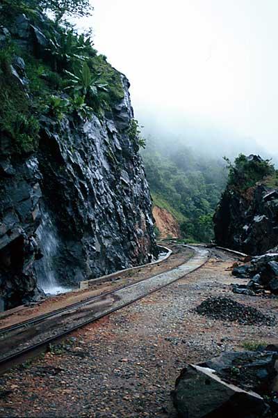
At a distance of 100 Kms from Mangalore, 30 Kms from Kukke Subramanya, 65 Kms from Hassan & 80 Kms from Chikmagalur, Yedakumeri is a beautiful place in the Western Ghats & a wonderful trekking destination.
A trekking along the abandoned meter gauge railway line between Donigal and Yedukumeri (17 Kms - 8 Hrs) is a unique experience and is popularly referred to as 'Yedakumeri Railway Trek' or 'Green Route Trek'. This route is nature lovers & photographers paradise.
The trek route has several curves, tunnels and bridges. The mountains stretch with more than 25 waterfalls and several small streams. Trekking usually starts from the Dhonigal (on Bangalore - Mangalore route) and run along the tracks to Yedakumeri. Camping can be done at Dhonigal & Yedakumeri stations. Trek can be extended till Kukke Subramanya (16 Kms extra).
Donigal can be reached by Bus/Cab from Sakleshpura (which is connected by Bus with Bangalore via Hassan) - 10 Kms away.
Pre & post monsoon is the best time.
Distance from Bangalore: 245 Kms
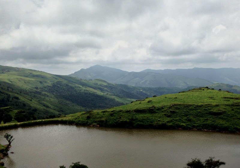
At a distance of 85 km from Madikeri and 10 km from Irupu Falls, Brahmagiri Wildlife Sanctuary is a popular wildlife sanctuary situated in Kodagu district of Karnataka state and is part of the Western Ghats. It is situated on the border of Wayanad district of Kerala and Kodagu district in Karnataka. It is one of the famous sites for trekking in Karnataka and also one of the popular places of trekking in Coorg.
Brahmagiri Wildlife Sanctuary was established in 1974. Situated at an altitude of 5357 feet, the sanctuary is spread across 181 Sq. km. The sanctuary derives its name from the highest point, the Brahmagiri Peak, which lies at an altitude of about 1607 m. The vegetation in the low-lying areas is predominantly evergreen and semi-evergreen forests, while shola grasslands cover the higher altitudes. The undulating terrain is dotted with several steep valleys and hillocks.
Elephant, gaur, tiger, jungle cat, leopard cat, wild dog, sloth bear, wild pig, sambar, spotted deer, Nilgiri langur, Malabar giant squirrel, giant flying squirrel, Nilgiri marten, common otter, brown mongoose, civet, porcupine, and pangolin are the common wildlife spotted at the sanctuary. Python, cobra, king cobra, malabar pit viper are some of the reptiles found in the sanctuary. Birds in the sanctuary include emerald dove, black bulbul and Malabar trogon.
Brahmagiri Peak, towers over the sanctuary, is a major tourist attraction and is also ...
Distance from Bangalore: 257 Kms
At a distance of 70 km from Madikeri, and 33 km from Somvarpet, Pushpagiri is a mountain peak situated in Kodagu district of Karnataka. Pushpagiri is one of the best places for trekking in Coorg and among the top Karnataka trekking places.
Pushpagiri is the highest peak in Pushpagiri Wildlife Sanctuary in the Western Ghats of Karnataka. Situated at an altitude of 5626 feet, Pushpagiri is the 6th highest peak in Karnataka and also 2nd highest peak in Coorg after Thadiyandamol. The Harangi River originates from the top of this hill. Covered by lush green forests, valleys, and hills, the area is perfect for hiking expeditions and it is one of the best places for trekking.
The trekking starts from the forest checkpoint at the base of Pushpagiri Hills, after Heggadamane village. The Pushpagiri peak is about 7 km from the Check Post and takes about 3-4 hours one way (moderate to difficult level) through thick forest, wet grasslands & some rocky terrain. There is a small temple at the peak dedicated to Kumara Swamy. It is possible to return on the same day if you wish to visit only Pushpagiri peak. But most of the trekkers continue to exit through the Kumara Parvatha (to Kukke) and camp at Girigadde which is 14 km from Pushpagiri Check Post (takes about 7 hours). There is very basic private accommodation available in Girigadde called Bhattara Mane and food is also served (need to carry sleeping bags).
Kukke is about ...
Distance from Bangalore: 256 Kms

At a distance of 45 Kms from Murudeshwar, 54 kms from Jog Falls, 95 Kms from Udupi & 20 Kms from Shiroor (on Udupi - Karwar road), Koosalli Waterfalls is a magnificent waterfall located in deep forest near Koosalli village. The waterfall is 20 Kms from Shiroor via Toodalli (also known as Soodalli) and 5 Kms from Koosalli village.
Koosalli Waterfalls is a 6 step cascading waterfall dropping from a height of 380 feet. One has to trek for 5 Kms from Koosalli through dense forest which also includes difficult rock climbing in order to reach the falls (2 Hrs trek from Koosalli village one-way). This place is highly dangerous during monsoons when the rocks become slippery. Nov - Dec is the best time to trek this place. Koosalli can be reached from Shiroor by Auto (very few buses are available till Toodalli - 5 Kms from before Koosalli).
First three falls are little smaller and remaining three falls are gorgeous. Especially, the sixth fall is awesome with a height of 150 feet.
Distance from Bangalore: 460 Kms
At a distance of 72 Kms from Murudeshwar, 88 Kms from Udupi, 33 Kms from Hosanagara, 53 Kms from Sagar, 109 Kms from Shimoga & 15 Kms from Kollur Temple, Hidlumane Falls is located near Bellakka village near Nittur. The falls are situated on Kodachadri trek route.
Hidlumane Falls are a series of 6 cascading falls each falling from a height of 50-70 feet. Part of the route from Kollur Road can be reached by a Jeep (can be hired at Kollur Temple, Hosenagara or Nagara). At least 3 Kms distance needs to be trekked from the road after the Jeep ride to reach the first fall. The total distance to Kollur main road is 8 Kms. The final trek route runs through thick forest and includes rock climbing. The trek from first fall to the 6th fall includes steeper trek that runs through forest, water and rocks.
The top most waterfall is more gorgeous and worth all the effort. The trek time is about 90 mins one way and recommended for experienced trekkers.
Distance from Bangalore: 377 Kms
At a distance of 18 Km from Sringeri, 20 Km from Agumbe & 65 Km from Udupi, Narasimha Parvatha is an excellent destination for trekking in Karnataka for a two day trip. It is situated at an altitude of 3780 feet. This is one of the popular moderate to difficult treks in Karnataka with overnight camping on the peak.
Most common trekking route starts from Malandur (6 Km from Agumbe) and ends at Kigga (10 Km from Sringeri) with overnight stay on Narasimha Parvatha. Malandur can be reached by private vehicle from Agumbe (walking takes 1.5 hrs). From Malandur, the trek distance to the peak is about 14 Km via Barkana Falls (6-7 Hrs trek). Camping is allowed on the peak. Kigga is about 8 Km from Narasimha Parvatha and takes about 3-4 Hrs (Sirimane Falls can be visited during this trek with 1-2 Hrs extra effort). Water filling can be done at Barkana Falls and there is also a small pond on the peak for emergency water. Sunrise from the peak offers a breathtaking experience.
Agumbe is the base station to start the trek to Narasimha Parvatha. Agumbe has direct bus connectivity with Bangalore and other major cities in Karnataka. There are a couple of small lodges and restaurants in Agumbe to fresh-up and pack food before starting the trek. Autos can be hired to Malandur where the actual trekking starts. It is mandatory to register the names at Agumbe police station before starting ...
Distance from Bangalore: 333 Kms
At a distance of 55 km from Bangalore City Junction and 95 km from Mysore Junction, Ramanagara is a town in Karnataka. It is also the headquarters of Ramanagara district. It is base for few good short trekking trails near Bangalore.
Ramanagara is famous for its silk market, giving it the other name of Silk town. The Ramanagara district is surrounded by seven majestic hills Shivaramagiri, Yatirajagiri, Somagiri, Krishnagiri, Revana Siddeshwara hill, Jala Siddeshwara hill and Sidilakallu hill. The town has an Agrahara on the left bank of the Arkavati with a temple of Arkeshwara built in later Vijayanagara style. The temple is said to have been renovated by Krishna raja Wodeyar III.
Ramanagara is one of the most popular trekking spots around Bangalore. The highest elevation is over 3,000 feet and the treks here are of moderate difficulties. It is home to some highly endangered species of birds such as the Long Billed Vulture and Yellow Throated Bulbul.
Another Famous hill at Ramanagara is Ramagiri hill, the shooting location of the famous film Sholay, which is about 4 km from Ramanagara. The top of the hill has an ancient Pattabhi Rama temple. The climb is not very strenuous and there are nearly 450 steps to reach this lovely temple. This is one of the most popular places for trekking in Karnataka. The Revana Siddeshwara Betta (3066 ft) Trek offers a breathtaking view of the valley. The Revana Siddeshwara Betta ...
Distance from Bangalore: 55 Kms
At a distance of 48 km from Bangalore City Junction, 31 km from Ramanagara and 13 km from Magadi, The Savandurga hill is considered to be among the largest monolith hills in Asia. Savandurga hills are located at an altitude of 1226 m above the sea level and are also considered to be a part of the Deccan Plateau. This is one of the popular one day trip from Bangalore for trekking and also one of the ideal weekend getaways from Bangalore.
Savandurga consists of two hills, the Billigudda and the Karigudda. They serve as the base for pilgrims who come to visit the Savandi Veerabhadreshwara Swamy temple and Narasimha Swamy temple, situated at the base of the hills. The paths leading to these temples are quite uneven and thrilling. Thus, they make it to the wish-list of the rock-climbers, cave-explorers and adventurers.
Savandurga was a prominent place during the Hoysala rule. The hill fort on the top of the hill was erected in 1543 by Samanta Raya. It came under control of Kempe Gowda until 1728 when it was captured by the Raja of Mysore from whom it passed to Haider Ali. In 1791 Lord Cornwallis captured Savandurga from Tipu Sultan's army in the Third Anglo-Mysore War.
Trekking in Savandurga is an extremely popular activity. There are actually two main trekking trails that run up towards Savanadurga. One is the Karigudda and the other is the Billigudda trail. Both Karigudda and Billigudda are tough ...
Distance from Bangalore: 48 Kms
At a distance of 61 km from Bangalore City Junction, 18 km from Doddaballapura and 6.4 km from Ghati Subramanya Temple, Makalidurga is a hill fort situated near the village of Makali in Karnataka. This is one of the top things to do in Bangalore.
Makalidurga hill is situated at an altitude of 1350 m above the sea level. It used to be granary storage of the late 1800's palegar 'Makaliraya'. Hence it is known as Makalidurga. At the foothill there is a temple dedicated to Lord Krishna. This hill is filled with date plants, lemon grass and small boulders. From the hill top it is very beautiful to see the lakes on either side, curvy roads and the railway track below this hill. The glimpse of the train from here is very exciting.
Makalidurga Trek is a moderately difficult trek. There are some directions written on the rock which provide directions for climbing. The trekking trail here is not as popular as Savandurga but the experience is still wonderful. The Fort situated atop the massive granite hill is the main attraction in Makalidurga. The fort at the summit has an old temple of Shiva with Nandi and in legend Markandeya Rishi performed penance here. The path leading to the fort comprises of rocky and uneven trails which are often traversed by trekkers from various regions.
According to the history of Makalidurga, Vijayanagara Empire where they used to conduct army exercises in this ...
Distance from Bangalore: 61 Kms
Distance from Bangalore: 290 Kms
Distance from Bangalore: 249 Kms
At a distance of 16 km from Munnar, Eravikulam National Park is a protected wildlife reserve located in Munnar. Situated on Munnar - Udumalpet Road, it is one of the popular national parks in Kerala, and among the must visit places during Munnar tour.
The Eravikulam National Park was established to protect the Nilgiri Tahr. Earlier, the area was managed as a game preserve by the Kanan Devan Hills Produce Company. The government of Kerala resumed control in 1971 and declared the Eravikulam-Rajamala Wildlife Sanctuary in 1975 and became a National Park in 1978.
The national park is spread across an area of 97sq. km and is a protected area. The park is extended into Tamil Nadu and is known as Annamalai Wildlife Sanctuary. This region is famous as the natural habitat of the endangered Nilgiri Tahr. Nearly half the world's population of this rare species is found in the area. Other faunal species found in the park are elephant Gaur, Giant Squirrel, Leopard, Lion-Tailed Macaque, Tiger, and Sambar. It is one of the beautiful places to see Neelkurnji flowers in South India as part of your wildlife tour in India.
The park is divided into 3 regions - the core area, the buffer area, and the tourism area. Visitors are allowed only to the tourism area, which is in the Rajamalai region. Tourists can take safari and trekking ...
Distance from Bangalore: 435 Kms
At a distance of 32 Kms from Munnar, Top Station is a breathtakingly beautiful place on Kerala - Tamilnadu boarder. From here, one can get 360 degrees view of the Western Ghats. This is one of the best Munnar tourist places and among the prime place to visit on a Munnar tour.
At an altitude of 2200 meters, this place is also known for the Neelakurunji Plant, which flowers only once every 12 years (next flowering year is 2018). The view point is at a distance of 2 kms from the road point and has to be trekked down. The trek path is very steep with deep valleys one side. One should be very careful while trekking to the view point, which offers lifetime memories. Top Station is the highest approachable road in South India.
The viewpoint at Top Station offers breathtakingly beautiful views of Kannan Devan Hills. The valleys all around, the misty mountains and distant waterfalls all make this place a must visit spot in Munnar.
Top Station is also a wonderful trekking destination in Munnar. There are multiple trekking routes in Top Station. The most popular route starts from Kurangani, a small village in Theni district of Tamilnadu. The total distance of Kurangani to Top Station is about 9 km and it usually takes around 6 hours to complete the trek. Camping is also allowed on the trail if overnight stay is preferred. This can also ...
Distance from Bangalore: 451 Kms
At a distance of 40 Kms from Idukki, 38 Kms from Kumily, 57 Kms from Munnar, 15 Kms from Nadumkandam & 18 Kms from Kambam (on NH220 towards Palani), Ramakkalmedu is a lovely tourist place with rolling green hills and the fresh mountain air.
The hilltop also offers a panoramic view of the picturesque villages of Kambam and surrounding places on the slope of the Western Ghats. Kerala Tourism Department has provided additional facilities for tourists with resting points & statues of Kuravan & Kurathi (local tribes) at Ramakkalmedu.
Ramakkalmedu is also a great trekking destination. The view point on top of the hill is the highest point in this area, which can be reached by 3-4 Kms trek from the Ramakkalmedu Junction.
This place is connected by bus service from Munnar, Kottayam and Ernakulam.
Distance from Bangalore: 481 Kms
At a distance of 29 km from Tada, 45 km from Srikalahasti, 85 km from Tirupati, 92 km from Chennai, 130 km from Nellore and 156 km from Chittoor, Tada falls or Ubbalamadugu Falls is situated in Varadaiahpalem mandal of Chittoor district. It is situated on the border of Tamil Nadu and Andhra Pradesh and is an ideal place for trekking near Chennai for a day trip.
The falls are located in a dense forest called Siddulaiah Kona. The falls are located within the Kambakam hills and are a popular destination for trekking, climbing and picnicking. The terrain that surrounds the falls includes rocky hill formations and lush forests interspersed with a number of streams.
To reach the falls visitors have go through the Varadaiahpalem village, about 12 km from Tada falls. There is only 7 km rugged path and the remaining distance has to be trekked through. SUVs or vehicles with high ground clearance are best suited to reach the trekking starting point. Autos can also be hired from Varadaiahpalem village to the trekking starting point. There is a forest check post on the way where visitors need to pay Rs 50 per vehicle and Rs 50 for camera. There is limited guidance in the form of arrow marks and it is advisable to hire a villager as guide in Varadaiahpalem village. The total trek distance would be about 10 km both ways, which is somewhat difficult and advisable only for physically fit people.
As soon as you enter the forest ...
Distance from Bangalore: 339 Kms
At a distance of 36 km from Coimbatore, and 50 km from Palakkad, Siruvani Waterfall is a scenic waterfall situated in the Siruvani Hills of Tamil Nadu. It is one of the popular waterfalls in Tamilnadu, and among the must-visit places during your Coimbatore trip.
Also called Kovai Kutralam Falls, the Siruvani Fall is formed by the Siruvani river. The reservoir at Siruvani was built for Tamil Nadu by the Kerala Government with funds collected by the Tamil Nadu government to meet the drinking water requirements of Coimbatore city. The water of the Dam is famous for its sweetness and it is typically known to be the second sweetest lake water in the world. It is one of the major tourist places in Coimbatore.
The visitors are not allowed to see the falls after 5 pm as it is located in the center part of a dense forest. With an outstanding panoramic view, the Siruvani dam is extremely beautiful and breathe taking. Tourists cannot make their visit to this falls anytime because only a few numbers of buses are available to visit the place.
Sadivayal Checkpost, where an entry fee Rs. 50 is charged, is at the gateway to the waterfalls. Private vehicles are not allowed beyond this point. However, vehicles arranged by the forest department can be used for the conveyance to the point where ...
Distance from Bangalore: 355 Kms
At a distance of 6 km from Kodencheri, 32 km from Kalpetta, & 48 km from Kozhikode, Thusharagiri Falls is a scenic waterfall located in the Kozhikode district of Kerala, India. This is one of the most beautiful waterfalls in Malabar region and among the most popular places of sightseeing in Wayanad.
Thusharagiri literally means 'snowcapped mountains'. Two streams originating from the Western Ghats meet here to form the Chalippuzha River. The river diverges into three waterfalls creating a snowy spray, which gives the name - Thusharagiri. The highest of the three falls is the Thenpara Fall dropping from a height of 75 meters. The first waterfall can be reached easily while the remaining two falls can be reached from the first one by trekking through thick forest. A 5 km upstream trek will take one to the origin of the stream.
Widely known as the 'trekker's paradise', the place offers challenging trekking and rock-climbing opportunities. Surrounding the magical waterfalls are the evergreen forests and soothing streams adding to the pristine beauty. There is a trek path from Thusharagiri to Vythiri in Wayanad and it is not for the faint heart. Starting from Thusharagiri Falls in the morning, and reached Vythiri by evening. An ideal destination for nature lovers and wildlife enthusiasts, this Kerala waterfall is also a great picnic spot as well as a nice romantic retreat.
Considered among ...
Distance from Bangalore: 306 Kms
At a distance of 35 Kms from Coimbatore Railway Station & 533 Kms from Chennai, Vaideki Falls are located near Narisipuram town.
The falls is very beautiful and has a naturally formed slope. It is located inside the forest and one must obtain permission before entering the forest. Visitors are only allowed by being escorted by a forest guard into the forest. This area of forest has lot of animal movements; especially elephants. There are lot of incidents of elephants attacking humans, so it is always advisable to obtain permission and get some guards accompanying while entering the forest.
About 5 Kms trek through forest is required to reach the falls from nearest road point. One can get private vehicles to reach forest trek point from Narisipuram town.
Distance from Bangalore: 353 Kms
At a distance of 18 km from Kodaikanal & 55 km from Palani, Perumal Peak is a trekker's delight situated near Perumalmalai village close to Palani road. Perumal Peak or Perumal Malai Peak is a high peak at kodaikanal in the Perumalmalai hills, which are part of the greater Western Ghat mountain range in Tamil Nadu. It is one of the popular places for trekking in Kodaikanal and also one of the top attractions you must include in Kodaikanal packages.
The trek begins from the foot of the Peak near Perumal Malai Village which is 11 km from Kodaikanal. The trek distance is about 7 km one way and takes about 3-4 hours one way. Most of the trekking stretch is of moderate difficulty while few parts are little steep. Overnight camping is also possible on the peak while most of the trekkers visit the peak and return on the same day.
Perumal Malai Village can be reached from Palani or Kodaikanal by bus or private vehicles.
Distance from Bangalore: 448 Kms
At a distance of 40 Kms from Kodaikanal & 485 Kms from Chennai, Thalaiyar Falls, also known as the Rat Tail Falls is the highest waterfalls in Tamil Nadu and third highest falls in India. It is also one of the popular sites for trekking near Kodaikanal.
With a height of 975 feet (297 meters), the falls is visible from a great distance on the ghat road towards Dindigul. This falls is considered inaccessible to the general public, as there is no access road to it. However, one can reach these falls with 6 kms trekking after 34 Kms of road journey on ghat road from kodaikanal. The trek duration is around 2-3 hours one way. The trek is considered to be of moderate difficulty.
The very edge at the top of the falls has a concrete wall. One can walk along the wall and get near the center of the falls. The water here is considered polluted and it's better to avoid bathing here.
One can catch Dindigal / Madurai buses from Kodaikanal, get down at the ghat road after 34 Kms and trek down to the falls from here. There are no sign boards but can get done at the mile stone which shows distance to Kodai as 34 km.
Distance from Bangalore: 423 Kms
At a distance of 20 km from Munnar, Anamudi Peak is a mountain peak situated in the Western Ghats of Kerala near Munnar. It is the highest point in India outside the Himalaya-Karakoram, and among the popular places of trekking in Kerala.
Located at an altitude of 8842 feet, Anamudi Peak is the highest point in South India, and among the must-visit Munnar tourist places. Located inside the Eravikulam National Park, it is a famous trekking destination in Kerala which offers breathtaking views of the Western Ghats. Anamudi, together with the Eravikulam Park, is home to one of the largest surviving populations of Asian elephants, Gaurs, and Nilgiri Tahrs. Anamudi is also famous for Kurunji flowers that blossom once in 12 years.
The 2-3 days trekking programming starts at the foothill of Eravikulam with night halts at tribal hamlets inside the forest. Taking prior permission from Wildlife authorities is mandatory before starting the trek to Anamudi Peak during your Munnar tour. It is advisable to take guided tours from travel agents in Munnar, who will provide food, guide, accommodation, permissions, pick up / drop, and all other facilities.
In order to just view the Anamudi Peak from a distance, visitors can take the guided minibus tour of Eravikulam National Park which will take to the viewpoint that offers ...
Distance from Bangalore: 435 Kms
At a distance of 12 km from Palakkad & 60 km from Coimbatore, Dhoni Hills is a famous picnic spot near Palakkad. It is one of the best places of sightseeing in Palakkad.
Adjacent to the Malampuzha Reservoir, Dhoni Hills is a wonderful destination for trekking. Dhoni is named after a boat-shaped rock on one of its hills, where thoni/dhoni means boat in Malayalam. It is famous for Dhoni Waterfalls and the Western Ghat forests. Visitors have to walk 4 km from the bottom of the hill to reach the waterfall.
Dhoni provides trekkers the opportunity to explore its hilly terrains. The trek from the base area to Malampuzha and Meenavallam and Dhoni waterfalls is very interesting. It is one of the famous trekking places near Coimbatore. One can encounter some rare species of flora and fauna on the trek here. Dhoni is also famous for its farmhouse, harboring hundreds of cattle of Swiss variety.
Timings: 6 AM - 6 PM
Entry: Rs. 100 for Person
Distance from Bangalore: 375 Kms
At a distance of 13 km from Muthappanpuzha, 63 km from Kozhikode Railway Station and 33 km from Thiruvambady, Vellarimala is a mountain range in Kerala, spread across Thiruvambady Panchayat in Kozhikode district and Meppadi Panchayat in Wayanad district. It lies at an altitude of 2200 m and is a popular hill resort around Kozhikode.
Vellari Mala is part of the popular Camel's Hump Mountains of the Western Ghats. The tallest peak in this range is called Vavul Mala and is situated an altitude of 2339 m. The meandering flow of the River Chaliyar through the rocky terrain of the hill range adds to the mystic beauty of the place by creating many waterfalls and cascades. Vellari Mala is a trekker's paradise but it is also a great picnic spot for a relaxing experience with family and friends.
Trekking to Vellari Mala starts from Muthappanpuzha, 3 km from Anakkampoyil, which is about 50 km from Kozhikode. KSRTC Bus Services are available from Thiruvambady to Anakkampoyil and Muthappanpuzha. There are jeeps available to Vellari Mala base from Muthappanpuzha. From the base visitors need to trek 9 km through thick forest and rocky terrains. It will take one full day to climb this peak and one could return only on the next day.
Vellarimala trek is one of the toughest treks in the South. Except for the initial 4 km stretch, the entire trek is through dense forest, frequented by ...
Distance from Bangalore: 329 Kms
At a distance of 7 km from Thirunelly Temple, 29 km from Mananthavady, 35 km from Irupu Falls & 52 km from Kalpetta, Pakshipathalam is an eco-tourist spot situated in the Brahmagiri hills of Wayanad district. Situated at an altitude of 1740 m, Pakshipathalam is one of the popular Wayanad tourist places and also one of the best places for trekking in Wayanad.
Pakshipathalam is the abode of large population of several species of birds. It is an ornithologist's paradise. The deep rock caves, formed among the thick blocks of rocks at the northern top end of the Brahmagiri, are the abode of various birds and wild beasts. The hill station of Pakshipathalam was once the meditating area for countless rishis or saints of ancient India. There is also a cave called Munikal Cave, where birds take shelter during night and early morning. The cave is also famous for the endangered species of birds known as 'Edible Nest Swift' which makes its nest with the help of its saliva. There is a small eagle shaped projection where the Garuda, the sacred vehicle of Lord Vishnu, was believed to have been landed.
Pakshipathalam is a challenging tourist spot for any adventure seeking tourist. This can be accessed only by trekking from Thirunelly Temple (about 8 km one way). The 3 hours trek to Pakshipathalam takes you through moist deciduous forests, rolling hillocks, open grasslands, slippery trails, and narrow rocky caves. There is also ...
Distance from Bangalore: 248 Kms
At a distance of 16 km from Nagalapuram town, 44 km from Puttur, 87 km from Chennai, 78 km from Tirupati, 107 km from Chittoor, 130 km from Vellore, 120 km from Kanipakam & 288 km from Bangalore, Nagalapuram is a small historical town located in the Chittoor District of Andhra Pradesh. Nagalapuram is famous for two things, one is Sri Vedanarayana Swamy Temple and the other one is Nagalapuram falls trekking (also known as Saddhi Koodu Madugu). This is one of the popular sites for trekking near Chennai and also among ideal weekend getaways around Chennai for a two day trip.
Sri Vedanarayana temple is grand shrine dedicated to Lord Vishnu and is said to have been built by Krishna Devaraya of Vijayanagar Empire in remembrance of his mother Nagala Devi, after whom the town is named. The temple reflects the Vijayanagara architectural and the main deity idol is facing west. The sanctum sanctorum has Vedanarayana Swamy with his consort's Sridevi and Bhoodevi on either side. Lord Vishnu is in Matsya Avatar, the first among the Dasavatar, who saved the four Vedas from Somakudu and returned to Brahma.
The large temple complex comprises of a grand entrance, tall gopura, wide corridors and beautiful central shrine with excellent carvings. The special feature of this temple is a festival called Surya Puja, celebrated annually for 3 days during the month of March. The ...
Distance from Bangalore: 288 Kms
| Package | Duration | Starting Price | Details |
|---|---|---|---|
| Mysore - Coorg - Bangalore | 5D/4N | ₹ 14950 | View Details |
| Mangalore - Udipi - Murudeshwar - Gokarna | 5D/4N | ₹ 16250 | View Details |
| Hampi - Badami - Pattadakal | 4D/3N | ₹ 12750 | View Details |
| Coorg - Udipi - Murudeshwar - Gokarna | 6D/5N | ₹ 18100 | View Details |
| Ooty - Mysore - Coorg | 6D/5N | ₹ 18450 | View Details |
| Best of Karnataka in 8 Days | 8D/7N | ₹ 22450 | View Details |
Similar Getaways