-
Tours
-
-
- Domestic Tours
-
-
- Resorts
- Car Rentals
- Destinations
- Getaways
- Hotels
- Tools
- * Workation
- * Tour Plans
- Blog
- List Property
- * Offers *


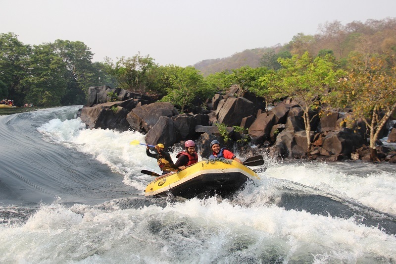
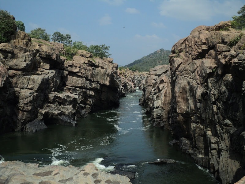
Situated on the banks of Kali River, the beautiful town of Dandeli is one of the top tourist places in Karnataka. Situated at 70 km from Hubli, 130 km from Goa, and 462 km from Bangalore, Dandeli is popular for its gorgeous natural backdrop, thick forests, wildlife, and adventure activities.
Dandeli Wildlife Sanctuary is the second largest wildlife sanctuary in Karnataka. Dandeli is also one of the top destinations for White Water Rafting in India. Kayaking, rafting, and canoeing trips on the Kali River are some of the popular activities one can indulge in Dandeli. Sathodi Falls, Syntheri Rocks, and Kavala Caves are the other important places to visit in Dandeli.
Jeep safari in Kali Sanctuary at Kulgi is quite a popular activities in summer season. Explore our Dandeli Travel Guide for complete details on the stunning scenic place. Dandeli can also be visited along with Goa tour packages and Gokarna Packages. It usually takes at least 2 full days to visit important attractions & activities in Dandeli. With an additional 2 days, tourists can also visit Goa or Gokarna & Murudeshwar.
Shimoga, also known as Shivamogga is one of the popular places to visit near Hubli, and among the must-visit destinations as part of Karnataka tour packages. It is located about 97 km from Chikmagalur, 183 km from Hubli,and 298 km from Bangalore.
Shimoga city is famous for its landscapes, waterfalls, and historical places, which are the main attractions of Shimoga holiday packages. Jog Falls, one of the highest waterfalls in Karnataka, as well as India, is the major attraction of Shimoga. Shimoga can be visited along with Chikmagalur tour packages.
Jog Falls, Kunchikal Falls, Barkana Falls, Achakanya Falls, Onake Abbey Falls, Hidlumane Falls, and Dabbe Falls are some of the popular waterfalls in Shimoga. Bhadra Wildlife Sanctuary, Agumbe, Kodachadri, Keladi, Tunga dam, Linganmakki dam, Shivappa Naik Palace, the Mandagadde Bird Sanctuary, Gudavi bird sanctuary, Tyarekoppa Lion Safari, and Sakrebayalu Elephant Camp are some of the important tourist place in Shimoga.
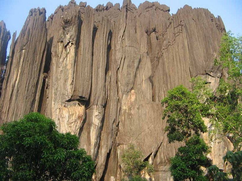
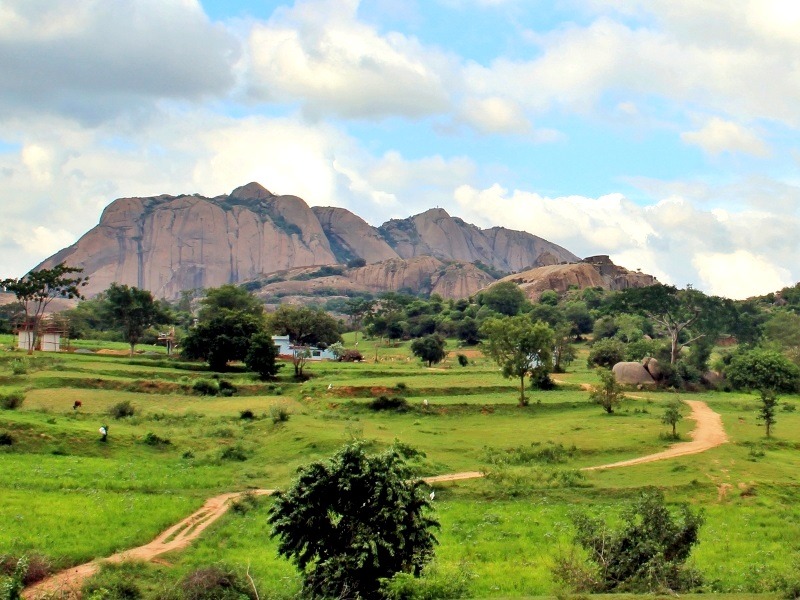
At a distance of 24 km from Benne Hole Falls, 30 km from Kumta, 55 km from Sirsi, 86 km from Karwar, and 103 km from Jog Falls, Yana is a village in Uttar Kannada district in Karnataka. It is well known for the unique rock formations in the Western Ghats.
Among the most prominent places to visit in Jog Falls, Yana is famous for two massive rock formations known as the Bhairaveshwara Shikhara and the Mohini Shikhara. The huge rocks are composed of solid black, crystalline Karst limestone. Bhairaveshwara Shikhara is 120 m (390 feet) in height, while the Mohini Shikhara, which is smaller, is 90 m (300 feet) in height. A cave temple dedicated to Lord Shiva is found at the base of the Bhairaveshwara Shikhara. Water drips from the projecting rocks over the Shiva lingam, and people call this water Gangodbhava. The idol of Goddess Parvathi is found at the base of the Mohini Shikhara. Yana can also be visited as part of Sirsi Tour Packages.
According to mythology, once the demon king Bhasmasura performed penance to acquire a boon from Lord Shiva. As per the boon, whatever he touched burnt into ashes. Bhasmasura chased Lord Shiva to destroy him, who found refuge in the Bhairaveshwara peak at Yana. It is also believed that the other peak called Mohini is dedicated to Lord Vishnu, who took the form ...
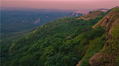
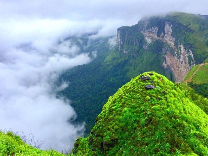
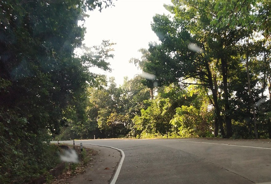
At a distance of 34 km from Belthangady and 57 km from Chikmagalur, Charmadi Ghat or Charmady is a Ghat in Belthangady taluk of Dakshina Kannada and Mudigere taluk of Chikmagalur. It is one of the popular ghat roads in Karnataka and among the must-visit places to visit as part of Chikmagalur Tour Packages.
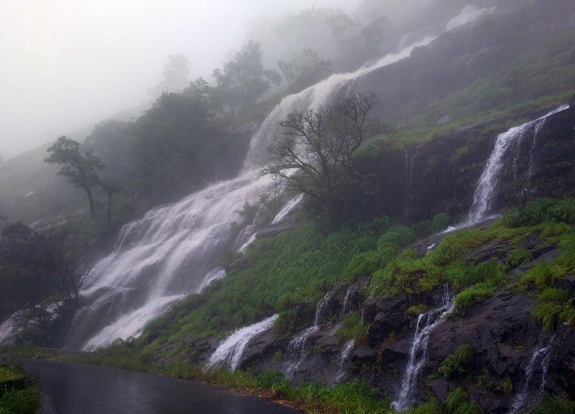
Charmady Ghat is one of the most scenic and dangerous (to drive) Ghats of Karnataka. It is one of the points in Western ghats through which motorable road passes connecting Dakshina Kannada with Chikkamagaluru district. The 25 km stretch starting from Kottigehara and ends at Charmadi Village is awesome, calm, and peaceful. It lies on National Highway 73 that connects Mangaluru to Tumkuru. This ghat section has 12 Hairpin curves and receives very heavy rainfall of over 7000 mm during the monsoon.
Charmadi Ghat is known for its visual beauty as it is home to lush forests, evergreen shrubs, streams, and waterfalls. The roads in this ghat section are very narrow and very deep compared to the other Ghat sections of Karnataka. The Netravati River originates at Bangarabalike which lies between Charmadi and Kudremukh. One of the major attractions of Charmadi is Ballarayanadurga. It is an amazing fort located atop a hill at a distance of 10 km from Sunkasale, via the Kottigehara-Kalasa route. Charmadi Ghat is also blessed with a waterfall named Bandaje Arbi. It falls from a height of 200 feet creating a staggering sight to experience. On a usual note, Charmadi is always ...
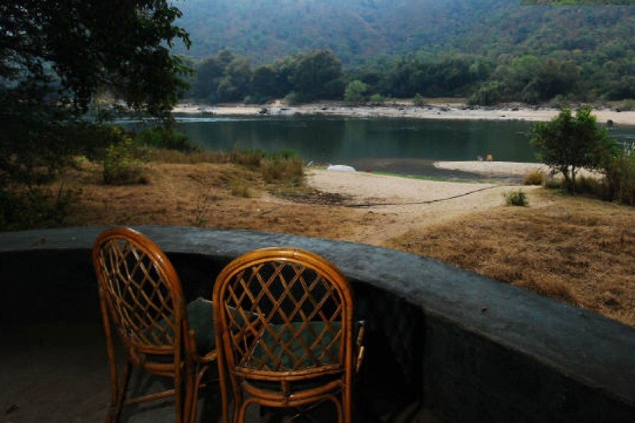
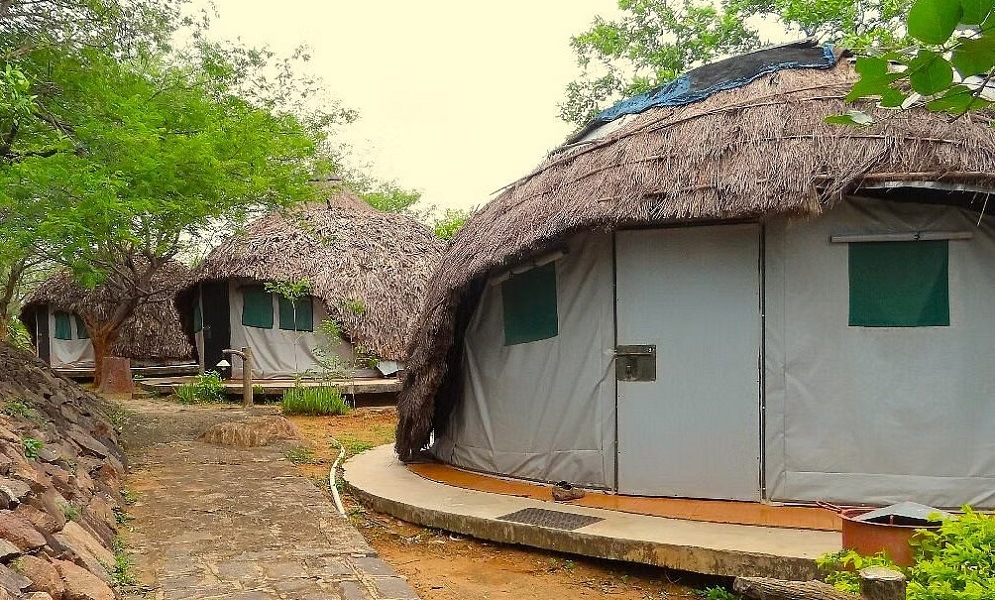
At a distance of 10 km from Sangama, 14 km from Bheemeshwari, 14 km from Mekedatu, and 102 km from Bangalore, Galibore Fishing & Nature Camp is a resort located deep in the deciduous forests of Cauvery Wildlife Sanctuary in Karnataka. It is one of the scenic accommodations maintained by the Jungle Lodges, Karnataka, and among the best places to visit near Bangalore.
Named after the windy hillock called Galibore that stands behind it, the Galibore Nature Camp is a good bet for a true sense of escape. Surrounded by hills, Galibore Camp has 10 tented cottages which will get you very close to nature. The camp is devoid of modern comforts such as electricity, however, you will be provided with hurricane/solar lamps. The camp also provides barbecue by the riverside and a bonfire for the guests in the evening.
Activities at this resort include coracle ride, trekking, joy fishing, lazing on the hammocks, angling, bird watching. If fishing is your kind of thing, the place offers you ample opportunities to indulge in this activity. Just ensure that you release the catch back in the waters as Galibore Fishing and Nature Camp practices a strict catch-and-release policy, especially to protect the endangered mahseer fish. Also, the Camp does not provide you with fishing gear and you are to make arrangements for these on your own.
The place is also home to amazing wildlife like spotted deers, the endangered grizzled giant squirrel, marsh crocodiles, turtles, and snakes await ...
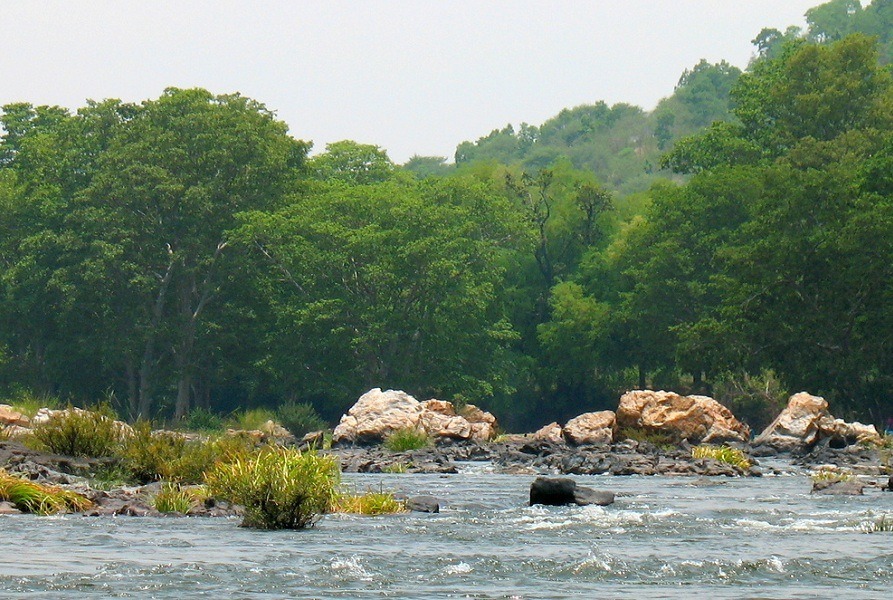
At a distance of 5 km from Bheemeshwari, 90 km from Mysore, and 97 km from Bangalore, Muthathi or Muttatti is a settlement situated on the banks of the Kaveri river near Malavalli in Karnataka. It is one of the must-visit places near Bangalore, especially for wildlife enthusiasts and nature lovers.
Muthathi is surrounded by a dense forest that is part of the Cauvery Wildlife sanctuary, with the Cauvery river flowing through it. River Kaveri and Hanuman temple are the main tourist attractions in Muthathi. The location has mythological associations with Sita, the wife of Rama and Hanuman. Once goddess Sita loses her nose ring while taking bath in the Kaveri river. Later, Lord Hanuman finds her nose ring in this place and returns it to her. Hence, Hanuman in this place is called 'Muthetharaya'. The village acts as a transit point and a stopover for folks that have a religious obligation and/or want to sacrifice animals.
The forest itself is quite amazing and the best time is to visit is in the early morning. It is quite an enthralling experience to see wild trees like 'Flame of the Forrest' bloom & the different hues of the leaves and topography during the summer months. It is home to a good number of bird species and wildlife, including Elephants, Langoors, Spotted deer, foxes, mongoose, Indian monitor lizards, and some reptile species. Bheemeshwari Fishing Camp is yet another spot near Muthathi.
The access to the river from the forest road has been cut-off ...

At a distance of 20 km from Shivanasamudra, 74 km from Mysore and 130 km from Bangalore, Doddamakali Nature Camp is a hidden gem nestled in the heart of Karnataka. Located on the banks of the magnificent River Cauvery, it is one of the scenic destinations in Karnataka, and among the top places to visit near Mysore as well as Bangalore.
Situated just 6 km upstream from the Bheemeshwari Fishing Camp, Doddamakali is known for its rustic charm and sylvan surroundings. It is one of the popular locations for corporate team building and weekend getaways in Bangalore. As it is isolated from the hustle and bustle of the city, this place promises a tranquil escape from the chaos of city life.
With its lush greenery, gushing river, and abundant wildlife, this place perfectly blends natural beauty and adventure. The main attraction here is the River Cauvery, which flows gracefully through the region, providing ample opportunities for water-based activities like angling, kayaking, and river rafting. The surrounding landscape of Doddamakali is adorned with dense forests, making it an ideal destination for wildlife enthusiasts. The region is home to various exotic species, including elephants, leopards, deer, and numerous bird species.
Mountain biking and hiking are also common at Doddamakali. Tourists visiting Doddamakali often go for nature walks and visit the ruins of an ancient Shiva temple located nearby. ...
At a distance of 14 km from Hogenakkal, 35 km from MM Hills, and 168 km from Mysore, Gopinatham Mystery Trails is an eco-tourism camp situated near Gopinatham, a quaint little hamlet on the border between Karnataka and Tamil Nadu. It is one of the least popular jungle lodges in Karnataka, and among the best places to stay as part of Mysore tour packages.
Situated in the Cauvery Wildlife Sanctuary, Gopinatham Mystery Trail camp offers amazing vistas and opportunities to enjoy Nature at its best. Look in any direction and one can see a chain of Nagamalai Hills. A waterbody called as Gopinatham Dam adjoin the camp adds to the beauty of the place. During the monsoon these dry forests turn into a verdant green that is soothing to the eyes.
While staying at the camp, guests can explore the forest for the colourful birds, visit the memorial of Mr. P. Srinivas, a celebrate forest officer who sacrificed his life while on the call of duty, and trek up to a vantage point to enjoy the uninterrupted vistas of the landscape. One can also walk around the lake, do some Kayaking,and Pedal boating. The raw power of the water experienced while in a coracle promises to be with you for a long time. Visitors can also Visit the famed Hogenakkal Falls - the Niagra of India which is just 14 km away from the camp.
Timings: 9 AM - 5 PM
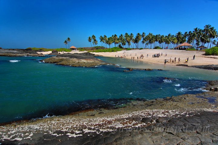
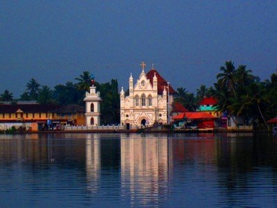
At a distance of 15 km from Udupi Railway Station, 65 km from Mangalore & 100 km from Murudeshwar, St. Mary's Island is a group of small beautiful islands situated to the north of Malpe Beach near Udupi. It is one of the best places to visit as part of Udupi Packages.
A quaint island just off the coast of Udupi, St. Mary's Island is an island of white sand beaches, rock monoliths, and great wildlife making it one of the best places to visit in Udupi. It is said that Vasco da Gama first reached this Island before reaching the Kappad Beach (near Calicut) while finding a sea route to India.
This island is a group of four individual islands namely Coconut Island, North Island, South Island, and Daryabahadurgarh Island. The island has two beautiful beaches and crystallized basalt rock formations which were created at the time Madagascar Island got separated from India. These unique rock formations scattered throughout the island giving a special landscape to the place. Watching the sunset standing on the crystalline rocks is one of the most alluring experiences on the island.
St.Mary's Island is 4 miles away from the coast and can be reached by 30 minutes boat ride from Malpe Beach. This island is uninhabited and there is no possibility to stay overnight there.
Ferry Timings from ...
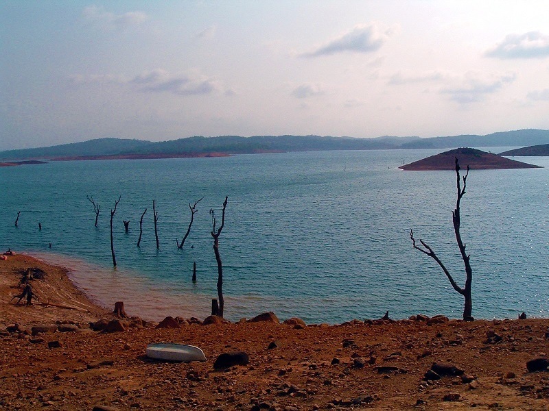
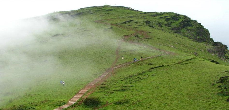
At a distance of 21 km from Jog Falls, and 101 km from Shimoga, Honnemaradu is a small town hidden away beside the beautiful and sprawling backwaters of the Sharavathi River. It is one of the offbeat places to visit in Jog Falls.
Situated on the way to Jog Falls, Honnemaradu is located on the hills that overlook the Linganamakki Reservoir. The village derived its name from the Honne tree. However, the literal meaning of Honnemaradu is Golden Lake, a big water reservoir that was created due to the Linganamakki Dam built across River Sharavathi, and the reservoir is also known as Honnemaradu Lake after the village. The reservoir area used to be a village before the dam was built. Now, post the construction, the village is very sparsely populated and the Honnemaradu Lake is pretty much the only tourist sight.
This sleepy little town is a paradise for sport-buffs and a haven for nature-lovers. Encompassing an area of 50 km by 80 km, the reservoir at Honnemaradu is known for its stunning views of sunrise and sunset. One can undertake hiking, boating, canoeing, kayaking, and wind rafting while in Honnemaradu. Camping is allowed on the island nestled in the middle of the lake. In addition, Honnemaradu is popular with birdwatchers, who can spend hours watching and identifying the variety of birds and butterflies.
Timings: 6 AM - 5 PM
Entry: Free, Rs. 300 for Rafting, Rs. 500 - ...
At a distance of 93 Kms from Bangalore (via Kanakapura), 107 Kms from Mysore, Sangama and Mekedatu are two lovely places situated nearby. This is one of the famous weekend getaways from Bangalore. Sangama is the place where Arakavathi river merges with River Kaveri. From this point, about 3.5 kilometers downstream, Mekedatu is a place where river Kaveri flows through a deep and narrow gorge. These two are the must visit places for those people who want to relax amidst pristine nature as part of Bangalore trip.
Mekedatu means goat's leap in Kannada. River Kaveri flows into a deep and narrow gorge, so narrow that a goat could leap over it and that is how it got its name. It is said that a goat being chased by a tiger saved its life by jumping over the gorge whereas the tiger did not attempt to take the risk and abandoned the chase. When reaching the gorge the river flows ferociously onto the rocks sculpting them into some amazing shapes. The river Kaveri flows through a deep ravine of just 5-10 meter wide. The water flow is very fierce at this place during monsoons making it very dangerous to swim here. The rocks are also very steep and slippery, and visitors need to be careful while descending the rocks. Several tourists downed here due to water force and slippery rocks.
Sangama, 3.5 kms ahead of Mekedatu, is the confluence of Kaveri and Arakavathi. ...
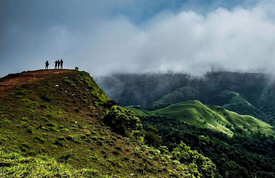
At a distance of 4 km from Durgadahalli, 7 km from Sunkasale, 24 km from Kottigehara, 41 km from Mudigere, and 70 km from Chikmagalur, Gatikallu Viewpoint is a stunning vantage point situated at Durgadahalli village in Karnataka. Located near Ballalarayanadurga Fort, it is one of the best places to visit near Chikmagalurfor nature lovers and trekking enthusiasts.
Nestled in the lap of Western Ghats, Ghatikallu is a 600 feet 'one rock mountain' with the most stunning view of the valley below. There are many myths about this 'one rock mountain' when heard will only kindle the nostalgic feeling of being one with history. From this viewpoint, one can get a panoramic view of the surrounding peaks, grasslands, valleys, thick jungle, Ballarayan Durga, and Rani Jhari Viewpoint. This place is a perfect getaway from all the hustles and bustles of routine city life.
Gatikallu Viewpoint can only be reached by trekking through the dense vegetation from Durgadahalli village. The trail starts from Kalabhairaveshwara Temple at Durgadahalli, which is around 41 km from Mudigere. The 4 km trekking route from the temple to the initial forest section (from where the actual trek starts) is on a moderately steep mud road. Jeeps and other SUVs can go all the way up to the start point covering a distance of 1 km else just park your vehicle at the temple and start trekking from there. It is a moderate trek and ...
At a distance of 5 km from Gutti, 22 km from Mudigere, 52 km from Chikmagalur, and 57 km from Sakleshpur, Devaramane is a scenic village in Mudigere Taluk of Chikkamagaluru district in the state of Karnataka, India. It is one of the mesmerizing offbeat trekking places in Karnataka and among the must include places in Chikmagalur Tour Packages.
Devaramane village is renowned for its Kalabhairaveshwara temple. Situated on a hill, this small nice temple looks like quite an old temple and is well maintained. The term 'Devaramane' roughly translates to the 'Abode of God' and the serene tranquility that prevails here quite aptly satisfies that nomenclature. There is a pond in front of the temple and a hill backside. The route leading to the temple provides us the mesmerizing view of the hills around and the road is in good condition. About 200 m from the temple, there is a viewpoint called Devaramane viewpoint that offers some panoramic views of the lush green surroundings, gurgling streams, and glittering lakes.
Devaramane offers a number of variations that make it an ideal trekking spot for both beginners and hardcore trekkers. There are several hillocks to climb, the Ettinabujha- Bulls Hump-back, also known as Shishila Gudda, towers over the rest of the peaks in the area. From a height of 3000 ft, the roar of the river flowing beneath can be heard. The famous Kapila fishing camp is located nearly 15 km from Devaramane.
Daily, buses ply between Bangalore, and ...
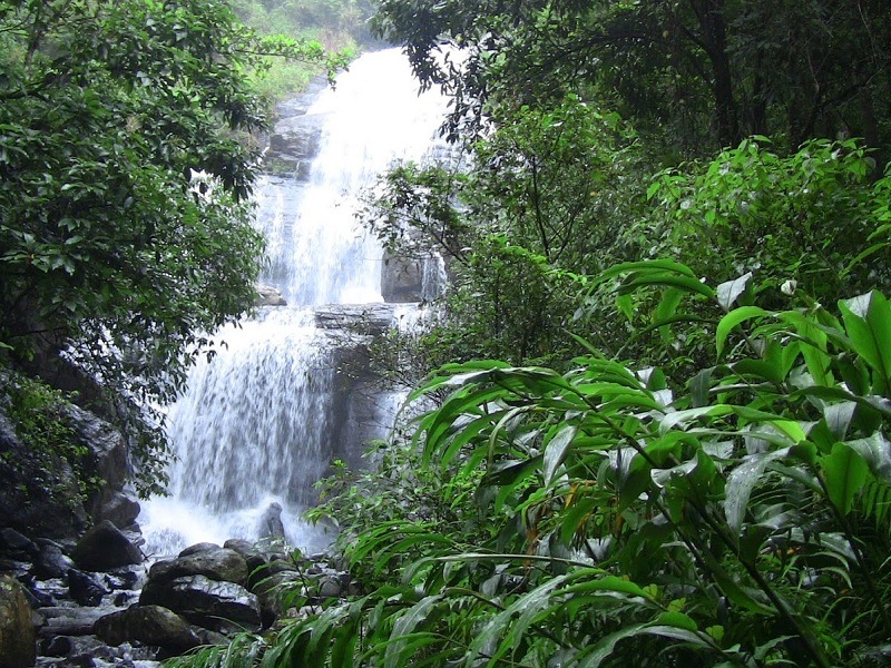
At a distance of 7 km from Kakkabe, 27 km from Virajpet and 48 km from Madikeri, Nilakandi Falls is a beautiful waterfall located near Kabbinkadu village in Coorg district of Karnataka. Well-known as Honey Valley, it is one of the stunning waterfalls in Coorg and among the must include places in Karnataka Tour Packages.
The Nilakandi Falls is set amidst the dense tropical forests of Coorg and starts somewhere in the Thadiyandamol range. Cascading down from a height of about 50 feet, it is a picturesque and serene waterfall that lends trekkers a wonderful waterfall shower experience. This place is definitely one of the few tourist places in Coorg that portray the enchanting beauty of this lovely destination. Do plan a visit to this waterfall if you want to plunge in the natural beauty of Coorg.
Honey Valley is a private resort owned and run by Mr. Suresh Chengappa and is situated 4 kilometers from the Kabbinkadu bus stop. The estate is spread over 75 acres of coffee, cardamom and pepper plantations. A forty-five-minute easy walk through more or less level ground takes one to Nilakandi Falls from Honey Valley. The actual trek to the waterfall starts from the dry pond which is about 1 km from the Honey Valley Resort. A three-kilometer trek from the lake takes one to the stream that flows down from the Nilakandi Falls. And another four kilometers from there takes you to the source of the waterfall, which is a small lake.
Timings: 6 AM - 5 PM
Entry: Fre ...

At a distance of 1 km from Barapole River Rafting Point, 20 km from Gonikoppal, 21 km from Kutta and 76 km from Madikeri, Glenlorna is a tea estate situated near Hudikeri town in Coorg district of Karnataka. Owned by Tata Plantations, this is the only tea estate in the center of the coffee-dominated Coorg and among the must-visit places for nature lovers while holidaying in this region of Karnataka.
Tucked away in the hills, the Glenlorna Tea Plantation Estate lies at an impressive elevation of 808 m, surrounded by the famed fauna and flora of the Western Ghats. Apparently, tea was grown here since 1914 and like many other estates, this was a part of the British legacy too. Spread over an area of about 1200 acres, Glenlorna is well- renowned for its impressive tea production averaging to roughly around 3,845 kilograms of tea per hectare, post-harvest. There is a tea processing factory here and is the only tea estate with a processing unit in the Coorg district.
The Glenlorna estate gets an abundance of rainfall and is not only famous for its tea, but also pepper crops and areca nuts. The area surrounding the estate is home to wild boars, hares and an array of birds, considered to be one of the most ecologically sustained zones. Providing sweeping views of the tea gardens and the hills in the distance, the Glenlorna Tea Plantation has an old British edifice that is charming and cozy and surrounded by boundless serenity. This old villa was named after Glen & Lorna, ...
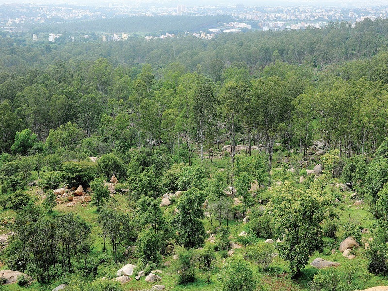
At a distance of 18 km from Bangalore Railway Station, Turahalli is a sprawling dry and deciduous forest located off Kanakapura Road, Bangalore. It is one of the best places to visit in Bangalore, especially for nature lovers.
Turahalli is a perfect escapade from the hustle and bustle of the city into nature. Considered to be the city's only surviving forest, the forest is sprinkled with huge rock boulders that make it a perfect spot not only to sit and relax but also to pose and take great pictures with the forest in the backdrop. In addition to that, the forest supports rich and varied wildlife, both in terms of flora and fauna. The trees are mostly eucalyptus among other species. The place is quiet, scenic, and surrounded by nature with a wide range of bird species.
Popularly known as Karishma Hills, this stretch of beautiful forest is perfect for a day trip if you are looking for a spot of fresh air, exercise, or even adventure. It has a nice view and a small Shani temple on top of a rocky hill. It is also among the few places within the city for natural rock climbing as there are several rocks of various sizes and shapes. Many climbers practice regularly, in preparation for local or international competitions.
Vehicles have been banned inside the forest except for cycles. So, the best way to enjoy Turahalli forest is to drive your vehicle up to the entrance, head out for a walk into the forest, and indulge in the rejuvenating environs of the forest. Cycling ...
At a distance of 8 km from Benne Hole Falls, 18 km from Manjuguni, and 37 km from Sirsi, Devimane Ghat is a mountain pass situated in Uttara Kannada district of Karnataka. It is one of the scenic ghats in Uttara Kannada, and among the must-visit places in Sirsi.
Devimane Ghat lies in the Western Ghat part of Karnataka, ultimately connecting Malenadu town Sirsi and Karavali town Kumta. Being under the lush forest zone in Uttara Kannada district, it consists of 15 hairpin curves, and the road elevation ranges from 25m to 567 m. In between these 15 hairpin curves lies the Devimane village, a pristine little hill town known for its tranquility. Perfectly nestled in the Western Ghats, this region has numerous waterfalls and viewpoints. There is a Durga Devi temple above the hill which led people to name this ghat as Devimane, meaning the home of goddess Devi.
There is also a viewpoint at Devimane that affords stunning views of the surroundings, as well as a temple of Kshetrapaleshwara that people believe protects the surrounding areas. Travelers going through this ghat usually stop at Kshetrapaleshwara Temple, and offer money, coconut, fruits, and flowers to God and pray for a safe journey. During the monsoon, the entire region gets covered by fog, reducing visibility and increasing the beauty of this place.
Devimane is also a protected forest reserve, preserving the evergreen flora of the Western Ghats. This region is home to many medicinal plants and fauna. Lion-tailed ...
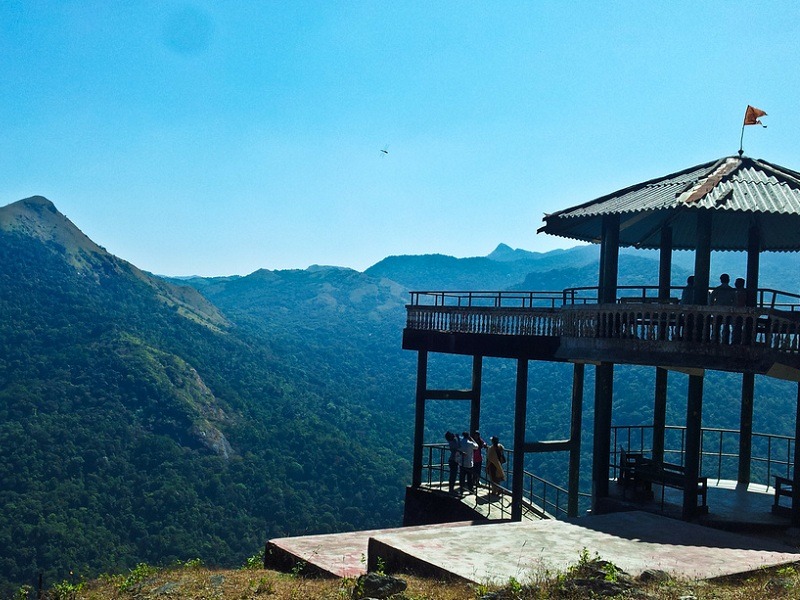
At a distance of 20 km from Kukke Subrahmanya and 55 km from Sakleshpur, Bisle Ghat is a ghat situated between Kukke Subrahmanya and Sakleshpura in Karnataka. It is one of the top adventurous spots in Karnataka and among the popular Sakleshpur Tourist Places.
Bisle is part of Western Ghats and situated in the border of Hassan district and Dakshina Kannada district. Bisle Viewpoint, about 5 Km from Bisle village, is popular as a view point to get the beautiful and astonishing views of three mountain ranges including Kumara Parvatha, Pushpagiri and Dodda Betta. The highlight of this point is that the view has a valley, with Giri River separating the beauty point and these mountain ranges. The forest department has erected a shelter here to sit and enjoy the view.
Besides breathtaking views, it is also a perfect destination for the trekkers. Bisle Reserve Forest is also situated here which is home to a variety of flora and fauna. The forest remains protected and unexploited as there is no human occupancy in it. Tourists here can also enjoy spotting some diverse wild animals like peacocks, monkeys, spotted deer, and elephants while passing through the reserve forest. With a blanket of greenery all around dotted with waterfalls and streams, Bisle Viewpoint offers an unforgettable time for nature lovers in Sakleshpur.
Bisle ghat is typically visited along with Kukke tour packages. The road leading to Bisle is being ...
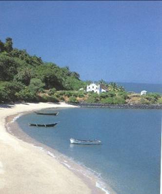
At a distance of 7 km from Karwar, Anjadiva Island or Anjadip Island is located in the Arabian Sea in South Goa. Due to the fact that the Island situates about 2 km from Binaga Village in Karnataka it is widely believed that Anjadiva belongs to this State but legally it is a part of Goa.
The Anjadip Island occupied an area of 1.5 sq km, it is the largest of the Karwar Panchadiva chain of five Islands and the other four are Kurnagal, Mudlingud, Devgad and Devragad. Anji stands for five in Tamil and it denotes the 5th Island. This idyllic Island is home to the Indian Navy.
The legendary sailor Vasco Da Gama and a Jewish trader Gaspar Da Gama requested the king of Portugal to create a naval fort at the region of Anjadiva to gain the administrative control of Goa. Anjadiva Fort is present on the Anjadip Island. Currently the fort lies in ruins and the Church of Our Lady of Springs which was constructed in the year 1505 is close to it. However, this fort was deserted by the Portuguese during the year 1843. The Hindus and Christians utilized the fort as a shelter when Portuguese territory was attacked by Tipu Sultan. On 19th December, 1961 Anjadiva Fort officially was declared a part of India.
The Island is known for its annual feast of Our Lady of Springs known as 'Nossa Senhora das Brotas' on 2nd February and feast of the Chapel of St. Francis D'Assisi on 4th October.
You can also travel by boat from the ...
At a distance of 48 km from Bangalore City Junction, 31 km from Ramanagara and 13 km from Magadi, The Savandurga hill is considered to be among the largest monolith hills in Asia. Savandurga hills are located at an altitude of 1226 m above the sea level and are also considered to be a part of the Deccan Plateau. This is one of the popular one day trip from Bangalore for trekking and also one of the ideal weekend getaways from Bangalore.
Savandurga consists of two hills, the Billigudda and the Karigudda. They serve as the base for pilgrims who come to visit the Savandi Veerabhadreshwara Swamy temple and Narasimha Swamy temple, situated at the base of the hills. The paths leading to these temples are quite uneven and thrilling. Thus, they make it to the wish-list of the rock-climbers, cave-explorers and adventurers.
Savandurga was a prominent place during the Hoysala rule. The hill fort on the top of the hill was erected in 1543 by Samanta Raya. It came under control of Kempe Gowda until 1728 when it was captured by the Raja of Mysore from whom it passed to Haider Ali. In 1791 Lord Cornwallis captured Savandurga from Tipu Sultan's army in the Third Anglo-Mysore War.
Trekking in Savandurga is an extremely popular activity. There are actually two main trekking trails that run up towards Savanadurga. One is the Karigudda and the other is the Billigudda trail. Both Karigudda and Billigudda are tough ...
| Package | Duration | Starting Price | Details |
|---|---|---|---|
| Mysore - Coorg - Bangalore | 5D/4N | ₹ 14950 | View Details |
| Mangalore - Udipi - Murudeshwar - Gokarna | 5D/4N | ₹ 16250 | View Details |
| Hampi - Badami - Pattadakal | 4D/3N | ₹ 12750 | View Details |
| Coorg - Udipi - Murudeshwar - Gokarna | 6D/5N | ₹ 18100 | View Details |
| Ooty - Mysore - Coorg | 6D/5N | ₹ 18450 | View Details |
| Best of Karnataka in 8 Days | 8D/7N | ₹ 22450 | View Details |
Similar Getaways