-
Tours
-
-
- Domestic Tours
-
-
- Resorts
- Car Rentals
- Destinations
- Getaways
- Hotels
- Tools
- * Workation
- * Tour Plans
- Blog
- List Property
- * Offers *

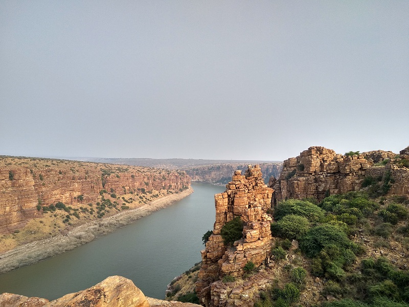
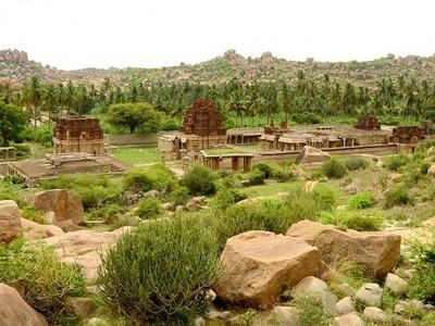
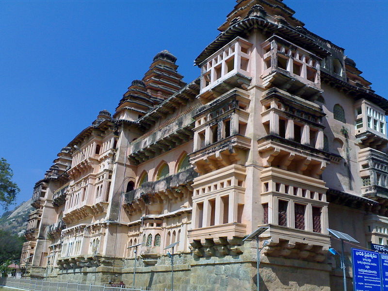
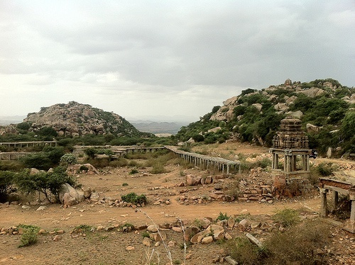
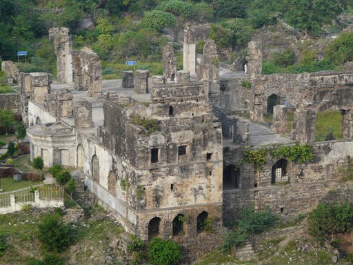
At a distance of 15 km from Jammalamadugu, 94 km from Kadapa, 155 km from Kurnool, 233 km from Tirupati, 280 km from Bangalore, 386 km from Hyderabad and 391 km from Chennai, Gandikota is a small village in Kadapa district of Andhra Pradesh. Situated on the banks of Pennar River, it is one of the popular historical places to visit in Andhra Pradesh and among the weekend gateways from Hyderabad as well as from Bangalore.
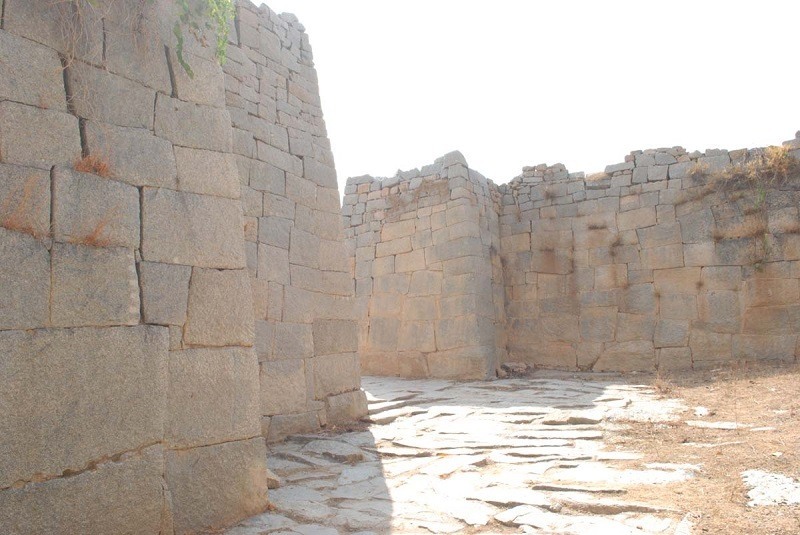
Gandikota is a small village spread in and around the historical Gandikota Fort. According to history, Gandikota area was first identified and made Sand fort in 1123 CE by Kapa Raja of nearby Bommanapalle village and a subordinate of Ahavamalla Someswara I, the Western Chalukyan king of Kalyana. The village transformed into major fort after the emergence of the Kamma kings, who ruled Gandikota more than 200 years. The fort fell into hands of Qutub Shahis of Golconda in 1650 CE. The medieval fort of Gandikota is named after the adjoining gorge which means gandi in Telugu. It is also believed that Vemana, the Telugu poet lived in Gandikota area for a short period.
Known to few ardent travelers, Gandikota is not the usual tourist hub as it is neither a world heritage site, nor is it marketed well by state tourism agencies. This untouched and unexplored place is worth a visit for history buffs as well as nature lovers. A frozen in time village in the middle of centuries old structures such as forts and temples is known for its spectacular gorge formed ...
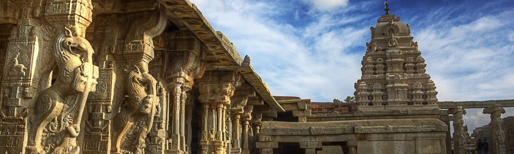
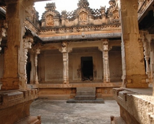
At a distance of 125 km from Anantapur, 124 km from Bangalore City Junction, 225 km from Tirupati, 478 km from Hyderabad & 569 km from Vijayawada, Lepakshi is a small village which lies 14 km east of Hindupur in Anantapur district of Andhra Pradesh. It is the one of the important heritage sites in Andhra Pradesh highlighting the legacy of Vijayanagara Dynasty. It is one of the famous Tourist places in Andhra Pradesh.
Lepakshi was founded in the 16th century during the reign of the Vijayanagara king, Aliiya Rama Raya. Virupanna, the royal treasurer was accused of drawing funds without the king's permission from the state treasury to build the Veerabhadra temple at Lepakshi. However, he blinded himself to avoid the king's punishment. Even today one can see two dark stains upon the wall near the Kalyana Mandapa, which are said to be the marks made by his eyes. Hence the village is called 'Lepa-akshi', means a village of the blinded eye.
Lepakshi is the centre of some of the finest temple architecture and paintings. Lepakshi consists of three important shrines dedicated to Shiva, Vishnu and Veerabhadra, of which Veerabhadra temple is the most important place to visit in Lepakshi (this is also referred as Lepakshi Temple). The temples of Papanatheswara, Raghunatha, Srirama, Veerabhadra and Durga are located in the same complex on a hillock named as Kurma Saila (tortoise shaped hill).
Lepakshi is also one ...
At a distance of 33 km from Guntur, 38 km from Vijayawada, 111 km from Machilipatnam, 162 km from Khammam, 178 km from Nalgonda, 178 km from Bhadrachalam, 194 km from Rajahmundry, 270 km from Nellore, 274 km from Hyderabad, 403 km from Vishakhapatnam, 450 km from Anantapur, Amaravati is a popular historical town situated on the southern bank of Krishna River in Guntur district of Andhra Pradesh. It is the new capital of Andhra Pradesh state and one of the popular pilgrimage sites for Hindus as well as Buddhists.
The town gets its name from Amareshwara or Amaravati temple, dedicated to Lord Shiva. The town has been mentioned in the Indian epics as Dhanyakataka and Andhranagari. It was also served as the capital of the Satavahanas, who ruled Andhra Pradesh from the 2nd century BCE to the 3rd century CE. Later it was ruled by several major dynasties like Andhra Ikshvakus, the Pallavas, the Cholas, the Kakatiyas, the Delhi Sultanate, Musunuri Nayaks, Bahmani Sultanate, Vijayanagara Empire, Sultanate of Golconda and Mughal Empire successively before the founding of the Nizam of Hyderabad in 1724. It was ceded to France in 1750 but was captured by England in 1759. It was briefly captured by Hyder Ali, but remained under British rule for the majority of time since the 1780s. Amaravati is currently the de-facto capital of the state of Andhra Pradesh, following its bifurcation from Telangana in 2014.
Amaravathi has gathered attention from all over the world because of the ...
At a distance of 215 km from Hyderabad, 360 km from Bangalore & 344 km from Vijayawada, Kurnool is one of the major towns in the state of Andhra Pradesh. It was the first capital of united Andhra Pradesh between 1 October 1953 and 31 October 1956. The town is built on the banks of Tungabhadra River.
Kurnool is known as the gateway to the Rayalaseema region. It was earlier known as Kandenavolu, as it was a transit place on the southern banks of the Tungabhadra River and acted as a greasing place for the carts. It was ruled by Cholas and later by Kakatiya kings in the 12th and 13th Centuries. Later it came under the influence of Vijayanagar Kings and Achyuta Raya built the Kurnool Fort in 16th Century. It was briefly ruled by local rulers in 16th - 17th century. The town came under the control of Mughal Emperor Aurangzeb in 1686. Later the town was ruled by Nawabs from Dawood Khan to Gulam Rasool Khan. In 1839 the British Government took control of the region.
The popular places to visit in the city are the ruins of the fort built by the Vijayanagar Kings, Konda Reddy Buruju and the tomb of Abdul Wahab. Kurnool district is home for the most important pilgrim sites in Andhra Pradesh, including Srisailam, Ahobilam, Yaganti, Mahanndi and Mantralayam, making ...
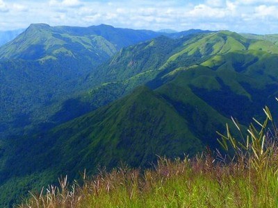
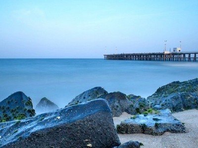
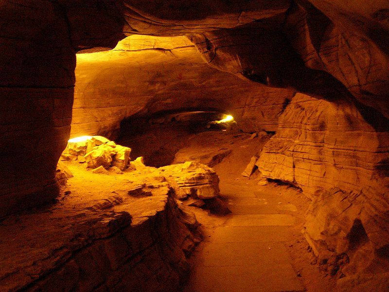
At a distance of 36 km from Araku, 88 km from Vizag & 662 km from Hyderabad, Borra Caves are one million year-old limestone caves and the deepest caves in the country. Situated in Anantagiri hills of Andhra Pradesh, the caves are situated at an altitude of 1400 m and occupy an area of 2 sq.km. Borra Caves is one of the best places to visit in Araku Valley as part of Vizag packages.
These natural caves were discovered in 1807 by William King George of the Geological Survey of India. According to locals, once a cowherd lost his cow while grazing. He soon realized that his cow had fallen down. While searching for the cow, the cowherd found these caves and came across a Linga inside it. The Linga is considered synonymous to Lord Shiva, who saved the cow. After this, a small Shiva temple was built right outside this cave.
The caves are filled with fascinating stalagmite and stalactite formations of calcium deposits. The Gosthani River used to flow through the caves between the formations. The caves were created due to the flow of river over the limestone area. The pressure was exerted by the humic acid in the water on the mineral deposits and the limestone dissolved in the water. The dissolved limestone trickled down drop by drop forming different shapes in the cave. One can see different formations of the stalactites and stalagmites as Shiv-Parvathi, Mother-Child, Rushi's Beard, ...
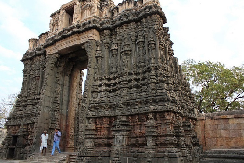
At a distance of 1 km from Bugga Ramalingeswara Swamy Temple, 3 km from Tadipatri Railway Station, 57 km from Anantapur, 106 km from Kadapa, 356 km from Hyderabad, 413 km from Vijayawada and 268 km Bangalore, Sri Chintala Venkataramana Swamy Temple is a famous temple located in Tadipatri town of Anantapur district in Andhra Pradesh. This temple is dedicated to Lord Vishnu, who is in the divine form of Venkataramana Swamy.
This temple is believed to have been built in 16th century by Timma Naidu, son of Ramalinga Naidu, a chieftain of Vijayanagar Kingdom. It was built during the same time as the Vittala Temple of Hampi in a similar manner. Most of the features of these two temples bear close resemblance to each other, being built on a similar ground plan. While the stone chariot here is compact and small in size when compared to the famous stone chariot at Hampi.
Originally the temple was called Chintala Tiruvengala Natha Swamy Temple. Spread across 5 acres of land, this temple is built according to the Silpa Sastras. The carvings of episodes of the Ramayana, Mahabharata and Bhagavatha are seen around the Garba Griha, Ranga Mandapa, Mukha Mandapa, Main Gopura and the Prakaraa.
The Mukhamandapa has forty pillars in the Vijayanagar style. Beyond the Mukhamandapa is a Rangamandapa, which has scenes of the Ramayana and rare sculptures of the Vishnu avatars. The idol of Lord Venkataramana Swamy is very beautiful and ...
At a distance of 4 km from Tadipatri Railway Station, 58 km from Anantapur, 107 km from Kadapa, 357 km from Hyderabad, 413 km from Vijayawada and 269 km Bangalore, Bugga Ramalingeswara Swamy Temple is located on the banks of Penna River at Tadipatri in Anantapur district of Andhra Pradesh. The presiding deity of the temple is Lord Shiva in the form of Ramalingeswara Swamy.
The temple got this name by a perennial underground stream from which water always keeps flowing (Bugga in Telugu) into the sanctum sanctorum at the spot where the Lingam is consecrated. Sri Bugga Ramalingeswara Swamy Temple was built by Ramalinga Nayudu, a chieftain of the Vijayanagara Kings, in 16th century. The records indicate that a sculptor Yellanchari was brought from Benaras to construct the temple. According to legend, the temple has been established at the site, where sage Parasurama lived and performed meditation.
The architecture of the temple shows a mixture of Chalukyan, Chola and Vijayanagar art. The temple has main entrances on South and West. The Vijayanagar kings have built the western, northern and southern gopurams of the temple. The north gopuram although unfinished has the most elaborate sculpture, with intricate carvings. The entire Shiva Purana is carved on the walls of the temple in miniature carvings with elaborate details. Episodes from Hindu epics Ramayana and Mahabharata are also carved on the walls. This temple has a mini stone chariot similar to the famous chariot ...
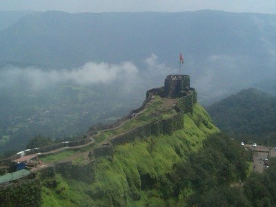
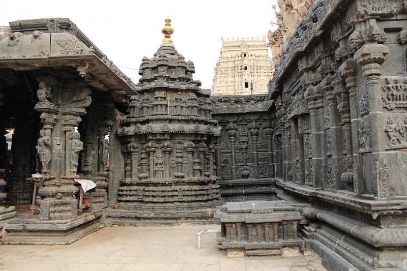
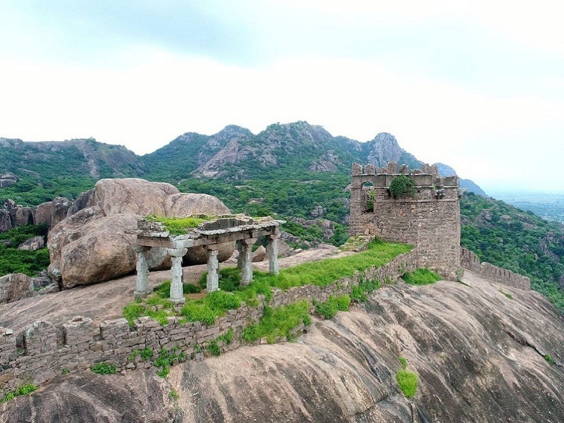
At a distance of 15 km from Tirupati, 33 km from Tirumala Tirupati Balaji Temple, 147 km from Chennai, 238 km from Bangalore & 574 km from Hyderabad, Chandragiri is an ancient town and the seat of Yadavaraya Kings from 11th to 13th centuries and fourth capital of Vijayanagar Dynasty. Chandragiri along with Tirupati is one of the ideal Chennai weekend getaways and a major heritage / historical site in Andhra Pradesh. It is one of the prime Tourist places in Tirupati town.
Chandragiri near Tirupati is famous for the historical fort, built in the 11th century. Chandragiri was under the rule of Yadavaraya Dynasty for about three centuries and came into control of Vijayanagar rulers in 1367. It came into prominence during Saluva Narasimha Rayalu. Chandragiri was the 4th capital of Vijayanagar Empire and they shifted their capital here when Golconda sultans attacked Penukonda. In 1646, the fort was annexed to the Golconda territory and subsequently came under Mysore rule before controlled by British.
The Fort is built on a huge rock at an altitude of 183 meters. The southern side of the hill is enclosed by strong walls, surrounded by a ditch to prevent any intruder from entering into the fort. The Chandragiri Fort has eight ruined temples inside the fortification ...
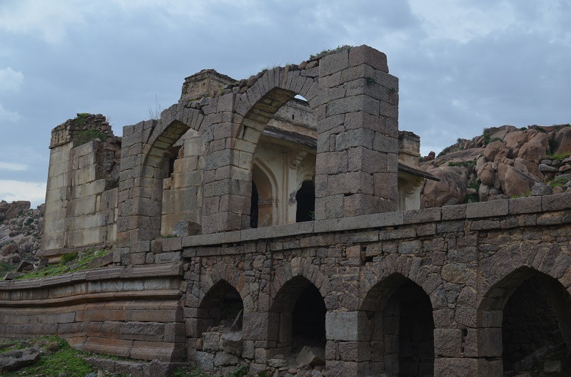
At a distance of 3 km from Penukonda Railway Station, 79 km from Anantapur, 436 km from Hyderabad, 550 km from Vijayawada and 142 km Bangalore, Penukonda Fort is a medieval fort situated at Penukonda in Anantapur district of Andhra Pradesh.
Penukonda was once served as the 2nd capital of Vijayanagar Kingdom after the fall of Hampi and was earlier called as Ghanagiri or Ghanadri. According to the inscriptions, the Penukonda state was gifted by the King Bukka-I to his son Virupanna. This fort was built at the time of Virupanna. This fort was one of the best defenses of the Vijayanagara kingdom. With the decline of Vijayanagara kingdom, the Sultan of Golconda captured this fort. Later Mysore Kingdom captured this fort briefly until British overtook after the fall of Tipu Sultan.
Built on a gigantic hill, the huge and imposing fort offers a spectacular view of the town below. The basement of the walls, bastions and gateways in the fort was made of stone, mortar and lime. The first inner section of the fort residential building designed amenities for royal family members. The central hall of the fort follows Hindu and Muslim architecture. Dome of this hall has been designed in Hindu style of construction, whereas the floor has the signature style construction of Islamic architecture.
The fort bounds with natural fortification of surround hills and moats dug up around the outer wall. There are seven citadels within ...
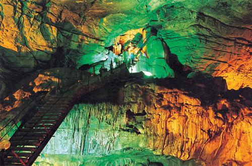
At a distance of 45 Kms from Yaganti, 70 Kms from Nandyal, 82 Kms from Ahobilam, 95 from Mahanandi, 109 Kms from Kurnool & 318 Kms from Hyderabad, Belum Caves are the second largest caves in India and the longest caves in India.
Situated between Nandyal and Tadipatri in Kurnool district, the caves are 3229 meters long. These caves have long passages, spacious chambers, fresh water galleries and siphons. The deepest point of caves is at 120 feet from entrance level. The caves were formed due to erosion in limestone deposit in the area by Chitravati River, millions of years ago. Now Chitravati River flows almost 30 km south of caves.
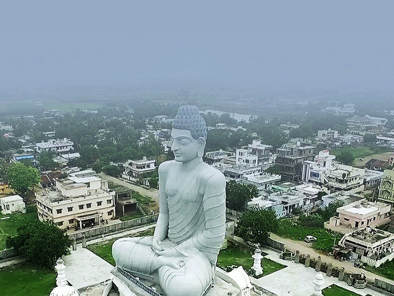
There is a big Buddha statue near the caves. This place was used as Meditation Hall by Buddhist monks in ancient days. AP Tourism has developed pathways and bridges for easy access of the caves. A resort is run by AP Tourism near the entrance of the caves.
This place is very close to Kolimigundla village (around 2 Kms) on Nandyal - Tadipatri route, connected by frequent buses.
Timings: 10 AM to 5 PM. Entry Fee: Rs. 50
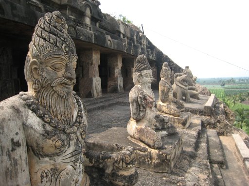
At a distance of 6.5 km from Vijayawada Railway Station, 30 km from Guntur and 275 km from Hyderabad, The Undavalli Caves, a monolithic example of Indian rock-cut architecture, are located in Undavalli Village of Guntur district in Andhra Pradesh.
The Undavalli Caves are ancient cave temples believed to be built between 4th and 5th centuries by Gupta dynasty. The caves are located on a hill overlooking the Krishna River. These caves have been carved out of solid sandstone on a hillside. The best known and largest one has four stories with a huge statue of Lord Vishnu in a reclining posture sculpted from a single block of granite in the second floor. Other shrines inside the cave are dedicated to Trimurti- Brahma, Vishnu and Shiva. Main cave belongs to the earliest examples of Gupta architecture, primarily primitive rock-cut monastery cells carved into the sandstone hills. Initially caves were shaped as a Buddhist monastery and the first floor still retains style of Buddhist vihara, including some Buddhist sculptures. Facade of the third floor is adorned with numerous sculptures, including depictions of lions and elephants.
Undavalli caves are associated with the Vishnukundina kings of 420 to 620 CE. It is also believed that these caves were used by the Buddhist monks as the rest houses. This is a good place to visit in the vicinity of Vijayawada.
Timings: 9 AM to 6 PM
At a distance of 24 km from Vijayawada Railway Station & 262 km from Hyderabad, Kondapalli Fort, also known as Kondapalli Kota, is located at Kondapalli Village in the Krishna district close to Vijayawada.
This 14th century Fort is believed to have been built by the Reddy King of Kondaveedu, Prolaya Vema Reddy. Spread over an area of 18 sq.km, this Fort is said to have served as a recreational palace for the king. The Fort was also used as a business centre. Later, the fort went into the hands of Gajapati rulers of Orissa. In the year 1520 AD the King, Sri Krishna Devaraya of Vijayanagara Empire has captured the Kondapalli fort in Kalinga wars. Later, the fort came into the hands of Qutubshahi Kings in the 16th century. During the colonial rule, the British soldiers were given training in this fort.
Situated on a hill, the fort has an impressive three storied rock tower protected by three levels of entries. The main entrance gate is known as the Dargah Darwaza, which has been made out of a single slab of granite. Another entrance gate of the fort is known as the Golconda Darwaza. The major attraction of the fort is the Tanisha Mahal or Palace, which is located on a crest between two hills. Near the fort there is a Dargah of a Persian Saint, Gareeb Sahib. One can still find several other ruined structures within the premises of the fort. There is a Gajasala, where elephants were kept, Queen's palace, Virupaksha Temple, Dining hall, a reservoir and prisons.
Kondapalli ...
At a distance of 32 km from Guntur, 58 km from Amaravati and 73 km from Vijayawada, Kondaveedu Fort is an ancient hill fortress located at Kondaveedu village in Guntur district of Andhra Pradesh. It is one of the historical forts in Andhra Pradesh and among the famous Amaravati Tourist Places.
Kondaveedu Fort was constructed during the time of Telugu Chodas, strengthened by Kakatiyas and occupied by Prolaya Vema Reddy who shifted his capital from Addanki to Kondaveedu in 1323 AD. Later it was taken over by Gajpathis of Orissa and ravaged by the Bahmani Sultans in 1458. The Vijayanagara emperor Krishnadevaraya captured it in 1516. The Golconda Sultans fought for the fort in 1531, 1536 and 1579, and Sultan Quli Qutb Shah finally captured it in 1579, renaming it as Murtuzanagar. Later it was recaptured by the Mughal army of Aurangzeb in 1687 and the fort came under the control of the French colonists in 1752 when it was extensively fortified. It passed on to the English imperialists who got control of the fort in 1788 but abandoned it in the early 19th century in favour of Guntur.
There are two other forts nearby. All the three forts on top of the narrow hill range are now in ruins. At an altitude of about 1700 feet, the earliest one date back to 12th century and was considered then as one of the strongest forts in the region. It comprises huge ramparts, warehouses, granaries, and wells. There are two entry gates into the forts, called the 'Kolepalli Darwaza' and the ...
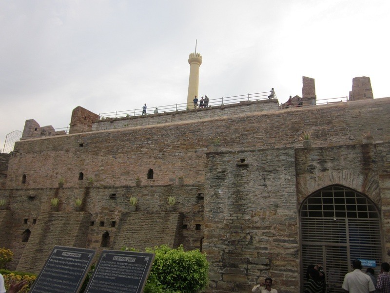
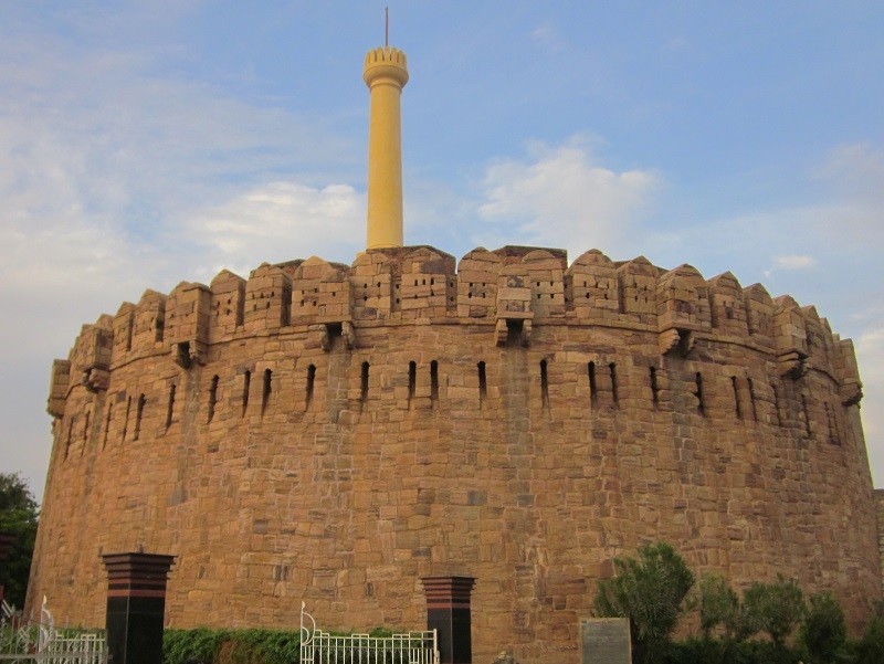
At a distance of 2 kms from Kurnool Railway Station & 24 kms from Alampur, Konda Reddy Buruju, also known as Konda Reddy Fort, is an imposing structure situated in the heart of Kurnool City.
The construction of the fort dates back to 12th century when the city of Kurnool was used as a base for halting before crossing Tungabhadra River. Kurnool was occupied by Vijayanagar ruler Devaraya II and Achyutaraya who suceeded Krishnadevaraya built the initial fort between 1530 to 1542.
The fort has different gateways and bastions. The gateways of the fort were constructed by Gopal Raja, the grandson of Rama Raja of Talikota Vijayanagara kings in 17th century. The fort has three levels and it was used as watch tower in 17th and 18th centuries. The ground level is closed for visitors, while the visitors can climb to the first and second floors and get a glimpse of the history. First level has few enclosures with large portico. Second level houses a large tower used for observation.
The fort is named after Konda Reddy, the last ruler of Alampur who was imprisoned in the fort by the Kurnool Nawab in 17th century. Konda Reddy eventually escaped from the fort, but had to loose his territory to Golconda Nawabs.
Timings: 6:30 AM to 6:30 PM.
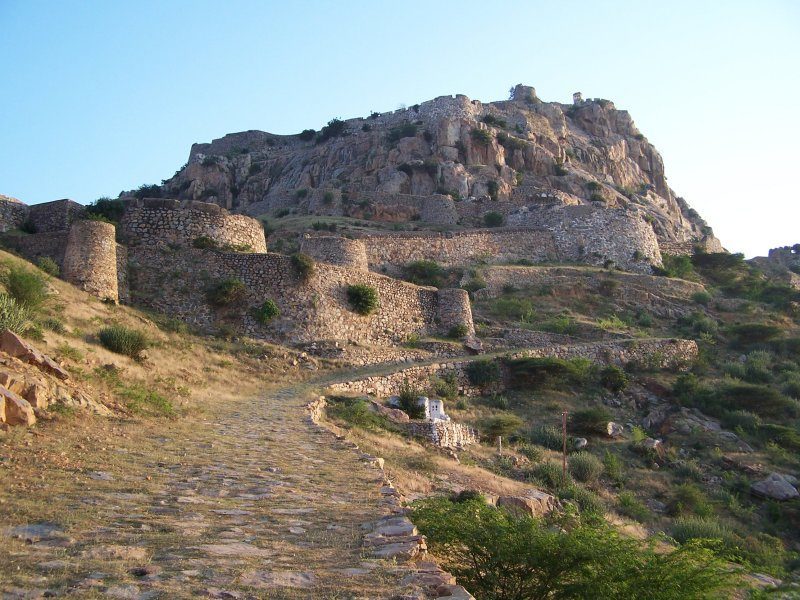
At a distance of 5 km from Gooty Railway Station, 52 km from Anantapur, 97 km from Kurnool, 311 km from Hyderabad, 425 km from Vijayawada and 265 km from Bangalore, Gooty Fort or Gutti Fort is a hill fort located at Gooty in Anantapur district of Andhra Pradesh.
Gooty was center of power struggle and witnessed several wars in the medieval period. Sri Krishnadevaraya of Vijayanagara Empire has enhanced the fortifications and added several sections in the fort. Bahmani Sultans have also occupied the fort for some time. After the fall of Vijayanagara Empire, this place came under the rule of Qutb Shahis of Golconda and Hyderabad Nizams. Later, it came under the rule of Hyder Ali in 1773, then Tipu Sultan and over a period of time it fell into the hands of Hyderabad Nizams. The fort was briefly occupied by Maratha forced under the command of Morari Rao. This place was gifted to British by Nizam for the maintenance and became part of Ceded region under Madras Presidency.
Previously this place was known as Gowthampuri and later renamed as Gooty. The earliest inscriptions on the walls of this fort date back to the 7th century. As per the inscriptions, the place was called as Gadha meaning Fort while an inscription of Bukkaraya mentions this place as King of Forts.
Gooty Fort is one of the oldest hill forts of Andhra Pradesh. It fort was made of granite rocks and the domes were constructed with fine stone, mortar ...
At a distance of 2 km from Rayadurgam Bus Stand, 99 km from Anantapur, 53 km from Bellary, 95 km from Guntakal, 245 km from Kurnool, 449 km from Hyderabad, 571 km from Vijayawada and 265 km from Bangalore, Rayadurgam Fort is a medieval fortress that is situated in Rayadurgam town in Anantapur district of Andhra Pradesh. Rayadurgam Fort is one of the oldest forts in Andhra Pradesh and was constructed at an elevation of 2727 feet.
According to the history, Rayadurgam Fort was built by Junga Nayaka, a chieftain of Vijayanagar Kings. The Battle of Talikota was a bitter battle fought between Rama Rayalu the son in law of King Sri Krishna Deva Raya and Deccan Sultanates. Later the Muslim force was driven out by Koneti Nayaka. The fort was strengthened to a greater extent by his son Venkatapathi Nayaka. Later Tipu Sultan captured the fort and it was annexed to the province of Gooty.
The Rayadurgam Fort comprises of several layers of inner forts that made the access difficult. The fort played a significant role during the reign of the rulers of the Vijayanagar Empire. The Rayadurgam Fort is one of the chief tourist destinations in Rayadurgam town. Majority of the fort stands strong till date.
A wonderful temple for Lord Ganapathi known as Dhasabhuja Ganapathi Temple has been built in the fort. It was carved out from a 4 m high monolithic stone. There are other temples that are dedicated to Lord Hanuman, Ellamma, Prasanna Venkateswara, Venugopala, Jambukeswara, Veerabhadra ...
At a distance of 36 km from Madakasira, 70 km from Hindupur, 156 km from Anantapur, 513 km from Hyderabad, 627 km from Vijayawada and 158 km Bangalore, Hemavathi is a small town located in Anantapur district of Andhra Pradesh. Hemavathi was the capital of Pallavas between 8th and 10th century AD. The town was known as Henjeri during the Pallava reign.
Pallavas built few fascinating temples at Hemavathi. Ruins of a large fort were excavated near Hemavathi town. There are many temples around this fort which possess wonderful architecture. Some of the famous temples are Siddeswara Temple, Doddeshwara Temple, Virupaksheswara Temple and Malleswara Temple. The temple complex is spread over an area of around 15 acres.
Among these temples, Doddeswara Swamy temple is most striking and a well built structure. The stone used in making the idols are polished like metal and also make a sound of metal when struck. There is a 6 feet tall Shivalinga installed inside the sanctum sanctorum. A huge 8x4 feet idol of Nandi made of black granite sits at the entrance. The temple boasts some wonderful artwork. The walls of the temple are adorned with several artistic sculptures and images. The pillars have scenes from the epics Ramayana and Mahabharata. Rajendra Chola was very much attracted by the massive pillars in this temple. The temple adorns the place as a witness of a striking collection of Pallava and Chola architecture.
The other two temples in this complex are dedicated ...
At a distance of 4 km from Adoni Railway Station, 100 km from Kurnool, 52 km from Mantralayam & 310 km from Hyderabad, Adoni Fort is a wonderful historical site built in 15th century. This is also a good place for trekking in the rocks and ruins of the fort.
Adoni fort is one of the largest forts in India with the fortification walls running beyond 50 km in length. Adoni was a military base for the Vijayanagara Empire in the 15th century. After the downfall of Vijayanagara empire, it was taken possession by the Bijapur sultan. Adoni continued to be ruled as relatively independent region by nobles appointed by Bijapur sultans. Siddi Masud, the governor of Adoni made several additions to the fort including the construction of Jamia Masjid and several townships. Siddi Masud had been an avid collector of painting. Adoni later went into the hands of Mughal empire followed by Hyderabad Nizams. Tipu Sultan briefly occupied this region. After the defeat of Tipu Sultan, Adoni came under British rule and remaining part of Ceded region (Rayalaseema) until independence.
The fort has several entrance gates, and it is encircled atop seven huge granite hills. The fort is actually a collection of 12 sub-forts built throughout several centuries. There are several places of interest within the fort premises including Nawab Darbar Hall, Jamia Masjid, Venu Gopala Temple, Malik Rahman Dargah, Shiva Temple, Amba Bhavani Temple and several ...
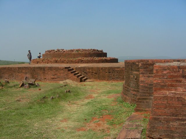
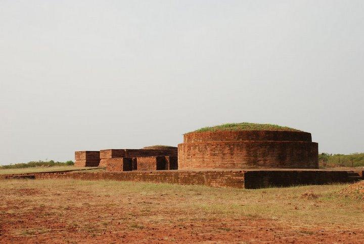
At a distance of 22 Kms from Vizag Railway Station & 620 Kms from Hyderabad, the Thotlakonda Buddhist Complex is situated on a hilltop in Chepala Uppadu village on Bheemili beach road (after Rishikonda).
Also known as 'the Hill of Eagles', the complex has a number of stupas, Chaityas, Viharas, a congregation hall and a refectory belonging to the Hinayana school, mostly excavated during1982-92. These remains are classifieds as religious, secular and civil. Excavations at Thotlakonda comprise pottery, beads, bangle pieces, tiles, stuccos, iron objects, sculptural remains, moulded bricks, inscriptions, coins, etc.
At a distance of 20 Kms from Vizag Railway Station & 618 Kms from Hyderabad, Bavikonda is historical Buddhist site near Kapula Uppadu village in Bheemili beach road (after Rishikonda).
The hill acquired the name Bavikonda due to the existence of wells on the hill to collect rain water for drinking purpose. The artifacts recovered here include Roman coins and satavahana coins apart from pottery dating back to 3rd century BC and 2nd Century AD. Excavations on the hill-top brought to light an extensive Buddhist establishment consisting of a Mahachaitya, stupas, chaityagrihas, a congregation hall, platforms, viharas, kitchen-cum-store complex, pottery, relic caskets, tiles, stuccos, iron objects, moulded bricks, coins etc
Similar Getaways