-
Tours
-
-
- Domestic Tours
-
-
- Resorts
- Car Rentals
- Destinations
- Getaways
- Hotels
- Tools
- * Workation
- * Tour Plans
- Blog
- List Property
- * Offers *

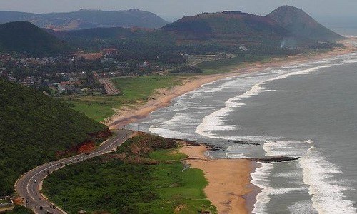
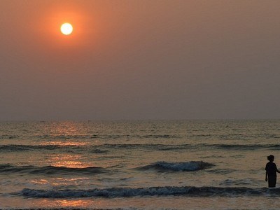
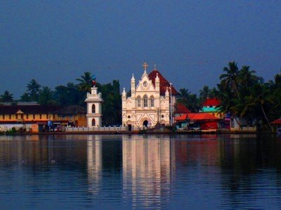
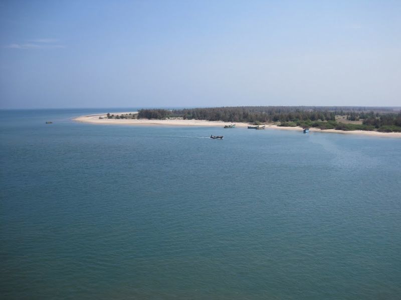
At a distance of 602 km from Hyderabad, 355 km from Vijayawada, 168 km from Kakinada, 203 km from Rajahmundry and 444 km from Bhubaneswar, Visakhapatnam (also called Vizag) is a coastal & port city in the state of Andhra Pradesh, located on the shores of Bay of Bengal. It is the headquarters of Visakhapatnam district and is the base for Eastern Naval Command of the Indian Navy. Vizag is also one of the top places to experience Andhra Pradesh tourism.
The city of Vizag, as Visakhapatnam is popularly called, derives its name from the Hindu God of valour, Visakha. The city is located beautifully among the hills of the Eastern Ghats with facing towards the Bay of Bengal. According to the Archaeological records, Visakhapatnam was built by Kulotunga Chola between the 11th and 12th centuries AD. Kailasagiri, Rama Krishna Beach and Rishikonda Beach are among the must include places in your Vizag tour packages.
The religious Hindu texts mention that the region of Visakhapatnam in the 5th century BC was part of the vast Kalinga territory which extended up to River Godavari. The relics found in the area also prove the existence of a Buddhist empire in the region. Kalinga later lost the territory to King Ashoka in the bloodiest battle of the time which prompted him to embrace Buddhism. The city was also under the rulers of Chalukya, Pallava,Vengi, ...
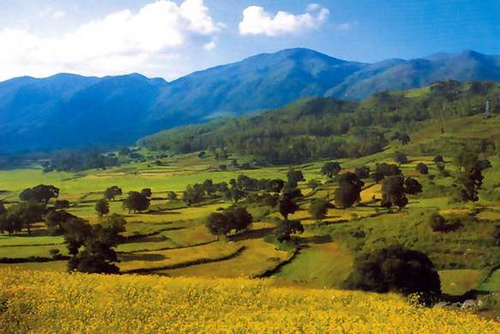
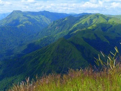
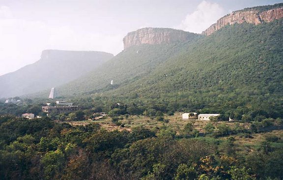
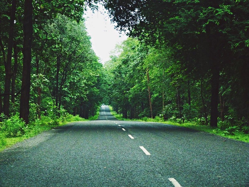
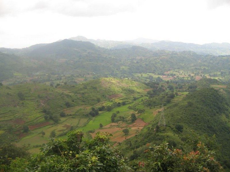
At a distance of 112 km from Vizag, 432 km from Vijayawada, 85 km from Vizianagaram, 26 km from Anantagiri and 635 km from Hyderabad, Araku Valley, popularly known as Araku, is a scenic hill station in the Vishakhapatnam district of Andhra Pradesh. Often referred to as Andhra Ooty, it is one of the most famous places to experince Andhra Pradesh tourism and is one of the top attractions you must include in Vizag tour packages.
Located on the Eastern Ghats at an altitude range of 900 to 1400 meters above sea level, Araku Valley is home to a number of tribal communities. Spread over an area of 36 sq. km, Araku is a perfect tourist destination with pleasant climate, lush greenery, waterfalls and streams. It is popular for its famous coffee plantations.
Araku has some interesting places to visit including Borra caves, Tyda, Katiki Falls, Tribal Museum & Padmapuram Botanical Gardens. Besides, these the coffee plantations are a must visit for those who want to indulge themselves in the flavors of nature. The tourists can see tribal folk dances like Dhimsa and Mayuri. The Araku Tribal Museum houses rich tribal tradition and number of artifacts and displays related to Eastern Ghat Tribal Culture.
The Anantagiri Reserved Forest and Sunkarimetta ...
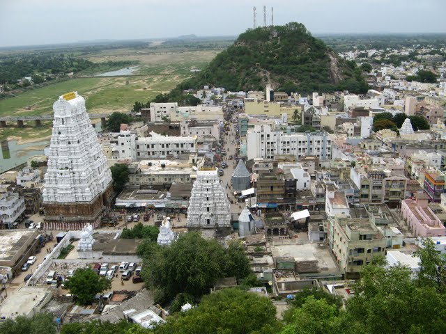
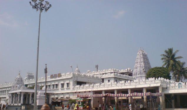
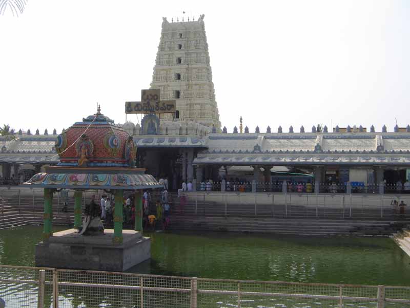
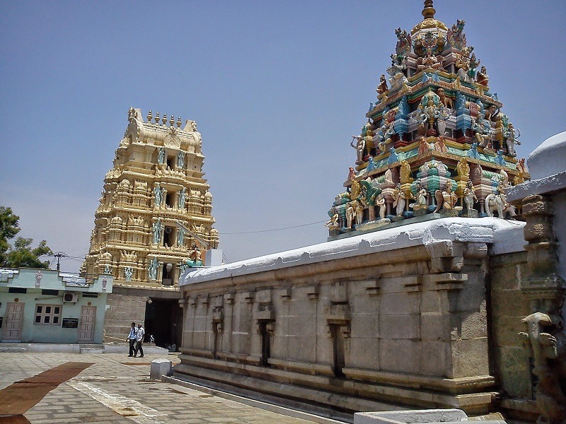
At a distance of 71 km from Chittoor, 413 km from Vijayawada, 556 km from Hyderabad, 763 km from Vizag, 134 km from Chennai and 259 km from Bangalore, Tirupati is a pilgrimage city in the extreme southeast of Andhra Pradesh in Chittoor district. It is often referred as a synonym to Tirumala, which is a sacred temple town famous for Sri Venkateswara Temple also known as Tirumala Tirupati Balaji Temple. Tirupati along with Chandragiri is an ideal weekend getaways from Chennai for a two day trip and also one of the top Andhra Pradesh tourist places.
Tirupati is one of the most ancient and sacred pilgrimage sites in India. Tirumala, the home of Lord Venkateswara is at a distance of 22 km from Tirupati. However, Tirupati is the town and transport hub at the bottom of the hill. The initial temple at Tirumala was built by the Tamil king Thondaimaan. The Pallavas of Kanchipuram (9th century), Cholas of Tanjore (10th century), Pandyas of Mathura and Vijayanagara Kings (14th & 15th centuries) regularly visited the temple and contributed largely to the temple development. Especially, Sri Krishna Devaraya of Vijayanagara Empire contributed a lot to the temple by enhancing the temple premises and building building several structures. Now the temple is under the maintenance of TTD board.
Spread over an area of 450 sq. km, Tirupati offers a magnificent religious and natural delight to devotees ...

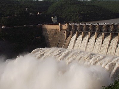
At a distance of 160 km from Nandyal, 181 km from Kurnool, 229 km from Hyderabad, 263 km from Vijayawada and 527 km from Bangalore, Srisailam is one of the twelve Jyotirlingas of Lord Shiva situated on the banks of River Krishna in Kurnool district of Andhra Pradesh. It is one of the most important pilgrimage centers of Lord Shiva in India and also one of the top Places to visit in Andhra. Srisailam is also one of the most popular weekend getaways from Hyderabad.
Srisailam is famous for Srisailam Dam & Bhramaramba Mallikarjuna Temple which is dedicated to Lord Shiva. The sanctum enshrines Lord Mallikarjuna in the form of a linga protected by a three-hooded cobra. This ancient temple built in the Dravidian style with lofty towers and sprawling courtyards is one of the finest specimens of Vijayanagara architecture. Though the exact origins of the temple are not available, the Satavahanas of the 2nd century AD have referred to it. The Kakatiyas and the Vijayanagara kings have made several endowments here.
The unique feature of this kshetram is the combination of Jyothirlingam and Mahasakthi (in the form of Bhramarambika) in one campus, which is very rare and only one of its kind. The great religious leader Aadi Sankara is said to have visited this shrine and composed his immortal Sivananda Lahiri here.
Srisailam is ...
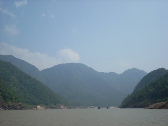
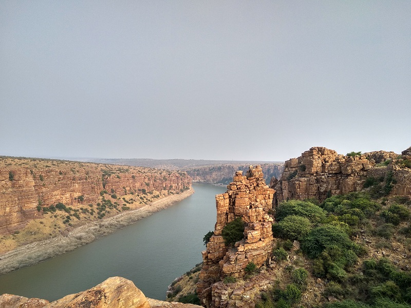
At a distance of 60 km from Rajahmundry, 180 km from Vijayawada, 20 km from Polavaram, 260 km from Vizag & 410 km from Hyderabad, Papi Kondalu is a breathtakingly beautiful hill range bounded by River Godavari in the state of Andhra Pradesh. Papi hills are a set of three hills which form a beautiful gorge on the Godavari River spread across East Godavari and West Godavari districts. Entire area of Papi Kondalu is covered by tropical rain forests and it was recently declared as a protected National Park and is one of the top places to experience the Tourism in Andhra Pradesh. Papikondalu is one of the top attractions you must include in Vizag tour packages.
The original name for this hill range was 'Papidi Kondalu'. Papidi is a rough translation for partition in Telugu. It is believed that the place was visited by Lord Rama and goddess Sita during their exile. Papi Kondalu has to be reached by boat from Rajahmundry, Pattisam (35 km from Rajahmundry), Polavaram (40 km from Rajahmundry), Kunavaram (50 km from Bhadrachalam) or Sriram Giri (60 km from Bhadrachalam). The boat service from Rajahmundry to Bhadrachalam is a wonderful experience and it is operated in post monsoon season.
Apart from enjoying the view of the hills, valley ...
At a distance of 27 km Madanapalle, 76 km from Rayachoty, 128 km from Cuddapah, 123 km from Chittoor, 116 km from Chikkaballapura, 128 km from Tirupati, 166 km from Bangalore and 531 km from Hyderabad, Horsley Hills is a famous Hill Station in Chittoor district of Andhra Pradesh and also one of the best Tourist places to visit in Andhra.
Horsley Hills is one of the popular Bangalore getaways for a weekend trip and also one of the top hill stations near Bangalore.Situated at an altitude of 1265 meters,Horsley Hills is an exciting place to visit. The old name of Horsley Hills was Yenugu Mallamma Konda. According to the legend there used to be a little girl named Mallamma who was taken care by Elephants. She used to heal tribal people on the hills. When she disappeared suddenly, people thought she was a goddess and built a temple for her. Later the place is named after W.D. Horsley, the Collector of Cuddapah district. He visited this place and was impressed by the beauty of the hills and chose this spot for his summer residence. Now the Governor of Andhra Pradesh uses this house as a summer residence and hence this house is called the Governors bungalow.
The scenic drive to Horsley Hills is exciting and has thick vegetation of various species of plants and wild animals.
Covering the entire stretch of narrow road are dense growth of Eucalyptus, ...
At a distance of 74 km from Kurnool, 148 km from Nandyal, 49 km from Adoni, 43 km from Raichur, 253 km from Hyderabad, 301 km from Hubli, 402 km from Bangalore and 416 km from Vijayawada, Mantralayam, also known as Manchale or Mantralaya is situated in Kurnool district of Andhra Pradesh. This is the place where the Vaishnava saint Sri Guru Raghavendra took Jeeva Samadhi (tomb) and is also one of the popular Places to visit in Andhra. Mantralayam is situated near the border of Karnataka and Andhra Pradesh along the banks of River Tungabhadra, a chief tributary of River Krishna.
Mantralayam is associated with the famous saint Sri Guru Raghavendra Swamy, renowned Hindu saint and philosopher. Sri Guru Raghavendra Swamy, lived between 1595 and 1671 was an influential saint in Hinduism. Followers of the saint consider him to be an incarnation of Bhakta Prahallada, who was saved by Vishnu in the avatar of Narasimha. Sri Raghavendra Swamy is said to have performed many miracles during his lifetime and has a large following even today. Mantralayam is a small and peaceful town situated on the banks of the River Tungabhadra and gets thousands of devotees from all over the country. He also served as the head of Sri Mutt of Kumbakonam from 1621 to 1671.
Mantralayam is also popular for Manchalamma Temple located near the Samadhi Temple, inside the Mantralayam ...
At a distance of 85 km from Rajahmundry, 112 km from Kakinada, 118 km from Bhadrachalam, 233 km from Khammam, 241 km from Vizag, 245 km from Vijayawada and 432 km from Hyderabad, Maredumilli is a village situated on Bhadrachalam - Rajahmundry highway in East Godavari district of Andhra Pradesh. Amidst the semi evergreen forests, it is one of the top places to visit near Rajahmundry and among the best places to visit in Andhra Pradesh. Maredumilli is one of the top attractions you must include in Vizag tour packages.
Located in the dense forests of Eastern Ghats, this quaint little village has been developed by the Forest Department as an Eco-tourism Centre. Maredumilli is a place of wildlife, nature and of tribal people. This forest area is conserved and developed by the tribals who have habituated the lands for generations. The entire region is amazing and picturesque with green grasslands encircled by hills with many streams flowing over undulating rocks.
The semi-evergreen forests of the village make it a wonderful place to have some adventure in the wild and immerse oneself with nature. The Maredumilli Community Conservation & Eco Tourism Area is situated on Maredumilli - Bhadrachalam road, nearly 4 km away from Maredumilli village. Jungle Star Nature Camp is a nature lover's paradise which provides an excellent opportunity to explore the Eastern Ghats. Located adjacent to the river Valamuru, the camp has a stream ...
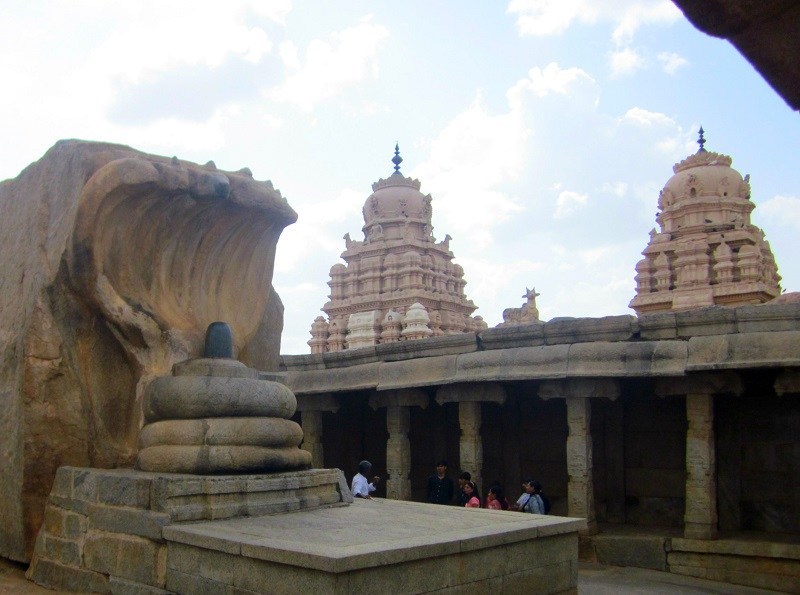
At a distance of 66 km from Nandyal, 137 km from Kurnool, 114 km from Kadapa, 348 km from Vijayawada, 350 km from Hyderabad and 407 km from Bangalore, Ahobilam or Ahobalam is an important pilgrimage center located in the Kurnool district of Andhra Pradesh. Ahobilam is one of the most famous pilgrimage sites in Andhra Pradesh and also one of the best Places to visit in Andhra Pradesh.
Ahobilam is the holy abode of Lord Narasimha, an incarnation of Lord Vishnu in man-lion form. According to legend, this is the place where Lord Narasimha killed Hiranyakasipu and saved Prahalada. Though the initial temples were built by Chalukyas in 8th century, most of the current structures were rebuilt by Vijayanagara kings around 15th century.
Situated amidst dense Nallamala Forest, Ahobilam is one of the 108 Divya Desams. This place is also called as Nava Narasimha Kshetra since Lord Narasimha is worshipped in 9 different forms and separate temples exist for all the forms within a radius of 5 km from the main temple. Jwala Narasimha, Ahobila Narasimha, Malola Narasimha, Kroda Narasimha, Kaaranja Narasimha, Bhargava Narasimha, Yaogananda Narasimha, Chathravata Narasimha and Paavana Narasimha are the nine forms of Lord Narasimha in Ahobilam. Few of these temples have easy access, but most of them have to be reached by difficult treks through thick forest and rocky paths.
The town is divided ...
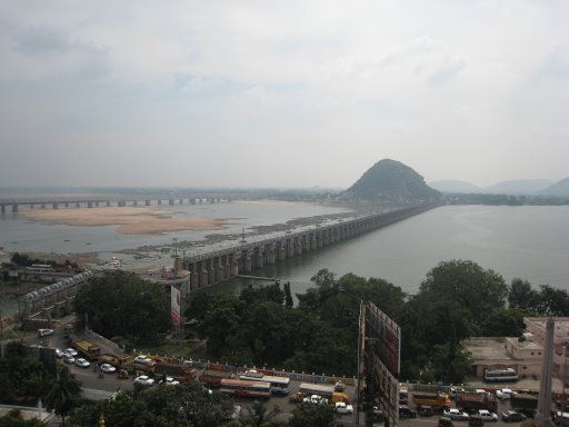
At a distance of 37 km from Guntur, 273 km from Hyderabad, 354 km from Vizag, 453 km from Chennai and 643 km from Bangalore, Vijayawada, also known as Bezawada, is the second largest city in Andhra Pradesh State and also one of the top Places to visit in Andhra Pradesh. It is located on the banks of the Krishna River to the South, Budameru River on the north and the Indrakiladri Hills on the west. This is the largest railway junction of the South Central Railway, situated along the Chennai-Howrah and Chennai-Delhi rail route.
Legend says that Goddess Durga took rest in this sacred place after destroying a Rakshasa and since then the name 'Land of Victory' or Vijayawada came into existence. The discovery of Stone Age artifacts along the banks of River Krishna from Machilipatnam to Nagarjuna Sagar indicates that this area was inhabited long before. The Chalukyas once conquered this place and it was later part of Vengi Kindom, Eastern Gangas, Vijayanagaras and Reddy Dynasty. Finally it came under British Madras presidency.
The major attractions of Vijayawada are Kanaka Durga temple and Mangalagiri temple. Apart from these, other tourist attractions include Prakasham Barrage, Gandhi Hill, Mogalarajapuram Caves, Victoria Museum, Hazarat Bal Mosque, Rajiv Gandhi Park and Bhavani Island. The Kondapalli Reserve Forest in the western outskirts that sprawls over an area of 121.5 sq. km is ...
At a distance of 37 km from Tirupati, 113 km from Chennai, 291 km from Bangalore, 375 km from Vijayawada and 552 km from Hyderabad, Srikalahasti, popularly known as Kalahasti is one of the ancient and most important Shiva Kshetras situated in Chittoor district of Andhra Pradesh. Srikalahasti is famous for Srikalahasteeswara Temple (referred as Srikalahasti Temple) built in 10th century. The entire temple was carved out of the side of a huge stone hill. Srikalahasti is among ideal weekend getaways from Chennai city for a two day trip and also one of the top places to experience AP Tourism.
Srikalahasti got its name from three words - 'Sri' meaning a spider, 'Kala' meaning a serpent and Hasti meaning an elephant, as these three creatures are believed to have worshipped Lord Shiva at this place and attained salvation. It is located on the banks of the River Swarnamukhi, which is a tributary to River Pennar, one of the major rivers in South India. The ancient Shiva temple of Srikalahasti finds reference in the three ancient epics the Skanda Purana, Shiva Purana and the Linga Purana. According to Skanda Purana Arjuna came to this place to worship Kalahasteeswara (Lord Shiva) and met Rishi Bharadwaja on the peak of a hill.
The temple of Kalahasteeswara is one of the most impressive Siva temples in India. This ...
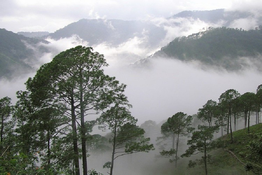
Also known as Korra Bayalu, Lambasingi is one of the hill stations in Andhra Pradesh and among the must include places in Vizag Tour Packages. It is about 92 km from Araku Valley, and 115 km from Vishakhapatnam.
Fondly called the 'Kashmir of Andhra Pradesh', the little hamlet of Lambasingi is situated at an altitude of 1025 m in the beautiful and lushly forested Eastern Ghats of Andhra Pradesh. One of the best-kept secrets of Andhra Pradesh, the tiny village is known for its majestic hills, quaint valleys, and chilling temperatures. This village is the only place in all of South India that experiences snowfall as the temperatures drop significantly.
Surrounded by mesmerizing hills, and dense forests, Lambasingi makes for a perfect weekend getaway from Visakhapatnam as this tiny village is covered with an ethereal white mist throughout the year that swirls with the wind. Thajangi Reservoir, Kothapalli Waterfalls, Susan Garden, Bojjanakonda, Kondakarla Bird Sanctuary, Annavaram Temple, and Yerravaram Waterfalls are some of the top places to visit in Lambasingi. Also, this village offers myriad interesting opportunities to adventure seekers ranging from trekking and mountain biking to hiking and camping. Lambasingi is famous for its tea and coffee plantations along with little apple and strawberry farms.
At a distance of 15 km from Jammalamadugu, 94 km from Kadapa, 155 km from Kurnool, 233 km from Tirupati, 280 km from Bangalore, 386 km from Hyderabad and 391 km from Chennai, Gandikota is a small village in Kadapa district of Andhra Pradesh. Situated on the banks of Pennar River, it is one of the popular historical places to visit in Andhra Pradesh and among the weekend gateways from Hyderabad as well as from Bangalore.
Gandikota is a small village spread in and around the historical Gandikota Fort. According to history, Gandikota area was first identified and made Sand fort in 1123 CE by Kapa Raja of nearby Bommanapalle village and a subordinate of Ahavamalla Someswara I, the Western Chalukyan king of Kalyana. The village transformed into major fort after the emergence of the Kamma kings, who ruled Gandikota more than 200 years. The fort fell into hands of Qutub Shahis of Golconda in 1650 CE. The medieval fort of Gandikota is named after the adjoining gorge which means gandi in Telugu. It is also believed that Vemana, the Telugu poet lived in Gandikota area for a short period.
Known to few ardent travelers, Gandikota is not the usual tourist hub as it is neither a world heritage site, nor is it marketed well by state tourism agencies. This untouched and unexplored place is worth a visit for history buffs as well as nature lovers. A frozen in time village in the middle of centuries old structures such as forts and temples is known for its spectacular gorge formed ...
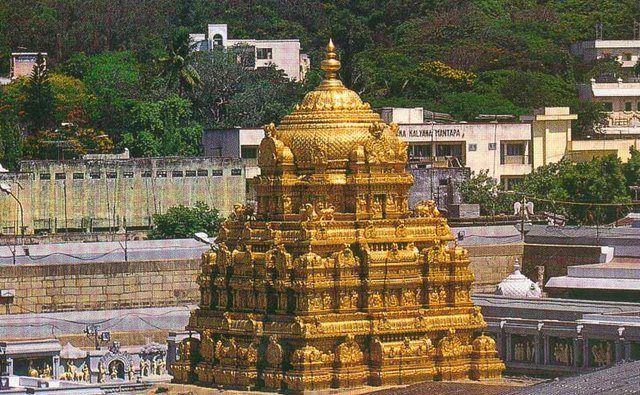
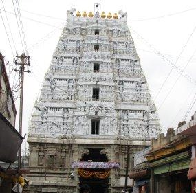
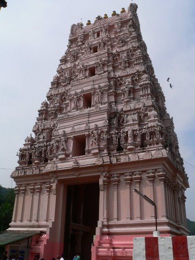
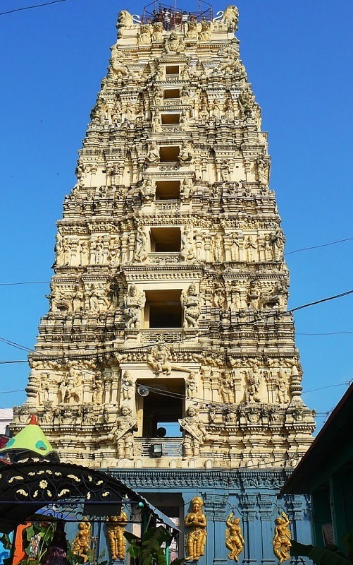
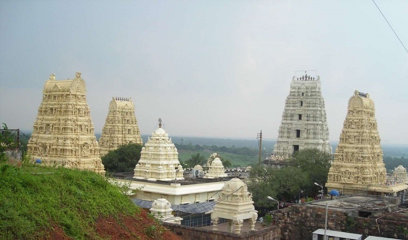
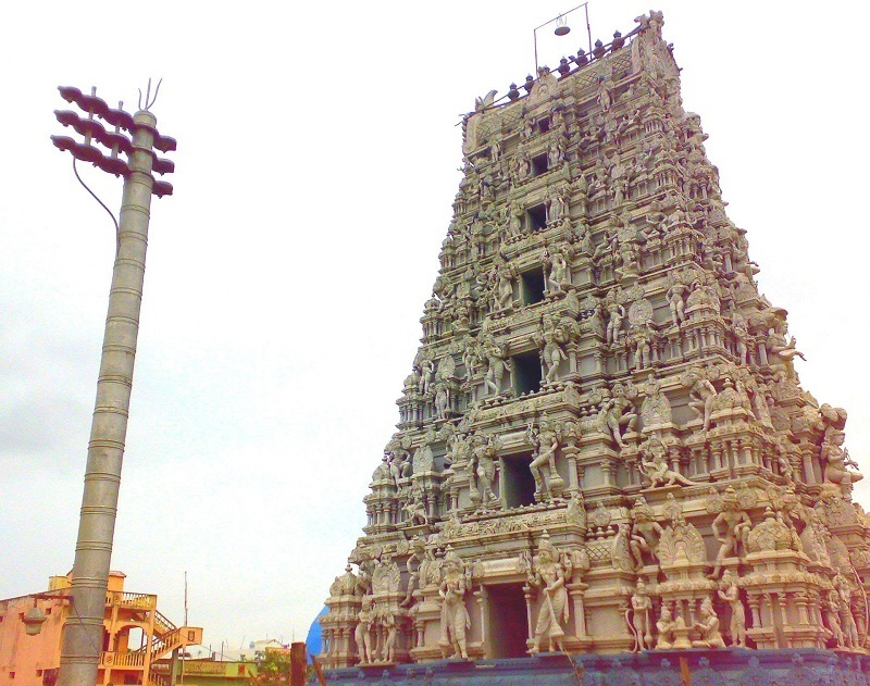
At a distance of 22 km from Tirupati, 87 km from Chittoor, 435 km from Vijayawada, 574 km from Hyderabad, 785 km from Vizag, 155 km from Chennai and 271 km from Bangalore, Tirumala, located in the Chittoor district of Andhra Pradesh, is one of the most famous pilgrimage centers in India and also one of the top places to experince Andhra Pradesh tourism. Tirumala is commonly referred as Tirupati by devotees, but they are 22 km apart and the sacred Balaji Temple is situated in Tirumala.
Tirumala, adobe of Sri Venkateswara (also known as Balaji - an incarnation of Lord Vishnu) is one of the most celebrated pilgrimage centers in India and it attracts millions of devotees every year. The Tirumala Tirupati Temple is situated atop the Tirumala Hills which consists of seven peaks known as Sapthagiri at an altitude of 3,200 feet. The seven peaks represent the seven hoods of Adishesha, the serpent on whom lies Lord Vishnu.
The temple of Lord Venkateswara was originally built by the Tamil king Thondaimaan. The Pallavas of Kanchipuram (9th century), Cholas of Tanjore (10th century), Pandyas of Madurai and Vijayanagara Kings (14th & 15th centuries) regularly visited the temple and made large contributions towards its development. Especially, Sri Krishna Devaraya of Vijayanagara Empire contributed a lot to the temple. The statues of Sri Krishna Devaraya and his spouses stand ...
At a distance of 55 km from Nandyal, 80 km from Kurnool, 308 km from Hyderabad, 359 km from Vijayawada & 11 km from Banaganapalle, Yaganti in Kurnool district of Andhra Pradesh is famous for Sri Yagantiswamy Temple (also called Uma Maheshwara Temple) dedicated to Lord Shiva.
Yaganti is one of the most famous Shiva Temple is Andhra Pradesh and also one of the popular places to experince AP Tourism. The temple dates back to 5th and 6th centuries with contributions from Pallavas, Cholas, Chalukyas and Vijayanagara rulers. The temple received significant contribution from Vijayanagara Kings Harihara & Bukka Rayalu, who finished the construction of several structures in and around the temple.
The Uma Maheshwara Temple at Yaganti houses the idol of Shiva & Parvathi (Ardhanareeswara) carved out of a single stone. This is probably the only place where Lord Shiva is worshipped in an idol form instead of Shiva Linga. It is believed that Sage Agastya performed penance for Lord Shiva at this place and requested Shiva to appear in Ardhanareeswara form which is worshipped here. Another unique feature of the temple is Nandi statue which has been growing in the size.
Yaganti is located in Yerramala hills that offer immense natural beauty and unique setting to the locality. There are a several natural caves in the hills around the temple which were home for several saints throughout the ages, ...
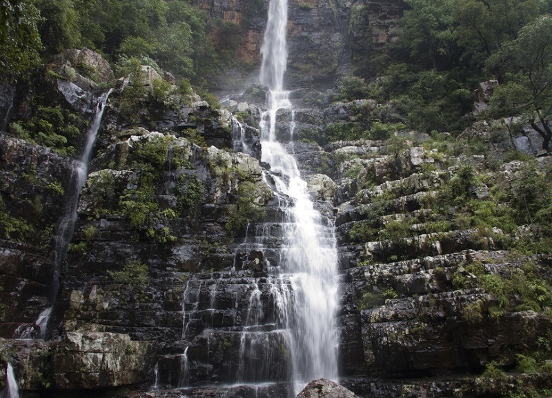
At a distance of 49 km from Bakarapet, 64 km from Tirupati, 120 km from Horsley Hills, 192 km from Chennai, 241 km from Bangalore and 89 km from Chittoor, Talakona Falls are situated in Sri Venkateswara National Park near Nerabailu Village of Yerravari Mandal of Chittoor district in Andhra Pradesh. The gorgeous waterfall falling deep into a valley from a height of around 270 feet makes it the highest waterfall in Andhra Pradesh and also one of the top Tourist places in Andhra Pradesh. It is also one of the popular waterfalls near Bangalore.
The waterfalls are placed amidst dense forest surrounded by natural beauty and greenery. It is believed that the water of Talakona Falls is enriched with herbs with healing powers. Talakona was declared as Bio-Sphere Reserve in 1990 because of wide variety of plant species present in the region. In this forest, one can find variety of endangered species like sambar, porcupine, cheetal, golden gecko, Indian giant squirrel, slender loris, panther and mouse deer etc. Talakona means 'head hill' in Telugu. This place is believed to be the starting point of Seshachalam Hills which are extended till Tirumala.
There is a 240 m long canopy rope walk, about 35 to 40 feet in height, giving a thrilling ...
At a distance of 84 km from Rajahmundry, 123 km from Vizag, 234 km from Vijayawada and 483 km from Hyderabad, Annavaram is a village situated on the banks of river Pampa in East Godavari district of Andhra Pradesh. Annavaram is famous for Sri Satyanarayana Swamy temple and is one of the famous Places to visit in Andhra Pradesh. It is believed that all the wishes of devotees will be fulfilled when Satyanarayana Vratam is performed here.
It is believed that the presiding deity of the place blesses the devotees with anina varam (pronounced or wanted boon), the place is called Annavaram. According to history, Sri Krishnadevaraya of Vijayanagar used the secret underground passages in the hills to attack the enemy from both sides during his invasion of Kalinga. The Andhra revolutionary late Alluri Seetharama Raju used the secret quarters in these hill ranges, when he rebelled against the British Rule.
The shrine of Lord Veera Venkata Satyanarayana Swamy is situated on Ratnagiri hill top. The name of the Goddess is Ananta Lakshmi Satyavathi Devi. Meruvu the Lord of the hills and his consort Menaka did great penance and got two sons by the grace of Lord Vishnu. One was Bhadra and the other Ratnakara. Bhadra pleased Lord Vishnu with his devotion and penance, became Bhadrachalam on which Lord Sri Rama had permanently settled. Ratnakara ...
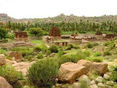
At a distance of 125 km from Anantapur, 124 km from Bangalore City Junction, 225 km from Tirupati, 478 km from Hyderabad & 569 km from Vijayawada, Lepakshi is a small village which lies 14 km east of Hindupur in Anantapur district of Andhra Pradesh. It is the one of the important heritage sites in Andhra Pradesh highlighting the legacy of Vijayanagara Dynasty. It is one of the famous Tourist places in Andhra Pradesh.
Lepakshi was founded in the 16th century during the reign of the Vijayanagara king, Aliiya Rama Raya. Virupanna, the royal treasurer was accused of drawing funds without the king's permission from the state treasury to build the Veerabhadra temple at Lepakshi. However, he blinded himself to avoid the king's punishment. Even today one can see two dark stains upon the wall near the Kalyana Mandapa, which are said to be the marks made by his eyes. Hence the village is called 'Lepa-akshi', means a village of the blinded eye.
Lepakshi is the centre of some of the finest temple architecture and paintings. Lepakshi consists of three important shrines dedicated to Shiva, Vishnu and Veerabhadra, of which Veerabhadra temple is the most important place to visit in Lepakshi (this is also referred as Lepakshi Temple). The temples of Papanatheswara, Raghunatha, Srirama, Veerabhadra and Durga are located in the same complex on a hillock named as Kurma Saila (tortoise shaped hill).
Lepakshi is also one ...
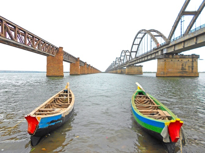
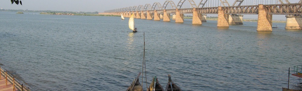
At a distance of 154 km from Vijayawada, 207 km from Vizag, 186 km from Guntur, 64 km from Kakinada, 151 km from Machilipatnam and 430 km from Hyderabad, Rajahmundry, formerly called as Rajamahendravaram, is a beautiful city located on the banks of Godavari River in Andhra Pradesh. It is also known as the 'cultural capital' of Andhra Pradesh and is one of the popular Tourist places in Andhra Pradesh. It is the birth place of Adikavi Nannayya who developed script for Telugu language. Rajamundry is one of the top attractions you must include in Vizag tour.
Rajahmundry is ranked amongst the oldest cities in the Indian subcontinent. The earliest rulers of the region were the Eastern Chalukyas. It was built by Chalukya king Rajaraja Narendra during 11th century. It was part of the Madras Presidency and was made into the District of Rajahmundry in the year 1823, during the British rule.
Rajahmundry is a blend of various qualities like picturesque landscapes, monuments of cultural importance, ancient temples and adventurous tourist spots that make the place unique, interesting and suitable for tourism for all ages. This is one of the major Pushkara Ghats on Godavari River. Pushkaras, held once every 12 years, is a holy congregation which sees millions of devotees taking a dip in the River Godavari. The last Pushkara was held in 2015. Godavari Bridge, Sir Arthur Cotton Museum, Dowleswaram ...
At a distance of 19 km from Nandyal, 93 km from Kurnool, 135 km from Kadapa, 306 km from Hyderabad, 316 km from Vijayawada and 360 km from Bangalore, Mahanandi is a holy Shivaite pilgrimage center located in Kurnool District of Andhra Pradesh. This is also one of the famous Andhra Pradesh places to visit.
Located to the east of Nallamala Hills, Mahanandi is a picturesque village surrounded by thick forest. Within 15 km radius from Mahanandi, there are nine Nandis (Bulls) known as Nava Nandis. Mahanandi is famous for the Mahanandiswara Temple and foremost shrines of Nava Nandis. The nine Nandi temples are Mahanandi, Shivanandi, Vinayakanandi, Somanandi, Prathamanandi, Garudanandi, Suryanandi, Krishnanandi and Naganandi.
The 7th century Mahanandiswara Temple dedicated to Lord Shiva is very famous and sacred place. Though the initial structure was built by Chalukyas in 7th century, several additions were done in 10th and 15th centuries. The gopuram over central sanctum is built in Badami Chalukyan style of architecture and other structures in the temple are in Vijayanagara style. According to the legend, the local kings known as Nandas ruled here in the 10th century AD and they built a number of temples and worshipped their ancestral deity the Nandi, hence the name Mahanandi.
The remarkable feature here is the crystal clear water in Pushkarini which flows throughout the year. ...
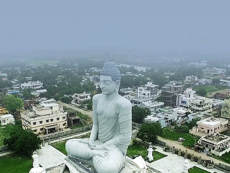
At a distance of 33 km from Guntur, 38 km from Vijayawada, 111 km from Machilipatnam, 162 km from Khammam, 178 km from Nalgonda, 178 km from Bhadrachalam, 194 km from Rajahmundry, 270 km from Nellore, 274 km from Hyderabad, 403 km from Vishakhapatnam, 450 km from Anantapur, Amaravati is a popular historical town situated on the southern bank of Krishna River in Guntur district of Andhra Pradesh. It is the new capital of Andhra Pradesh state and one of the popular pilgrimage sites for Hindus as well as Buddhists.
The town gets its name from Amareshwara or Amaravati temple, dedicated to Lord Shiva. The town has been mentioned in the Indian epics as Dhanyakataka and Andhranagari. It was also served as the capital of the Satavahanas, who ruled Andhra Pradesh from the 2nd century BCE to the 3rd century CE. Later it was ruled by several major dynasties like Andhra Ikshvakus, the Pallavas, the Cholas, the Kakatiyas, the Delhi Sultanate, Musunuri Nayaks, Bahmani Sultanate, Vijayanagara Empire, Sultanate of Golconda and Mughal Empire successively before the founding of the Nizam of Hyderabad in 1724. It was ceded to France in 1750 but was captured by England in 1759. It was briefly captured by Hyder Ali, but remained under British rule for the majority of time since the 1780s. Amaravati is currently the de-facto capital of the state of Andhra Pradesh, following its bifurcation from Telangana in 2014.
Amaravathi has gathered attention from all over the world because of the ...
Kanipakam is a pilgrimage center located in Chittoor district of Andhra Pradesh famous for Varasiddhi Vinayaka Temple (Kanipakam Temple). At a distance of 71 km from Tirupati, 13 km from Chittoor, 175 km from Chennai, 181 km from Bangalore, 50 km from Vellore, 59 km from Sripuram, 420 km from Coimbatore and 575 km from Hyderabad, Kanipakam is one of the top Andhra Pradesh places to visit. This is one of the ideal weekend getaways near Bangalore & Chennai for a day trip and a major pilgrimage site in Andhra Pradesh.
Kanipakam lies close to Karnataka & Tamil Nadu border on the banks of Bahuda River. The temple was constructed in the 11th century by Chola king Kulothunga Chola I and was expanded further in 1336 by Vijayanagara Kings. Kanipakam temple is a rare temple with a self-manifestation (swayambhu) idol of Lord Ganesha.
The striking feature of the idol is that it is still growing in size. According to a legend, there were three handicapped brothers, Dumb, Deaf and Blind. They were farmers and used to draw water for farming from a well nearby. One day the well got dried and they could no longer continue cultivation. One of them got into the well and started digging it up. He was shocked to see blood coming out of the well. Within in a few seconds the entire water turned red. All the three became normal getting rid of their deformities. As soon as the villagers came to know about this miracle, they thronged ...
At a distance of 215 km from Hyderabad, 360 km from Bangalore & 344 km from Vijayawada, Kurnool is one of the major towns in the state of Andhra Pradesh. It was the first capital of united Andhra Pradesh between 1 October 1953 and 31 October 1956. The town is built on the banks of Tungabhadra River.
Kurnool is known as the gateway to the Rayalaseema region. It was earlier known as Kandenavolu, as it was a transit place on the southern banks of the Tungabhadra River and acted as a greasing place for the carts. It was ruled by Cholas and later by Kakatiya kings in the 12th and 13th Centuries. Later it came under the influence of Vijayanagar Kings and Achyuta Raya built the Kurnool Fort in 16th Century. It was briefly ruled by local rulers in 16th - 17th century. The town came under the control of Mughal Emperor Aurangzeb in 1686. Later the town was ruled by Nawabs from Dawood Khan to Gulam Rasool Khan. In 1839 the British Government took control of the region.
The popular places to visit in the city are the ruins of the fort built by the Vijayanagar Kings, Konda Reddy Buruju and the tomb of Abdul Wahab. Kurnool district is home for the most important pilgrim sites in Andhra Pradesh, including Srisailam, Ahobilam, Yaganti, Mahanndi and Mantralayam, making ...
At a distance of 64 km from Rajahmundry, 168 km from Vizag, 211 km from Vijayawada and 459 km from Hyderabad, Kakinada is a city as well as a municipal corporation and also the headquarters of the East Godavari district in Andhra Pradesh. It is a port city situated on the Bay of Bengal and also one of the popular Andhra Pradesh tourist places.
The original name of this place was Kakanandivada. The city developed substantially after the European settlers came into the region. The Dutch were one of the first settlers in the region followed by the British; they named this place as Co-Canada. The name was then changed to Kakinada after the independence during 1947. Several signs of colonial times are seen around the city even today. Kakinada is one of the top attractions you must include in Vizag packages.
Kakinada is often referred to as the 'Fertilizer City' because of the numerous factories like Fertilizer, Sugar, Natural gas and Petroleum, Power generation, Edible oil refineries and Biofuel plants etc. It is part of a Special Economic Zone (SEZ) and the proposed sectors for investment in the city are Chemical, Petroleum and Petrochemical sectors. It is also known as the 'Pensioner's Paradise' and 'Second Madras' because the city is very well planned, and at the same time very peaceful.
The city has a historical significance, rich tradition, breathtaking natural beauty, ...
At a distance of 149 km from Kurnool, 168 km from Kadapa, 361 km from Hyderabad, 475 km from Vijayawada and 215 km Bangalore, Anantapur is a city and the headquarters of the Anantapur district in Andhra Pradesh. This is the largest district in the state bounded on north by Kurnool, on the east by Kadapa and Chittoor and on the south and west by the Karnataka State. This is also one of the famous Andhra Pradesh tourist places.
This region is also known by the name of Anantapuram and was earlier known as Anantasagaram, which means an endless ocean. The villages of Anantasagaram and Bukkarayasamudram were constructed by Chilkkavodeya, the minister of Bukka-I, a Vijayanagar ruler. During the Vijaynagar period, Anantapur was an important center and popularly known as Hande Anantapuram. Anantapur and a couple of other places were gifted by the Vijaynagar rulers to Hanumappa Naidu of the Hande family. Penukonda in Ananthapur district was the capital was Vijayanagaras after the fall of Hampi.
The place subsequently came under Qutub Shahis, Mughals, and the Nawabs of Kadapa, although the Hande chiefs continued to rule as their subordinates. Later it came into the possession of Hyder Ali and Tipu Sultan. Tipu hanged all the male members of Hande rulers except Siddappa who escaped from his confinement at Srirangapatnam. After ...
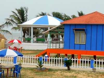
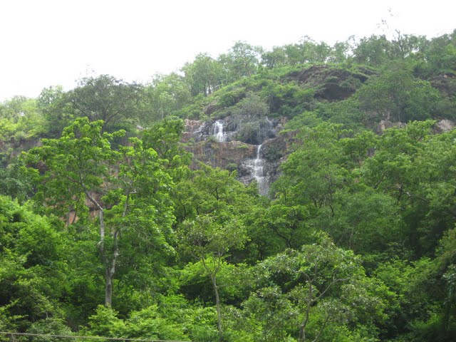
At a distance of 26 km from Araku, 85 km from Vizag & 660 km from Hyderabad, Anantagiri is a lovely tiny hill station between Vizag and Araku Valley. It is one of the top tourist places to visit in Araku Valley and is also among the top hill station in Andhra Pradesh apart from being a popular weekend getaway from Vizag city.
At an altitude of 1168 meters, Anantagiri is famous for extensive coffee plantations and numerous waterfalls. There is a view point on the way to Anantagiri on main road that offers excellent views of the deep valleys on one side and coffee plantations on the other side.
Anantagiri Hills are well known for its scenic beauty and charming weather. It is a perfect gateway to spend some time amidst the lap of nature. Anantagiri is paradise for coffee lovers and nature enthusiasts. The village is surrounded by coffee estates that emit the rich aroma of coffee and the surrounding hillocks are home to cascading waterfalls that feed the lush greenery.
The famous Borra Caves are very close to Anantagiri. This unexplored and peaceful environment of the hill station attracts tourists from various parts of the state. Watching the panoramic views ranging from sunrise, sunset, thick forests and mountain ranges cover the route between Vizag to Anantagiri. The Anantagiri hill resort is a perfect getaway from the hot and humid weather of Vizag in summer months.
Accommodation ...
At a distance of 5 km from Tirupati Railway Station & 27 km from Tirumala Tirupati Balaji Temple, Tiruchanur also called as Alimelumangapuram is famous for Alimelu Manga Temple dedicated to goddess Padmavati, the consort of Lord Venkateswara. It is believed that pilgrimage to Tirumala is incomplete without a visit to Sri Padmavati Ammavari Temple at Tiruchanur.
According to ancient scripts, as Lord Venkateswara Temple at Tirumala was not easily accessible, a new temple called Tiruvalan Koil was constructed at Tiruchanur near Tirupathi to house Lord Venkateswara in 8th century by Pallavas. The temple was later dedicated to Padmavati Devi by Yadava Rayas in 12th century.
According to the legend, Lord Vishnu showed his reverence towards the sage Bhrigu, even though the sage had insulted Vishnu. In anger, Sri Maha Lakshmi immersed herself for 12 years here in pushkarini the banks of Swarnamukhi River and emerged from it in a Golden Lotus in the 13th year on Panchami day of Kartika month. The temple symbolizes reunion of Lord Venkateswara and Goddess Padmavathi.
The temple was built in Vijayanagara style and is made in white and gold around the southern banks of Swarnamukhi Pushkarini. The temple is an impressive structure with a Gopura, Mandapa and the sanctum. The presiding deity, Sri Padmavati Devi is seated in Padmasana holding a lotus. Tiruchanur also comprises Sri Krishna Temple, Sri Sundararaja Swamy Temple ...
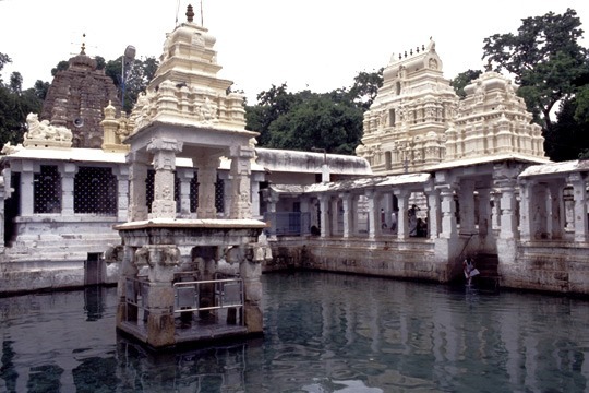
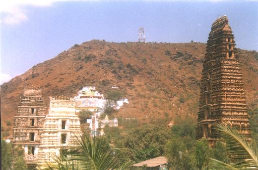
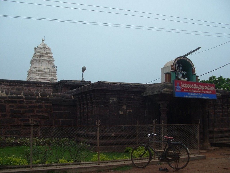
At a distance of 18 km from Vizag Railway Station & 128 km from Annavaram, 208 km from Rajahmundry, 359 from Vijayawada, 607 km from Hyderabad, Simhadri or Simhachalam is a Hindu temple located in the Visakhapatnam City suburb of Simhachalam in Andhra Pradesh. This 11th century temple is dedicated to Sri Varaha Narasimha Swamy, an incarnation of Vishnu and situated on top of the Simhachalam Hills.
The temple is believed to have been constructed in 1098 by the famous Chola king, Kulothunga Chola. The queen of Kalinga gifted golden armor to the statue. The Eastern Ganga King Narasimha Deva has constructed the central shrine in 1267. Krishna Deva Raya, the Vijayanagara Emperor visited this temple in the year 1516, as seen from inscriptions here. The temple activities are managed by the Pusapati Gajapatis, for last three centuries.
The architectural of the central shrine follows Kalinga style. Facing towards west, it is a square shrine surmounted by a high tower, a portico in front with a small tower, a carved 16 pillared Natya mantapa. The shrine has inscriptions dating back to 1098 AD on its walls. The deity is always kept covered with sandal paste. The actual form of the deity is in the tribhanga posture with two hands & head of a lion, which can be viewed only during the 'Chandanotsavam' in April/May. Legend has it that the Ugra form of ...
At a distance of 12 Kms from Vijayawada Railway Station & 287 Kms from Hyderabad, Mangalagiri in Guntur district is famous for Panakala Narasimha Swamy Temple on the hill and Laxmi Narasimha Swamy Temple at foot of the hill.
Panakala Narasimha Swamy Temple - The idol is said to be Swambhu. The idol is covered by metal face and only the mouth is visible & it's widely opened. The God takes jaggery water (Panakam) as offering. The water is poured into the mouth, only half of the water is consumed and remaining is thrown out.
Panakala Swamy temple is opened only till 3 PM.
Laxmi Narasimha Swamy Temple ' Yudhishtira, the eldest of the pandavas is said to be the founder of the chief image of this temple and the deity here is called Sri Lakshmi Narasimha Swamy. The temple has a very tall 153 feet tower with beautiful sculpture which has 11 stairs. It was constructed by Raja Vasireddi Venkatadri Naidu, during the years 1807-09.
The Brahmothsavams held in feb/march attract lakhs of devotees.
Timings: Panakala Swamy Temple - 7 AM to 3 PM
Lakshmi Narasimha Swamy Temple - 5 AM to 12.30 PM & 4 PM to 8.30 PM
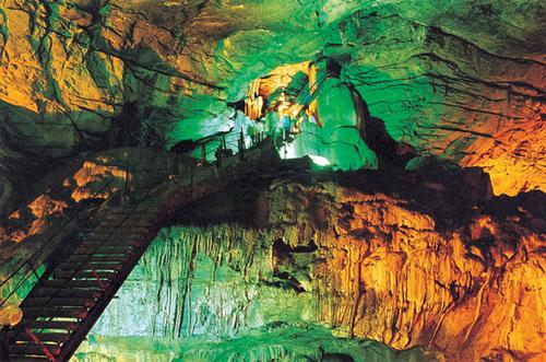
At a distance of 36 km from Araku, 88 km from Vizag & 662 km from Hyderabad, Borra Caves are one million year-old limestone caves and the deepest caves in the country. Situated in Anantagiri hills of Andhra Pradesh, the caves are situated at an altitude of 1400 m and occupy an area of 2 sq.km. Borra Caves is one of the best places to visit in Araku Valley as part of Vizag packages.
These natural caves were discovered in 1807 by William King George of the Geological Survey of India. According to locals, once a cowherd lost his cow while grazing. He soon realized that his cow had fallen down. While searching for the cow, the cowherd found these caves and came across a Linga inside it. The Linga is considered synonymous to Lord Shiva, who saved the cow. After this, a small Shiva temple was built right outside this cave.
The caves are filled with fascinating stalagmite and stalactite formations of calcium deposits. The Gosthani River used to flow through the caves between the formations. The caves were created due to the flow of river over the limestone area. The pressure was exerted by the humic acid in the water on the mineral deposits and the limestone dissolved in the water. The dissolved limestone trickled down drop by drop forming different shapes in the cave. One can see different formations of the stalactites and stalagmites as Shiv-Parvathi, Mother-Child, Rushi's Beard, ...
At a distance of 1 km from Bugga Ramalingeswara Swamy Temple, 3 km from Tadipatri Railway Station, 57 km from Anantapur, 106 km from Kadapa, 356 km from Hyderabad, 413 km from Vijayawada and 268 km Bangalore, Sri Chintala Venkataramana Swamy Temple is a famous temple located in Tadipatri town of Anantapur district in Andhra Pradesh. This temple is dedicated to Lord Vishnu, who is in the divine form of Venkataramana Swamy.
This temple is believed to have been built in 16th century by Timma Naidu, son of Ramalinga Naidu, a chieftain of Vijayanagar Kingdom. It was built during the same time as the Vittala Temple of Hampi in a similar manner. Most of the features of these two temples bear close resemblance to each other, being built on a similar ground plan. While the stone chariot here is compact and small in size when compared to the famous stone chariot at Hampi.
Originally the temple was called Chintala Tiruvengala Natha Swamy Temple. Spread across 5 acres of land, this temple is built according to the Silpa Sastras. The carvings of episodes of the Ramayana, Mahabharata and Bhagavatha are seen around the Garba Griha, Ranga Mandapa, Mukha Mandapa, Main Gopura and the Prakaraa.
The Mukhamandapa has forty pillars in the Vijayanagar style. Beyond the Mukhamandapa is a Rangamandapa, which has scenes of the Ramayana and rare sculptures of the Vishnu avatars. The idol of Lord Venkataramana Swamy is very beautiful and ...
At a distance of 12 kms from Kakinada, 40 kms from Annavaram, 52 km from Rajahmundry,199 km from Vijayawada, 172 km from Visakhapatnam & 447 km from Hyderabad, Samalkota is very famous for Pancharama Sri Kumararama Bheemeshwara Swamy temple. Situated just beside the Railway Station, this temple is dedicated to Lord Shiva.
This place was known as Purva Chalukya Bhimavaram as the Eastern Chalukyans ruled this place. The temple was built by Chalukya Kumara Rama during the end of 9th century as a celebration of his victories in more than 300 wars. A mantapam supported with one hundred pillars is built here along with Eka Shila Nandi (Single Stone Bull) at the temple entrance opposite to Shiva Lingam. Goddess Shri Bala Thripura Sundari is also worshipped in this temple. Pushkarni Lake is situated to the east of temple. The main entrance to the temple is called Surya Dwaram.
Kalyana Mahotsam & Mahashivratri are most celebrated festivals here.
Timings: 6 AM to 12 PM & 4 PM to 8 PM
At a distance of 4 km from Tadipatri Railway Station, 58 km from Anantapur, 107 km from Kadapa, 357 km from Hyderabad, 413 km from Vijayawada and 269 km Bangalore, Bugga Ramalingeswara Swamy Temple is located on the banks of Penna River at Tadipatri in Anantapur district of Andhra Pradesh. The presiding deity of the temple is Lord Shiva in the form of Ramalingeswara Swamy.
The temple got this name by a perennial underground stream from which water always keeps flowing (Bugga in Telugu) into the sanctum sanctorum at the spot where the Lingam is consecrated. Sri Bugga Ramalingeswara Swamy Temple was built by Ramalinga Nayudu, a chieftain of the Vijayanagara Kings, in 16th century. The records indicate that a sculptor Yellanchari was brought from Benaras to construct the temple. According to legend, the temple has been established at the site, where sage Parasurama lived and performed meditation.
The architecture of the temple shows a mixture of Chalukyan, Chola and Vijayanagar art. The temple has main entrances on South and West. The Vijayanagar kings have built the western, northern and southern gopurams of the temple. The north gopuram although unfinished has the most elaborate sculpture, with intricate carvings. The entire Shiva Purana is carved on the walls of the temple in miniature carvings with elaborate details. Episodes from Hindu epics Ramayana and Mahabharata are also carved on the walls. This temple has a mini stone chariot similar to the famous chariot ...
At a distance of 17 km from Kakinada, 42 km from Rajahmundry, 65 Kms from Annavaram, 197 km from Vijayawada, 198 km from Vizag & 466 Kms from Hyderabad, Draksharamam is famous for one of the pancharama temples called Draksharama Bheemeshwara Swamy temple. This temple is situated in a green belt of river Godavari. Draksharamam is among prime place to visit on a Vizag tour.
This temple was constructed by the East Chalukyan king during 9th century. The temple also consists one of the Shakti Peethas called Sri Manikyamba. The speciality of this Shiva Lingam in this temple is that, the early morning tender Sun light falls on the Linga. There are nearly 800 ancient scripts on the walls of the temple. The celebrations in this temple were started during 14th century in the period of Reddy Kings. Shiva Lingam is nearly 9 ft height and the top part is seen at the first floor.
There are other small temples inside the main temple premises. Once upon a time Draksharama was considered as a Buddhist complex.
It is easily accessible by Bus from Kakinada & Rajahmundry (40 Kms).
Timings: 6 AM to 12 PM & 3 to 8 PM
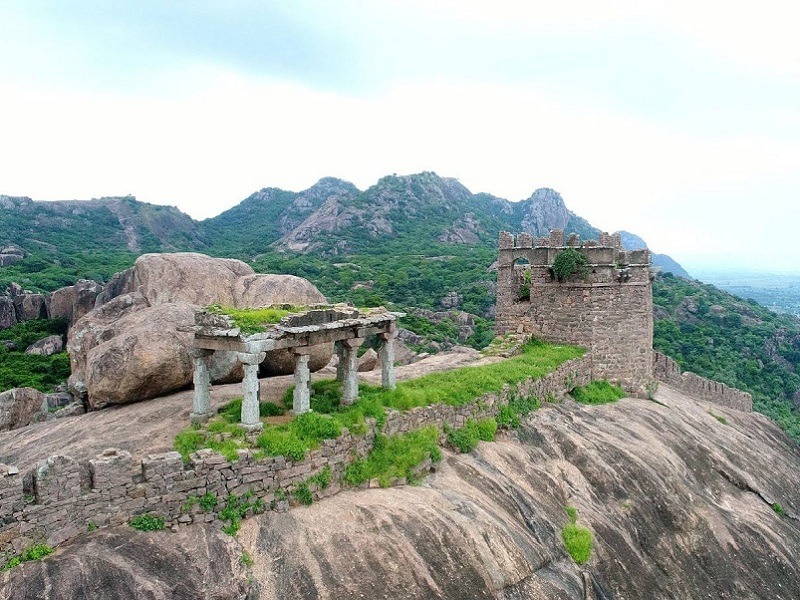
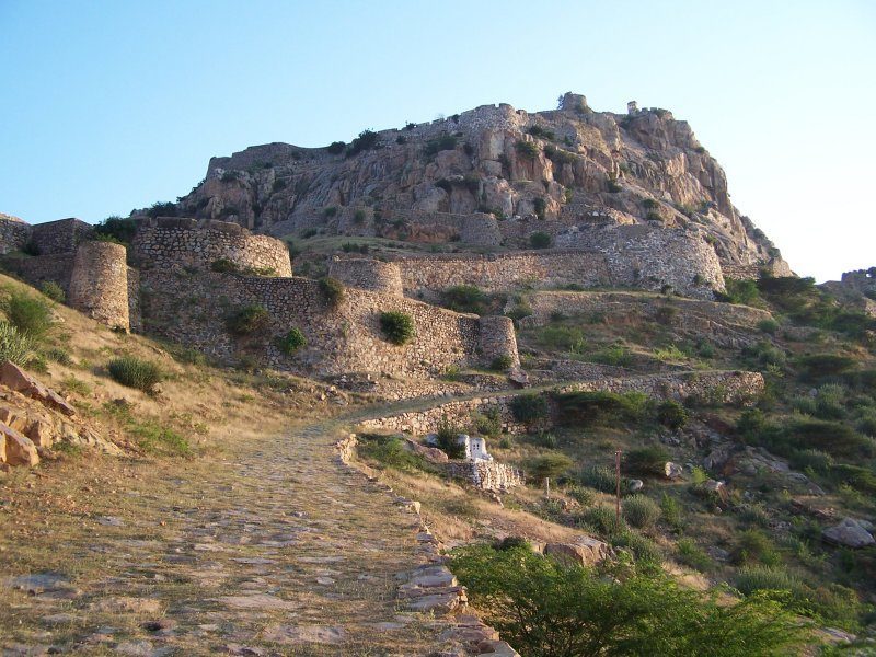
At a distance of 15 km from Tirupati, 33 km from Tirumala Tirupati Balaji Temple, 147 km from Chennai, 238 km from Bangalore & 574 km from Hyderabad, Chandragiri is an ancient town and the seat of Yadavaraya Kings from 11th to 13th centuries and fourth capital of Vijayanagar Dynasty. Chandragiri along with Tirupati is one of the ideal Chennai weekend getaways and a major heritage / historical site in Andhra Pradesh. It is one of the prime Tourist places in Tirupati town.
Chandragiri near Tirupati is famous for the historical fort, built in the 11th century. Chandragiri was under the rule of Yadavaraya Dynasty for about three centuries and came into control of Vijayanagar rulers in 1367. It came into prominence during Saluva Narasimha Rayalu. Chandragiri was the 4th capital of Vijayanagar Empire and they shifted their capital here when Golconda sultans attacked Penukonda. In 1646, the fort was annexed to the Golconda territory and subsequently came under Mysore rule before controlled by British.
The Fort is built on a huge rock at an altitude of 183 meters. The southern side of the hill is enclosed by strong walls, surrounded by a ditch to prevent any intruder from entering into the fort. The Chandragiri Fort has eight ruined temples inside the fortification ...
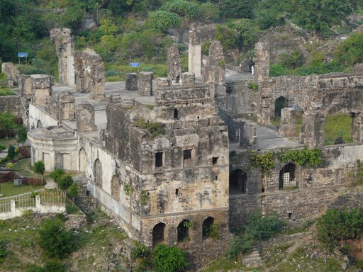
At a distance of 3 km from Penukonda Railway Station, 79 km from Anantapur, 436 km from Hyderabad, 550 km from Vijayawada and 142 km Bangalore, Penukonda Fort is a medieval fort situated at Penukonda in Anantapur district of Andhra Pradesh.
Penukonda was once served as the 2nd capital of Vijayanagar Kingdom after the fall of Hampi and was earlier called as Ghanagiri or Ghanadri. According to the inscriptions, the Penukonda state was gifted by the King Bukka-I to his son Virupanna. This fort was built at the time of Virupanna. This fort was one of the best defenses of the Vijayanagara kingdom. With the decline of Vijayanagara kingdom, the Sultan of Golconda captured this fort. Later Mysore Kingdom captured this fort briefly until British overtook after the fall of Tipu Sultan.
Built on a gigantic hill, the huge and imposing fort offers a spectacular view of the town below. The basement of the walls, bastions and gateways in the fort was made of stone, mortar and lime. The first inner section of the fort residential building designed amenities for royal family members. The central hall of the fort follows Hindu and Muslim architecture. Dome of this hall has been designed in Hindu style of construction, whereas the floor has the signature style construction of Islamic architecture.
The fort bounds with natural fortification of surround hills and moats dug up around the outer wall. There are seven citadels within ...
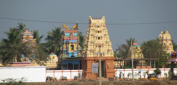
At a distance of 2.5 km from Pithapuram Railway Station, 12 km from Samarlakota, 16 km from Kakinada, 61 km from Rajahmundry, 31 km from Annavaram, 208 km from Vijayawada and 152 km from Vizag, Sri Kukkuteswara Swamy temple is an ancient Siva temple in East Godavari District of Andhra Pradesh. Pithapuram which was earlier known as Pithikapuram is one of the Ashta Dasha (Eighteen) Shakthi Peethas.
Kukkuteswara Swamy temple is the most famous temple of Lord Shiva at Pithapuram. The presiding Deity is Lord Shiva, who reveals himself in the form of a Spatika Linga. This is a Swayambhu Linga of white marble and is about two feet in height. The Linga resembles that of a cock; hence Lord Shiva is called Sri Kukkuteswara Swamy. There is a huge beautiful idol of Nandi (bull) made from a single stone in front of the temple. The shrine of Sri Rajarajeswari, consort of Sri Kukkuteswara Swamy, is present beside the Shiva temple.
There is the temple of Puruhutika Devi inside the campus of Sri Kukkuteswara Swamy Temple. It is one of the Asta Dasha Shakti Peethas. After Daksha Yagna, Goddess Sati Devi's body part (back part) has fell down in this area, because of this place earlier people has called as Puruhoothika puram later it has changed as Peetika Puram. Finally it has changed Pithapuram. This temple is considered as the 10th Sakthi Peetham of the 18 Shakti Peethas.
This place ...
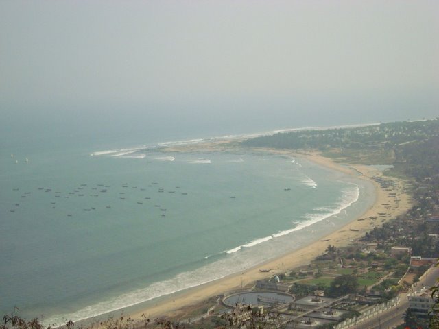
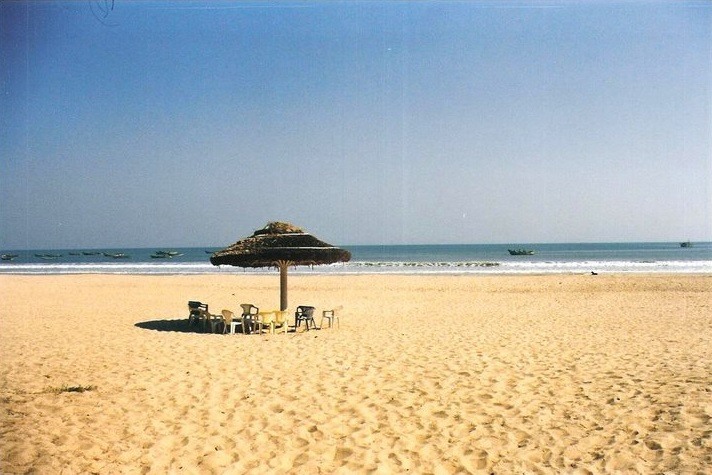
At a distance of 32 km from Vizag Railway Station, 377 km from Vijayawada, 227 km from Rajahmundry & 628 km from Hyderabad, Bheemunipatnam popularly known as Bheemili is famous for a picturesque beach. It is located at the mouth of the river Gosthani which merges with Bay of Bengal at Bheemunipatnam.
The beach is known for its soft golden sand, blue water and unspoiled beach front. A concrete pathway too has been laid along the beach to hold statues of Buddha, Five Pandavas and a dinosaur. The beach is considered to be safe for swimming. It is an ideal place for nature lovers and adventurers. The beach is famous for several water sports like snorkeling, scuba diving, swimming and water-skiing. Boating facility is also available here.
Bheemili beach provides a beautiful seafront to the fishing town of Bheemunipatnam, one of the oldest municipalities in India and is dotted with thatched cottages and ancient Dutch bungalows that are a reminder of its historic past. The 17th century ruins of a fort and cemetery built by the Dutch are seen here. The cemetery named Hollanders Green has some tombs embossed with the skull and cross bones motif of sea pirates. It is located near the beach and it is one of the oldest cemeteries in India. The Bheemili port used to operate passenger vessels to Madras and Calcutta during the British rule.
Bheemunipatnam was an important Buddhist center. Evidence of Buddhism dating back to the ...
At a distance of 45 Kms from Yaganti, 70 Kms from Nandyal, 82 Kms from Ahobilam, 95 from Mahanandi, 109 Kms from Kurnool & 318 Kms from Hyderabad, Belum Caves are the second largest caves in India and the longest caves in India.
Situated between Nandyal and Tadipatri in Kurnool district, the caves are 3229 meters long. These caves have long passages, spacious chambers, fresh water galleries and siphons. The deepest point of caves is at 120 feet from entrance level. The caves were formed due to erosion in limestone deposit in the area by Chitravati River, millions of years ago. Now Chitravati River flows almost 30 km south of caves.
There is a big Buddha statue near the caves. This place was used as Meditation Hall by Buddhist monks in ancient days. AP Tourism has developed pathways and bridges for easy access of the caves. A resort is run by AP Tourism near the entrance of the caves.
This place is very close to Kolimigundla village (around 2 Kms) on Nandyal - Tadipatri route, connected by frequent buses.
Timings: 10 AM to 5 PM. Entry Fee: Rs. 50
At a distance of 1.7 km from Palakollu Railway Station, 85 km from Eluru, 67 km from Rajahmundry, 138 km from Vijayawada, 97 km from Kakinada, 22 km from Bhimavaram and 258 km from Visakhapatnam, Sri Ksheera Rama Temple is one of the Pancharama temples, situated in West Godavari district of Andhra Pradesh. The other four are Amararama Temple in Amaravathi, Draksharama Temple in Draksharamam, Kumararama Temple in Samalkoti and Somarama Temple in Bhimavaram.
Lord Shiva is worshipped as Ksheera Ramalingeswara Swamy at this temple. The temple tower is one of the tallest among the temple towers in Andhra Pradesh. The height of the temple is 120 ft with 9 floors constructed during the reign of Chalukya Bheema in 9th century. The Prakara was designed by Sri Velupathi during 10th century. Gopuram was constructed by Sri Alladu Reddy during 14th Century. This ancient temple has been listed as a protected monument by the Archaeological Department.
The Shivlinga is a unique milky white in color and the tallest. According to legend, Upamanyu the son of sage Kaushik, requested Lord Shiva to grant him enough milk so that he can carry on the rituals in the temple. Lord Shiva filled the Ksheera Pushkarni Tank with the mythical milky ocean (Ksheera Sagaram). Hence this place is known with different names, Ksheerarama, Palakollu and Dugdhapovanam.
The Shiva Lingam inside the garabha griha can be seen from all the four sides through ...
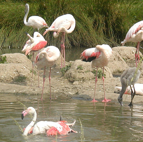
At a distance of 9 from Sullurpet, 50 km from Srikalahasti, 105 km from Nellore & 88 km from Chennai Central Railway Station, Pulicat Lake is the second largest brackish water lake in India, after Orissa's Chilka Lake. It lies at the border of Thiruvallur district in Tamil Nadu and Nellore district in Andhra Pradesh states. The island of Sriharikota (home for famous ISRO) separates the lake from the Bay of Bengal. This is one of the popular tourist places to visit near Chennai and an ideal weekend getaway near Chennai.
The sanctuary is home to wide range of migratory birds that migrate in large numbers in winter. It is one of the best places for bird watching in the vicinity of Chennai city and at the same time experience the memorable boat riding in Pulicat Lake. The entrance to the sanctuary is situated on Sullurpet - Sriharikota road.
The lake is 60 kms long and width varies between 0.2 to 17.5 kms. It is an important stopover of migrant birds and approximately 15,000 flamingos visit the lake each year, along with pelicans, kingfishers, herons, painted storks, spoonbills and ducks.
Pulicat village, which is 60 km from Chennai (via Ponneri), is also an alternate place to experience the beauty of the lake & sanctuary. Boating is available in the lake at Pulicat ...
At a distance of 1 km from Dwaraka Tirumala Bus Stand, 45.5 km from Eluru, 73 km from Rajahmundry, 101 km from Vijayawada, 135 km from Kakinada and 278 km from Visakhapatnam, Sri Venkateswara Swamy Temple is located on the top of the Seshachala Hill at Dwaraka Tirumala in West Godavari district of Andhra Pradesh. This temple is considered as sacred as the famous Sri Venakteswara Temple of Tirumala.
Lord Vishnu is presiding deity here in the form of Sri Venkateswara Swamy. The temple was constructed by the Mylavaram Zamindars in 19th century. The self-manifested idol of Sri Venkateswara Swamy was unearthed by a saint named Dwaraka and hence, the temple is called Dwaraka Tirumala. This place is also called Chinna Tirupati.
The statue of the lord is visible above the waist and the lower portion is imagined to be in the earth. The holy feet are said to be offered to Bali Chakravarthi in Patala loka for his daily worship. The full size idol of Lord Venkateswara standing at the back of the main idol is said to have been installed by the great social reformer Ramanujacharya in 11th century. These two idols are located in the same sanctum sanctorum which is a unique feature of this temple. The idols of Goddess Padmavathi and Nanchari are installed in the Arthamandapa.
This temple is a masterpiece of South Indian Architecture with its five-storied main Rajagopuram facing the ...
At a distance of 1.2 km from Bhimavaram New Bus Station, 65 km from Eluru, 76 km from Rajahmundry, 117 km from Vijayawada, 116 km from Kakinada, 22 km from Palakollu and 277 km from Visakhapatnam, Sri Someswara Temple is one of the Pancharama Kshetras of Lord Shiva known as Somaramam and is situated at Bhimavaram town in West Godavari District of Andhra Pradesh. The other four are Amararama Temple in Amaravathi, Draksharama Temple in Draksharamam, Kumararama Temple in Samalkoti and Ksheera Rama Temple in Palakollu.
The main contribution for temple construction was made by the King Chalukya Bheema I during 10th century. The Shiva lingam is called Someshwara as it is believed that this lingam has been installed by Lord Chandra. The color of the linga is believed to change according to the Lunar rays. In Full Moon days it changes into white and during Amavasya day, it turns into black in form.
According to legend, Tharakasura worships Lord Shiva and gets his Atma Linga. Then, Tharakasura starts troubling people and Devatas. The Devathas then got frightened and went to Lord Vishnu for help. Lord Vishnu told them that Tarakasura was a great Shiva bhaktha and a devoted worshipper of Lord Shiva. Lord Vishnu advised the devathas to go and pray to Lord Shiva. As per blessings, Tharakasura dies only by a boy. Lord Kumara Swamy Avatar thus happens and boy kills Tharakasura. After Tharakasura is destroyed, the Athmalinga gets divided ...
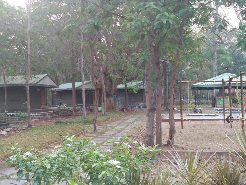
At a distance of 15 km from Atmakur, 47 km from Dornala, 85 km from Kurnool, 96 km from Srisailam, and 300 km from Hyderabad, Bairluty is a tribal village in Atmakur mandal of Kurnool district, Andhra Pradesh. This is one of the eco-tourism projects initiated by AP Tourism and among the best weekend getaways near Hyderabad.
Nallamala Jungle Camp at Bairluty is a community-based eco-tourism initiative which was started in 2017. The main aim of the camp is to elicit local support for wildlife, to impart conservation education to the visitors and to empower the local communities improving their livelihoods. Bairluty is the one among the three locations of eco-tourism programmes initiated by Andhra Pradesh Government in Nagarjunasagar - Srisailam Tiger Reserve; the other two are Thummalabailu and Pacherla.
The camp is build around the concept of Jungle Lodges & Resorts (JLR) in Karnataka. Spreads over an area of 10 acres, Nallamala Jungle Camp has four semi-permanent cottages, six semi-permanent tented accommodation cottages, reception, a library and dormitory, built at a cost of Rs. 2.17 crore. Eco-tourism programmes like Jungle safari, Trekking, Bird watching and Tribal Archery are available for the tourists at this camp. About 2 hours of Jeep Safari offered by the Camp in the Nallamala Forests offers wilderness experience and exposure on the floral and faunal diversity of Eastern Ghats apart from its awesome landscapes. ...
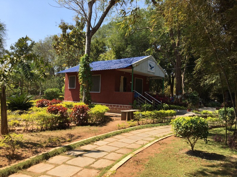
At a distance of 31 km from Mahanandi, 33 km from Nandyal, 77 km from Ahobilam, 110 km from Kurnool, 143 km from Kadapa, 167 km from Srisailam, and 328 km from Hyderabad, Pacherla is a tribal village situated near Nandyal in Kurnool district of Andhra Pradesh. This is one of the eco-tourism projects initiated by AP Tourism and among the best weekend getaways near Hyderabad.
Nallamala Jungle Camp at Pacherla is a community-based eco-tourism initiative which was started in 2017. The main aim of the camp is to elicit local support for wildlife, to impart conservation education to the visitors and to empower the local communities improving their livelihoods. Pacherla is the one among the three locations of eco-tourism programs initiated by Andhra Pradesh Government in Nagarjunasagar - Srisailam Tiger Reserve; the other two are Thummalabailu and Bairluty.
The camp is build around the concept of Jungle Lodges & Resorts (JLR) in Karnataka. Nallamala Jungle Camp has four semi-permanent cottages, 2 semi-permanent tented accommodation cottages, reception, and dormitory. Jungle safari is available for the tourists at this camp. About 2 hours of Jeep Safari offered by the Camp in the Nallamala Forests offers wilderness experience and exposure on the floral and faunal diversity of Eastern Ghats apart from its awesome landscapes. During Jeep safari, one can also visit Dongalabavi in the forest.
Nallamala forest is also ...
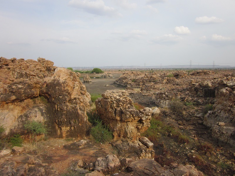
At a distance of 23 km from Kurnool, 53 km from Nandyal, 45 km from Alampur, 56 km from Yaganti, 70 km from Mahanandi & 237 km from Hyderabad, Orvakal Rock Garden (also known as Orvakallu) is a wonderful site with abundant natural beauty of rock formations. It is situated on Kurnool - Nandyal highway at a distance of 3 km from Orvakal village.
Orvakal Rock Garden is a rare silica and quartz rock formation site with beautiful surroundings. The rocks are formed around a natural lake in the middle of the site that enhances the beauty of the place. This is one of the must visit places in the surrounding of Kurnool. The rocks are spread across an area of 50 acres adjacent to Kurnool - Nandyal highway.
The garden is well developed by AP Tourism with a restaurant at the entrance and cottages spread across the garden. There is a walkway built through the formations which allows the tourists explore the beauty of the site. At the center of the hilltop, there is a metal animal garden with several large animal structures built with iron which is an added attraction. There is enough parking area and a children play area near the restaurant.
September to February is the best season to visit the place when the lake is filled with water that enhances the character of this beautiful place.
This place is well connected by bus ...
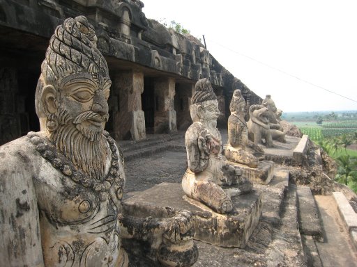
At a distance of 6.5 km from Vijayawada Railway Station, 30 km from Guntur and 275 km from Hyderabad, The Undavalli Caves, a monolithic example of Indian rock-cut architecture, are located in Undavalli Village of Guntur district in Andhra Pradesh.
The Undavalli Caves are ancient cave temples believed to be built between 4th and 5th centuries by Gupta dynasty. The caves are located on a hill overlooking the Krishna River. These caves have been carved out of solid sandstone on a hillside. The best known and largest one has four stories with a huge statue of Lord Vishnu in a reclining posture sculpted from a single block of granite in the second floor. Other shrines inside the cave are dedicated to Trimurti- Brahma, Vishnu and Shiva. Main cave belongs to the earliest examples of Gupta architecture, primarily primitive rock-cut monastery cells carved into the sandstone hills. Initially caves were shaped as a Buddhist monastery and the first floor still retains style of Buddhist vihara, including some Buddhist sculptures. Facade of the third floor is adorned with numerous sculptures, including depictions of lions and elephants.
Undavalli caves are associated with the Vishnukundina kings of 420 to 620 CE. It is also believed that these caves were used by the Buddhist monks as the rest houses. This is a good place to visit in the vicinity of Vijayawada.
Timings: 9 AM to 6 PM
At a distance of 24 km from Vijayawada Railway Station & 262 km from Hyderabad, Kondapalli Fort, also known as Kondapalli Kota, is located at Kondapalli Village in the Krishna district close to Vijayawada.
This 14th century Fort is believed to have been built by the Reddy King of Kondaveedu, Prolaya Vema Reddy. Spread over an area of 18 sq.km, this Fort is said to have served as a recreational palace for the king. The Fort was also used as a business centre. Later, the fort went into the hands of Gajapati rulers of Orissa. In the year 1520 AD the King, Sri Krishna Devaraya of Vijayanagara Empire has captured the Kondapalli fort in Kalinga wars. Later, the fort came into the hands of Qutubshahi Kings in the 16th century. During the colonial rule, the British soldiers were given training in this fort.
Situated on a hill, the fort has an impressive three storied rock tower protected by three levels of entries. The main entrance gate is known as the Dargah Darwaza, which has been made out of a single slab of granite. Another entrance gate of the fort is known as the Golconda Darwaza. The major attraction of the fort is the Tanisha Mahal or Palace, which is located on a crest between two hills. Near the fort there is a Dargah of a Persian Saint, Gareeb Sahib. One can still find several other ruined structures within the premises of the fort. There is a Gajasala, where elephants were kept, Queen's palace, Virupaksha Temple, Dining hall, a reservoir and prisons.
Kondapalli ...
At a distance of 30 km from Kakinada, 62 km from Rajahmundry, 212 km from Vijayawada and 197 km from Vizag, Yanam is a town in the Indian union territory of Pondicherry; it is located in Yanam district, which forms a 30 sq. km enclave adjacent to East Godavari district in Andhra Pradesh.
Yanam was a Dutch colony prior to French takeover in the 1720s. Neelikundilu (indigo wells) are still found in the west of Yanam. The Dutch built a fort, which they used to store their currency, minted in nearby Neelapalli. The region was presented to the French general the Marquis de Bussy by the Vijayanagaram King as a token of gratitude for the help rendered by Bussy in his fight against the rulers of Bobbili.
For 200 years it was a French colony, and though united with India in 1954. It possesses a unique blend of French and Telugu culture prevailing in Andhra Pradesh. During French rule, the Tuesday market at Yanam was popular among Telugu people in the Madras Presidency who visited Yanam to buy foreign and smuggled goods during Yanam People's Festival held in January. Yanam is situated between the confluence of Coringa and Gowthami Godavari Rivers into Bay of Bengal. This place is surrounded by plenty of coconut trees.
There are number of places to visit in Yanam town. Sivalayam, Grand Mosque, Catholic Church, Yanam beach and Venkanna Babu Temple are the important tourist ...
At a distance of 1.5 km Kadiri Railway Station, 100 km from Anantapur, 113 km from Kadapa, 458 km from Hyderabad, 476 km from Vijayawada, and 174 km from Bangalore, Sri Kadiri Lakshmi Narasimha Swamy Temple is located in Kadiri town in Anantapur District of Andhra Pradesh. The temple is dedicated to Lord Narasimha, a Man-lion form and is one of the 10 avatars of Lord Vishnu.
Lord Narasimha in this temple is swayambhu emerging from the roots of Khadri tree (Indian mulberry). The specialty of this temple is that after the daily Abhishekam is performed, the idol of Lord Lakshmi Narasimha oozes sweat continuously even after repeatedly wiping off sweat by the temple priests.
The construction of this temple is said to have been commenced during the Western Chalukya rule but it was completed during the time of Vijayanagara rulers. The inscriptions in the temple relate mostly to the Vijayanagar period. One of them states that the temple was built by a Nayaka during the reign of Bukka I in 1332 AD. The raja gopuram was built by Harihararaya. The popular king of Vijayanagara Sri Krishna Devaraya and Maharashtra King Shivaji visited this famous temple and constructed sub temples and Mahishasuramardini Temple respectively.
The temple is enclosed in large walled compound with 4 entrances having a gopura over each entrance. On the eastern entrance one can see the idol of Anjaneya. Garbgriha is decorated beautifully with four lions in corner. There is an idol of Prahalada ...
At a distance of 9 km from Bapatla, 28 km from Vodarevu Beach, 92 km from Vijayawada and 61 km from Guntur, Suryalanka Beach is situated in Guntur District of Andhra Pradesh. Also known as Bapatla Beach, it draws a large number of visitors on weekends and holidays.
Suryalanka Beach is the perfect weekend getaway beach to spend time with friends and families. The natural beauty of the beach is major draw for people, who are looking to refresh and rejuvenate themselves. The shore of the beach is wide and spacious. The Suryalanka Beach overlooks the crystal blue waters of the Bay of Bengal.
This beach is quite safe for swimming and sunbathing is another popular activity. Sunrise is very beautiful at this beach. The major tourist attraction of the beach is the sightseeing for dolphins in the month of November.
Haritha Beach Resort run by AP Tourism provides accommodation here. Advance booking is advised for a weekend stay. Other than this beach resort, Bapatla town also has various affordable accommodations available.
The Bhavanarayana Swamy temple at Bapatla town is another place which can be visited from here.
From Bapatla town, this place can be reached by public buses and autos. Bapatla town has very good train and bus connectivity with major towns in Andhra Pradesh.
At a distance of 8 km from Chirala, 28 km from Suryalanka Beach, 103 km from Vijayawada and 72 km from Guntur, Vodarevu Beach is located on the coastline of Bay of Bengal. It is situated 6 km from the Ramapuram Beach in Prakasam district.
Vodarevu beach is popular and one of the most visited beach around Vijayawada. This Beach is a beautiful beach with a constant inflow of tourists spending their weekends in serene settings. The tranquil setting of the beach can make visitors forget time and the beautiful sunsets and sunrises just add to the overall charm and attraction of the beach.
The Vodarevu Beach provides adventure in the form of exciting water-sports, swimming and fishing. Local boats are available which facilitate boating in the sea. There is also a light house nearby which can be visited.
There are several accommodation facilities near Vodarevu beach. The Sip and Dip Cottages, situated on the Vodarevu Beach Road is equipped with all basic amenities. Also, the nearby Jolley Home Resort and Ramapuram Beach Resort are also good options. Alternately, there are several accommodation options available in Chirala town.
Vodarevu is connected by bus and autos from Chirala town. Chirala has very good train and bus connectivity with major towns in Andhra Pradesh.
At a distance of 95 km from Rajahmundry, 111 km from Kakinada, 15 Kms from Narasapur, 35 km from Palakollu, 171 km from Vijayawada & 430 Kms from Hyderabad, Antharvedi is the place where Godavari confluences with Bay of Bengal. This place is also famous for Sri Lakshmi Narasimha Swamy Temple situated on the banks of River Godavari.
In this temple, the deity is faced towards West instead of East as in other temples. Vashishta Sevashram is situated on a small island near River Godavari and can be reached by a boat from the bank near temple. There is a small Shiva Temple near the main temple.
Bramhotsavams celebrated here are very famous and attract lakhs of devotees from the whole state. Other festivals celebrated here include Sri Swamy Vari Kalyanam, Rathayatra ,Sri Venkateswara Swamy kalyanam, Sri Narasimha Jayanthi.
There is a small light house near the temple, from where the whole surroundings of the temple, the confluence of River Godavari can be seen clearly. It is accessible by frequent buses from Narasapur town (150 Kms from Annavaram)
At a distance of 32 km from Guntur, 58 km from Amaravati and 73 km from Vijayawada, Kondaveedu Fort is an ancient hill fortress located at Kondaveedu village in Guntur district of Andhra Pradesh. It is one of the historical forts in Andhra Pradesh and among the famous Amaravati Tourist Places.
Kondaveedu Fort was constructed during the time of Telugu Chodas, strengthened by Kakatiyas and occupied by Prolaya Vema Reddy who shifted his capital from Addanki to Kondaveedu in 1323 AD. Later it was taken over by Gajpathis of Orissa and ravaged by the Bahmani Sultans in 1458. The Vijayanagara emperor Krishnadevaraya captured it in 1516. The Golconda Sultans fought for the fort in 1531, 1536 and 1579, and Sultan Quli Qutb Shah finally captured it in 1579, renaming it as Murtuzanagar. Later it was recaptured by the Mughal army of Aurangzeb in 1687 and the fort came under the control of the French colonists in 1752 when it was extensively fortified. It passed on to the English imperialists who got control of the fort in 1788 but abandoned it in the early 19th century in favour of Guntur.
There are two other forts nearby. All the three forts on top of the narrow hill range are now in ruins. At an altitude of about 1700 feet, the earliest one date back to 12th century and was considered then as one of the strongest forts in the region. It comprises huge ramparts, warehouses, granaries, and wells. There are two entry gates into the forts, called the 'Kolepalli Darwaza' and the ...
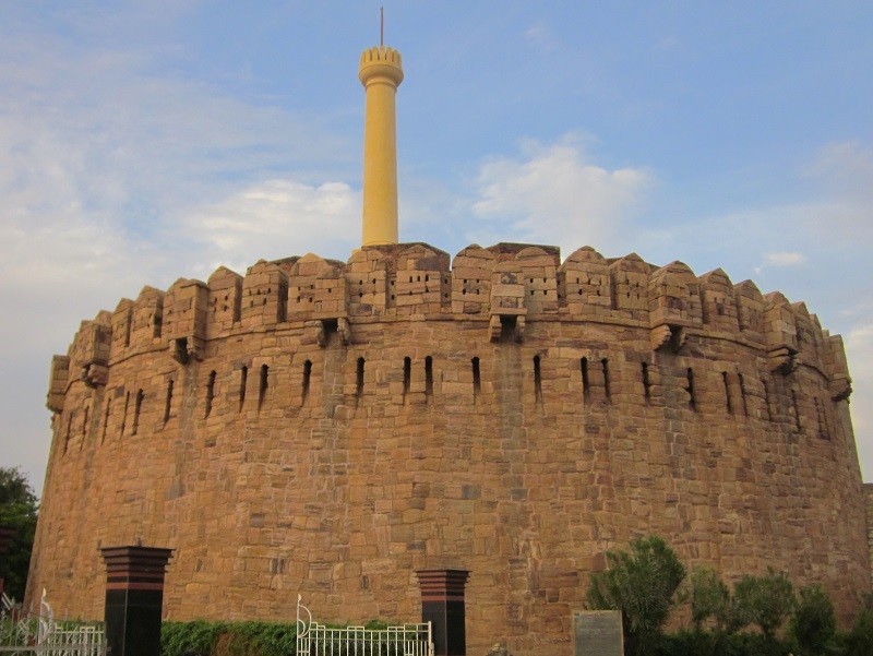
At a distance of 2 kms from Kurnool Railway Station & 24 kms from Alampur, Konda Reddy Buruju, also known as Konda Reddy Fort, is an imposing structure situated in the heart of Kurnool City.
The construction of the fort dates back to 12th century when the city of Kurnool was used as a base for halting before crossing Tungabhadra River. Kurnool was occupied by Vijayanagar ruler Devaraya II and Achyutaraya who suceeded Krishnadevaraya built the initial fort between 1530 to 1542.
The fort has different gateways and bastions. The gateways of the fort were constructed by Gopal Raja, the grandson of Rama Raja of Talikota Vijayanagara kings in 17th century. The fort has three levels and it was used as watch tower in 17th and 18th centuries. The ground level is closed for visitors, while the visitors can climb to the first and second floors and get a glimpse of the history. First level has few enclosures with large portico. Second level houses a large tower used for observation.
The fort is named after Konda Reddy, the last ruler of Alampur who was imprisoned in the fort by the Kurnool Nawab in 17th century. Konda Reddy eventually escaped from the fort, but had to loose his territory to Golconda Nawabs.
Timings: 6:30 AM to 6:30 PM.
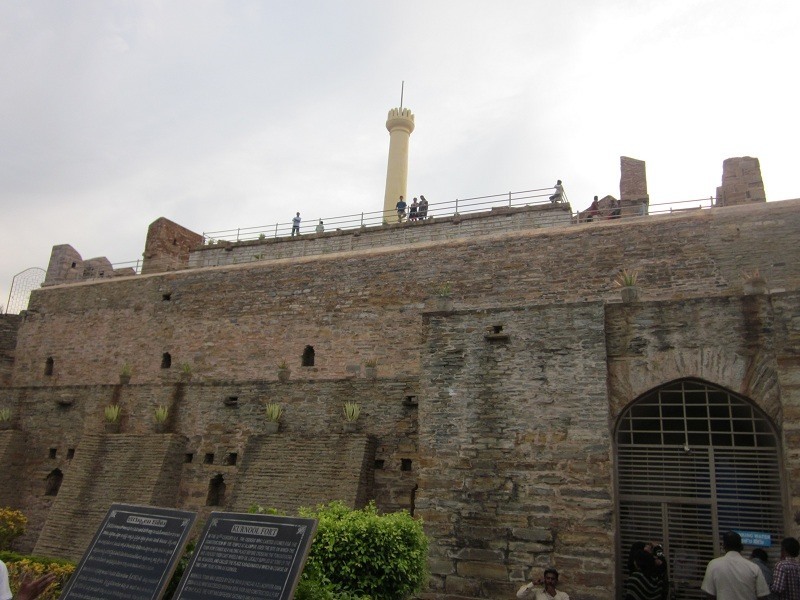
At a distance of 5 km from Gooty Railway Station, 52 km from Anantapur, 97 km from Kurnool, 311 km from Hyderabad, 425 km from Vijayawada and 265 km from Bangalore, Gooty Fort or Gutti Fort is a hill fort located at Gooty in Anantapur district of Andhra Pradesh.
Gooty was center of power struggle and witnessed several wars in the medieval period. Sri Krishnadevaraya of Vijayanagara Empire has enhanced the fortifications and added several sections in the fort. Bahmani Sultans have also occupied the fort for some time. After the fall of Vijayanagara Empire, this place came under the rule of Qutb Shahis of Golconda and Hyderabad Nizams. Later, it came under the rule of Hyder Ali in 1773, then Tipu Sultan and over a period of time it fell into the hands of Hyderabad Nizams. The fort was briefly occupied by Maratha forced under the command of Morari Rao. This place was gifted to British by Nizam for the maintenance and became part of Ceded region under Madras Presidency.
Previously this place was known as Gowthampuri and later renamed as Gooty. The earliest inscriptions on the walls of this fort date back to the 7th century. As per the inscriptions, the place was called as Gadha meaning Fort while an inscription of Bukkaraya mentions this place as King of Forts.
Gooty Fort is one of the oldest hill forts of Andhra Pradesh. It fort was made of granite rocks and the domes were constructed with fine stone, mortar ...
At a distance of 10 km from Kakinada Town Railway Station, 66 from Rajahmundry and 37 from Annavaram, Uppada Beach is located on Uppada Road and it offers a relaxed and rejuvenating ambience to enjoy the sun kissed sand and water. The wide shore is a major attraction of this beach. The clear water, the silver sand and the golden sun gifts the beach with a majestic beauty.
The wide shoreline and the gradual inclination into the water make it a safe beach. One can have a variety of activities at this beach. Shore activities like cricket, football, jogging and trekking can be fun and rejuvenating. The local fishermen along the beach are very friendly and also, one could get an experience of going along with the local fishermen for deep water fishing.
The sunrise and the sunset are very worth watching at this beach. This riveting seashore also has a beautiful well maintained park that adds to its beauty. One can find snack bars and local restaurants selling fresh seafood near the beach. Haritha Beach Resort situated Kakinada and Uppada Beach offers Accommodation, food and boating facilities.
This place Uppada is a village which is known for weaving, located on the shores of the sea and also is a home to many fishermen. It is also a very popular fishery station which is famous for prawns. The view of nature alongside the road from Kakinada to Uppada Road Beach is another attraction to the visitors.
At a distance of 40 km from Kurnool, 43 km from Nandyal, 63 km from Alampur, 59 km from Mahanandi, 71 km from Yaganti & 255 km from Hyderabad, Rollapadu Wildlife Sanctuary is one of the best sanctuaries in the state. It is primarily known as a habitat of the Great Indian Bustard, a rare species of bird. The sanctuary also attracts large number of migratory birds and it is often called as Rollapadu Bird Sanctuary. It is situated at a distance of 4.5 km from Rollapadu village.
Covering an area of 6.14 sq. km, it was established in 1988 to protect the Great Indian Bustard. It is the only habitat for the Bustard in Andhra Pradesh which is a critically endangered species. Rollapadu sanctuary is a dry grassland area that provides unique setting to the location. There is also a large lake called Alaganuru Reservoir at a distance of 3 km from the Rollapadu village (7 km from the sanctuary). Alaganuru Reservoir is the base site for the migratory birds and it's a must visit place.
Rollapadu sanctuary is home to variety of species with large number of deer's and black bucks. Other wildlife includes Foxes, jackals, bonnet macaques, jungle cats and sloth bears have been reported at the sanctuary. It also houses 132 bird species with the Alaganuru reservoir near the sanctuary being a haunt for migratory species. Some of the bird species ...
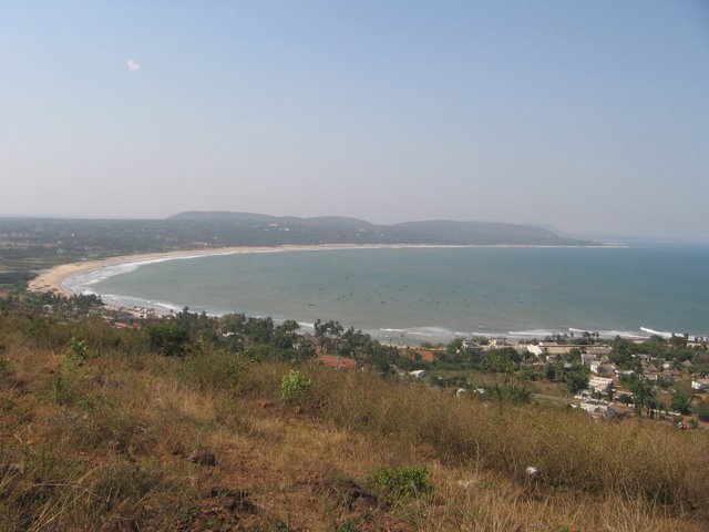
At a distance of 15.5 km from Vizag Railway Station, Rishikonda Beach is a fascinating place at a close distance to the city of Vizag situated on the way to Bheemili. Rishikonda Beach is one of the prime attractions of Vizag city and also one of the top places to experince Andhra Pradesh tourism. Rishikonda Beach is among prime place to visit on a Vizag tour.
The lovely Rishikonda Beach here with golden sands and vast stretch of water is considered the best beach in Vizag. The unspoiled beauty of the beach is its main attraction and offers a unique opportunity to relax and enjoy the golden sands, palm trees and cool breeze. The beach is a haven for watersports lovers and one can enjoy water skiing, speed boating, sunbathing, wind surfing and swimming.
The Rishikonda Beach is the best site for the swimmers. The waves at the beach are peaceful compared to RK Beach. But a sudden increase in depth can surprise the visitors and is advised to be careful while swimming at the beach. On Holi, the beach gets transformed to a hue of vibrant colours, with people splashing color and water on each other.
This beach is famous for outings of love birds. There are several huts on the beach to enable visitors enjoy the view in shade. There is a 14th century temple on Rishikonda beach called Sapta Rusheswara Temple.
Andhra Pradesh Tourism has accommodation facility in the form of ...
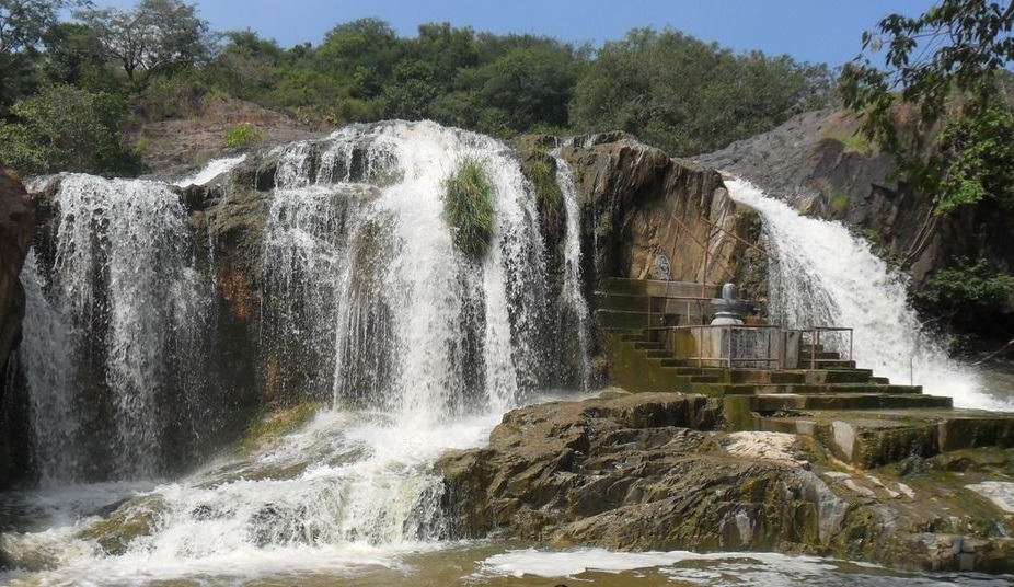
At a distance of 2.5 km from Kaigal Village, 28 km from Palamaner, 55 km from Kolar, 92 km from Horsley Hills, 142 km from Tirupati, 123 km from Bangalore, 68 from Chittoor, 78 km from Kanipakam, 96 km from Vellore & 225 km from Chennai, Kaigal Water Falls, also known as Dumukurallu Waterfalls is a nice waterfall located on the Palamaner - Kuppam Highway.
The waterfall is natural, perennial and water comes from a big rock at a height of 40 feet, irrespective of seasons. But its force and beauty is increased during the Monsoon season. The name Dumukurallu waterfalls came into prominence because of its sound resembling the fall of stones from above.
The falls is formed by the Kaigal stream which is one of the two streams flowing through Koundinya Wildlife Sanctuary. There is a big pond below the waterfalls and this is a nice place to visit for nature lovers. It is situated in a dense forest with plenty of birds, shrubs, trees and wildlife. The falls is particularly popular picnic destination for people from surrounding areas. There is a shivalinga installed near the falls which attracts pilgrims from nearby villages during Shivaratri festival.
Visitors seeking public transportation can take Palamaner - Kuppam bus and get down at Kaigal waterfalls bus stop. From the Kaigal Waterfalls bus stop, the falls can be reached by 10 minute walk on mud road. The road from ...
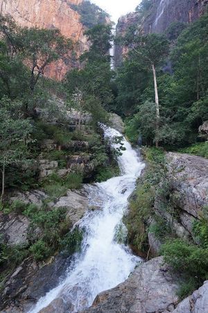
At a distance of 29 km from Tada, 45 km from Srikalahasti, 85 km from Tirupati, 92 km from Chennai, 130 km from Nellore and 156 km from Chittoor, Tada falls or Ubbalamadugu Falls is situated in Varadaiahpalem mandal of Chittoor district. It is situated on the border of Tamil Nadu and Andhra Pradesh and is an ideal place for trekking near Chennai for a day trip.
The falls are located in a dense forest called Siddulaiah Kona. The falls are located within the Kambakam hills and are a popular destination for trekking, climbing and picnicking. The terrain that surrounds the falls includes rocky hill formations and lush forests interspersed with a number of streams.
To reach the falls visitors have go through the Varadaiahpalem village, about 12 km from Tada falls. There is only 7 km rugged path and the remaining distance has to be trekked through. SUVs or vehicles with high ground clearance are best suited to reach the trekking starting point. Autos can also be hired from Varadaiahpalem village to the trekking starting point. There is a forest check post on the way where visitors need to pay Rs 50 per vehicle and Rs 50 for camera. There is limited guidance in the form of arrow marks and it is advisable to hire a villager as guide in Varadaiahpalem village. The total trek distance would be about 10 km both ways, which is somewhat difficult and advisable only for physically fit people.
As soon as you enter the forest ...
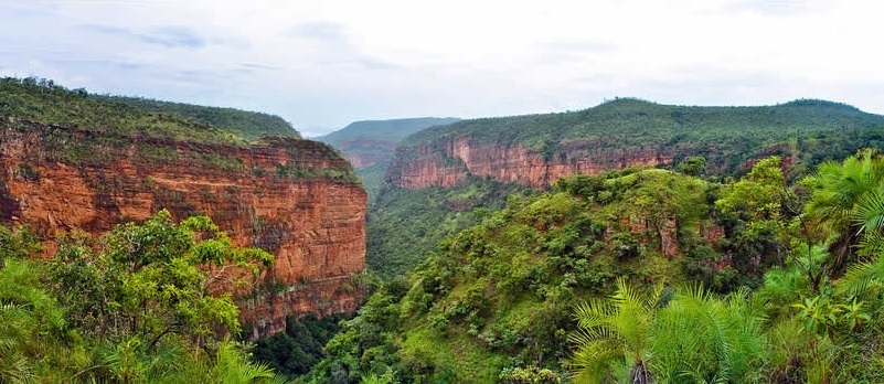
At a distance of 15 km from Tirumala and spread around Tirumala Hills, Sri Venkateswara Wildlife Sanctuary covers an area of 353 Sq. kms, over Kadapa and Chittoor districts of Andhra Pradesh. Established in 1989, the park is a heaven for nature lovers with unfathomable valleys and striking waterfalls, surrounded by Seshachalam and Tirumala Hills. The waterfalls is also a great place for trekking and it's a nice place to visit from Chennai as a weekend getaway.
The wide range of fauna found here includes Tiger, Civet, Jackal, Black Buck, Panther, Spotted Deer, Ibex, Sloth Bear, Bonnet Monkey, Wild Dogs, Bison, Jackal, Fox, Rare Golden Gecko, Jungle Fowl, Indian Giant Squirrel, Tree Shrew, Flying Lizards, Nilgai, Wildboar, Occasional Leopard and Hyena. Fauna comprises of more than 100 species of birds, including Crested Serpant Eagle, Ashy Crowned Finch Lark, Indian Roller, Kingfishers, White bellied Woodpecker, etc.
The best gateways to the sanctuary are Papanasam Dam on Tirumala Hills and Talakona waterfalls which is 64 km from Tirupati by Road. The best way to explore this beautiful sanctuary is by foot from these two entry points.
There are several trekking trails within the sanctuary with duration ranging from half day trek to 3 full days. Tumbura Thirtham is situated within the sanctuary which can be completed within ...
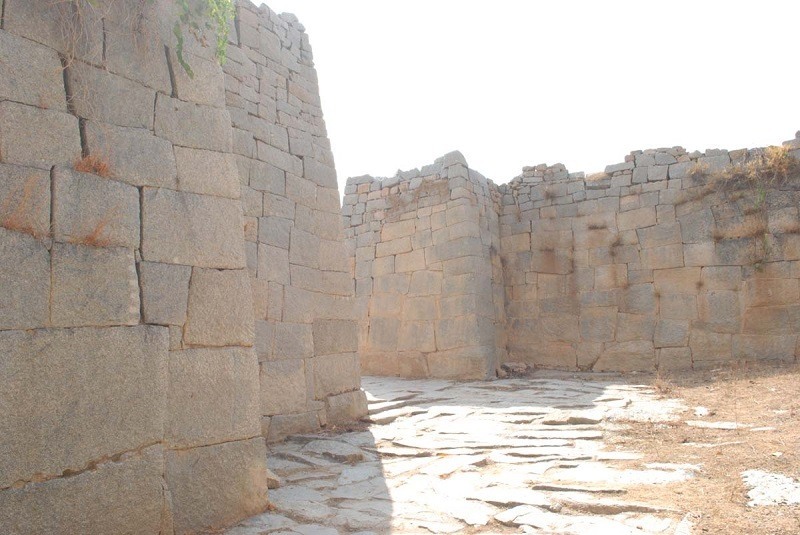
At a distance of 2 km from Rayadurgam Bus Stand, 99 km from Anantapur, 53 km from Bellary, 95 km from Guntakal, 245 km from Kurnool, 449 km from Hyderabad, 571 km from Vijayawada and 265 km from Bangalore, Rayadurgam Fort is a medieval fortress that is situated in Rayadurgam town in Anantapur district of Andhra Pradesh. Rayadurgam Fort is one of the oldest forts in Andhra Pradesh and was constructed at an elevation of 2727 feet.
According to the history, Rayadurgam Fort was built by Junga Nayaka, a chieftain of Vijayanagar Kings. The Battle of Talikota was a bitter battle fought between Rama Rayalu the son in law of King Sri Krishna Deva Raya and Deccan Sultanates. Later the Muslim force was driven out by Koneti Nayaka. The fort was strengthened to a greater extent by his son Venkatapathi Nayaka. Later Tipu Sultan captured the fort and it was annexed to the province of Gooty.
The Rayadurgam Fort comprises of several layers of inner forts that made the access difficult. The fort played a significant role during the reign of the rulers of the Vijayanagar Empire. The Rayadurgam Fort is one of the chief tourist destinations in Rayadurgam town. Majority of the fort stands strong till date.
A wonderful temple for Lord Ganapathi known as Dhasabhuja Ganapathi Temple has been built in the fort. It was carved out from a 4 m high monolithic stone. There are other temples that are dedicated to Lord Hanuman, Ellamma, Prasanna Venkateswara, Venugopala, Jambukeswara, Veerabhadra ...
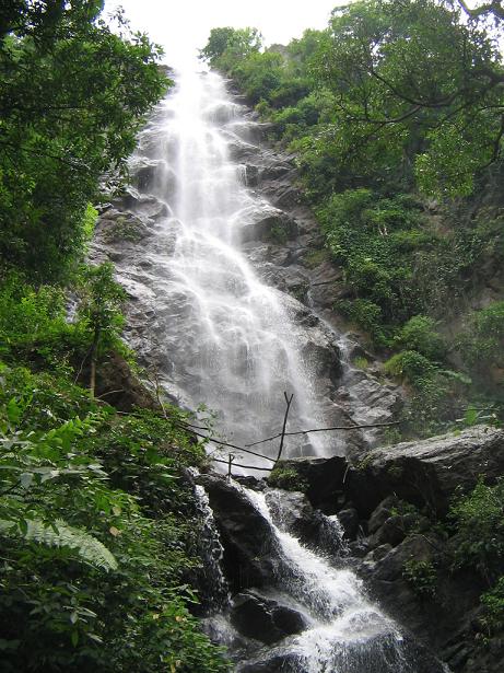
At a distance of 7 km from Borra Caves, 39 km from Araku, 90 km from Vizag & 665 km from Hyderabad, Katiki or Katika Waterfall is magnificent waterfall situated near Borra Caves in Visakhapatnam district of Andhra Pradesh. It is one of the best waterfalls in Araku and also among the top places to visit in Araku.
The name of the falls is derived from the name of the village nearby. Katiki waterfall is formed by the Gosthani River and it cascading down from a height of 100+ feet. The pond at the bottom of the waterfall is an excellent place for taking a bath after a tough trek to the place. It has to be reached by 20-30 minutes trek (one way) through lush forest and upwards to mountain top from the nearest motorable road. Cooking and camping are also permitted at this place. This is also a good place for trekking.
To reach Katiki falls from Araku, you have to take Borra Caves road at Mulyaguda junction between Araku and Visakhapatnam (around 30 km from Araku, after Anantagiri). Cross the Borra Caves railway crossing on the same road. Nearly 2 km from the railway crossing, you have to take left turn where the straight road takes to Borra Caves (caves are 2 km from here). After 300 meters on the same road, take a left turn and go for about 4-5 km. The road ends at the railway track near Tunnel #44. From here, you have to cross the railway track and go straight trekking the mountain. The falls are nearly 20-30 minutes trek from here and the path is narrow and slippery. ...
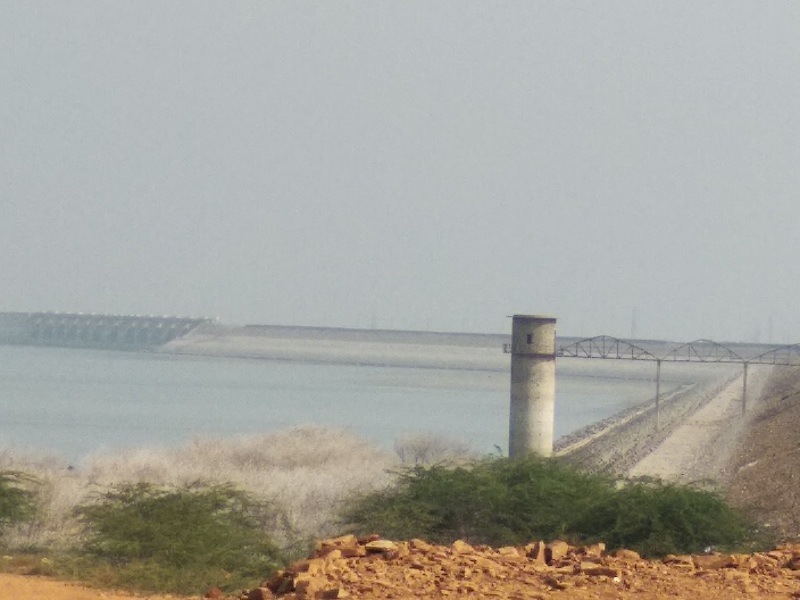
At a distance of 10 km from Gandikota, Mylavaram Dam is a medium irrigation project built across Penna River near Mylavaram in Kadapa district of Andhra Pradesh. It is one of the beautiful reservoirs on River Pennar and among the must visit Gandikota Tourist Places.
Also known as Tatireddy Narasimha Reddy Reservoir, Mylavaram Dam is an earthen dam constructed for providing irrigation potential to an extent of 75,000 acres. The construction of the project and formation of canals were completed by the end of 1981-82 and the distributary system was completed by 1985-86. The reservoir has a gross storage capacity of 9.96 tmc. The reservoir consists of two main canals viz. MR South Canal & MR North Canal having an extent of 25,000 acres & 50,000 acres of ayacut respectively. With the completion of Srisailam right bank canal, Krishna River water would be fed from Srisailam Dam to this reservoir.
The dam view is amazing and one can see a museum nearby. It is a nice place to visit in the evening so that you can see spectacular sunset. Recently, AP Tourism has set up a boat club in the backwaters of Mylavaram Dam in order to attract tourists. Tourists can indulge in various water sports activities like speed boat, kayaking etc.
Timings: 9 AM - 6 PM
Boating Cost: Rs. 200 per Person for Speed Boat (Max 4) & Rs. 200 for Kayaking (Max 2)
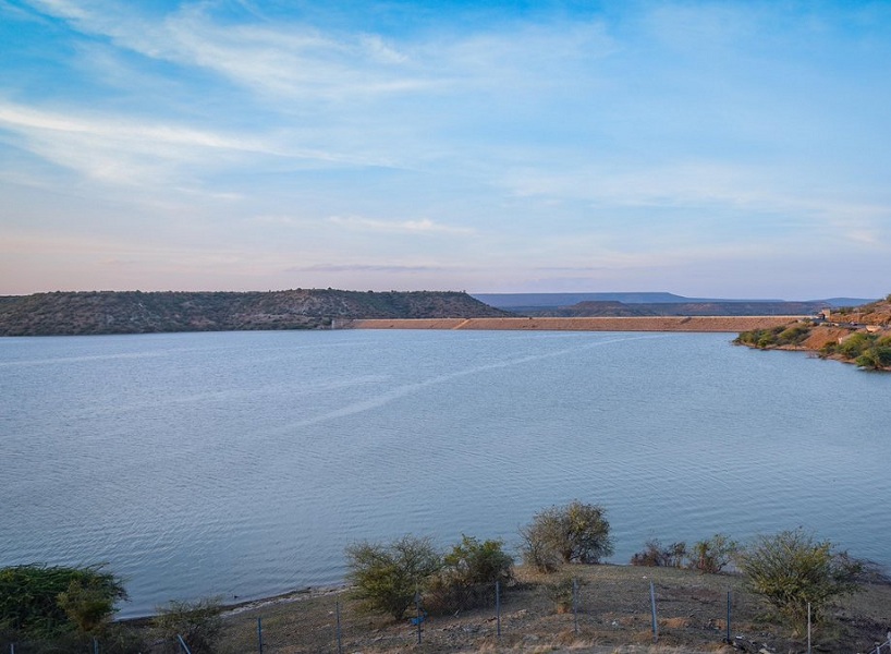
At a distance of 6 km from Owk, 10 km from Belum Caves, 34 km from Yaganti, 56 km from Jammalamadugu and 70 km from Gandikota, Owk Reservoir is an earthen dam built across Paleru River near Owk in Kurnool district of Andhra Pradesh. It is one among the popular places to visit in Gandikota.
Built in 1946, Owk Reservoir is a balancing reservoir comprising of three smaller dams namely Paleru, Gollaleru and Thimmaraju Cheruvu. Previously the Paleru and Thimmaraju earth dams are the tanks feeding water to Owk village ayacut of approximately 600 acres and 2000 acres respectively. These tanks were converted into Owk Reservoir by raising its bund to 220 feet height. Now, the reservoir has internal area of more than 1000 acres and it is main source of irrigation in Rayalaseema region and also providing drinking water facility to nearby villages and towns.
Recently, AP Tourism has set up a boat club in backwaters of Owk Reservoir in order to attract tourists. Tourists can indulge in various water sports activities like Cruise Boat, speed boat, etc. There are two water falls namely, Gollaleru and Paleru in the catchment area of the dam.
Timings: 9 AM - 1.30 PM & 2 PM - 5.30 PM
Boating Cost: Rs. 150 per Person for Cruise Boat & Rs. 200 per Person for Speed Boat (Max 4)
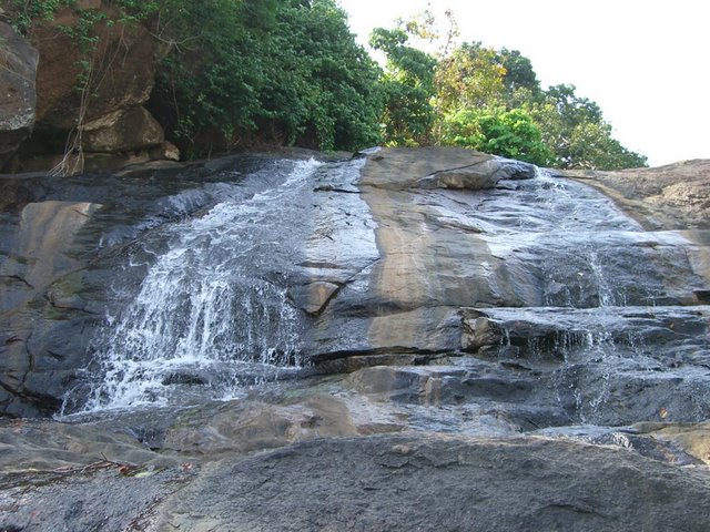
At a distance of 28 km from Araku, 3 km from Anantagiri village, Tadimada waterfalls, also known as Anantagiri Waterfalls is a charming waterfall situated near Anantagiri town in Vizag district of Andhra Pradesh. It one of the best waterfalls in Araku and also one of the top tourist attractions in Araku.
With a height of about 100 feet, Anantagiri falls offer best views in monsoon season. The best way to reach these waterfalls is by walking / trekking from Anantagiri. The falls is about 1-2 km away from the main road between Anantagiri and Araku Valley (after about 1.5 km from Anantagiri). The approach road from main road is very narrow and bumpy. Only SUVs can manage well on this road. It's advisable to walk to these falls from Anantagiri - Araku main road which takes about 20 minutes. The road is almost flat and anyone can manage to walk easily.
The rocks near the falls are very slippery and should be careful while getting on to the rocks. Though swimming is possible, water here is bit dirty.
Timings: 9 AM - 5 PM
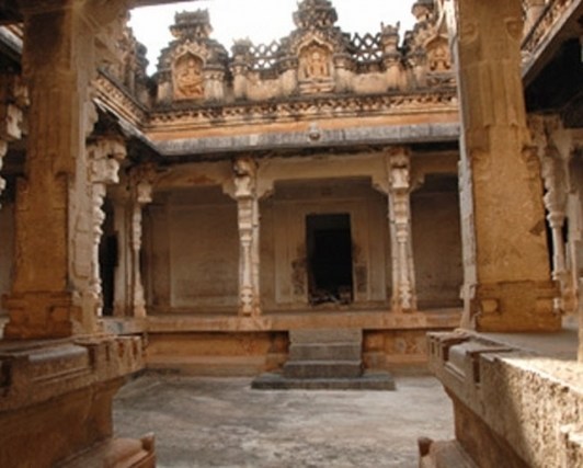
At a distance of 36 km from Madakasira, 70 km from Hindupur, 156 km from Anantapur, 513 km from Hyderabad, 627 km from Vijayawada and 158 km Bangalore, Hemavathi is a small town located in Anantapur district of Andhra Pradesh. Hemavathi was the capital of Pallavas between 8th and 10th century AD. The town was known as Henjeri during the Pallava reign.
Pallavas built few fascinating temples at Hemavathi. Ruins of a large fort were excavated near Hemavathi town. There are many temples around this fort which possess wonderful architecture. Some of the famous temples are Siddeswara Temple, Doddeshwara Temple, Virupaksheswara Temple and Malleswara Temple. The temple complex is spread over an area of around 15 acres.
Among these temples, Doddeswara Swamy temple is most striking and a well built structure. The stone used in making the idols are polished like metal and also make a sound of metal when struck. There is a 6 feet tall Shivalinga installed inside the sanctum sanctorum. A huge 8x4 feet idol of Nandi made of black granite sits at the entrance. The temple boasts some wonderful artwork. The walls of the temple are adorned with several artistic sculptures and images. The pillars have scenes from the epics Ramayana and Mahabharata. Rajendra Chola was very much attracted by the massive pillars in this temple. The temple adorns the place as a witness of a striking collection of Pallava and Chola architecture.
The other two temples in this complex are dedicated ...
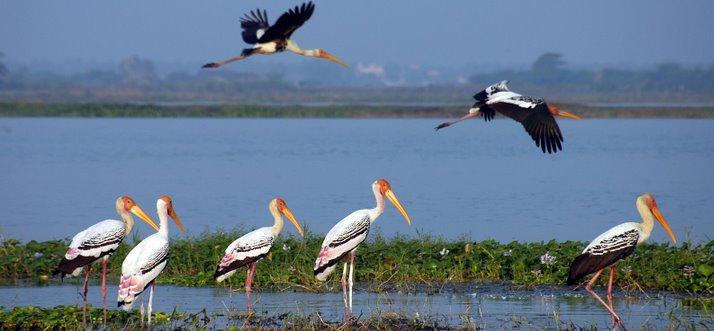
At a distance of 95 Kms from Vijayawada & 349 Kms from Hyderabad, Kolleru Lake is a large freshwater lake spread over an area of 300 Sq. Miles between Krishna and Godavari delta. It is home to migratory birds between October and March every year.
Now declared as Bird Sanctuary, the lake is a great picnic spot and a paradise for birdwatchers. The lake was an important habitat for an estimated 20 million resident and migratory birds. The visitors include Open Bill Storks, Painted Storks, Glossy Ibises, White Ibises, Teals, Pintails, Shovellers, Red-Crested Pochards, Blackwinged Stilts, Avocets, Common Redshanks, Wigeons, Gadwalls and Cormorants, etc.
The lake is approachable from all four sides of the lake by road: Atapaka - 2.5 Kms from Kaikaluru & 25 Kms from Eluru, Murthiraju Tank - 8 kms from Nidamarru & 45 Kms from Eluru, Gudivakalanka - 15 kms from Eluru. Watchtowers are available at these places for bird watching. Eluru is connected by frequent buses from Vijayawada.
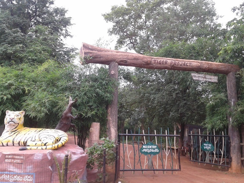
At a distance of 60 km Nagajuna Sagar, 30 Kms from Srisailam and 173 km from Hyderabad, the Nagarjuna Sagar - Srisailam Sanctuary (or Srisailam Sanctuary) is the largest tiger reserve in the country, spread across 3568 Sq. Kms. It is spread between Nagarjuna Sagar reservoir & Srisailam reservoir. It was declared a sanctuary in 1973 and was incorporated under Project Tiger a decade later.
Animals that can be found here are the panthers, tigers, spotted deer, mouse deer, black buck, sambars, chousingha nilgai, tree straw, mugger crocodile, and wolfs, sloth beer & wild dogs. Mannanur (104 Kms from Mahbubnagar towards Srisailam), Kandla Kunta (30 Kms from Macherla & 60 Kms from Sagar towards Srisailam), Vatwarla Palle (30 Kms from Srisailm towards Mahbubnagar) are different gateways into the sanctuary.
The Forest department organized a Jeep Safari in the forest (to Farahabad Viewpoint) from the entry point on Hyderabad to Srisailam highway. The entry point is situated between Mannanur and Vatvarlapally, 57 km before Srisailam. The duration of the trip is about 1 hr 30 minutes and costs Rs. 800 per trip (can accommodate 6 people). Private vehicles are not allowed for Safari.
Several places of interest near Srisailam like Malleka Teertham Falls, Saleshwaram & Uma Maheshwaram are acitually situated inside the sanctuary and provide an opportunity to experience the ecology ...
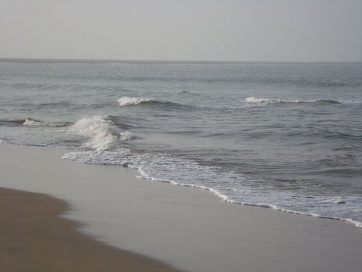
At a distance of 83 Kms from Vijayawada, 11 Kms from Machilipatnam & 351 Kms from Hyderabad, the Manginapudi Beach is scenic beach on Bay of Bengal. A unique feature of this beach is that it has black soil instead of the sand like other beaches.
On the occasion of Magha Poornima lakhs of pilgrims gather here to take a holy dip in the sea. An old light house is one of the added attractions. A number of beach resorts are coming up to cater to the tourist crowd. On the banks of the sea coast, Dattashram is an ancient pilgrimage site comprising a temple of Lord Shiva. Owing to the sanctification of 9 wells of bath, like Rameswaram, Manginapudi is also known as Datta Rameswaram.
Several buses are available to Manginapudi from Vijayawada and Machilipatnam.
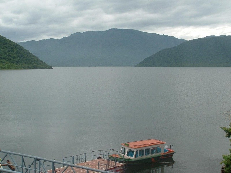
At a distance of 65 Kms from Vizag, 55 Kms from Araku & 632 Kms from Hyderabad, the Tatipudi Reservoir is located near Srungavarapukoda (also called S Kota) town situated between Vizag and Araku Valley in Vizianagaram district.
The Reservoir was built in 1963 across River Gosthani to provide drinking water facility to the Vizag City. This location is very beautiful with lush green mountains on all the sides. Boating facility is available. Several migrant birds make this reservoir their home in the months of April/May.
The Reservoir is about 10 Kms from S Kota and can be reached via Kothavooru and Krishnapuram (while coming from Vizag), or via Tennuboddavara and Tadupudi village (while coming from Araku). Private vehicles can be hired by S Kota town to reach this place.
This place can be visited while going to Araku or during return to Vizag with 1-2 Hours additional effort.
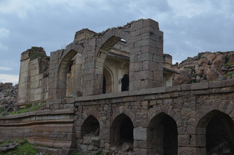
At a distance of 4 km from Adoni Railway Station, 100 km from Kurnool, 52 km from Mantralayam & 310 km from Hyderabad, Adoni Fort is a wonderful historical site built in 15th century. This is also a good place for trekking in the rocks and ruins of the fort.
Adoni fort is one of the largest forts in India with the fortification walls running beyond 50 km in length. Adoni was a military base for the Vijayanagara Empire in the 15th century. After the downfall of Vijayanagara empire, it was taken possession by the Bijapur sultan. Adoni continued to be ruled as relatively independent region by nobles appointed by Bijapur sultans. Siddi Masud, the governor of Adoni made several additions to the fort including the construction of Jamia Masjid and several townships. Siddi Masud had been an avid collector of painting. Adoni later went into the hands of Mughal empire followed by Hyderabad Nizams. Tipu Sultan briefly occupied this region. After the defeat of Tipu Sultan, Adoni came under British rule and remaining part of Ceded region (Rayalaseema) until independence.
The fort has several entrance gates, and it is encircled atop seven huge granite hills. The fort is actually a collection of 12 sub-forts built throughout several centuries. There are several places of interest within the fort premises including Nawab Darbar Hall, Jamia Masjid, Venu Gopala Temple, Malik Rahman Dargah, Shiva Temple, Amba Bhavani Temple and several ...
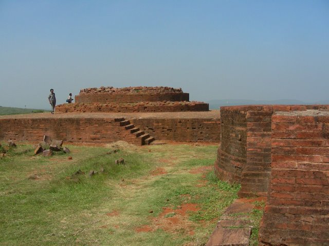
At a distance of 22 Kms from Vizag Railway Station & 620 Kms from Hyderabad, the Thotlakonda Buddhist Complex is situated on a hilltop in Chepala Uppadu village on Bheemili beach road (after Rishikonda).
Also known as 'the Hill of Eagles', the complex has a number of stupas, Chaityas, Viharas, a congregation hall and a refectory belonging to the Hinayana school, mostly excavated during1982-92. These remains are classifieds as religious, secular and civil. Excavations at Thotlakonda comprise pottery, beads, bangle pieces, tiles, stuccos, iron objects, sculptural remains, moulded bricks, inscriptions, coins, etc.
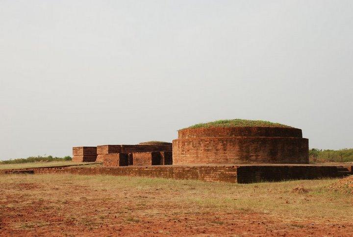
At a distance of 20 Kms from Vizag Railway Station & 618 Kms from Hyderabad, Bavikonda is historical Buddhist site near Kapula Uppadu village in Bheemili beach road (after Rishikonda).
The hill acquired the name Bavikonda due to the existence of wells on the hill to collect rain water for drinking purpose. The artifacts recovered here include Roman coins and satavahana coins apart from pottery dating back to 3rd century BC and 2nd Century AD. Excavations on the hill-top brought to light an extensive Buddhist establishment consisting of a Mahachaitya, stupas, chaityagrihas, a congregation hall, platforms, viharas, kitchen-cum-store complex, pottery, relic caskets, tiles, stuccos, iron objects, moulded bricks, coins etc
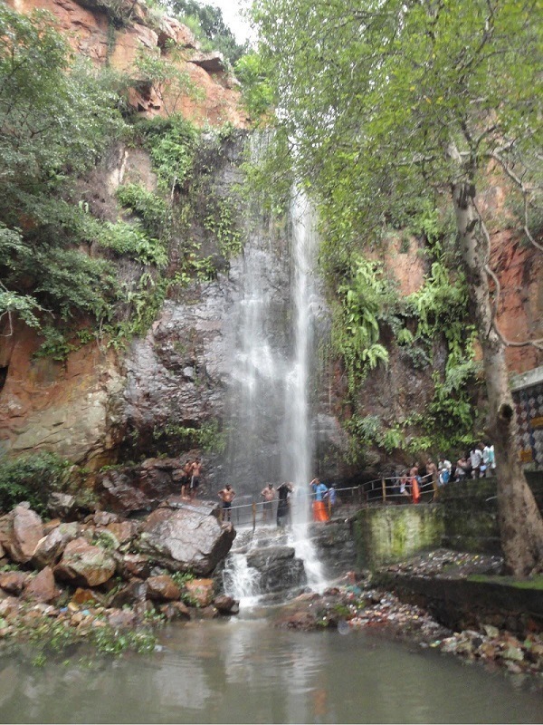
At a distance of 13 km from Puttur, 25 km from Nagari, 46 km from Tirupati, 92 km from Chennai, 76 from Chittoor, 86 km from Kanipakam, 85 km from kanchipuram and 110 km from Vellore, Kailasakona Waterfalls are a natural perennial waterfall in the valley of Nagari hills in Chittoor District. The water originates from the split in a mass rock.
The height of the waterfalls is about 30 meters and it cascades down into a small pond below the rock. The water here is crystal clear having considerable mineral values & medicinal powers and can heal ailments. The tourists are not allowed to go uphill to the top of the falls.
There is a small temple of Lord Shiva and Parvati near the waterfall. According to the legend, Lord Kailasanatheswara Swamy came down to earth to attend the marriage of Lord Venkateswara Swami with Goddess Padmavathi at Narayanavanam which is 9 km from Kailasakona falls. Lord Kailasanatheswara was impressed with the picturesque location and the silent environment that he stayed in this place to meditate, hence the name Kailasakona.
Kailasakona can be reached easily and has good transportation facilities; vehicles can reach the foot of waterfalls. APSRTC buses are available to Kailasakona waterfalls from Tirupati and Puttur. AP Tourism has constructed guest houses in Kailasakona waterfalls for visitor's accommodation - Haritha Hotel. There is also Punnami ...

At a distance of 70 Kms from Vijayawada & 340 Kms from Hyderabad, Machilipatnam is a port town and the headquarters of the Krishna District.
It is renowned for its cotton textiles, especially the finely woven muslins and brightly coloured prints. Products include Hand printed silk and cotton saris, upholstery, sling bags and dresses. This was once the principal port town in the Krishna Delta, but now little can be seen of this port town's mercantile past. There are Dutch tombs with carved instructions and coats of arms bearing dates from 1649 to 1725, a reminder of the colonial history of Machilipatnam.
Regular RTC buses are operated to Machilipatnam from Vijayawada Central Bus Station.
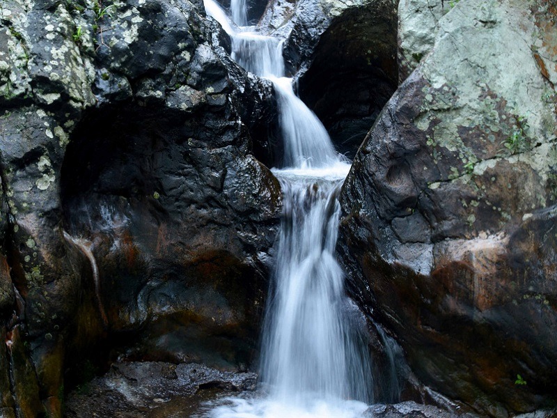
At a distance of about 3 km from Padmapuram Gardens and 6 km from Araku Bus station, Araku Waterfalls, also known as Ranajilleda falls is lovely and little known waterfalls situated near Ranajilleda Village near Araku.
At a height of over 60 feet, Araku Waterfalls is one of the best waterfalls in Araku Valley. Named after Ranajilleda village, this falls is located on mountain peak and about 10-15 minutes trekking is required to reach the falls from nearest motorable road.
To reach the falls, one has to drive straight from Padmapuram Gardens till Ranajilleda village from where the falls can be reached by trekking the summit. Best time to visit these falls is the post monsoon season.
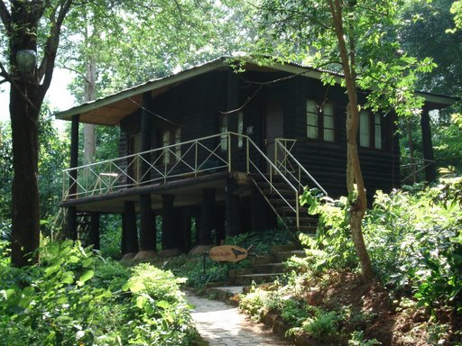
At a distance of 40 Kms from Araku, 70 Kms from Vizag & 632 Kms from Hyderabad, Tyda is a small tribal village nestling in the wooded hills of the Eastern Ghats between Vizag and Araku Valley.
Also known as Jungle Bells, the nature camp has facilities for rock climbing, trekking, bird watching and target shooting with bow & arrows. This eco-tourism destination is home for a variety of animals and birds. With the help of naturalists or guides in the camp, one can learn the language of the jungle, identification of calls, marks etc.
There are log huts and tents set in tribal environment for tourists.
Tariff: Rs. 800 to Rs 1800. Visit - http://www.tourisminap.com/accomodation/index.php
Trains between Vizag and Araku stop at Tyda. Tatipudi Reservoir is about 25 Kms from Tyda, which is connected by several buses.
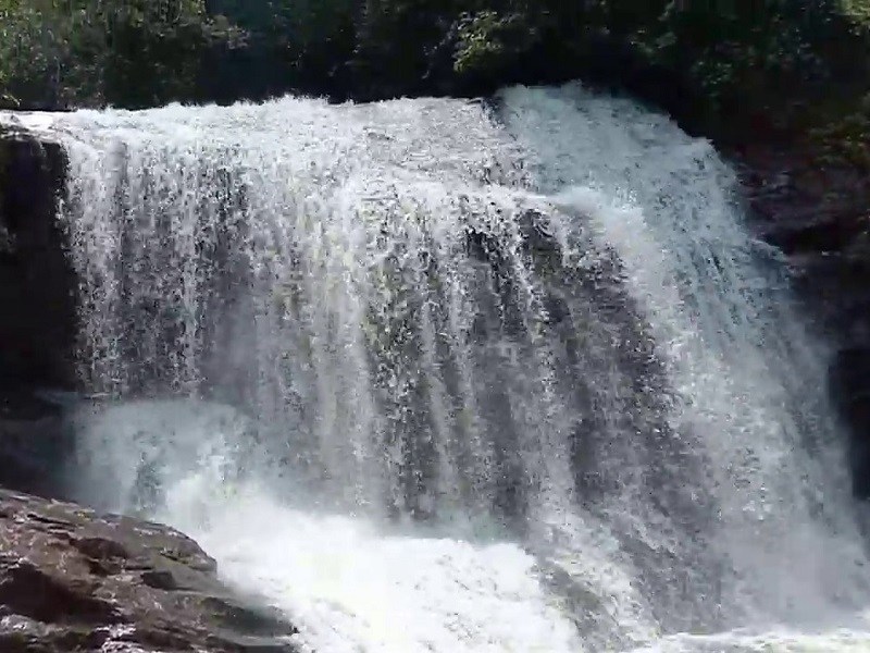
At a distance of 20 km from Lambasingi, and 25 km from Narsipatnam, Yerravaram Falls is a picturesque waterfall located at Yerravaram village in Narsipatnam Taluk of Andhra Pradesh. Situated on Narsipatnam-Chintapalli Road, it is one of the mesmerizing waterfalls in the Narsipatanam region and among the must include places to visit as part of the Lambasingi Tour Packages.
Yerravaram waterfall is situated in Yerravaram, a beautiful valley known for its lush green pastures, breathtaking views, and wide meadows. The waterfall spans around 10 feet in height and 15 feet wide. The water drops in different cascades and forms a pool at the bottom. It is a year-round waterfall. Those who are interested in hill-climbing, then this is the best place for them.
This place attracts a large number of tourists during the summer and winter seasons. To reach the falls, one can hire a cabs auto from Narsipatnam City till Yerravaram village and then hike up to 5 km amidst the dense forest cover. With multiple trails to explore and numerous viewpoints, this place is a true (hidden) treasure. Activities like trekking, stargazing, and camping are much recommended in this area.
Timings: 6 AM - 5 PM
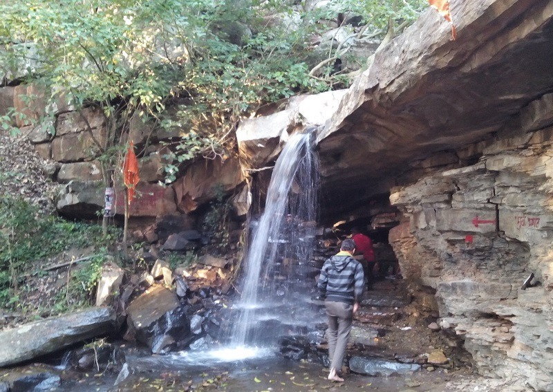
At a distance of 22 Kms from Srisailam and 12 Kms from Akka Mahadevi Caves, Kadalivanam Caves are natural caves with lot of history attached to it. After reaching Akka Mahadevi Caves on Motor Boat from Srisailam, trekking through multiple mountains for a distance of 12 Kms will take you to this place.
This is a huge cave like natural rock shelter which can accommodate nearly 500 persons comfortably. Near the rock shelter flows a stream and evidences of stone age man in the form of stone tools were discovered. Akkal Maharaj, who is a famous saint in Maharashtra did penance at this place for several years before heading to Maharashtra.
Akkamahadevi is said to have spent her last days at this place. It is said that Bhagavan Dattatreya and his other incarnations are believed to have been dwelling at this place. This excellent spot is considered to be extremely sacred by devotees. Many devotees from Karnataka and Maharastra also visit this place during their trip to Srisailam.
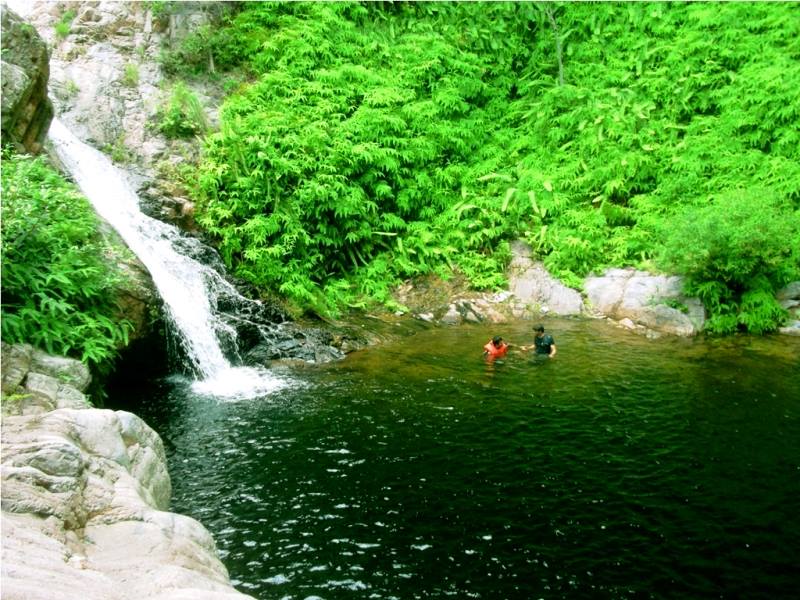
At a distance of 16 km from Nagalapuram town, 44 km from Puttur, 87 km from Chennai, 78 km from Tirupati, 107 km from Chittoor, 130 km from Vellore, 120 km from Kanipakam & 288 km from Bangalore, Nagalapuram is a small historical town located in the Chittoor District of Andhra Pradesh. Nagalapuram is famous for two things, one is Sri Vedanarayana Swamy Temple and the other one is Nagalapuram falls trekking (also known as Saddhi Koodu Madugu). This is one of the popular sites for trekking near Chennai and also among ideal weekend getaways around Chennai for a two day trip.
Sri Vedanarayana temple is grand shrine dedicated to Lord Vishnu and is said to have been built by Krishna Devaraya of Vijayanagar Empire in remembrance of his mother Nagala Devi, after whom the town is named. The temple reflects the Vijayanagara architectural and the main deity idol is facing west. The sanctum sanctorum has Vedanarayana Swamy with his consort's Sridevi and Bhoodevi on either side. Lord Vishnu is in Matsya Avatar, the first among the Dasavatar, who saved the four Vedas from Somakudu and returned to Brahma.
The large temple complex comprises of a grand entrance, tall gopura, wide corridors and beautiful central shrine with excellent carvings. The special feature of this temple is a festival called Surya Puja, celebrated annually for 3 days during the month of March. The ...
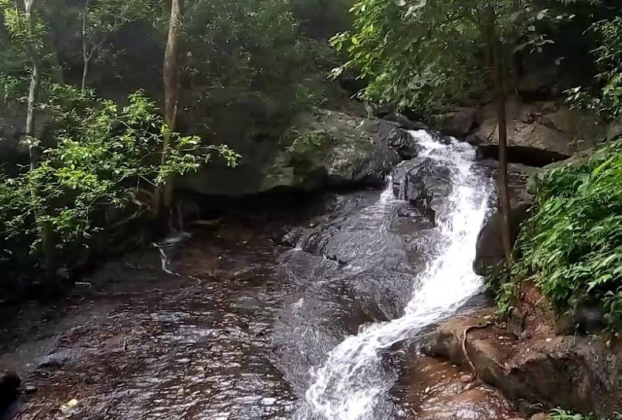
At a distance of 15 km from Maredumilli Bus Stand, Amruthadhara is a beautiful waterfall situated on Rajahmundry - Bhadrachalam Highway near Maredumilli in East Godavari district of Andhra Pradesh. It is a seasonal waterfalls and one of the must visit places in Maredumilli as part of Vizag tour packages.
Amruthadhara is formed over a seasonal stream amidst forest and steep rocks. During monsoon this small waterfall is in full gush and would be a heaven for nature lovers. The waterfall is in two stages. This place is not so comfortable to take bath but one can slide.
One needs to climb down a steep pathway of 1 km to reach the waterfalls from the entrance. It will take 1 hour to visit the falls. The trekking path is very slippery and strenuous. The waterfall is maintained by local tribes and they maintain the area by making steps and preparing easy Jungle path with side barricade supports. There is ample space for parking the vehicles.
Timings: 8 AM - 5 PM
Entry Fee: Rs. 20 for Person
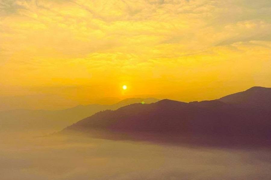
At a distance of 10 km from Araku Valley Bus Stand, Madagada viewpoint, or Madagada Sunrise Viewpoint is another spectacular vantage point located in Araku, Andhra Pradesh. Situated at Madagada village, it is one of the most prominent tourist places in Araku.
Madagada Sunrise Point in Araku is a renowned destination for observing both sunrise and sunset. The vista from the Madagada Viewpoint is truly stunning, particularly at sunrise when a layer of mist blankets the hills, creating a magical atmosphere. As the day begins, the landscape transforms into a vivid spectrum of colors, offering an exceptional opportunity for photography enthusiasts to capture the awe-inspiring scenery.
There are two viewpoints on the hill. The first viewpoint can be accessed via a brief trek from the parking area, while reaching the second viewpoint requires a more extended trek. The second viewpoint provides a unique perspective of clouds hovering above the mist. Encircled by lush forests, visitors can enjoy a tranquil and pleasant environment, making it an ideal spot for relaxation.
Parking facilities are available near shops that offer snacks and tea. Additionally, visitors have the option to rent traditional tribal attire for photography sessions at the viewpoint. Cultural experiences such as the Dhimsa dance, pottery making, and various tribal events, including archery and shooting, are also available ...
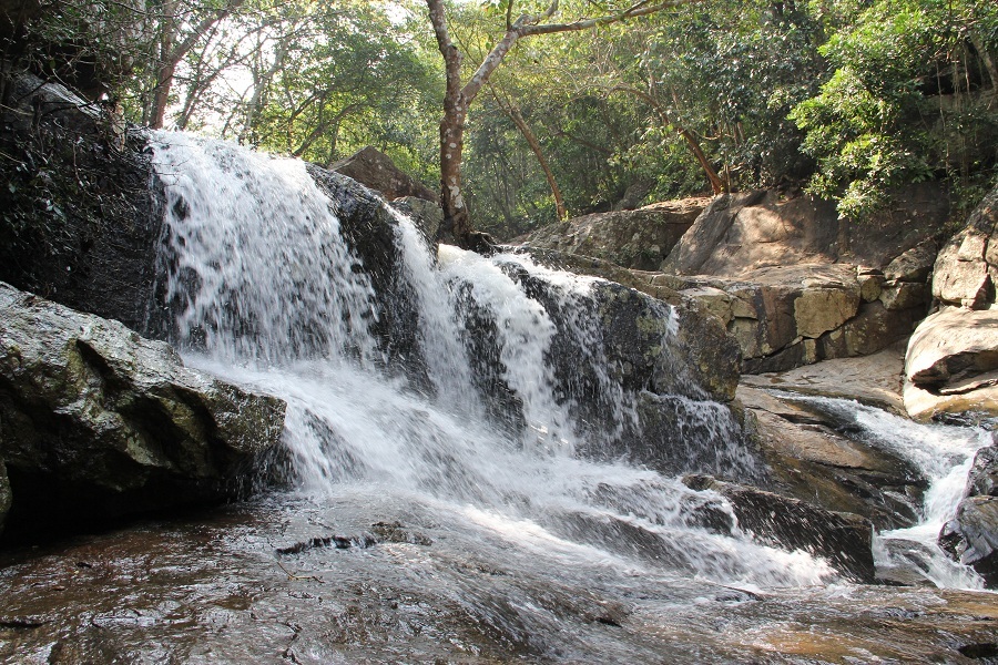
At a distance of 4 km from Rampachodavaram village and 29 km from Maredumilli, Rampa Waterfalls is a stunning waterfall in East Godavari district of Andhra Pradesh. It is one of the popular places to visit in Maredumilli and among the best waterfalls in Andhra.
Also known as Rampachodavaram Falls, the waterfall cascades down from a height of about 50 feet. Situated near Rampachodavaram village, this is the only coastal fall in Andhra Pradesh. One can take a dip in this falls amidst thick jungle is very refreshing. Water remains throughout the year in this waterfall and the downstream.
The waterfall is located in a dense jungle and can be accessed by jeeps. The drive through the dense jungle is an exhilarating experience. The road and the area up to the waterfall are maintained by local villagers. There is a small trek to reach the waterfall from the entrance. While climbing the flowing water stream will be at your right and there are several small waterfalls making the small trek more enjoying. It will be a 20 minutes climb to reach the main waterfall.
There is an ancient Shiva Temple named Sri Neelakanteswara temple near the Rampachodavaram waterfalls. A dance festival is organized every year on Shivratri day here where famous tribal dance Vela is displayed. During this dance, the costumes used by the dancers are very attractive.
Timings: 8 AM - 5 PM
Entry Fee: Rs. 10 for Person
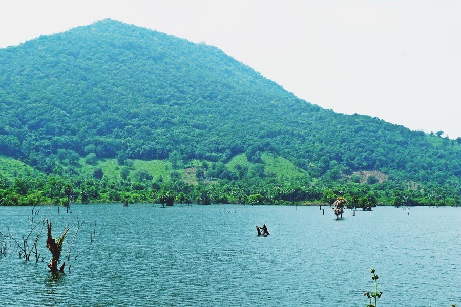
At a distance of 4 km from Rampachodavaram Bus Stand and 21 km from Maredumilli, Bhupathipalem Reservoir is an earthen dam situated at Bhupathipalem near Rampachodavaram town in East Godavari district of Andhra Pradesh. It is one of the popular Maredumilli Tourist Places.
The Bhupathipalem Reservoir Project is a medium irrigation project constructed on Seethapalli Vagu, which is a hill stream and tributary to river Godavari. The project is intended to provide irrigation facilities to an extent of 11,526 acres of tribal ayacut and to also provide drinking water to 32 villages in Rampachoadavaram & Gangavaram Mandals of East Godavari district.
The reservoir is surrounded by lush pine and coniferous trees. The reservoir has a tiny island and submerged trees with tall mountains as the back ground. Every curve along lake presents a different view of the scenery. There is a parking and boating facility for visitors. Only paddle boats are available here. The absences of mechanized boats make the waters still and reflections of the mountains can be seen as a big natural mirror.
Boating Timings: 10 AM - 5 PM
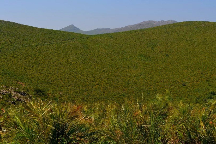
At a distance of 10 km from Araku Valley Bus Stand, Mahindra Peak is a mountain peak situated near Sunkarimetta, Araku. It is one of the must-include places in Araku Valley adventure tour.
The trek to Mahindra Peak remains relatively uncharted within this area, as there is no clearly defined path leading to the summit. Consequently, undertaking this trek necessitates the assistance of a local guide. The journey commences from Sunkarametta village and can be segmented into three distinct phases: the initial segment from Sunkarametta village to the stream (approximately 15 minutes), the stream to the meadow (around 1 hour and 30 minutes), and finally, the meadow to the peak of Mahindra (about 20 minutes). Each phase presents a unique type of terrain.
The trek begins at the Sunkarametta Baptist Church, one of the region's oldest churches, constructed by the British between 1936 and 1939. This church features Gothic architectural elements and was built without the use of sand. From the church, one must proceed approximately 300 meters into Sunkarametta village until reaching a sharp right turn. The trek officially starts from the trail located on the left side. The path from this point to the stream is relatively straightforward, consisting of around 300 stone steps that lead to a small hut near the stream. This segment takes roughly 15 minutes to complete.
From the stream, the trail becomes ...
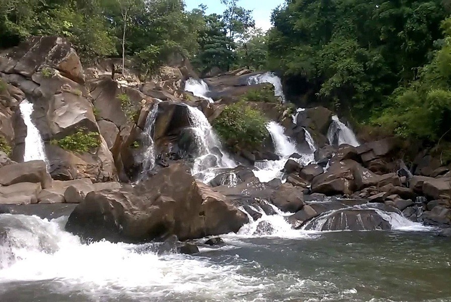
At a distance of 7 km from Mothugudem, 36 km from Chinturu, 65 km from Maredumilli and 102 km from Bhadrachalam, Mothugudem waterfalls is a mesmerizing waterfall situated near Polluru village in Chinturu Mandal of Khammam district in Telangana. Also known as Mothugudem Falls, it is one of the popular places to visit near Maredumilli.
Locally known as Thadikevagu Falls, the waterfall is nestled in the Lakkavaram forest range of Bhadrachalam. This enchanting waterfall has several streams flowing in three stages. It is brimming with visitors from far and near particularly on weekends. The water is crystal clear and take a bath in this falls is very refreshing. The falls is in full spate and avoid getting into the water during monsoon. One can also go for a trek into the surrounding forest.
There is no direct public transportation to reach the falls. Tourists have to make their own arrangements to reach this wonderful destination. One needs to reach Chinturu by bus from Bhadrachalam or Maredumilli and then Mothugudem. There is a mud road till the falls from the entrance.
The area has only very basic facilities so if you are visiting better pack some food. There is no accommodation available near the falls. Visitors need to report at the police station with ID proof as this is an Agency Area.
Timings: 9 AM - 5 PM
Entry: Rs. 10 for Person
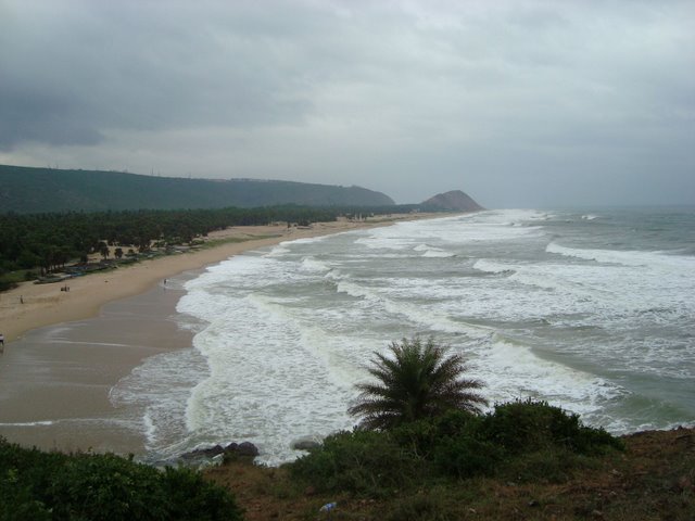
At a distance of 14 Kms from Vizag Railway Station, Yarada Beach is a calm and peaceful beach in the vicinity of Vizag.
This beach offers a fabulous landscape with its exotic blend of golden sands and the lush green stretch of hills. Nestled between the hills on all the three sides and the Bay of Bengal on one side, this beach is an ideal spot for outing. Unlike RK Beach, this beach is not commercialized much.
Similar Getaways