-
Tours
-
-
- Domestic Tours
-
-
- Resorts
- Car Rentals
- Destinations
- Getaways
- Hotels
- Tools
- * Workation
- * Tour Plans
- Blog
- List Property
- * Offers *


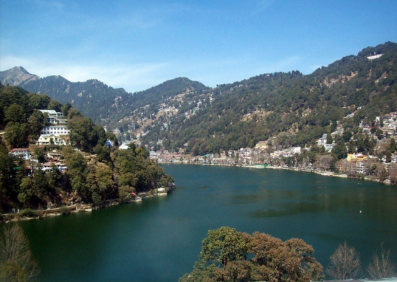
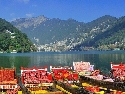
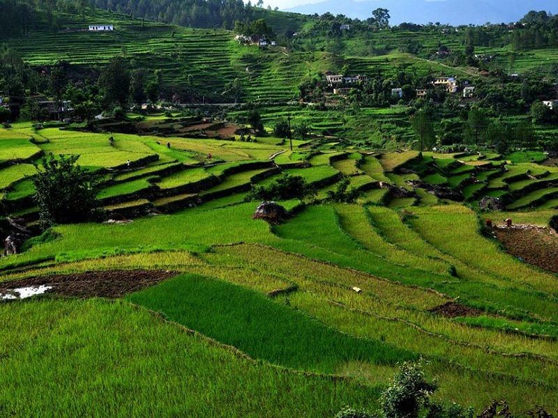
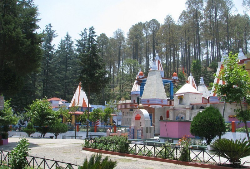
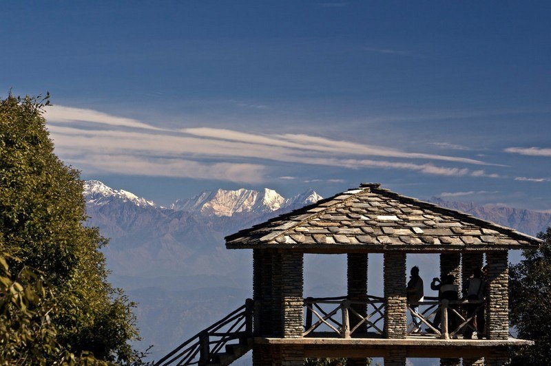
Nainital is a stunningly beautiful hill station in Uttarakhand situated at the Kumaon foothills of Himalayas. It is one of the most popular hill stations in India and among the must-include places in Uttarakhand. Located at 278 km from Dehradun, and 294 km from Delhi, Nainital is famous for its scenic mountain views and is commonly known as the Lake District of India. Situated at an altitude of 1938 m, Nainital derives its name from Naini Lake, among the must include places in Nainital. It attracts large number of domestic and foreign tourists every year.
Nainital is one of the popular hill stations near Delhi. Naina Peak, Nainital Lake, Naina Devi Temple, Mall, Raj Bhavan, High Altitude Zoo, Bhimtal and Sattal are some of the prominent tourist places in Nainital. It usually takes 2-3 days to visit main attractions in Nainital.
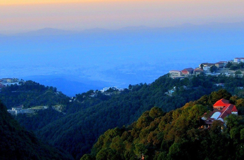
Mussoorie is a majestic hill station in Dehradun district of Uttarakhand state. It is one of the most popular hill stations in India and also among the best tourist places near Delhi.
Situated at 33 km from Dehradun, 197 km from Chandigarh & 278 km from Delhi, Mussoorie is situated in the mountains of Garhwal at an average altitude of 1880 m. It offers commanding views of the underlying Doon Valley and the magnificent Himalayas. Kempty Falls, Camel's Back Road, Mall Road and Dhanaulti are among the main attractions in Mussoorie tour packages. Mussoorie also offers some adventure and shopping opportunities. Tourists can enjoy horse riding or a leisurely walk across Camel's Back Road and a ropeway ride to the top of Gun Hills.
Mussoorie is one of the best places to visit Himachal. It has pleasant climate throughout the year. During spring, the town looks beautiful with blossoming flowers all around and the trees looking lush and green. It usually takes 2 full days to visit main attractions in Mussoorie town. Additional 1 or 2 days can cover Dehradun or Haridwar / Rishikesh.
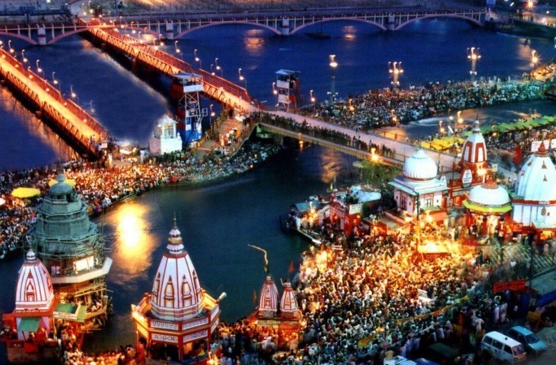
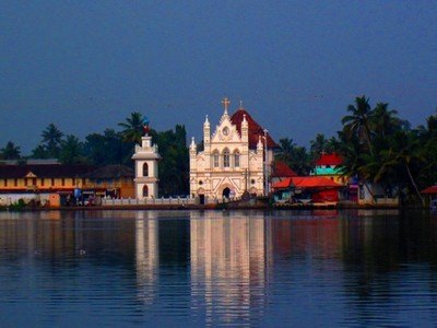
Haridwar, or Hardwar is an ancient religious city in the state of Uttarakhand. About 192 km from Chandigarh, and 208 km from Delhi, it is one of the most visited pilgrimage sites near Delhi and also most popular tourist places in Uttarakhand.
Situated on the banks of the River Ganges, Haridwar, literally translated as Gateway to God, is one of the seven holiest places for Hindus. It is the place where the river Ganga descends to the plains. It serves as a gateway to the Char Dham destinations of Uttarakhand which are Badrinath, Kedarnath, Gangotri, and Yamunotri. Haridwar is also one of the well known places to visit near Chandigarh.
Har-ki-Pauri is one of the most important places to visit in Haridwar where thousands of people take a dip in the holy waters of the Ganges. Chandi Devi Temple, Mansa Devi Temple at Bilwa Parvat, Vaishno Devi Temple, Bharat Mata Temple, Maya Devi Temple, Bhimgoda, Shanti Kunj, Sapt Sarovar, Triveni Ghat, Kanva Rishi Ashram, Chila Wildlife Sanctuary are the other placesto visit as part of Haridwar trip.
Haridwar is one of the venues for the famous Kumbh Mela which takes place once every 12 years. It takes at least 2 full days to visit main attractions in Haridwar. With additional 2-3 days, near by places like Rishikesh, Mussoorie can also be covered.
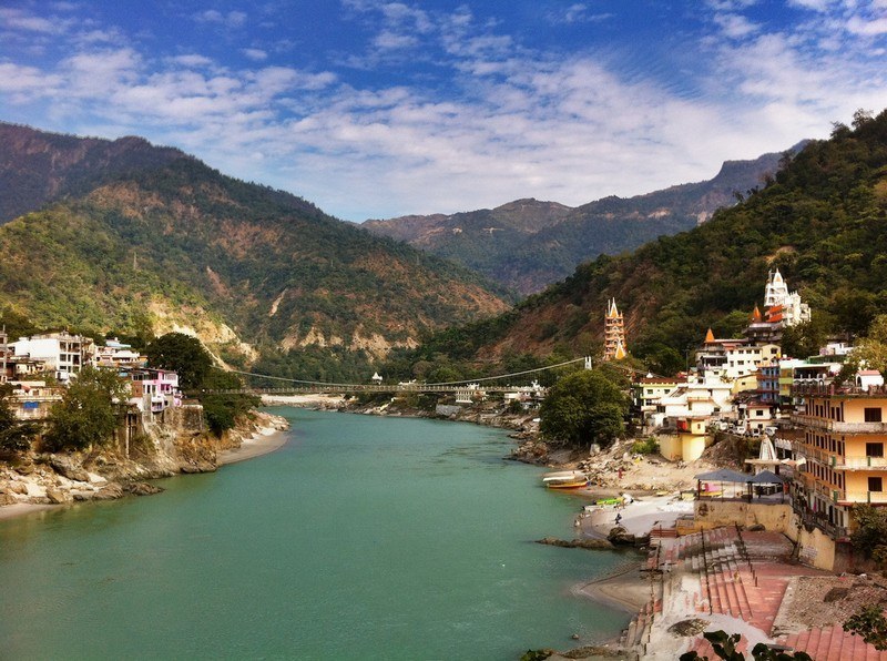
Located at the foothills of the Himalayas, Rishikesh is a holy city on the banks of the River Ganges in Uttarakhand. It is one of the top pilgrimage sites near Delhi, and among the prominent places to visit in Uttarakhand. It is about 42 km from Dehradun, 201 km from Chandigarh, and 233 km from Delhi.
Rishikesh is the gateway to the upper Garhwal region and the starting point for the Char Dham pilgrimage (Gangotri, Yamunotri, Badrinath, and Kedarnath). Rishikesh has several famous ashrams and temples. Triveni Ghat, Neel Kanth Mahadev Temple, Swarganiwas Temple, and Bharat Mandir are the important Rishikesh places to visit.
Rishikesh is now famous as the Yoga Capital of the World. Every year during the February month one-week-long International Yoga Festival is hosted here. One can also try several activities like mountain biking, bungee jumping, and white water rafting as part of Rishikesh trip. It is also the base for several trekking trails in Uttarakhand state. It takes at least 2 full days to visit main attractions in Rishikesh. Additional 2-3 days can also cover near by places like Haridwar, Dehradun or Mussoorie.
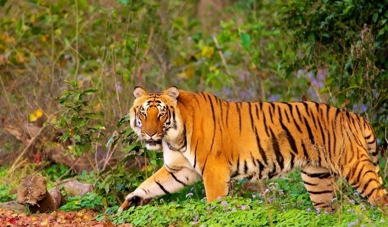
At a distance of 4 km from Ramnagar Railway Station, 65 km from Nainital, 232 km from Dehradun, and 261 km from Delhi, Jim Corbett National Park is India's oldest and most popular National Park. The Park acts as a protection zone for Bengal Tigers of India. It is one of the wellknown wildlife sanctuaries in India and among the best weekend getaways near Delhi.
Corbett National Park was established in 1936 as Hailey National Park. After India's independence the park was named as Ramganga National Park but later in 1956, it was renamed after Jim Corbett - the famous hunter turned conservationist and author, who played a major role in the establishment of the national park. The area came under Project Tiger in 1973. Spread over an area of about 520 sq. km, out of which 330 sq. km forms the core area. Owing to its location in the Himalayan low lands, many streams flow through the park, supporting the diverse vegetation. The altitude of this park ranges from 360 m to 1,040 m. Jim Corbett National Park is among the must include place in your Nainital tour package.
Corbett National Park is one of the best managed and protected areas in the country and attracts thousands of Indian and Foreign visitors each year. It is home to around 50 species of trees, 580 bird species and 25 reptile species. The park is also home to wide variety of wildlife including Tigers, Elephants, Chital, ...
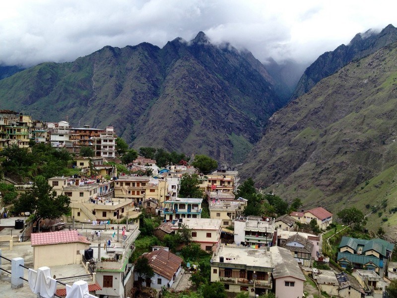
At a distance of 64 km from Nainital, 50 km from Ranikhet, 357 km from Dehradun, and 364 km from Delhi, Almora, a scenic hill station in the Almora district is a famous hill resorts in Uttarakhand. It lies at an altitude of 1,651 m, amidst the southern part of the Kumaon Hills. It is a one of the popular hill stations near Delhi and also of one of the top Tourist places in Uttarakhand.
Almora is located on a 5 km long horse shoe shaped ridge, the eastern portion of which is called the Talifat and the western one is known as Selifat. The Kosi and Suyal rivers run alongside the town adding to the beauty of the place. Almora is considered the cultural heart of the Kumaon region of Uttarakhand. The town got its name from kilmora, a short plant found in nearby region, which was used for washing the utensils of Katarmal Temple. The people bringing kilmora were called Kilmori and later Almori and the place came to be known as Almora. Almora is one of the top attractions you must include in Nainital packages.
Almora was founded in 1568 by Kalyan Chand during the rule of the Chand dynasty. Prior to that the region was under the control of Katyuri King Bhaichaldeo and he has donated part of this land to a Gujrati Brahmin Sri Chand Tiwari. In the days of the Chand Kings it was called Rajapur and was ...
At a distance of 40 km from Kotdwar, 131 km from Rishikesh, 106 km from Haridwar, 158 km from Dehradun and 247 km from Delhi, Lansdowne is a small hill town in Pauri Garhwal district of Uttarakhand. It lies at an elevation of 1706 m above sea level and is surrounded by thick oak and pine forests. It is one of the best hill stations in Uttarakhand state and also among wonderful hill stations for a 2 day trip from Delhi. This is also one of the popular places to experince Uttarakhand tourism and also among the top places to visit near Delhi.
Lansdowne was a popular hill resort for the British and they built a cantonment here. Lansdowne is named after its founder Lord Lansdowne, the Viceroy of India between 1888 and 1894. Currently, the command office of the legendary Garhwal Rifles of the Indian Army is situated in Lansdowne.
Lansdowne is known for its natural beauty and its tranquil environment. The Garhwal Rifles Regimental War Memorial, Regimental Museum, St. Mary's Church, St. John's Church, Durga Devi Temple, Kaleshwar Mahadev Temple, Bhim Pakora, Bhulla Tal, Tip-in-Top or Hawagarh, Tarkeshwar Mahadev Temple and Bhairav Garhi Temple are the important tourist places in Lansdowne. It is famous for its eco-friendly tourism involving ...
At a distance of 37 km from Bageshwar, 58 km from Almora, 59 km from Ranikhet, 115 km from Nainital, 164 km from Pithoragarh, 241 km from Jim Corbett National Park, 318 km from Dehradun, 401 km from Delhi, Kausani is a small hill station situated in Bageshwar district of Uttarakhand, India. Situated at an altitude of 1890 m, Kausani is one of the top hill stations in Uttarakhand and also one of the prime places to visit in Uttarakhand in summer.
During ancient times, Kausani was under the administrative control of the Katyuri king, Baichaldeo. Later, he donated a large part of this land to a Gujarati Brahmin, Sri Chand Tiwari. During Independence of India in 1947, Kausani was a part of Almora district till 1997 after which Bageshwar district was carved out of Almora district. Kausani is among the must include place in your Nainital tour packages.
Located atop the ridge between dense pine trees, Kausani overlooks the Someshwar valley on one side and Garur and Baijnath Katyuri valley on the other side. Described by Mahatma Gandhi himself as the 'Switzerland of India', Kausani is known for its scenic splendor and its spectacular 300 km wide panoramic view of Himalayan peaks like Trishul, Nanda Devi and Panchchuli.
The town's amazing location among thick pine forests and valleys on both sides attracts large number of domestic and international ...
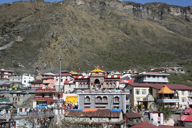
At a distance of 293 km from Rishikesh, 335 km from Dehradun and 523 km from Delhi, Badrinath is an ancient holy town in Chamoli district of Uttarakhand. It lies at an altitude of 3133 m in the Garhwal Himalayan ranges along the banks of River Alaknanda near India - Tibet border. It is one of the most famous centers of pilgrimage in India. It is also one of the most popular places to visit in Uttarakhand and part of Char Dham pilgrimage.
Badrinath is the most important of the four sites of famous Char Dham pilgrimage; the other three being Puri, Dwarka and Rameshwaram. It is also visited as part of Chota Char Dham Pilgrimage along with Kedarnath, Yamunotri and Gangotri in Himalayan region of Uttarakhand. Surrounded by Nar and Narayana mountain ranges and the Nilkantha peak, Badrinath has great mythical significance. According to the epic Mahabharata, Badrinath is the site where Nara and Narayana, the dual forms of Vishnu, did meditation. It is also believed that the Pandavas passed through Badrinath on their way to heaven. Legend has it that Sage Vyasa authored Mahabharata at a cave in Mana, which is about 4 km from Badrinath.
Badrinath is famous for its Badrinath Temple that houses Lord Badrinarayan, an incarnation of Lord Vishnu. The present temple is believed to have been established by saint-philosopher Adi Shankaracharya in the 8th century. Adi Shankara discovered a Saligram idol of Lord Badrinarayan in the river ...
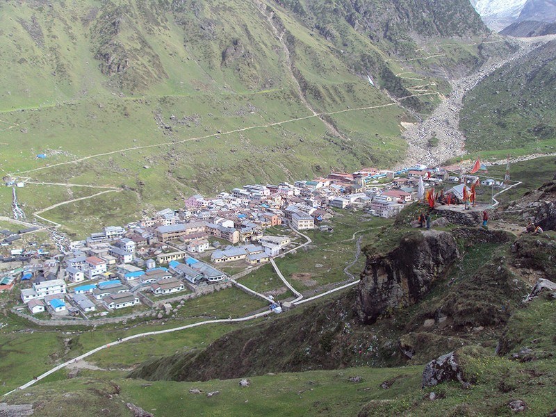
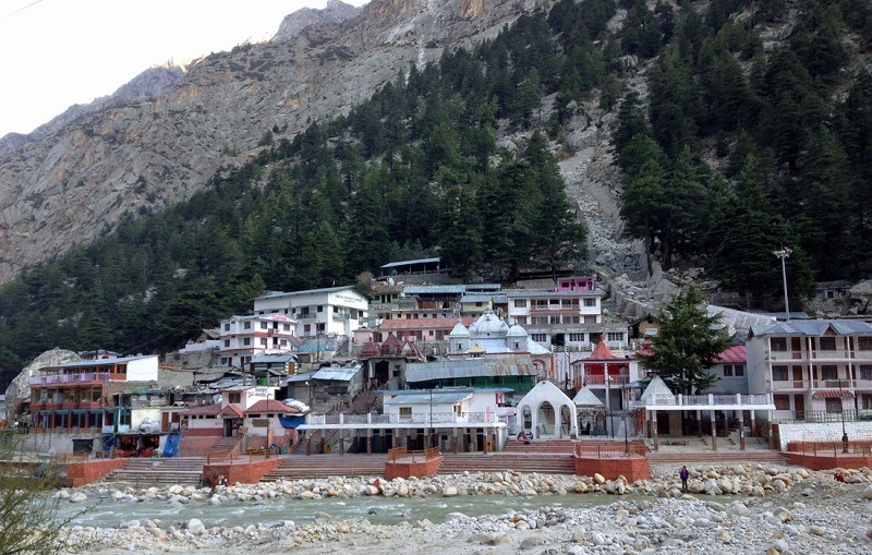
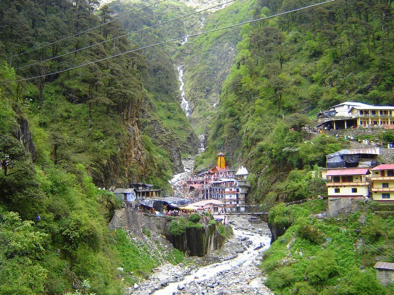
Kedarnath is a town and a famous center of pilgrimage in Uttarakhand situated in Rudraprayag district.
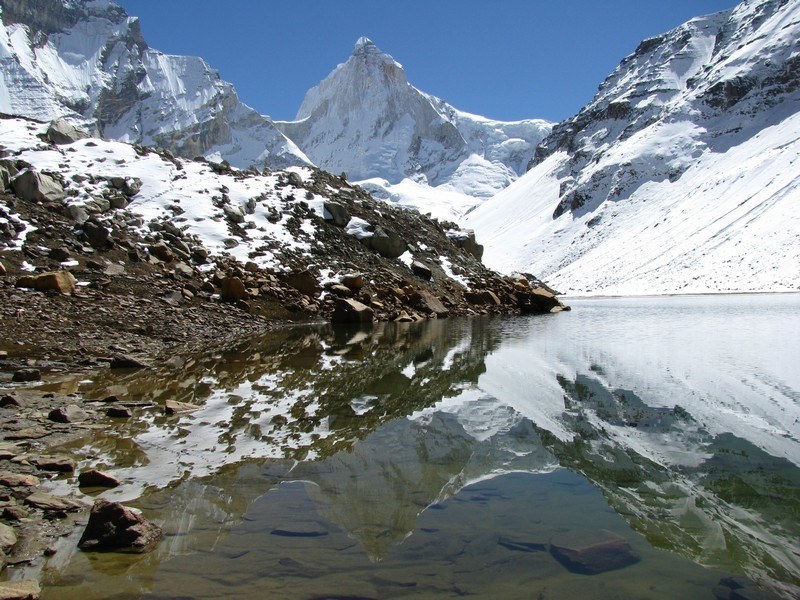
At a distance of 224 km from Rishikesh, 264 km from Dehradun and 439 km from Delhi, Kedarnath is a popular pilgrimage destination for Hindus and is one of the four major Places to visit in Uttarakhand known as Chota Char Dham pilgrimage that also includes Badrinath, Gangotri and Yamunotri. It lies at an altitude of 3584 m near Chorabari Glacier, the head of river Mandakini. It is the most remote of the four Char Dham sites and is flanked by breathtaking snow-clad peaks.
Kedarnath is named after King Kedar. According to a mythology, King Kedar ruled Kedarnath during the Satya Yuga. It is believed that the temple existed even during the time of Mahabharata. It is the place where Lord Shiva absolved Pandavas from the sin of killing their own cousins Kauravas in the battle of Kurukshetra. The famous Kedarnath temple is one of the twelve Jyotirlingas and is thronged by thousands of tourists each year. Other than Kedarnath temple, Bhairavnath temple, Chorabari Tal, Shankaracharya Samadhi and Hans Kund are the some other religious places near Kedarnath.
Kedarnath temple is a major tourist attraction and pilgrims book their hotels way in advance. Rooms in budget hotels and dharamshalas are available under Rs 500 and provide comfortable accommodation ...
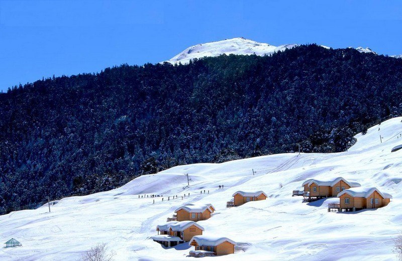
At a distance of 16 km from Joshimath, 56 km from Badrinath, 262 km from Rishikesh, 304 km from Dehradun and 495 km from Delhi, Auli is a cute hill station in Chamoli district of Uttarakhand. It is one of the best ski resorts in India and one of the top Uttarakhand tourism destinations for adventure sports. Known for its snow-cladded surroundings, Auli is one of the best places preferred by many Indians during their honeymoon tour.
Auli, also known as Auli Bugyal which means meadow in Garhwali, is located at an average altitude of 2800 m in the Garhwal Himalayas. Earlier, Auli was a prominent trade centre and the trails of Auli were frequently traversed by the semi-nomadic Bhotiya tribes who maintained barter trading with Tibet for centuries. According to legend, the revered Guru Adi Shankaracharya visited Auli during 8th century AD. He built a math at Joshimath, which still is intact and is known by the name Shankaracharya Tapastali.
Auli is also a beautiful ski destination, but less known compared to Shimla, Gulmarg and Manali. It was only in the recent time, after the creation of new state Uttarakhand, Auli was marketed as a tourist destination. Today, Auli is known for its snow covered slopes and panoramic views of the surroundings. The slopes of Auli ...
At a distance of 98 km from Uttarkashi, 242 km from Dehradun, 264 km from Rishikesh, 288 km from Haridwar and 483 km from Delhi, Gangotri is a popular pilgrimage town in Uttarkashi district of Uttarakhand. It is situated at an altitude of 3100 m in the Garhwal Himalayan Range on the banks of the holy Bhagirathi River. It is one of the best pilgrimage sites in India and also one of the most popular Places to visit in Uttarakhand.
Gangotri, the origin of the River Ganges, is one of the four sites in the Chota Char Dham pilgrimage circuit along with Badrinath, Kedarnath and Yamunotri. River Ganges originates at Gaumukh in Gangotri Glacier, which is located about 19 km away from Gangotri town. As per legends, Goddess Ganges took the form of a river in order to absolve the sins of King Bhagiratha's ancestors, after his severe penance. Lord Shiva received River Ganges in his thick hair locks, to reduce the impact of her fierce flow.
Gangotri is famous for its ancient temples and religious significance. The present Ganga Temple at Gangotri was built by a Gorkha General Amar Singh Thapa in the early 18th century. It is one of the most important temples of River Ganga. The river is called Bhagirathi at the source and acquires the name Ganga from Devprayag ...
At a distance of 50 km from Almora, 56 km from Nainital, 82 km from Haldwani, 325 km from Dehradun, and 350 km from Delhi, Ranikhet is a picturesque hill station and a cantonment town in the Almora district of Uttarakhand. Surrounded by Himalayan mountain ranges, Ranikhet is situated in the upper Kumaon Hills at an altitude of about 1869 m. It is one of the famous Tourist places in Uttarakhand and also among popular hill resorts near Delhi to visit as weekend getaway.
The word Ranikhet stands for Queen's Meadow. As per the folklore, Queen Padmini of Kumaon was so impressed with the natural beauty of this tiny hill paradise and decided to stay here. Later King Sukherdev built a palace for her at this place and named it Ranikhet. Ranikhet is among the prime place to visit on a Nainital tour.
The region around Ranikhet was ruled by local Kumaoni rulers and later came under British rule. The British developed Ranikhet as a hill station for their troops and established a cantonment in 1869. The town of Ranikhet became the headquarters of the British Kumaon Regiment and was also a summer retreat for the British officers. Ranikhet is still a cantonment town and is the Kumaon Regimental Center.
Ranikhet is a popular hill resort well known for the views of the mighty Himalayas. Bhalu Dam, Binsar ...
At a distance of 46 km from Uttarkashi, 134 km from Gangotri, 138 km from Mussoorie, 176 km from Dehradun, 209 km from Rishikesh, 224 km from Haridwar and 415 km from Delhi, Yamunotri is one of the four sites of Chota Char Dham pilgrimage situated in Uttarkashi district of Uttarakhand. It is one of the best sacred pilgrimage sites in India and also one of the most wellknown Places to visit in Uttarakhand.
Yamunotri is the source of River Yamuna and is regarded as the seat of Goddess Yamuna. This is the western most shrine in the Garhwal Himalayas, situated at an altitude of 3293 m atop Bandarpunch parvat. Geologically, River Yamuna originates from the Champasar Glacier, which is located below Bandarpunch Mountain at an altitude of 4421 m. Champasar Glacier is about 1 km upstream from the riverbed near Yamunotri Temple but in order to reach the glacier one has to trek for 10 km from the temple. Yamunotri Temple can be reached by 5 km trek from Janki Chatti which is the nearest road point.
According to the ancient legend, Yamunotri is also believed to be the residence of sage Asit, who used to bath in the Ganges and Yamuna each day. Unable to go to Gangotri during his old age, a stream of the Ganges appeared opposite Yamunotri for him. According to mythology, Goddess Yamuna is the daughter of Lord Surya ...
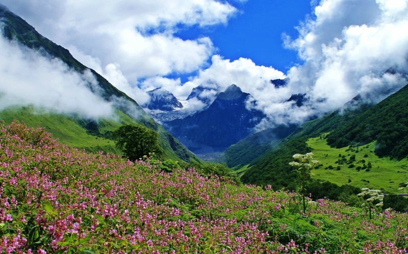
At a distance of 16 km from Govind Ghat, 34 km from Joshimath, 41 km from Badrinath, 277 km from Rishikesh, 300 km from Haridwar, 318 km from Dehradun, and 518 km from Delhi, Valley of Flowers National Park is one of the most popular tourist destinations in India located in Western Himalayas in Chamoli district of Uttarakhand. It is perched at an altitude of 3600 m and is known for its meadows of endemic alpine flowers and the variety of flora. Valley of Flowers is one of the best national parks in India and also among the best Tourist places in Uttarakhand for trekking enthuasists.
Stretching over a vast expanse of 87.50 sq. km, the park is about 5 km long and 2 km wide. The gentle landscape of the Valley of Flowers complements the rugged mountain of Nanda Devi National Park to the east. Together, they encompass a unique transition zone between the mountain ranges of the Zanskar and Great Himalayas. Valley of Flowers and Nanda Devi National Park, together, constitute the Nanda Devi Biosphere Reserve.
The Valley of Flowers was declared a National Park in 1982 and was included in the list of UNESCO World Heritage Sites in 2004. Initially known as Bhyundar Valley, the Park was discovered and renamed in 1931 by British mountaineer Frank Smith. The highest point of the park is Gauri Parbat, at ...
At a distance of 33 km from Mussoorie, 157 km from Chandigarh, 231 km from Delhi, 144 km from Ambala, 225 km from Shimla and 278 km from Nainital, Dehradun is the capital city of Uttarakhand and also the headquarters of Dehradun district. Dehradun is located in Doon Valley in the foothills of Himalayas nestled between two of India's mightiest rivers - the Ganges on the east and the Yamuna on the west. It is one of the wellknown destinations to experience the Tourism in Uttarakhand and also one of the popular tourist places near Delhi.
The history of Dehradun city is linked to the stories of Ramayana and Mahabharata. It is believed that after the battle with Ravana, Lord Rama and his brother Laxmana visited this site. Dronacharya, the legendary Royal guru to the Kauravas and Pandavas, is believed to have been born and resided in this region. Ancient temples and ruins have been found in the nearby areas, which are almost 2000 years old. Dehradun is among the must include place in your Mussoorie tour packages.
The city is famous for its picturesque landscape and pleasant weather. Dehradun is the gateway to the famous hill stations of Mussoorie, Nainital and ...
Dhanaulti is a picturesque hill station situated on Mussoorie - Chamba Road. At a distance of 29 km from Mussoorie, 60 km from Dehradun, and 309 km from Delhi, it is one of the popular weekend getaways from Delhi, and among the best offbeat destinations to visit in Uttarakhand.
Situated at an altitude of 2286 m, Dhanaulti is known for its quiet environment and tranquility. The long wooded slopes, relaxed outdoors, cool crossing breeze, warm and hospitable inhabitants, lovely weather, and fabulous view of snow-capped mountains, makes Dhanaulti an enticing hideaway for tourists. Away from the city hustle-bustle, devoid of fancy hotels and modern cafe-style eateries, Dhanaulti is the place for those who seek a weekend of privacy in the hills. Eco Park, Surkhanda Devi Temple, Camp Thangdhar, Potato Farm, Dhanaulti Adventure Park, Dashavatar Temple, Deogarh Fort, Kanatal Adventure Camp, and Tehri Dam are some of the top places to visit in Dhanaulti as part of Uttarakhand Tour Packages.
Also, Dhanaulti is the base point for numerous treks into the snow-capped Himalayas like Surkanda Devi, Chandrabadni, and Kunjapuri. Camp Thangdhar in Thangdhar village at a distance of 14 km from Dhanaulti is an adventure camp for those interested in mountain adventure.
At a distance of 26 km from Lata Village, 52 km from Joshimath, 94 km from Badrinath, 300 km from Rishikesh, 345 km from Dehradun, 327 km from Haridwar and 535 km from Delhi, Nanda Devi National Park is situated in the higher ranges of Himalayas in Chamoli district of Uttarakhand. The entire park lies at an altitude of 3,500 m and is surrounded by the Nanda Devi Mountains on three sides. It is one of the most scenic national parks in India apart from being a top trekking destination as well as one of the popular Tourist places in Uttarakhand.
The Nanda Devi basin was declared a game sanctuary in 1939. In 1982, an area of 630.33 sq. km was added and it was declared a national park, which now forms the core zone of Nanda Devi Biosphere Reserve. Along with adjoining Valley of Flowers National Park, Nanda Devi Park was inscribed as UNESCO World Heritage Site in 2004.
Nanda Devi National Park covers an area of 630.33 sq. km, which is surrounded by a buffer zone of 5148.57 sq. km. The whole region of Nanda Devi National Park falls under the Western Himalayas Endemic Bird Area (EBA). The park is divided into two parts - Inner Sanctuary and Outer Sanctuary. The Upper Rishi Valley, often referred to as the Inner Sanctuary is featured by Changabang, North Rishi and North Nanda Devi glaciers. The Trisul ...
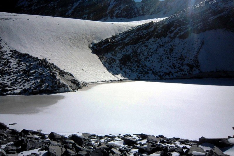
At a distance of 3 km from Kedarnath, Chorabari Tal, also known as Gandhi Tal, is a beautiful lake produced from the Chorabari Bamak glacier.
Chorabari Tal is a small lake that holds crystal clear water. Perched at an altitude of 3,900 m above sea level, Gandhi Sarovar lies on the foot of Kedarnath and Kirthi Stambh peak. It offers magnificent views of the surrounding Himalayan peaks.
The original name of the lake is Kanti Sarovar. In the year 1948, some of Mahatma Gandhi's ashes were immersed here, after which it was renamed Gandhi Sarovar. According to mythology, this lake was the place where Lord Shiva imparted the knowledge of Yoga to the Saptrishis. There is a Bhairava Temple close to the glacier adjacent to a cliff known as Bhairava Jhamp. The cliff was a place where devotees jumped off, believing that it would bring them mukti. The practice was banned by the British administration in the 19th century.
The lake demands a trek of 3 km and is visited in summer. It is advised to visit Gandhi Sarovar early in the morning, because the weather of this region changes rapidly. The 3 km trek commences from the iron bridge of Kedarnath and ends up at Gandhi Sarovar. The trek is easy and beautiful through grassy fields. There is a beautiful Madhu Ganga waterfall enroute to this lake.
At a distance of 37 km from Lansdowne and 69 km from Kotdwar, Tarkeshwar Mahadev Temple is an ancient temple situated in the Pauri Garhwal district of Uttarakhand. Located atop a hill at an elevation of 2092 m, Tarkeshwar Mahadev Temple is believed to be one of the ancient holy sites known as Siddha Piths dedicated to Lord Shiva. It is one of the famous temples of Uttarakhand state.
According to the legend, Tarkasur was a demon who meditated and worshiped Lord Shiva at this location for a boon. Pleased by his devotion, Lord Shiva gave him a boon of immortality as per Tarkasur request except from Lord Shiva's son. Tarkasur started being evil by killing saints and threatening gods. Sages asked for help from Lord Shiva. Disturbed by wrong doings of Tarkasur, Lord Shiva married Parvati and Kartikeya is born. Kartikeya soon killed Tarkasur but at the time of death Tarkasur makes prayer to Lord Shiva and asked for pardon. Mahadev then attached his name to the temple where Tarkasur meditated once. Hence the place named as Tarkeshwar Mahadev.
The Presiding deity of this temple is Lord Shiva. The temple is located amidst thick forests of Deodar, Cedar and Pine. Earlier there was a Shivling present at the Tarkeshwar Mahadev temple, but now a Lord Shiva idol performing tandava is worshiped. The Shivling in the temple is placed under the idol of the deity. A temple dedicated to Goddess Shakti lies adjacent to the main temple. According to another myth, it is said that Goddess ...
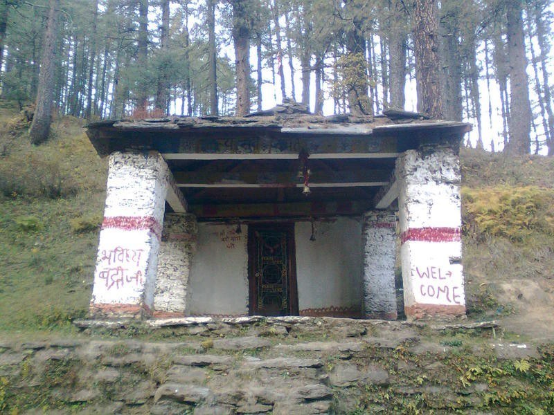
At a distance of 23 km from Joshimath and 35 km from Auli, Bhavishya Badri, also spelt as Bhabisya Badri, is situated near Subhain village of Niti Valley on the way to Lata from Tapovan in Uttarkashi district of Uttarakhand.
Bhavishya Badri is one of Panch Badri temples located at a height of 2744 m above sea level. The presiding deity of this small temple is Lord Narsimha, an incarnation of Lord Vishnu and known to be the future seat of Badrinath. According to the legend of Bhavishya Badri, at the end of Kali Yuga, a landslide will occur collapsing Nara and Narayan hills and blocking the path to Badrinath. This devastating landslide will occur when the right arm of the statue of Narasimha currently situated in Joshimath detaches from its body. Then, Badrinath will appear at the Bhavishya Badri temple and be worshipped here, instead of the Badrinath shrine.
Bhavishya Badri can be reached via Saldhar which is 18 km by road from Joshimath. Saldhar is situated on the way to Lata from Tapovan in Niti valley. From Saldhar, about 5 km trek will lead to Bhavishya Badri. The initial trekking path from Saldhar to Subhain village (3 km) is very steep and approximately takes one hour. From Subhain, the destination is about 2 km trek through unmarked path. It is advised to take a guide at Subhain village to complete the remaining part of the trek. Accommodation cab be arranged in home stays by villagers of Subhain.
Best ...
At a distance of 3 km from Chopta, 32 km from Ukhimath, 88 km from Kedarnath, 73 km from Rudraprayag, Tungnath is one of the Panch Kedar temples and at an altitude of 3,680, it is the highest Shiva temple in the world. It is located on the Chandranath parvat in the Rudraprayag district of Uttarakhand. It is a well know pilgrimage center and also a frequented place of trekking in Uttarakhand.
Tungnath temple is dedicated to Lord Shiva. The temple is believed to be 1000 years old and is the third in the order of the Panch Kedars. This sacred temple was discovered by Adi Shankaracharya. According to mythology, Vyas Rishi told the Pandavas that since they were culpable of slaying their own cousins during the Mahabharata war; their act could be pardoned only by Lord Shiva. Pandavas began to search Lord Shiva in the Himalayas and Lord Shiva kept avoiding them because they were guilty. In order to escape from the Pandavas, Lord Shiva disguised himself as a bull and took refuge underground. The places where the parts of the bull were found are now renowned Shiva temples, where Pandavas built temples of Lord Shiva at each location, to worship and venerate, seeking his pardon and blessings. Each one is identified with a part of his body; the navel and stomach at Madyamaheshwar, the hump at Kedarnath, the arm at Tungnath, the face at Rudranath, and his jata (hair or locks) at Kalpeshwar.
The temple was built in the Nagara style of architecture. It is a small shrine and can accommodate ...
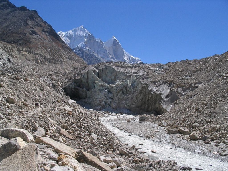
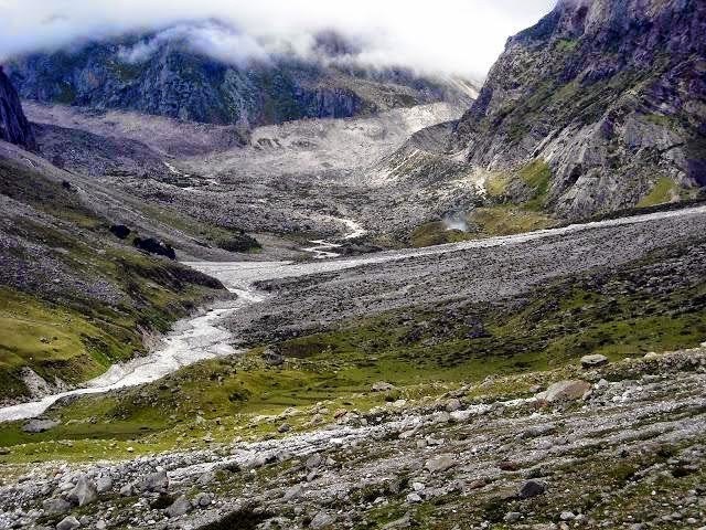
At a distance of 19 km from Gangotri, Gomukh or Gaumukh is the source of Bhagirathi River situated in Uttarkashi district of Uttarakhand. The word Gomukh literally means Face of a Cow because earlier the snout exactly looked like face of a cow. It is one of the popular pilgrimage and trekking site near Gangotri.
Gomukh is one of the primary sources of the Ganges River. The sight of Gaumukh is incredible with Bhagirathi emerging out of an enormous cavern. The place is situated at a height of 13,200 feet and is the second largest glacier of India with 30 km in length and 4 km in width, first one being Siachen. The river is called Bhagirathi at the source and acquires the name Ganga from Devprayag onwards where it meets the Alaknanda. From Devprayag, the river flows 2,480 km to meet Bay of Bengal.
Gaumukh is a popular Hindu pilgrimage site as well as trekking destination. The Gomukh snout, due to the excessive visits of the tourists is rapidly moving backwards. According to the modern research the snout has moved 1 km in just 70 years. The trail to Gomukh begins from Gangotri, about 19 km from Gomukh. It was heavily damaged by rockslides during 2013 floods. The path is narrow and the terrain is rough. About 9 km ahead of Gangotri is Chirbasa, the abode of Chir trees. After 4 km of Chirbasa comes the dangerous Gila Pahar, the place well known for its landslides.
Only 2 km from Gila Pahar is Bhujbasa, the only night halting place on the way with accommodation. ...
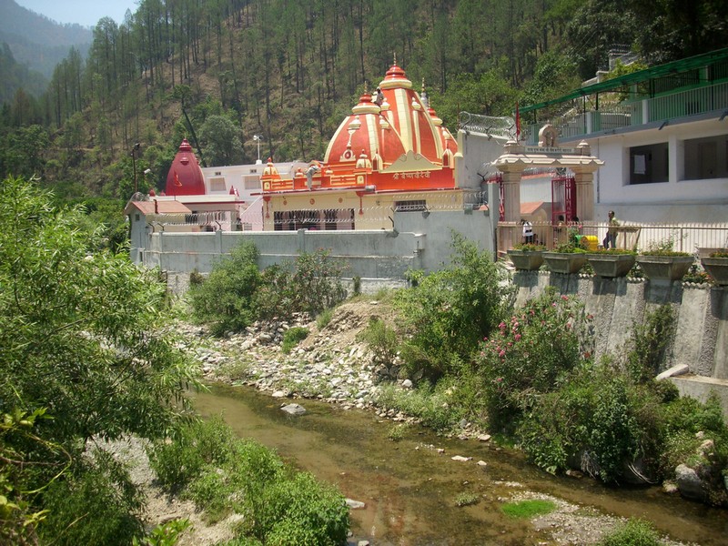
At a distance of 18 km from Ranikhet, Binsar Mahadev Mandir is an ancient Hindu temple situated at Bisaona near Ranikhet in Uttarakhand. The temple is surrounded by thick deodar forests and lies at an altitude of 2480 m. This is among the most visited temples in Uttarakhand.
The Binsar Mahadev Temple is dedicated to Lord Shiva worshipped here as Bindeshwar. The temple was built in 10th century by King Pithu in memory of his father Bindu, hence this temple is also known as Bindeshwar temple. The temple also houses the idols of Lord Ganesha, Goddess Gauri and Goddess Mahisasuramardini. The idol of Mahisasuramardini is engraved with texts in Nagarilipi which dates back to as early as the 9th century.
The temple is known for its fine architecture. It is believed that Binsar Mahadev temple was built in a single day. The surroundings of the temple offer beautiful views of fresh water springs and cedar forests. It is a unique place for meditation and picnic. The temple also has an ashram nearby, dedicated to Binsar Mahadev.
A large number of devotees came here on the occasion of Baikunth Chaturdashi in the month of June. It is said that devotees, especially women, pray all night with lamps in their hands on this day for the Lord's blessings. Binsar Mahadev is famous for its Archeological significance.
Timings: 7 AM to 7 PM
At a distance of 20 km from Auli, 27 km from Joshimath, 21 km from Tapovan & 17 km from Gurson Bugyal, Kuari Bugyal is a famous meadow known for untouched beauty of Himalayas situated at an altitude of 3350 m. It is well known for one of the famous trekking trails in Uttarakhand, Kuari Pass Trek.
Kuari Bugyal is perfect place for trekking. During summer season, tourists throng to this place to explore the trekking trails of this beautiful region. Lord Curzon made the trek to Kuari Pass, and since than it has come to known as Curzon's trail. It is very popular among European and American travelers.
There are four trekking routes to reach Kuari Pass with different starting points at Auli, Ghat, Joshimath and Tapovan. The Ghat route is the longest trail with a length of 40 km spread across 4-5 days while Auli route is shortest which is 20 km long and take about 3 days. All the trails reach Gailgarh, from where Kuari Pass is scaled on same day and returned back to the base camp. Among these four trails, Auli route is most famous and most frequented trekking path to Kauri Pass.
Trekkers can hire porters, guides, camping equipment and cooks from the Joshimath base camp. It is also an amazing place to watch the magnificent mountains like Nandadevi, Dunagiri and Trisul from very close.
Route 1: Auli - Gorson - Gailgarh - Kuari Pass (20 km trek, 3 days)
Route 2: Ghat - Ramni - Sanatoli - Kuari Pass (10 km motor + 40 km trek, 5-6 days)
Route 3: Joshimath ...
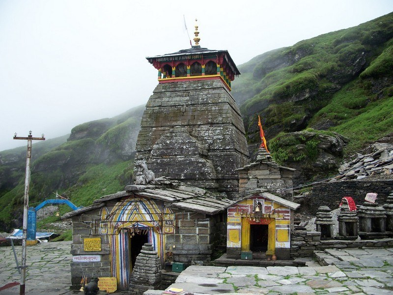
At a distance of 25 km from Gopeshwar, 83 km from Ukhimath and 140 km from Kedarnath, Rudranath is a pilgrimage site dedicated to Lord Shiva, situated in the Chamoli district of Uttarakhand. It lies at an altitude of 2286 m in the Garhwal Himalayan Mountains. Rudranath is the third temple to be visited in the Panch Kedar pilgrimage circuit. It is a popular pilgrimage site and also a famous place for trekking in Uttarakhand.
The Rudranath temple is believed to be established by the Pandavas, the heroes of the Hindu epic Mahabharata. Legend has it that the Pandavas came to the Himalayan mountains in search of god Shiva, to redeem them of the sins of killing Kauravas in the epic Kurukshetra war. God Shiva did not wanted to meet them and escaped in form of a bull in the ground and reentered in parts in the Panch Kedar places: the hump raising in Kedarnath, the arms appearing in Tungnath, the navel and stomach surfacing in Madhyamaheshwar, the face showing up at Rudranath and the hair and the head appearing in Kalpeshwar.
Rudranath is situated amidst thick forests; here the face (mukha) of god Shiva is worshipped as Nilkanth Mahadeva. The deity is a Swyambhu (self-manifested) Shivalinga shaped like a human face formed by the projection of a huge rock. There are numerous sacred water tanks near the temple. These include Surya-kund, Chandra-kund, Tara-kund, Mana-Kund etc. Nanda Devi, Trishul and Nanda Ghunti are the famous mountain peaks, which provide the backdrop to the ...
At a distance of 23 km from Gangotri, 9 km from Bhojbasa and 5 km from Gaumukh, Tapovan is an area consisting of beautiful meadows at the feet of Mt. Shivling in Uttarkashi district of Uttarakhand. It lies at an altitude of 4460 m in Garhwal Himalayas beyond Gomukh.
Tapovan means forest of penance and as the name suggests it is actually a cold barren dry land suitable for offering penance. Tapovan area is full of meadows, streams and flowers. It is one of the most visited trails in Uttarakhand trekking. These meadows are considered as one of the best high altitude meadow in India. Tapovan area is base camp for several mountaineering expeditions including Shivling peak, Bhagirathi peak etc.
The trek to Tapovan begins from Gangotri and the trek is considered as moderate to difficult. It is a 4 day trek from Gangotri to Tapovan and back. Tapovan can be reached by two routes; the first one is the classic route which goes via Gaumukh Glacier. One has to trek 15 km to reach Bhojbasa from Gangotri. Gaumukh is 4 km from Bhojbasa and Tapovan is 5 km beyond Gaumukh. After reaching Gaumukh Glacier one need to traverse the glacier and climb a rugged track to reach Tapovan. The Tapovan trek is done as a four day trip from Gangotri.
To take the second route, trekkers need to cross Bhagirathi River at Bhojbasa. From here, 9 km long trek on moraine and small ridges will lead to Tapovan. The Tapovan campsite is located at the foot of Mount Shivling (6,543 m). There is also ...
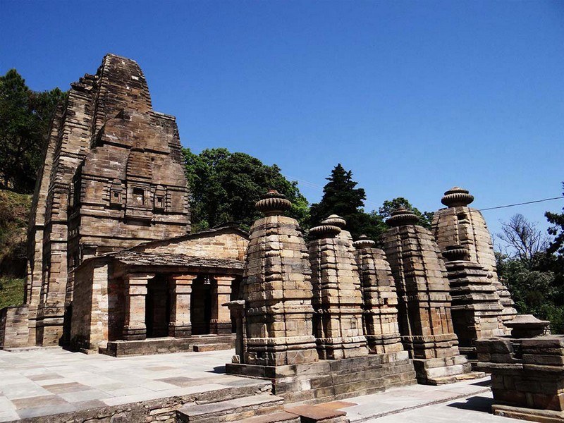
At a distance of 34 km from Ranikhet & 77 km from Almora, Dwarahat is an ancient town situated in Almora district of Uttarakhand. It is famous for its ancient temples which were constructed mainly by the Katyuri kings and are maintained by ASI.
Dwarahat, which means Way to Heaven, was once the principal seat of the Katyuri kings whose empire was stretched from the Sutlez River in the west to river Gandak in the east, and from the Himalayas to the plains, including the whole of Rohelkhand. Later it came under the rule of the Chand Rajas of Kumaon in the sixteenth century.
Dwarahat has 55 ancient temples of exquisite architectural excellence, divided into 8 groups. Some temples now have great archaeological value. These were constructed in the Indo-Aryan, Maru-Pratihara or Nagara type. The temples are constructed mainly of masonry blocks of Pre-Cambrian granite available in the nearby area. Instead of mortar, iron clamps and dowels have been used to tie adjoining blocks.
Badrinath Group of Temples has three temples, of which the main temple is dedicated to Lord Vishnu, worshiped as Badrinath. Constructed in Sikhara style facing east, it consists of garbhagriha, antrala and mandapa. The black stone image of Vishnu is placed in the sanctum. The temple bears an inscription of samvat 1105, suggesting the date of the construction of the temple as 1048 AD. There are two more miniature shrines in the group; one ...
At a distance of 20 km from Chamoli Gopeshwar, 23 km from Karnaprayag, 74 km from Auli and 60 km from Joshimath, Nandaprayag is a town and a nagar panchayat in Chamoli district of Uttarakhand. Situated at an altitude of 870 m, it is a well known places of pilgrimage in Uttarakhand state.
Nandaprayag is one of the Panch Prayagas of Alaknanda River, and lies at the confluence of Alaknanda River and Nandakini River. Nandaprayag, Vishnuprayag, Karnaprayag, Rudraprayag and Devprayag form the Panch Prayagas. The source of Alaknanda River is Satopanth near Badrinath Dham and Nandakini River is emerging from the foot of the Nanda Devi Peak. It is believed that a holy dip in the confluence of Nandaprayag washes all the sins.
Nandaprayag was once the capital of Yadu Kingdom. Raja Nanda performed yagna on a stone which was later used as the foundation of the Nand temple situated in Nandaprayag. According to the legend, Raja Nanda was promised the boon of Vishnu as a son. Unfortunately, the same boon was also granted to Devaki, wife of Vasudeva. Finally the gods found a solution to the problem that Vishnu would be born as Krishna to Devaki but would be brought up by Raja Nanda's wife, Yasodha. There is temple for Gopal, an alternate name to Lord Krishna, here. The legends also narrate that sage Kanva did penance here and also that wedding of King Dushyanta and Shakuntala took place at this venue.
It serves as a gateway ...

At a distance of 11.5 km from Badrinath and 6 km from Mana Village, Vasudhara Falls is one of the famous tourist attractions around Badrinath. It is one of the popular places for short trekking near Badrinath.
Vasudhara Falls is surrounded by beautiful mountain peaks. The water of this cascading falls flows down from the height of 400 feet and is situated at an altitude of 12,000 feet. The falls is considered as a haunting site. There is a myth behind this waterfall that the water of Vasudhara Falls turns away from the visitors who are not pure at heart. From a distance, the water of the fall appears like milk flowing down the mountain.
The fall looks stunning during monsoon & post monsoon season with lush greenery and beautiful mountains around. March to June is the ideal time to visit this waterfall. Mana is accessible only when Badrinath season starts in Apr/May, so the best season to visit this place is between May and June.
Visitors have to trek 6 km from Mana village to reach the falls. The trekking from Mana to Vasudhara takes about two hours one way. The first 2-3 km is comparatively easy to walk. But, after passing the Saraswati Mandir, the trek becomes difficult as the trail becomes very steep. The views of Vasudhara river valley during this trek are very scenic. A bath under the falling water is very refreshing and adventurous. One can see mountains like Chaukhamba, Nilkantha and Balakun from ...
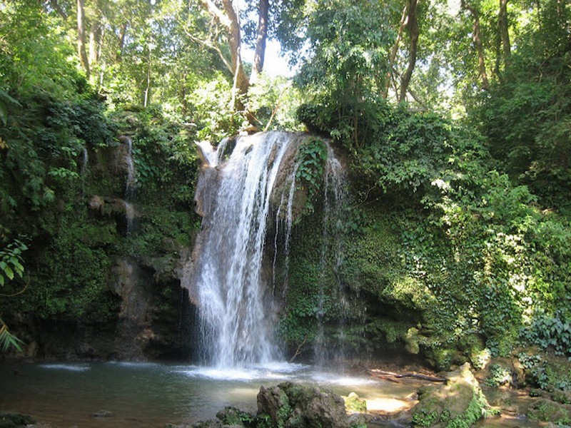
At a distance of 10.5 km from Mussoorie Library Bus Stand, Bhatta Falls is situated on Mussoorie - Dehradun Road near Bhatta Village. This fall is one of the major tourist attractions and also among the best waterfall to include in Mussoorie tour.
Bhatta Falls is a natural waterfall cascading down from a height of 30 feet into a naturally encircled pool. This waterfall is relatively untouched by commercialization and a good place to spend some time. Visitors can see several picturesque locations ideal for photographer to catch nature at its best. The pond at bottom of the falls provides some opportunity for swimming. There is also a children's park, slopes and swings are provided for playing purpose.
Bhatta Falls is easily accessible by car or bus from Mussoorie and Dehradun. The falls about 100 meters from parking area and can be reached through well laid steps.
Timings: 8 AM to 5 PM
At a distance of 12 km from Helang, 27 km from Joshimath and 56 km from Gopeshwar & 215 km from Kedarnath, Kalpeshwar is a pilgrimage site dedicated to Lord Shiva located in the picturesque Urgam valley in Chamoli district of Uttarakhand. It lies at an altitude of 2200 m in the Garhwal Himalayas. It is a part of the famous Panch Kedars and also a good trekking route near Joshimath.
Kalpeshwar temple is the fifth temple to be visited in the Panch Kedar pilgrimage circuit, comprising five Shiva temples in the Garhwal region. Kalpeshwar is the only Panch Kedar temple accessible throughout the year. This temple is a small stone temple and has a stone idol of Lord Shiva. Nearby the temple is a cave upon which is the image of hair locks are carved naturally. These are considered to be the hair locks of Lord Shiva that appeared in Kalpeshwar. Hence, Lord Shiva is also called as Jatadhar or Jateshwar. Kalpeshwar houses the famous Kalpavriksha. This tree is believed to fulfill all the wishes of a person.
The Kalpeshwar temple is believed to be established by the Pandavas, the heroes of the Hindu epic Mahabharata. Legend has it that the Pandavas came to the Himalayan mountains in search of god Shiva, to redeem them of the sins of killing Kauravas in the epic Kurukshetra war. God Shiva did not wanted to meet them and escaped in form of a bull in the ground and reentered in parts in the Panch Kedar places: the hump raising in Kedarnath, the arms appearing in Tungnath, the navel ...
At a distance of 61 km from Ghuttu village and 15 km from Kedarnath, Mayali Pass is situated at an elevation of 5300 m in Bhilangana Valley and it offers great views of Masar Tal and Vasuki Tal. Also the pass is famed for the spectacular view of Thalay Sagar, Kedar dome and other peaks of Gangotri region.
Mayali Pass is a famous place for trekking in Uttarakhand and is followed by many trekkers every year. In ancient time this trek was used by pilgrims to travel between Gangotri and Kedarnath. The Mayali Pass trek route starts from Ghuttu and the goes along Bhilangana valley. The Mayali Pass trek from Ghuttu to Gaurikund is of moderate difficulty. The trek offers an extraordinary experience of Himalayan peaks. The remote Indian villages of Gangi, Bhilangna River Catchment, Thalay Sagar peak, and Khatling glacier are the highlights of Mayali Pass trek.
Mayali Pass is approachable by two routes. One is from Ghuttu and the other is from Mala, a village right above Uttarkashi. The route from Mala goes through a lot of grasslands and is very beautiful, but takes two weeks. The route from Ghuttu is the shorter one and is 9-10 days trek.
The trek starts from Ghuttu and moves parallel to River Bhillangna via Reehi, Gangi, Kalyani, Kharsoli, Tambakund and then reaches Khatling Glacier, the source of River Bhilangna. Chowki, a meadow near Khatling Glacier is an amazing camping ground with great view of peaks, the most impressive being Thalay Sagar peak. From Chowki, ...

At a distance of 30 km from Badrinath and 25 km from Mana, Satopanth is a mountain lake situated close to Swargarohini Peak in the Chamoli district of Uttarakhand. It is situated at an altitude of 4,600 m (15,100 feet) in Garhwal Himalayas. It is one of the well known destination for trekking in Uttarakhand.
Satopanth is a triangular lake with three corners spread within the circumference of about a kilometer. The lake is surrounded by snow covered peaks and is named after the Hindu gods Mahesh, Vishnu and Brahma. It is believed that the divine Trinity of Brahma, Vishnu and Mahesh had meditated here and each corner of the triangular lake is named after them.
The lake is considered to be of religious significance to the local people. There is a saint known as Moni Baba, who stopped talking several years ago. There is a common belief that he can live only on sun and air, if food is unavailable. Also some unique birds are found here, which pick up the pollutants of the lake and thus keep the lake clean. The local belief is that these birds are Gandharvas who guard the lake against evils. The lake can be reached by trek crossing Lakshmivan and Chakratirtha. It is said that goddess Lakshmi and her husband Narayan meditated in Lakshmivan and Chakratirtha respectively and while meditating Narayan kept his famous Sudarshan Chakra on the valley which depressed by the weight of that Chakra to form a beautiful round shaped meadow surrounded by lofty mountains.
Satopanth ...

At a distance of 38 km from Badrinath and 33 km from Mana, Swargarohini is a mountain range in the Saraswati Range of the Garhwal Himalayas. It lies in the Uttarkashi district of Uttarakhand, west of the Gangotri group of peaks. Swargarohini is 8 km trek from Satopanth Lake. It is one of the best trails among Uttarakhand trekking.
Swargarohini is a group of four peaks, of which Swargarohini I draws the attention and lies at a height of 6252 m. Swargarohini trek is the only trek which allows trekkers to go deep inside the Greater Himalayas. This trek is famous for enchanting rocky views and exhaustive conditions. Swargarohini derives its name from the legends associated with the peak which mentions that the path leads to heaven and it was followed by Pandavas & Draupadi.
The ideal time to visit Swargarohini is from May to October. The trek starts from Mana, 5 km ahead of Badrinath. The trek from Mana village to Swargarohini is difficult and requires local guide. This route is trekked by very few people and requires porter to carry tent and food. Visitors have to take the regular trekking route to Vasudhara, the trail ascends higher and then crossing a dangerous Dhano Glacier. Trek from Mana village to Lakshmivan (8 km) is picturesque. The 13 km trek from Lakshmivan to Chakratirth is little tough. The 4 km trek from Chakrathirth to Satopanth Lake is even tougher. But the beautiful view of the mountains alongside is ...
At a distance of 9 km from Badrinath, Nilkantha is a snowy peak in the shape of a pyramid near Badrinath in Chamoli district of Uttarakhand. The peak is situated at an elevation of 6,597 m above sea level. It is one of the best trekking trails in Uttarakhand.
Neelkantha, which is also known as the Garhwal Queen, is named after Lord Shiva. From a distance the peak resembles Lord Shiva sitting in meditation. It receives the first ray of Sun which glimmers the valley. Nilkantha is a major peak of the Garhwal Himalayas in the Uttarakhand region. Although substantially lower than the highest peaks of the region, it towers dramatically over the valley of the Alaknanda River and rises 3,474 m above Badrinath. Frank Smythe described the peak as second only to Siniolchu in Himalayan Beauty.
The Satopanth Glacier is on the northwest side of Nilkantha, the Panpatia Glacier remains on the southwest side and feeds Khirao Ganga, a small stream that runs under the south side of the peak. Few successful ascents have been reported on Mt. Neelkanth, the first climb from its western ridge was attempted in 1993 by two British Climbers.
The best time to visit Neelkanth Peak is from June to September. The 10 km long Nilkantha trek starts from Badrinath. Trek from Badrinath to Charan Paduka (3 km) is picturesque and visitors can visit the foot prints of Lord Vishnu along with Rishi Ganga Falls here. The 6 km trek from Charan Paduka ...
At a distance of 22 km from Badrinath and 21 km from Joshimath, Pandukeshwar is a sacred village in the Chamoli district of Uttarakhand. It lies at an altitude of 6300 feet and is situated on the way to Badrinath. It is a famous pilgrimage center situated between Joshimath and Badrinath.
According to legend, Pandukeshwar was established by King Pandu, father of great Pandavas of Mahabharata epic. He was living with his wives Kunti and Madri in Pandukeshwar after giving his throne to his elder brother Dhritharashtra. One day Pandu went on hunting in the jungle and unintentionally killed a sage making love in deer form. While the sage was dying he cursed Pandu that he will not be able make love with anyone and if he does, he will die instantly. To get cleanse of sin of killing of the sage, Pandu installed the bronze image of Vishnu in the Yogadhyan Badri shrine and mediated. Meanwhile Kunti and Madri gave birth to Pandavas through yogadhyan. Once, Pandu got attracted towards Madri who was taking bath in Alakananda River, soon Pandu died due to curse of sage.
There are two famous temples in Pandukeshwar. Yogadhyan Badri Temple, one of Sapta Badri shrines and other is Lord Vasudev Temple. Pandu is believed to have installed the bronze image of Vishnu in the Yogadhyan Badri shrine. Copper plate inscriptions found here indicate rule by early Katyuri Rajas and the region was known as Panchal Desh, now known as Uttarakhand.
The ...
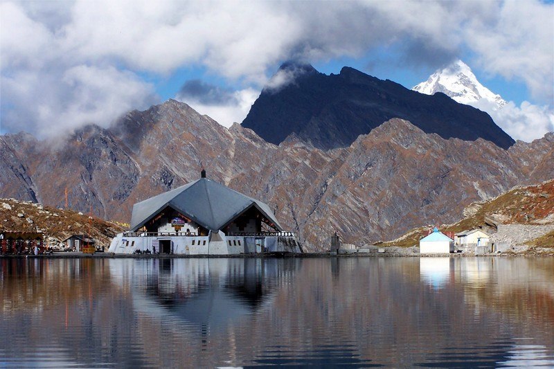
At a distance of 18 km from Govind Ghat, 42 km from Badrinath and 36 km from Joshimath, Hemkund Sahib is a well-known Sikh shrine located in Chamoli district of Uttarakhand. It is also known as Gurudwara Hemkunt Sahib and is one among the 508 important pilgrimages for Sikhs. Situated near Valley of Flowers, it is also a popular place for trekking in Uttarakhand apart from being one of the most scenic places in Himalayas.
Gurudwara Hemkund Sahib is dedicated to Guru Gobind Singh, the tenth Sikh Guru. This gurudwara is situated at an altitude of 4329 m and is surrounded by seven snow-capped mountain peaks. This gurudwara is the world's highest gurudwara and is visited by both Sikhs as well as Hindus. It is believed that at this particular spot Guru Gobind Singh meditated for a long time. According to Hindu mythology, Rishi Medhasa of the Markandeya Purana and Lord Ram's younger brother, Lakshman, performed penance at this site.
The construction of this gurudwara started in the mid-1960s, after Major General Harkirat Singh of the Indian Army discovered it. This star shaped Gurudwara is made up of white marbles and concrete. It is located on the shores of the pristine Hemkund Lake. The circumference of the crystal clear Lake is 2 km and its clear, still waters mirror images of the Saptashringa Peaks which surround it. A small temple dedicated to Lakshman, brother of Lord Rama is also located in the vicinity of the gurudwara.
This gurudwara can be reached only ...
At a distance of 42 km from Badrinath, Joshimath, also known as Jyotirmath is a town and a municipal board in Chamoli district of Uttarakhand. It is situated at an altitude of 6150 feet in the snow-capped Himalayan ranges just above the mountains of Dhauliganga and Alaknanda. It is also the gateway to many Himalayan expeditions, trekking trails, camping and pilgrimage centers.
Joshimath is one of the four maths or monasteries established in the 8th century by Adi Guru Sri Shankaracharya. The math here is dedicated to Atharva Veda. Joshimath lies in the region of Vishnuprayag, where two rivers of Dhauliganga and Alaknanda meet.
Joshimath is an important pilgrimage center with several temples and religious sites. Narasimha temple and Bhavishya Badri Temples are the prominent temples located in Joshimath. Narasimha Temple is an ancient temple of Lord Vishnu and main temple of Joshimath. It has idol of Lord Narasimha, which is believed to be established by Shankaracharya. As per local belief, the right hand of this idol has become as thin as hair. When it breaks, the mountains Jay-Vijay shall join and become one and Lord Badrinath will disappear from present temple and re-appear as black stone at new place called Bhavishya Badri, which is situated at a distance of 10 km from Joshimath. When Badrinath temple remains closed during winter every year, one idol of Lord Badri is brought to Narasimha temple and worshiped ...
At a distance of 32 km from Badrinath and 11 km from Joshimath, Vishnuprayag is one of the Panch Prayags of Alaknanda River, and lies at the confluence of Alaknanda River and Dhauliganga River, in Chamoli district of Uttarakhand. It is a famous pilgrimage center in Uttarakhand state.
The Alaknanda River, which originates in the eastern slopes of glacier fields of Chaukhamba, is joined by the Saraswathi River near Mana, and then flows in front of the Badrinath temple. It then meets the Dhauli Ganga River, which originates from the Niti Pass, to form the Vishnuprayag. This stretch of the Alaknanda River is called the Vishnu Ganga. Vishnuprayag is the first of Panch Prayag, other four being Nandaprayag, Karnaprayag, Rudraprayag and Devprayag according to descending order of river Alakananda that meets other four tributaries of holy Ganga at four different places.
Situated at an altitude of 1,372 m, Vishnuprayag derives its name from Lord Vishnu who appeared at this place to sage Narada. A Vishnu temple is located near the confluence that is dated to 19th century, and is credited to the Maharani of Indore - Ahalyabai. A stairway from this temple leads to the confluence spot. Most of the pilgrims take a dip in the nearby Vishnu Kund before entering the temple. It is prohibited to take dip in confluence at Vishnuprayag because of its strong current.
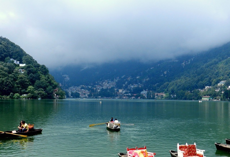
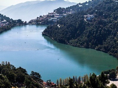
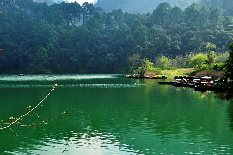
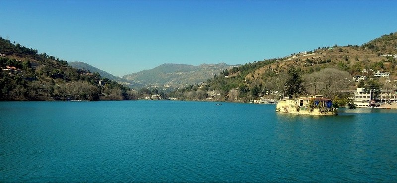
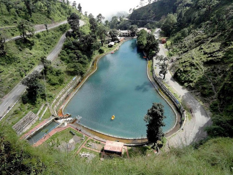
At a distance of 1.5 km from Tallital Bus Stand, Nainital Lake is a natural freshwater lake, situated amidst the main town of Nainital. It is one of the prime Nainital tourist places.
Nainital Lake is commonly represented to promote Nainital Tourism. The lake was built in 1839 by P. Barron. Situated at an altitude of 2,000 m, this is one of the four lakes of Kumaon hills, the other three lakes are Sattal Lake, Bhimtal Lake, and Naukuchiyatal Lake. Nainital Lake is lunar-shaped and has an outlet at the southeastern end. The lake covers a perimeter of 2 miles with a depth that varies from 6 m to 28 m. The northern part of the lake is called Mallital while the southern part is known as Tallital. Balia Nala is the main feeder stream of the lake. Other than this, 26 major drains, including the three perennial ones, feed it. It is surrounded by panoramic hills on three sides.
According to a legend, three sages Atri, Pulastiya, and Pulha had come here for pilgrimage; they felt thirsty and could not find any water. They dug a deep hole where the present lake stands and filled with water brought from Mansarovar Lake in Tibet. This lake is also mentioned in Skand Purana as Trishul Sarover.
This captivating lake is one of the must-visit places as part of Nainital packages. The Nainital Boat Club provides boating and yachting facilities. ...
At a distance of 27 km from Gangotri, 12 km from Bhojbasa and 8 km from Gaumukh, Nandanvan is a small meadow located on the base of Bhagirathi Glacier at an altitude of 4330 m past Tapovan in Uttarkashi district of Uttarakhand.
Nandanvan offers the astounding view of famous peaks like Shivling, Bhagirathi, Sudarshana, Thalay Sagar, and Kedar dome. From Gaumukh to Nandanvan, one has to trek along the Gangotri and Chaturangi glaciers. The trek is not a very tough one but needs good physical fitness. The scenic Nandanvan is the base camp for the Bhagirathi peaks that offers a panoramic view of the surrounding Shivaling peak.
The trek to Nandanvan begins from Gangotri. This is a long trek over terminal glacial moraine and steep ascents and descents. One has to trek 14 km to reach Bhojbasa from Gangotri. Gaumukh Glacier is 5 km from Bhojbasa and Nandanvan is 8 km from Gaumukh. Most of the terrain is with loose rocks that are prone to fall. The trek is considered difficult and it is a 4 day trek from Gangotri to Nandanvan and back. An experienced guide is a must.
While there is direct access from Gomusk to Nandanvan, tourists can also trek to Nandanvan from Tapovan by crossing the massive Gaumukh Glacier. The 7 km trek starts with steep descent from Tapovan to reach the glacier and ends with steep climb of approximately 100 m to reach Nandanvan. A further ascent starting from Nandanvan and following the Chaturangi glacier brings one to the Emerald green Vasuki Tal. ...
At a distance of 22 km from Nainital & 12 km from Bhimtal, Sattal or Sat Tal is a cluster of seven inter-connected freshwater lakes located in Nainital district. At an altitude of 1,370 m, it is one of the most scenic places around Nainital and also one of the popular Uttarakhand tourist places.
The group of lakes is set amidst dense forests of oak and pine trees. Sattal is one of the few unspoiled and unpolluted fresh water bodies in India. This is often compared with Westmoreland of England by British. The names of the seven lakes of Sattal are Purna Tal, Ram Tal, Sita Tal, Laxman Tal, Nal Damyanti Tal, Sukh Tal and Garud Tal. The Garud Tal is a solitary lake and is not interconnected. The Ram, Sita and Lakshman Tal all together form the Sattal main Lake.
These lakes are heaven for migratory birds. It has 500 species of resident and migratory birds, 20 species of mammals, over 525 species of butterflies and over 11,000 species of moths, beetles, bugs and other insects. Birds like red-billed blue magpie, kingfishers, blue-throated and brown-headed barbets are easily spotted. These birds try to escape the harsh cold of the great Himalayan region by migrating to lower areas of the Himalayas. The market and tourist activities of Sattal are located around the main Sattal Lake.
Visitors ...
At a distance of 11 km from Sattal, and 20 km from Nainital, Bhimtal is a picturesque lake located in the town of Bhimtal near Nainital. Situated at an altitude of 1,370 m, it is one of the picturesque lakes in the Kumaon region, and among the most prominent places of sightseeing in Nainital.
The town of Bhimtal is older than the Nainital city and it was once part of the ancient silk route. The town and the lake are named after Bhima, one of the Pandavas of the epic Mahabharata who is said to have visited the place during the exile period. This is another popular attraction not to miss in a Nainital tour packages.
Bhimtal is the largest lake in the Kumaon region and is situated amidst lush green mountains. The lake is 1701 m in length, 451 m in width, and a depth of 18 m. It is spread across 63.25 hectares of area. The Victoria dam was built on this Lake in 1883 when the Kumaon region was under the British Raj. Bhimtal offers splendid views and visual vistas of nature's beauty. The lake provides a drinking water supply and supports aquaculture with several species of fish.
The Bhimtal Lake is much cleaner and less crowded than the Lake at Nainital. There is an island at the center of the lake which can be reached by boat. This island has an aquarium with different species of fish from China, South Africa, and Mexico. Earlier ...
At a distance of 17 km from Gangotri, Kedartal, also known as Shiva's Lake, is a glacial lake situated in Uttarkashi district of Uttarakhand. It is one of the highest lakes in Uttarakhand, situated at an astounding altitude of 4,912 m. It is also one of the beautiful trekking routes in Uttarakhand.
The picturesque Kedartal is situated at the base of the Thalay Sagar and Bhrigupanth Peak. The lake is fed by the water from snow over Thalay Sagar (6,904 m), Meru (6,672 m) and Bhrigupanth (6,772m), and is the source of Kedar Ganga, an important tributary of Bhagirathi River, considered as Lord Shiva's contribution to Bhagirathi River.
Kedartal is a popular trekking destination and the trek commences from Gangotri. The Kedartal trek, being one of the moderate treks in the Garhwal Himalayan region, is recommended for trekkers having prior trekking experience. The route involves a steep rocky climb along the narrow Kedar Ganga gorge en route to Bhoj Kharak, which is 8 km from Gangotri. Kedar Kharak is the next available camping site, which is 4 km from Bhoj Kharak. From here one need to trek 5 km to reach Kedartal. This 17 km trek usually takes 3-4 days to complete. The camping points of the trek are Bhoj Kharak, Kedar Kharak and Kedartal. The route passes through scenic Himalayan forests.
Kedartal is an immaculate lake holding crystal clear water and the view of the reflections of Thalay Sagar peak is truly enchanting. It is surrounded by Thalay Sagar, Bhrigupanth, ...
At a distance of 25 km from Nainital and 6 km from Bhimtal, Naukuchiatal is a picturesque lake situated in Nainital district. It is situated at an altitude of 1,220 m and it literally means nine cornered lake.
The lake is 175 feet deep and is the deepest lake in the Nanitaal region. It is surrounded by thick vegetation of trees and shrubs. The length of lake is 983 m and breadth is 693 m. The lake is fed by an underground perennial spring.
According to mythology, any person who can spot all the nine corners of the lake standing on the ground is guaranteed nirvana. It is believed that the lake was created by Lord Brahma and a small temple dedicated to Brahma exists near the KMVN guesthouse. It is also said that anyone who performs a circumambulation of the lake will be blessed by Lord Brahma.
This place is famous for the mesmerizing beauty of terrain and green landscapes. A walk through the woods, which offers scenic views of the lake, is a popular activity for locals and tourists. Naukuchaital has wide variety of wildlife, birds and captivating collection of butterflies. This is also a favorite spot for adventure seekers providing ample opportunity for adventure activities such as angling, trekking, paragliding, paddling and river rafting.
At a distance of 1.5 km by trek from Gangotri, Gangotri National Park is a national park situated in the upper catchment of Bhagirathi River in Uttarkashi district of Uttarakhand. The Park falls under the bio-geographical zone and is situated at an altitude of 1800 m to 7083 m. It is one of the most beautiful high-altitude wildlife sanctuaries in India apart from being one of the best areas for trekking in Uttarakhand.
Gangotri National Park was established in 1989 and it covers an area of 2390 sq. km. The northeastern boundary of Gangotri National Park is along the international boundary with China and has various springs, waterfalls and snowy mountain peaks. The river Bhagirathi flows through the valleys inside the park, providing it the nourishment for sustaining the innumerable bird and animal species in this region. The landscape of the park is mainly dominated by alpine scrub, oak and betula.
The origin of Ganga River, known as Gaumukh, is located inside Gangotri National Park. The enchanting beauty of the area is dominated by the snow clad mountains, eye catching springs and tall dense green forests. Gangotri National Park has typical high altitude ecosystem influenced by the trans-Himalayan elements. The area enclosed by the park also borders with Kedarnath Wildlife Sanctuary and Govind National Park.
The park contains more than 15 species of mammals and 150 species of birds. This also includes some of ...
At a distance of 8 km from Tallital Bus Stand, Sariyatal is a small but beautiful lake located on Kaladungi Road in Nainital.
Sariyatal is among the numerous lakes of Kumaon range and is fed by a beautiful stream surrounded by lush green picturesque landscape. The water of the stream is very cold. This deep emerald lake is also referred as Sarita Tal.
Apart from the beautiful lake, Sariyatal is also famous for Himalayan Botanical Garden which is run by Forest Department. The Botanical Garden, spread over an area of 30 hectares, is a prominent center of study. It has a collection of several rare and endangered native plant species. This garden also has some major attractions which include an orchidarium, herbarium, Thunia Alba orchid, geodesic dome, waterfalls, etc.
Entry Ticket for Botanical Garden: Rs.20 per person.
Timings: 10 AM to 5 PM.
At a distance of 25 km from Bhaironghati and 34 km from Gangotri, the Nelong valley is a valley situated inside the Gangotri National Park in Uttarkashi district of Uttarakhand. The unexplored Nelong valley, situated at an altitude of around 11,000 feet, has a mountain desert landscape similar like Lahaul-Spiti and Leh-Ladakh.
The valley was reopened for tourists in May 2015 after a gap of 53 years. The valley had been closed to civilians since the 1962 Indo-China war, but before the war, it was the major corridor for Indo -Tibetan trade. The valley still contains some of the earlier infrastructure such as the Gartang Galion wooden bridge and the Lal Devta temple. The valley offers a panoramic view of the Tibetan plateau. Apart from the charming landscapes, Nelong Valley is also home to some of the important wildlife species like snow leopard, Himalayan blue sheep and musk deer.
The valley can be approached from Bhaironghati, located about 90 km away from Uttarkashi town. From Bhaironghati, One can take a 25 km ride in a forest department vehicle to reach the valley. The state forest department has decided to allow six forest department vehicles carrying four people each. A permit letter from the sub-divisional magistrate along with fitness certificate is required to visit the area. Foreign tourists are prohibited from visiting the valley owing to its strategic location on the India-China border.
The best time to visit Nelong Valley is from May to November ...
At a distance of 15 km from Tallital Bus Stand and 3 km from Pangot, Pangot and Kilbury Bird Sanctuary is a bird watcher's paradise on Kilbury road in Nainital. This is one of the famous wildlife sanctuaries in Uttarakhand, and among the top Nainital tourist places.
Kilbury is one of the prime places to visit as part of Nainital tour. Located at an altitude of 2528 m, the sanctuary is famous for numerous bird species. It is surrounded by dense forests of oak, pine, and rhododendron which provides ample opportunities for bird watching.
One of India's scenic and famous birding routes, Kilbury is known for more than 580 species of birds. Both migratory and local birds can be spotted in the region. The most commonly found birds are the Brown wood Owls, White-throated laughing thrushes, Collared Grosbeaks, and Fork tails. The Sanctuary is situated in the reserve forest of Nainital. The place is calm and serene and the occasional sounds made by birds are just pleasant to the ears.
A lot of Mammals can be spotted here such as Leopard cat, Sambar, Himalayan Goral, Barking deer, Wild Boar, Red Fox. Kilbury has a tourist bungalow for visitors who want to spend a day in the company of birds.
At a distance of 10 km from Yamunotri Temple, Saptarishi Kund is the original source of Yamuna River fed by Champasar Glacier situated in the upper parts of the massif created by Bandarpunch Mountain. It is an ideal place for trekking near Yamunotri for 2-3 days.
Saptrishi Kund is about a half km in diameter, and its water is dark blue in color, The water of the nearby glaciers gathers in this lake. On the banks of Saptrishi Kund Lake, there are naturally created slate stones. The rare Brahma Lotus grows here. It is believed that seven great Rishis Kasyapa, Atri, Bharadwaj, Viswamitra, Gautama, Jamadagni, and Vasistha performed penance at Saptrishi Lake in ancient times.
The Saptrishi Kund is located amidst magnificent and enchanting surroundings of the lofty rock strewn glaciers. This scenic spot lies at an altitude of 4421 m. Trek to Saptrishi Kund is considered to be one of the most difficult treks in the Himalayas. The route of Saptrishi Lake is covered with ice and it is a difficult journey which needs a guide.
The 10 km trek to Saptrishi Kund starts from the Yamunotri temple. The whole trek passes through dense forests and rugged mountainous terrain. Around 5 km up the hill there is a little camp site between two rivulets if one wishes to pitch tent for a night. From the camp site, it is another 5 km of steep walk to the Kund and it is risky to camp at Saptrishi Kund due to heavy winds. Saptrishi Kund ...
At a distance of 38 km from Nainital, 5 km from Kaladhungi and 26 km from Ramnagar, Corbett Waterfalls is situated on Ramnagar - Kaladhungi highway in Nainital district. Corbett Falls is among the top places to visit in Nainital and also one of the best places to visit near Delhi.
Corbett Falls is a scenic water fall and is surrounded by dense teak wood forest. This waterfall is cascading down from a height of 20 m in to a pool. Sound of the waterfall makes perfect melody with chippings of the birds. The fall is not very huge and bathing in the falls is no longer permitted, but the natural beauty around the place has to be enjoyed and appreciated. This is another popular attraction not to miss in a Nainital tour packages.
Trekking in the forests, bird watching and nature walks are popular activities around Corbett Falls. There are no shops or stalls, so visitors need to carry their own food and water.
Corbett Waterfall can be reach by hiring taxi or bus from Kaladhungi or Ramnagar. Visitors have to take small trek of 1.5 km from main road to reach Corbett Falls or one has to drive from the main road on a very bumpy road till the parking area and then walk to the falls about 300 m away.
Entry Fee: Rs. 50 for ...
At a distance of 9 km from Yamunotri, Bali Pass Trek is one of the least explored treks in the Indian Himalayan region that connects Har Ki Dun Valley with Yamunotri. It is one of the best and tough treks in Uttarakhand.
Bali Pass is situated at an elevation of about 4,800 m in the Garhwal Himalayan region and was an old route from the Tons river valley to the Yamuna river valley. It continues to attract trekkers during the monsoon season when the snow melts and the pass is approachable. The pass is more approachable from the Har Ki Dun valley as the gradient is small.
The Bali Pass trek commences from Sankri, which is approximately 153 km from Mussoorie and 130 km from Yamunotri by road. The trekking trail stretches for approximately 7-8 days with elevation ranging from 1,900 m to 4,800 m, passing through the charming Har Ki Dun valley. The trail runs through Govind National Park, which houses several colorful orchards, species of animals and birds. The Bali Pass Trek after crossing the Har Ki Dun valley moves through the Ruinsara Tal. The trek to Bali Pass is considered as one of the moderate treks in the Garhwal Himalayan region. The area is surrounded by Bandarpunch range and some of the famous peaks are Kalanag, Bandarpunch west and Ruinsara. This region was made popular by Jack Gibson, a teacher at the Doon school in the late 1940's.
Day 1: Sankri to Taluka - 12 km (4-5 Hours)
There is a motorable ...
At a distance of 34 km from Nainital and 28 km from Mukteshwar, Ramgarh is a small hill station in Uttarakhand state and popular places to visit in Nainital district. Situated on the way to Mukteshwar, this place is famous for orchards.
Ramgarh is divided in two parts known as Malla located on elevation and Talla located downhill. This is situated at an average elevation of 1518 m above sea level. Ramgarh is away from the hustle bustle of the city offering pristine environment and gigantic view of the Himalayas.
This hill station is founded by British and was frequently visited by many high profile personalities of India and British. The place was once the cantonment of the English army. The hill station carries the legacy of some ancestral buildings, used as inspection bungalows and temporary palaces for officers dating back to British colonial period.
Ramgarh is also known as Fruit Bowl of Kumaon as it houses orchards of apples, apricots, peach and pears. It is an ideal destination for leisure trip in solitude, calm and serenity with pleasing atmosphere. The famous poets Rabindranath Tagore and social worker Narain Swami had established their ashrams over here. Rabindranath Tagore had composed some of his compositions at Ramgarh. There is also a library dedicated to famous Hindi poet writer Mahadevi Varma, who got the idea of writing the famous story Lachma, in Ramgarh.
At a distance of 50 km from Yamunotri and 61 km from Uttarkashi, Barkot is a hill town located on the banks of the Yamuna River in Uttarkashi district of Uttarakhand. Situated at an elevation of 1220 m above sea level, Barkot is one of the popular places of tourism in Uttarakhand state.
Barkot is known for its scenic beauty and offers panoramic views of the snow-capped mountains of Bandarpunch and other beautiful mountain peaks of the Himalayas. Barkot is an important stopover en route Yamunotri and Gangotri, among the four Chota Char Dham pilgrimages. It is an ideal holidaying and adventure destination as the place offers many trekking excursions and white water rafting opportunities. The ravishing landscapes, gushing water of the sacred Yamuna River and apple orchards attract the tourists in large number.
The best time to visit Barkot is between the months of April and October. Snowfall during winters changes this picturesque hamlet to a heavenly paradise. Try to avoid monsoon months as risk of landslide increases during the season.
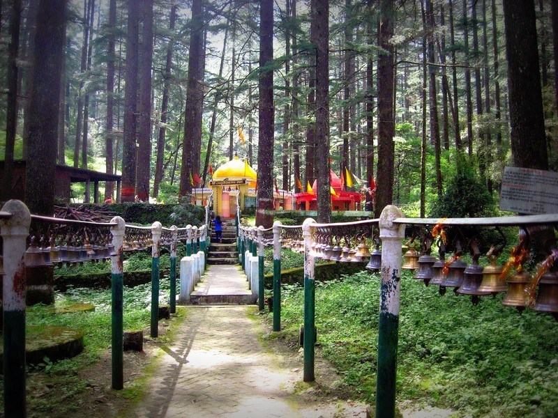
At a distance of 17 km from Nainital and 8 km from Bhowali, Kainchi Dham is a religious pilgrimage center located at Kainchi on the Nainital - Almora Road in Uttarakhand. The word Kainchi means two sharp hairpin bends in a local dialect and hence the name. It is one of the well known temples of Uttarakhand state and one of the top places to visit in Nainital. Famous visitors of the temple include Apple founder Steve Jobs and Facebook founder Mark Zuckerberg. This is another popular attraction not to miss in a Nainital tour package.
Kainchi is a beautiful secluded shrine and is famous for the Hanuman Mandir. The ashram is situated at an altitude of 1400 m. In 1962, Neem Karoli Baba built a platform around a place where two spiritual gurus Sadhu Premi Baba and Sombari Maharaj had performed Yagyas in Kainchi village. The Hanuman temple was later built over the platform thus establishing the Kainchi Ashram. The first temple of Lord Hanuman was inaugurated in June 15, 1964 by Neem Karoli Baba.
Baba Neem Karoli died on September 10, 1973. A temple for him was subsequently built at the Ashram. His statue was consecrated on 15th June 1976. Thousands of devotees from all around the country visit this place every year. Among the most well-known of Neem Karoli Baba's disciples were spiritual ...
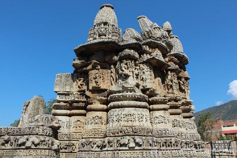
At a distance of 20 km from Almora and 30 km from Ranikhet, Katarmal Sun Temple is an ancient Hindu temple situated at Katarmal village in Almora district of Uttarakhand.
Katarmal Temple is dedicated to Lord Burhadita or Vriddhaditya (the old Sun God) and is one of the famous historical places of Kumaon hills in Uttarakhand. The present image of Surya in the temple dates back to 12th century. Built in the 9th century by Katarmalla, a Katyuri king, this temple is perched at an altitude of 2116 m.
The Sun Temple is noted for its magnificent architecture and is a monument of historical importance. The temple complex has one main temple surrounded by 45 smaller exquisitely carved temples. The idols of Shiva-Parvati and Lakshmi-Narayana can also be spotted in this temple. The building faces the east in a way such that the first rays of the sun fall on the Shiva Lingam. Stone-built walls, intricate figures, beautiful pillar carvings and exquisitely cut out wooden doors are among the distinctive features of this temple.
The carved wooden doors and panels were transported to the National Museum, Delhi, after the original idol of presiding deity was stolen in the 10th century. The temple, which holds other carvings on walls and panels, was declared a monument of national importance.
Though the temple is in a decaying state, it is visited by many devotees who come here to offer prayer to the Sun God. There is no ...
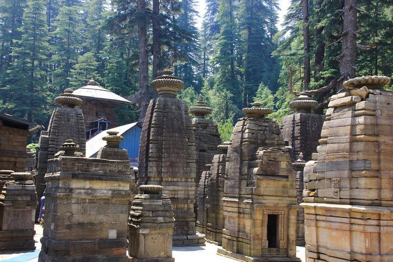
At a distance of 37 km from Almora, Jageshwar is a Hindu pilgrimage town in Almora district of Uttarakhand. It is located at an altitude of 1870 m on the banks of Jataganga River.
Jageshwar was once the center of Lakulish Shaivism (Lakulish is 28th Avatar of Shiva). Origin and history of Lakulish (Shiva with a wooden stick) traverse back to Gujarat region of current India. The temple city comprises a cluster of 124 large and small temples with many preserved by the Archaeological Survey of India, which include Dandeshwar Temple, Chandi Temple, Jageshwar Temple, Kuber Temple, Mritunjaya Temple, Nanda Devi or Nava Durga, Nava-grah temple, a Pyramidal shrine, and Surya Temple, amongst which the oldest shrine is the Mrityunjaya Temple and the biggest shrine is the Dandeshwar Temple.
There is no definite dating of the construction of Jageshwar group of temples but according to the ASI, they belong to the post-Gupta and pre-medieval eras. These temples range in the period from the 8th century (early Katyuri Dynasty) to the 18th century (Chand Dynasty). The temples were renovated during the reign of Katyuri King Shalivahandev. There is an inscription of Malla Kings in the main temple indicating their devotion to Jageshwar. The Katyuri Kings also donated villages to the temple priests for its maintenance. The Chand Kings of Kumaon were also patrons of the Jageshwar temple. Numerous Jageshwar temples were constructed or restored during the Gurjara Pratihara era.
Over ...
At a distance of 26 km from Almora, Binsar Wildlife Sanctuary is located in the foothills of Himalayas in Almora district of Uttarakhand. It is one of the must visit places as part of wildlife tours in India.
Binsar wildlife sanctuary was declared in the year 1988. This reserve forest is located at an altitude of 2270 m and it covers an area of 47.04 sq. km. The peak point known as Jhandi Dhar is at an elevation of 2412 m. Apart from protecting wildlife, the sanctuary was established with an aim to conserve the broad leaf oak forests, mainly located in the Central Himalayan region.
Binsar was the summer capital of the Chand Kings, who ruled Kumaon from the 11th to 18th centuries. During British rule there was a base at Almora and during summer Binsar was used as official summer capital. There are 5 villages inside the sanctuary and 30 villages on the boundary of the sanctuary.
This sanctuary is rich in diversified flora and fauna as the place is home to variety of plants and animals. The sanctuary has been declared an Important Bird Area by Bird Life International as there are more than 200 species of birds in the sanctuary, including Fork tail, Blackbirds, Laughing Thrush, Pheasant, Nuthatches, Parakeets and Monal. The Sanctuary is also home to Barking Deer, Himalayan bear, leopard, fox, musk deer, langur, porcupine, flying squirrel, chital, jungle cat etc.
Binsar Wildlife Sanctuary, perched on top ...
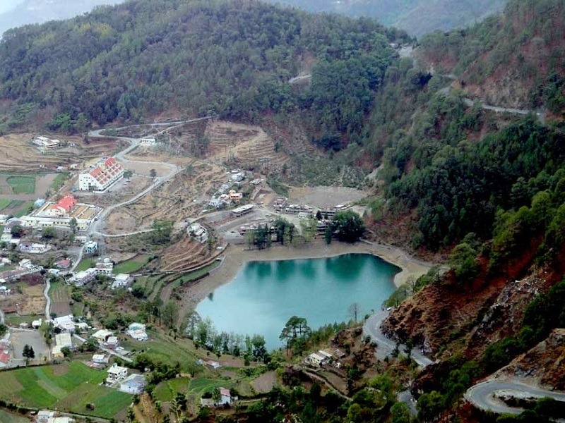
At a distance of 11 km from Tallital Bus Stand, Khurpa Taal is a beautiful lake located in the Khurpatal area on the outskirts of Nainital hill station. Situated on the Bajpur - Kaladgungi Road, this is one of the gorgeous lakes in Uttarakhand and among the top places to visit as part of Nainital Tour Packages.
Situated at an altitude of 1635 m, Khurpa Taal is one of the most picturesque places near Nainital. The lake is known for its pleasant climate and crystal clear water. Nestled amidst the tall trees and high hills, this emerald green lake is the best tourist place for those who wish to stay away from hustle and bustle of Nainital and want to spend some quiet moments amid nature as it is less crowded. Unexploited by tourists, the lake is a secret haven replete with bounteous nature.
Surrounded by terraced fields, the lake is also considered ideal for fishing owing to its crystal clear waters and abundance of freshwater fish. Tourists can enjoy boating on the lake along with family and friends. Undulating hills and tall trees encompass the lake on all sides and provide picture-perfect backdrops for beautiful snapshots, especially during sunrise as the lake glistens like a diamond when the rays of the sun fall on it.
Timings: 6 AM - 6 PM
Entry: Free
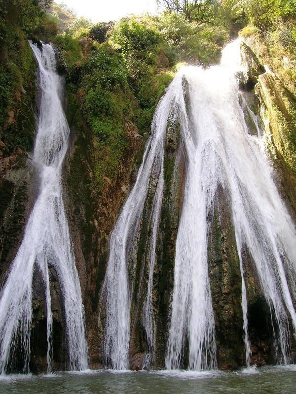
At a distance of 14.5 km from Mussoorie Library Bus Stand and 48 km from Dehradun, Kempty Fall is a fascinating waterfall and one of the best tourist places to visit in Mussoorie. This fall is located on Mussoorie-Yamunotri Road. Kempty Falls is one of the best waterfalls in Uttarakhand and also among the top waterfalls in India. It is most often represented to promote Mussoorie Tourism and also one of the wellknown Uttarakhand tourist places.
Kempty Falls was developed as a tourist destination by a British officer John Mekinan, around 1835. The name of the place is derived from Camp-tea, the place where Britishers organized tea parties during colonial period.
Kempty Falls is situated at an altitude of 4,500 feet. It offer a remarkable view as the water dropping from a height of about 50 feet flowing through five cascading falls in the downstream. There are two main falls in Kempty with water falling into big pools that offer excellent opportunity to play in the crystal clear water of the mountain stream. The lower waterfall is very popular and attracts large crowd while the upper one relatively calm. The falls are close to the main road and the first waterfall can be reached by about 5-10 minutes walk from the main road. The second ...
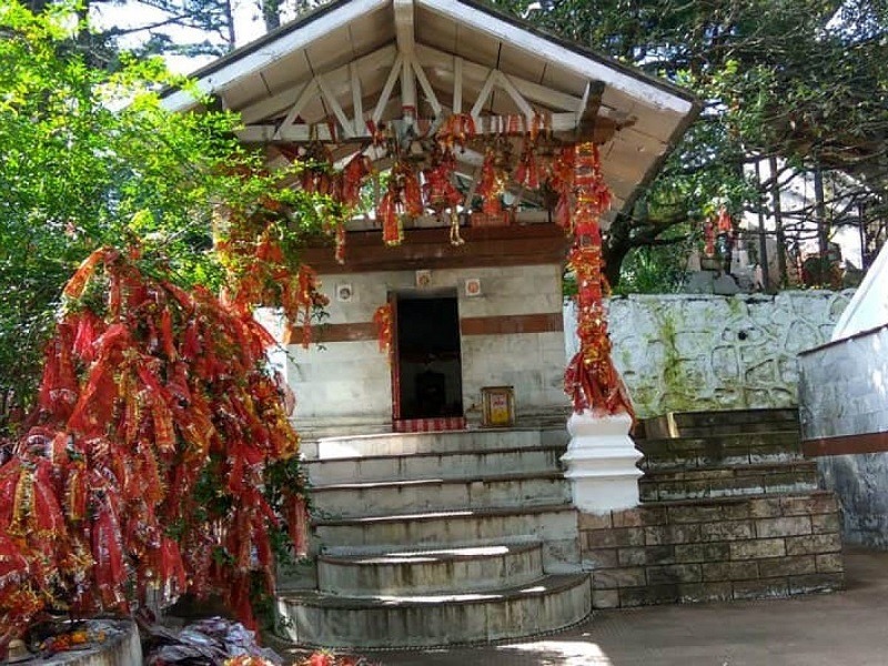
At a distance of 49 km from Nainital, Mukteshwar Dham is a Hindu temple located in Mukteshwar town near Nainital, Uttarakhand. Also known as Mukteshwar Temple, it is one of the famous places of pilgrimage near Nainital.
Dedicated to Lord Shiva, Mukteshwar Dham is a 350-year-old temple that enshrines a white marble Shiva Linga. this temple is identified as one of the eighteen most important temples dedicated to Lord Shiva in the Hindu scripture. According to Puranas, it is believed to be the place where Lord Shiva killed a demon and gave him Mukti. The shrine has a simple architecture with a flight of stone stairs that lead devotees to the main shrine. Apart from the sacred Shiva Lingam, it also houses idols of other deities like Lord Brahma, Lord Vishnu, and consort of Goddess Parvati.
Perched at an altitude of 2315 m in the Kumaon hills, this temple offers a commanding vista of the entire picturesque valley that lures many tourists every year. Apart from the temple, one can also visit a rock named 'Chauli Ka Jali', located near the temple which is used for rock climbing and rappelling.
With lush green trails and narrow lanes, Mukteshwar is a popular destination for trekking, apart from rock climbing and rappeling. Major attractions here are the picturesque orchards, coniferous forests, rolling meadows, and little cottages and homes built in quaint colonial style. As it is located on a high hill, there are ample opportunities for clicking some beautiful pictures ...
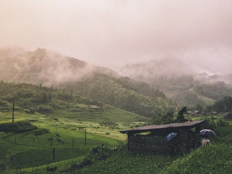
At a distance of 20 km from Mukteshwar, 30 km from Almora, and 59 km from Nainital, Peora is a tiny hamlet located in the Nainital district of Uttarakhand. Cradled in the lap of Himalayas, it is one of the offbeat places to visit in Uttarakhand and among the must include places in Nainital Tour Packages.
Perched at an elevation of 6600 feet, Peora is a small Kumauni hamlet with traditional tiled-roof village huts sparsely scattered on the slopes of its contoured valleys, surrounded by dense pine forests. If you are looking for a tourist place away from the touristy crowd of Nainital, then Peora is the perfect place to enjoy solitude bliss and quietude. The lush green surroundings tend to have an enriching impact on the visitors along with the picture-perfect views of the outer Himalayas draped in snow which is a treat to the eyes.
Untouched by the hands of modernity, this hidden gem is bountiful in scenic beauty and picturesque views that make it a perfect getaway. From the colors of the Blue Magpie to countryside village walks through dense pine forests, the fascinating night sky with myriad stars and lights of the Almora town across the valley, the place attracts nature enthusiasts, bird lovers & photographers. Also, many British Era bungalows in the hamlet give it a rustic vibe.
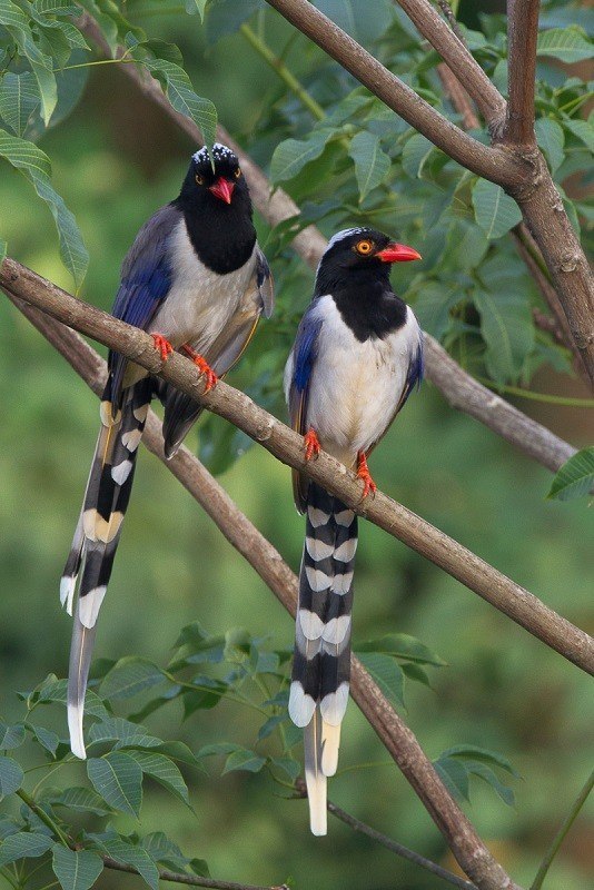
At a distance of 12 km from Library Bus Stand, Benog Wildlife Sanctuary has is a bird-watching haven and a part of famous Rajaji National Park, one of the popular wildlife sanctuaries in India. Set amidst thick forests, Benog Wildlife Sanctuary is one of the top tourist destinations in Mussoorie and among the must include in Mussoorie packages.
Benog Wildlife Sanctuary, also known as Vinog Mountain Quail Sanctuary, was established in the year 1993. This beautiful sanctuary, spreading across an expanse of about 339 hectares, is a heaven for birdwatchers. It is located in a pine-clad slope and is surrounded by snowcapped peaks of the Himalayan ranges.
The place is known for the rare species of birds that habitats in its area. The sanctuary is home to several species of exotic birds such as White Capped Water Redstart and Red Billed Blue Magpie to name a few. The Mountain Quail or the Pahari Bater was last spotted here in 1876, and is now considered extinct. This is also home to a variety of rare and common fauna like Himalayan goat, panther, leopard, deer and bear.
Apart from large number of fir and pine trees, this sanctuary is also populated with several medicinal plants. Beautiful views of snow peaks like Chaukhamba and Bandar Punch can be seen from this sanctuary. Aglar River, a tributary of Yamuna River ...

At a distance of 18.5 km from Library Bus Stand, Bhadraj Temple is located on the western region of Mussoorie at Bhadraj. It is an ideal spot for trekking and is also known as the milkman's trail in Mussoorie.
Bhadraj temple is dedicated to Lord Bal Bhadra, brother of Lord Krishna. This temple is situated atop a hill and offers a splendid view of the Doon Valley, Chakrata ranges and the Jaunsar Bawar area of Himalayas. Every year Bhadraj temple organizes a fair from 15th to 17th of August which attracts thousands of devotees who seek blessings from Lord Bhadraj. The devotees offer milk and butter to the idol of the deity.
Bhadraj temple can be reached by 11 km trek from Clouds End. The trail passes through Dudhli village (3 km) from where the temple is 8 km trek. The terrain close to the summit is covered with thick forest of oak trees. There are multiple trails to reach the temple from Dudhli village.
The best time to visit Bhadraj temple is post Monsoons. This place can be visited as a one day trip from Mussoorie.
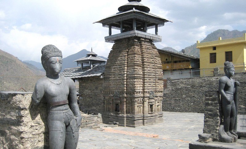
At a distance of 75 km from Mussoorie and 68 km from Chakrata, Lakha Mandal is an ancient Hindu temple complex situated in the Jaunsar - Bawar region of Dehradun district. This monument has been declared as a monument of national importance by ASI. It is one of the famous heritage sites in Uttarakhand.
The Lakha Mandal temple is dedicated to Lord Shiva. The temple is surrounded by beautiful mountains and Yamuna River. Lakhamandal gets its name from the two words, lakha meaning many and mandals meaning temples. This temple is popular among the Shakti Cult, who believes that a visit to this temple shrine will end their misfortunes.
According to 6th century AD stone inscription, the Shiva temple at Lakhamandal was built by princess Ishwara belonging to Royal race of Singhpura. It was built for the spiritual welfare of her late husband Chandragupta, the son of king of Jalandhra. The present structure of Nagara style was built in 12th - 13th century AD.
According to the legend, Lakhamandal is the place where Duryodhan tried to kill the Pandavas by making them stay at Laksha Griha, the house made of Wax. But fortunately Pandavas escaped from there by running away through a Cave. The next end of the cave can be seen at a distance of 2 km from Lakha Mandal temple. This place is called Dhundhi Odaari in the local Jaunsari language, meaning misty or foggy cave.
The main attraction of this temple shrine is the ...
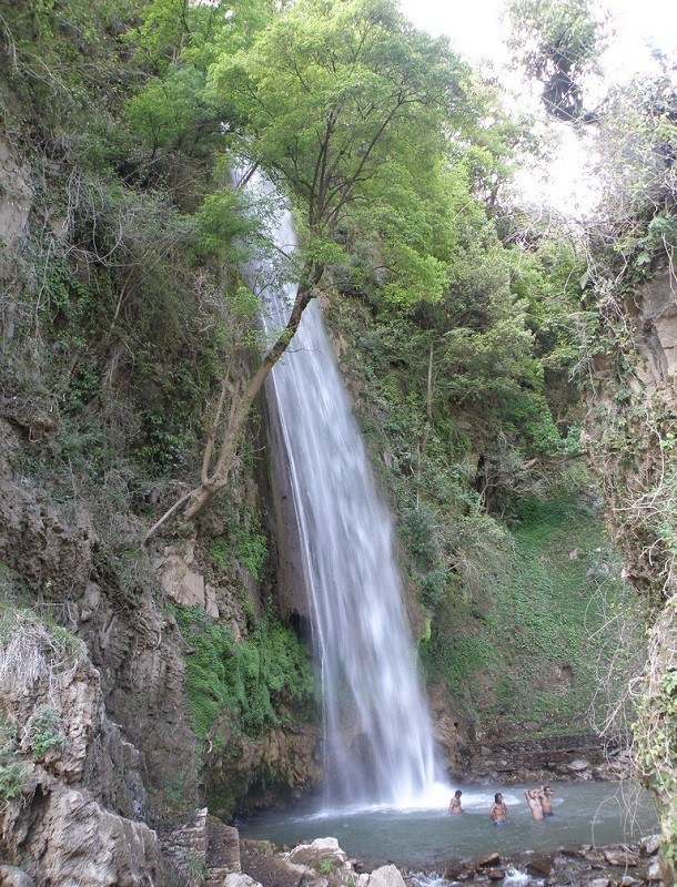
At a distance of 111 km from Dehradun, 105 km from Mussoorie and 26 km from Chakrata, Tiger Falls is a magnificent waterfall located amidst hilly terrain near Chakrata in Uttarakhand. Tiger fall is also known as Keraao Pachad and Kailu Pachad in local languages. This is one of the top places to visit around Dehradun
At an elevation of 1395 m above the sea level, this waterfall cascades down from a height of 50 meters. The waters of this majestic fall are collected in a small pond. Visitors can enjoy a rejuvenating bath in the pond. Tiger Falls is a favorite attraction for the people of Chakrata and surrounding region.
During monsoon Tiger fall can be seen in its full glory. Tiger fall could be approached by a 25 km road drive on Chakrata - Lakhamandal route followed by 1 km trek. Alternatively, travellers can take 5 km trek from Chakrata through forest to reach Tiger Falls. The trekking route takes the travellers through the dense forests with rhododendron and oak trees.
Tiger Falls is not a well developed tourist attraction and attracts relatively lesser crowd. The road leading to Tiger fall from Chakrata is rough and narrow and suitable for SUVs and heavy vehicles. There are no shops around the waterfall and it's suggested to carry enough water & food.
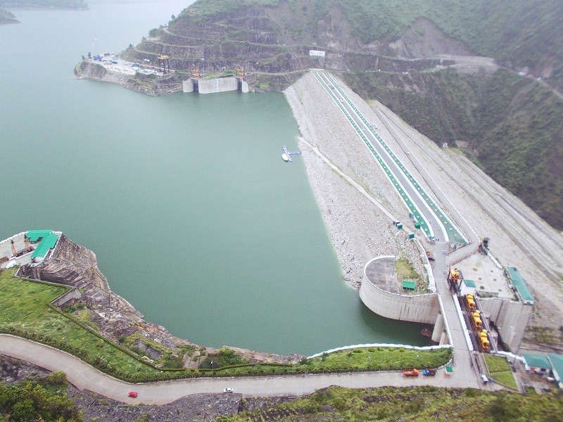
At a distance of 50 km from Dhanaulti, Tehri Dam is a multi-purpose rock and earth-fill embankment dam situated near Tehri in Uttarakhand. It is the tallest dam in India and one of the popular tourist attractions in Dhanaulti.
With a height of 260 m, Tehri Dam or Tehri Dam Reservoir is the tallest dam in India and also one of the tallest in the world. Built across Bhagirathi River, the Tehri dam was commissioned in 2006 to provide water for electricity generation, irrigation, and drinking water. It has a sediment trap efficiency of 95 % and was designed to offset 150 years of sedimentation. The length of the dam is about 575 m, crest width 20 m, and base width 1,128 m. The dam creates a reservoir of 4.0 cubic km of about 3,200,000 acre-feet, having a surface area of 52 sq. km. Provides more than 1,000 MW of hydroelectricity, it serves as the world's biggest hydro-electrical project drawing water from two great rivers of the Himalayas- Bhagirathi and Bhilangana.
The dam offers an astounding and magnificent sight with scenic views of the hills in the backdrop and clear waters in the front. This dam flocked by tourists and locals during the rainy season to get the splendid view of the overflowing water through the spillways of the dam. The dam reservoir, also known as Tehri Lake, is usually flocked with tourists interested in boating, jet skiing, water zorbing, and rafting.
Timings: 9 AM - 6 PM
Entry: Free
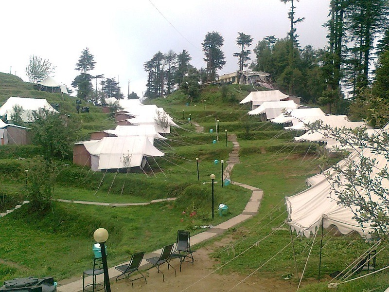
At a distance of 15 km from Dhanaulti Bus Station, Camp Kanatal / Camp Thangdhar is an adventure camp located at Kanatal near Dhanaulti. Situated on Chamba-Mussoorie Road, it is one of the best adventure campsites in Dhanaulti, and among the must include places as part of Dhanaulti Tour Packages.
Situated at an altitude of about 8300 feet, Camp Kanatal, is one of the most exciting and famous places to visit in Dhanaulti for camping lovers and adventure junkies. It offers plenty of outdoor activities like rock climbing, snow camping, trekking or mountain biking. For those who wish to relax, stargazing, and bird-watching are the most relaxing things to do while staying in this camp. The camp also organizes bonfires, buffet meals, indoor-outdoor games and barbeque nights, etc.
Surrounded by pine and deodar trees, the camp also graciously provides sightseeing service to the nearby tourist destinations. The stunning and picturesque 180-degree view of the snow-clad Garhwal Himalayas will fill you with a romantic allure. If you like the company of the lost architectural ruins of the past, you can head over to the Jain temples nearby, which are the structural marvels of the gone era, intricately carved with the Jain deities. The temples are located in the Kanali Fort, overlooking the Betwa river.
This adventure camp is open for 24 hours and has accommodation facilities that have been developed especially for the tourists who are interested in mountain adventure. ...
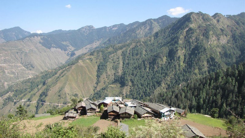
At a distance of 87 km from Dehradun, 98 km from Mussoorie and 43 km from Kalsi, Chakrata is a beautiful town in Dehradun district. It is situated between the Tons and Yamuna rivers, at an elevation of 2118 m. It was originally a cantonment town during British rule. The town, enclosed between Kinnaur in the west and Mussoorie in the east, is known for its beautiful and serene location. It is one of the popular summer destinations in Uttarakhand state and also one of the best places around Dehradun.
The town was earlier known as Jaunsar Bawar, belonging to the Jaunsari tribes. The cantonment of British Indian Army was established here in 1866 by Colonel Hume of the 55th Regiment and the troops first occupied the cantonment in April 1869. This place was a summer retreat for officials of the English East India Company.
Chakrata is an ideal spot for nature lovers, bird watchers, adventure lovers and wildlife enthusiasts. The hill station is rich in varied panoramic views. Kharamba Peak, at an altitude of 10,000 feet provides opportunities for climbing and skiing. There are numerous caves and ancient temples near Chakrata which add to the attraction of this secluded hill station. The chief attraction around Chakrata is Tiger Fall waterfall and a small hamlet known as Deoban that provides ...
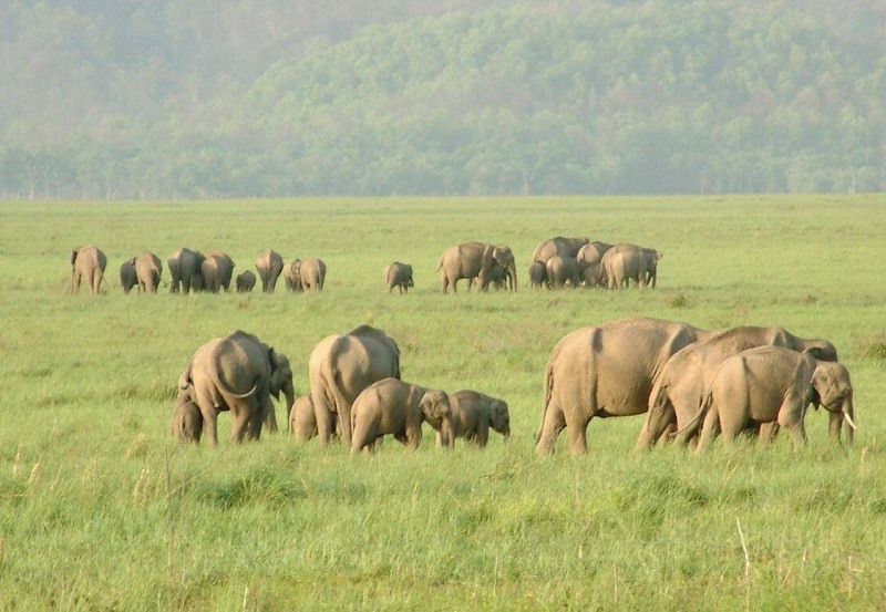
At a distance of 8 km from Haridwar, 21 km from Rishikesh & 55 km from Dehradun, Rajaji National Park is a Tiger Reserve situated at the edge of the sprawling Dehradun Valley. It is one of the must-visit national parks in India, and among the top tourist places in Haridwar.
Motichur Wildlife Sanctuary, which covers about 90 sq. km, was carved out of Dehradun forests in the year 1966. Similarly, Rajaji Wildlife Sanctuary was formed from the Shivalik forests and Chilla Wildlife Sanctuary from the Lansdowne forests in 1967 and 1974 respectively. The Rajaji National Park was established by merging these three wildlife sanctuaries and named Rajaji National Park in the year 1983 after the famous freedom fighter and the last Governor-General of India Sri C. Rajagopalachari, popularly known as Rajaji.
Spread over an area of 820.42 sq. km, the Rajaji National Park is situated along with the Shivalik ranges in the Himalayan foothills and bordered by Haridwar, Dehradun, and Chillawali. The Park comprises the Shivalik ecosystem. The Motichur and Rajaji sanctuaries are contiguous and are separated from the Chilla Sanctuary by the Ganges River and the Chilla River. Rajaji National Park is rich in diverse species of flora and fauna. It is one of the best national parks in Uttarakhand.
The ...
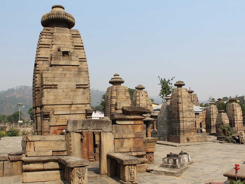
At a distance of 17 km from Kausani and 21 km from Bageshwar, Baijnath is a small ancient town situated on the banks of the Gomti River in Bageshwar district of Uttarakhand, India. Baijnath is most noted for its ancient temples and is one of the top places to visit in Kausani.
Once known as Kartikyapura, Baijnath was the capital of the Katyuri kings who ruled Uttaranchal during 12th and 13th centuries AD. Baijnath is famous for Baijnath Temple which is devoted to Lord Shiva. Baijnath Temple was constructed during the 12th century and as per the legend Lord Shiva and Parvati were married here at the confluence of River Garur Ganga and River Gomti. The temple is approached from the riverside by a flight of steps made of stones constructed by the orders of a Katyuri queen.
The Baijnath temple is actually a temple complex with the idols of Shiva, Ganesh, Parvati, Chandika, Kuber, Surya and Brahma. The temple of Mahishasur Mardini portrays the slaying of the bull-headed demon by the Goddess Kali. Situated on the left bank of the Gomti River at an elevation of 1126 m, these temples are constructed in stone. The main temple that houses a beautiful idol of Parvati is chiseled in black stone. The complex of Baijnath Temple is decorated with delicate and intricate carvings. The complex is maintained by Archeological Survey of India. Just outside the temple complex there lies a lake full of fishes Golden Masheer and fishing is strictly restricted.
Around 3 km from ...
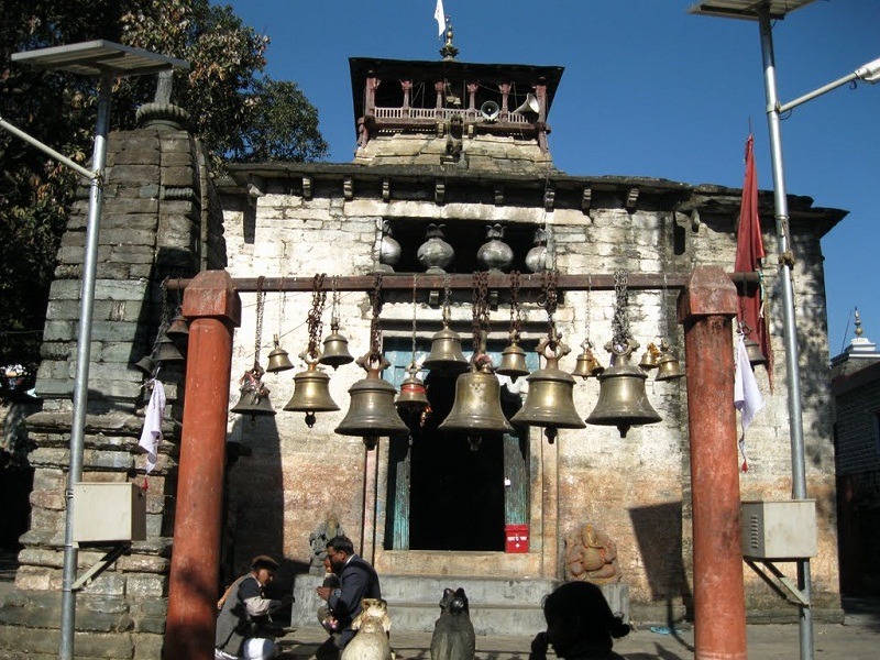
At a distance of 38 km from Kausani and 21 km from Baijnath Temple, Bagnath Temple is an ancient temple situated in the town of Bageshwar at the confluence of Sarayu and Gomti Rivers. It is one of the famous pilgrimage places in Uttarakhand and also one of the prime places to visit in Kausani.
The Bagnath temple is dedicated to Lord Shiva. Some sources state that the existence of Bagnath temple since 7th Century and the present building in nagara style was built in 1450 AD by Chand ruler, Laxmi Chand. The various statues in the temple date back from 7th century AD to 16th century AD.
The town Bageshwar has derived its name from the temple of Lord Shiva. According to legend, Bagnath temple is the place where Sage Markandeya worshipped Lord Shiva. Pleased with his prayers Lord Shiva manifested in Tiger avatar and blessed Markandeya. The significance of the temple finds mention in the Skanda Purana.
Every year in the memory of the sage being visited by the god, a fair is held in the Hindu calendar month of Shravan and is thronged by thousands of people who come to take a dip in the holy waters.
Timings: 6 AM to 6 PM
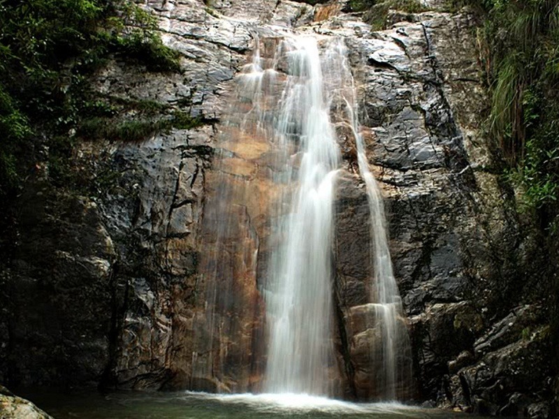
At a distance of 10 km from Kausani Bus Stop, Rudradhari Falls & Temple are located at Kantali Village on Kausani - Almora Road, Uttarakhand. It is one of the popular places to visit in Kausani and also one of the top places of trekking in Kausani.
The Rudradhari waterfall is a natural location with lush green paddy fields where water flows over a vertical drop in the course of a river. This waterfall can be easily watched while trekking to Adi Kailash region or Trishul parvat. There are many ancient caves which have been explored near the water fall. The caves are natural and very impressive with green mountains and a natural environment around.
There is a small cave temple situated near the waterfall where Lord Shiva and Lord Vishnu worshiped. The name Rudradhari has been derived from the Hindu gods Rudra (Lord Shiva) and Hari (Vishnu) as according to the Puranic stories this place relate to these gods. The location of the falls and temple is festooned with terraced fields, thick pine forests and verdant green paddy fields because of which both of the falls and temple looks immensely beautiful thus attracting great number of visitors.
Visitors can reach this place only through trekking. As it is located on the way of Kausani to Almora, one can come to Kantali village in any vehicles and from there visitors have to trek 2 km to reach this place. It will take 2 hours to finish the trek.
Timings: 8 AM to 6 PM
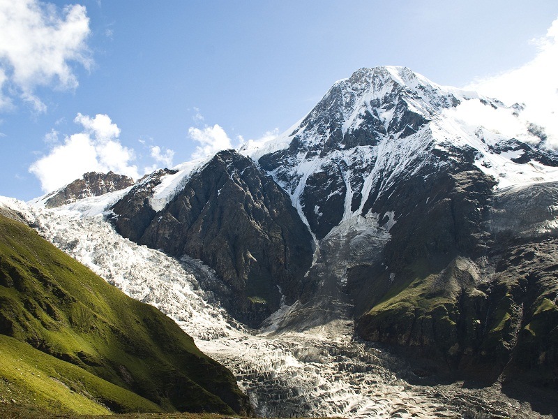
At a distance of 120 km from Kausani and 80 km from Bageshwar, Pindari Glacier is a glacier found in the upper reaches of the Kumaon Himalayas, to the southeast of Nanda Devi, Nanda Kot. It is one of the most easily accessible of all the Himalayan glaciers and also one of the top places of trekking in Uttarakhand.
The glacier flows to the south for a short distance of about 3 km, 0.25 km in breadth and gives rise to the Pindari River which meets the Alakananda at Karnaprayag in Garhwal district. The Pindari trek offers serenity and tranquility along with the spectacular mountain scenery. It lies between the Nanda Devi and Nanda Kot peaks and terminates at an altitude of 3627 m.
Trek to Pindari Glacier is a soft core trekking experience, within the capacity of amateur trekkers in love with nature and its pristine glory. The trail to reach the Pindari Glacier crosses the villages of Song, Loharkhet, crosses over the Dhakuri Pass, continues onto Khati village (the last inhabited village on the trail), Dwali, Phurkia and finally Zero Point, Pindar, the end of the trail. Though most of the trail is along the banks of the Pindari River, the river is mostly hidden until after Khati. The Pindari Glacier trail provides for a 80 km (56 mi) round-trip trek that most people find comfortable to complete in 7 days. The Pindari Glacier is also famous for other adventure sports like ice climbing and mountain biking.
Day 1 - Loharkhet to Dhakuri (10 km / 5 hours)
Start ...
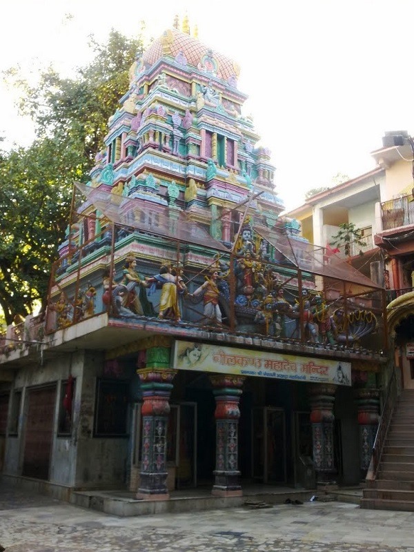
At a distance of 26 km from Rishikesh and 50 km from Haridwar, Neelkanth Mahadev Temple is an ancient Hindu temple situated at an altitude of 1330 m and is located in the Pauri Garhwal district of Uttarakhand. This is one of the most revered places to visit in Rishikesh.
Neelkanth Mahadev Temple is one of the most revered holy shrines dedicated to Lord Shiva. It is surrounded by dense forest and is adjacent to the mountain ranges of Nar-Narayan. The temple lies amidst the valleys of Manikoot, Brahmakoot, and Vishnukoot and is located at the confluence of the rivers Pankaja and Madhumati. It is one of the must-visit places during your Rishikesh trip.
According to Hindu mythology, this is the place where Lord Shiva consumed the poison Halahala that originated from the sea when Devas and Asuras churned the ocean to obtain Amrita. He stopped the poison in his throat, due to which his neck turned blue. Thus, Lord Shiva is also known as Neelkanth, literally meaning The Blue Throated One.
The architecture of the temple is magnificent and the exterior showcases the mythological story of Samudra-Manthan. The story of Samudra-Manthan is depicted with intricate carvings of colorful idols of Devas and Asuras and Lord Shiva is seen drinking poison. The sanctum sanctorum houses a Shiva lingam and a life-size idol of goddess Parvati at the ...
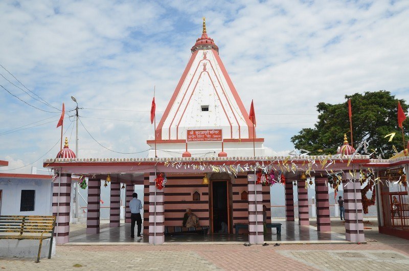
At a distance of 27.5 km from Rishikesh, Kunjapuri Devi Temple is located on a hillock at a distance of 11 km from Narendra Nagar. The temple is situated at an altitude of 1676 m and it is one of the most revered Hindu shrines in Uttarakhand.
Kunjapuri temple is dedicated to Goddess Parvati and is one of the three Siddha Peethas in Tehri district which were established by Jagadguru Shankaracharya. Other two Siddha Peethas in the district are Surkanda Devi and Chandrabadni. Situated on top of a hillock, this temple gives a breathtaking view of the mighty Himalayas and the holy towns of Haridwar and Rishikesh. Snow peaks of Garhwal Himalayas like Swarga Rohini, Gangotri, Banderpunch and Chaukhamba, can also be spotted from this temple.
The Kunjapuri temple receives large number of visitors throughout the year. Dusserah is the main festival celebrated here. The best time for Kunjapuri visit is from May to October. One can hire a taxi from Rishikesh or Narendra Nagar to reach Kunjapuri Devi Temple. There are 150 steep steps to reach out the main shrine from the parking area. One can also go for trekking to this temple from Hidolakhal village. The 5 km trek through dense forest is an adventurous and beautiful activity.
Timings: 6 AM - 8 PM
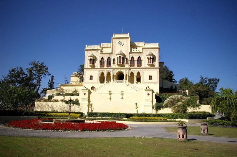
At a distance of 16 km from Rishikesh, Narendra Nagar is a city and a municipal board in Tehri Garhwal district of Uttarakhand. Situated at an altitude of 1,326 m, it is one of the best heritage places in Uttarakhand, and among the must-include places in Rishikesh sightseeing packages.
The present town of Narendra Nagar came into existence in 1919 when Maharaja Narendra Shah of Tehri Garhwal moved his capital from Tehri to the picturesque location of Odathali or Narendra Nagar. The last Maharaja, Manabendra Shah took over the control of Tehri Garhwal in 1946, from Maharaja Narendra Shah. The province was eventually merged with the state of Uttar Pradesh shortly after India gained independence.
This town is famous among visitors for its mythological and historical importance. According to legend, sage Uddhava is known to have performed severe penance at this spot. Also, Purasara, the founder of astrology, has been known to conduct various experiments on the movements of planets and stars.
The small town nestled in the Shivalik foothills was chosen not only for its extraordinary scenic beauty but also for its proximity to the plains below. The town is well planned and the buildings are neatly placed and are a century old, many of these like the secretariat and the hospital are still in use. It is one of the major places to Rishikesh sightseeing places.
The ...
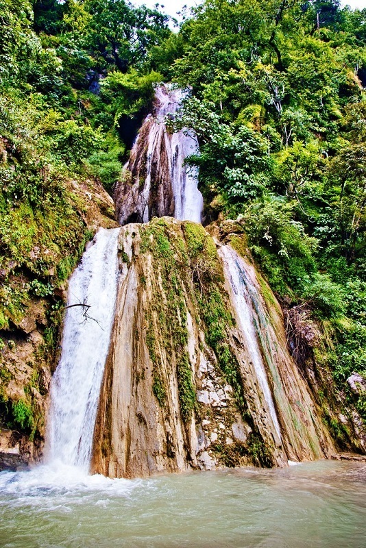
At a distance of 9 km from Rishikesh Railway Station, Neer Gaddu or Neer Garh Waterfall is a natural waterfall situated on Rishikesh - Badrinath Highway in Uttarakhand. This is one of the popular waterfalls in Uttarakhand, and among the must-visit Rishikesh tourist places.
Neer Gaddu Waterfall is famous for its small trek. The water flowing from natural rocky cliffs tempts the holidaymakers to take a cool dip in the narrow stream. Trekking to the waterfall is an adventurous activity as it involves walking through the jungle on narrow trails. This is a beautiful waterfall and is extremely refreshing to stand near the waterfall.
This is a two-tier waterfall with two bathing pools. There is a very small waterfall after a 200 m trek from the road where visitors can also take bath in a small pool as part of Rishikesh holiday packages. A further 1.2 km trek will take you to the bigger and main waterfall which has a large pool.
There are two bridges on the waterfall and few resting stops. Butterflies of different species are seen fluttering around the wildflowers, adding beauty to this wonderful spot. Water, soft drinks, noodles, and tea are available here in small shops.
Neer Gaddu Waterfall is accessible by trek only. The trek route to the Neer Garh waterfall starts 3 ...
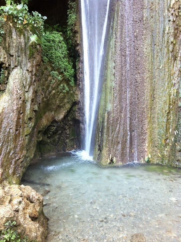
At a distance of 13 km from Rishikesh Railway Station and 6.5 km from Lakshman Jhula, Patna Waterfall is located at Patna village on Neelkanth Temple Road in Uttarakhand.
Patna Waterfall is named after the small village where this waterfall is located. This waterfall is also famous for the limestone caves located next to the waterfall. The trek to the waterfall starts 5 km from Lakshman Jhula on Neelkanth temple road. It is a beautiful 1.5 km trek one way from the road through Rajaji Forest. This trek to the waterfall is steep and little hard. The waterfalls would be almost dry in summer season and not advised to visit in summer. There are no sign boards to the waterfall so visitors have to be careful and confirm the route with locals.
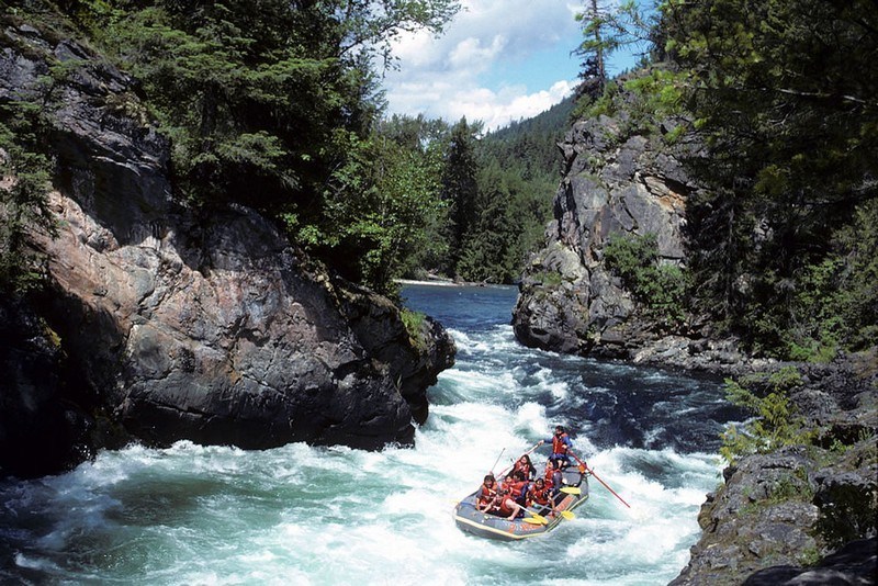
At a distance of 16 km from Rishikesh Railway Station, Shivpuri is a small town located on the Rishikesh - Badrinath Road. Famous for White Water, it is one of the top places to visit as part of Rishikesh tour packages, especially for adventure enthusiasts.
Known for its numerous camps, Shivpuri is the major River Rafting destination in Rishikesh. Shivpuri is the starting point of the most popular River Rafting trip on the Ganges River. Rafting at Shivpuri is one of the things to do in Rishikesh as it has the most ideal river rafting stretch in Rishikesh. Rafting from Shivpuri till Lakshman Jhula is a 16 km stretch and covers some of the most exciting Grade III, IV Rapids for approximately 3 hours. This adventurous trip covers exciting rapids like a roller coaster, golf course, clubhouse, etc. The rafting is supported by excellent safety standards and well-trained guides.
Besides rafting, tourists can indulge in several activities like camping, mountaineering, and jungle trekking at Shivpuri. Visitors will also have the opportunity of learning the techniques of yoga and meditation during their stay in Shivpuri.
The Rafting season in Shivpuri starts in Mid-October and ends in June. Shivpuri Rafting is ideal for non-swimmers. Shivpuri Rafting trip can be enjoyed by friends, families, college groups, corporate groups, and everyone ...
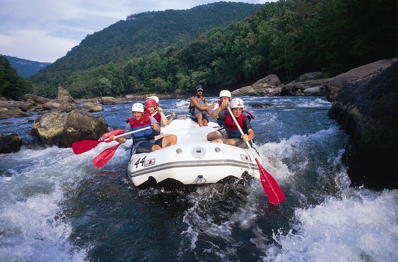
At a distance of 38 km from Rishikesh and 22 km from Shivpuri, Kaudiyala is a small village located on Badrinath Road in Uttarakhand.
Situated at an altitude of 380 m on the banks of River Ganga, Kaudiyala is famous for White Water rafting and it is a beautiful camping site. The 36 km stretch of River Ganges from Kaudiyala till Rishikesh offers some of the world's most fun-filled and challenging Grade III and Grade IV river rapids along with a Grade V rapid. These rapids are termed as difficult, as they feature some serious obstacles to rafters sailing along.
Kaudiyala rafting is especially famous because this stretch includes a Grade V rapid which is the only grade V rapid on the Ganges. Kaudiyala rafting is not recommended to a group of first-time river rafters. The total time taken to complete the expedition is around 8 hours.
The GMVN Tourist and Rafters' Camp offers courses in trekking, rafting and water-skiing. Some of the good private camps include Camp Panther and Beach Tented Camp run by Snow Leopard Adventures at Shivpuri. These camps offer package for rafting and camping. All the necessary rafting equipment, meals, games like volleyball, water polo and bonfires are part of the package. The rafting packages range from standard 2 day/1 night options to longer ones.
Best season to enjoy Kaudiyala beauty and adventure is from October to April. Rafting and camping bookings can be done online ...
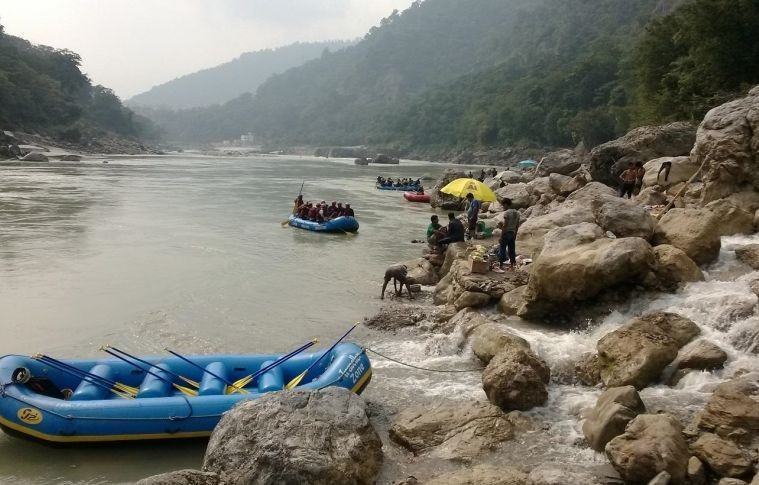
At a distance of 8.5 km from Rishikesh Railway Station, Brahmapuri Rafting Point is situated on Bhadrinath Road in Uttarakhand. It is one of the best places for adventure sports in Uttarakhand. This rafting stretch serves as the inaugural rafting trip every year in Rishikesh. The rafting trip is the first one to open and the last one to get closed each year.
The Brahmapuri rafting is one of the cost-effective and safe river rafting packages in Rishikesh. This stretch has around 4 rapids most of which can be classified as Grade I and Grade II. These are ideal for family rafting trips in Rishikesh and school groups. The 9 km long rafting stretch that starts from Brahmapuri takes about 2 hours which can be participated by anyone aged 8 years and above. The package includes Brahmapuri rafting trip and several fun activities like camping, bonfire, volleyball, cliff jumps, Body surfing, etc.
Rafting Cost: Rs.350 Per Person, Rs.1450 per person for 1N/2D
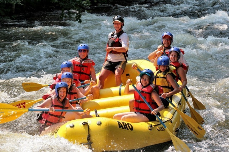
At a distance of 16 km from Shivpuri and 32 km from Rishikesh Railway Station, Marine Drive River Rafting Camp is located near Byasi and is one of the most adventurous river rafting trips in Rishikesh.
This is a 25 km long rafting stretch starts from Marine drive near Byasi to Lakshman Jhula and takes about 4 hours. Marine Drive rafting package includes camping with all meals, bonfire snacks, rock climbing/rappelling and the 25 km Marine Drive Rafting stretch. The rafting stretch has around 12 rapids most of which can be classified as Grade III and Grade IV. Among these the major ones are the Three Blind Mice, Roller Coaster and the Golf Course rapids. The Marine drive rafting package is one of the most adventurous rafting packages in Rishikesh.
This rafting package includes Marine drive rafting and several fun activities like camping, bonfire, volleyball, cliff jumps, Body surfing, etc. This rafting package is ideal for persons having prior experience in rafting.
Rafting Cost: Rs.750 Per Person, Rs.2000 Per Person for 1N/2D
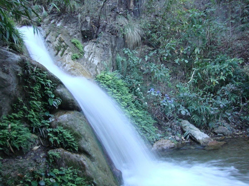
At a distance of 9 km from Rishikesh Railway Station and 4 km from Lakshman Jhula, Garud Chatti waterfall is situated at Neelkanth road near Rishikesh.
Garud Chatti waterfall is one of the hot spots, mainly among foreign tourists in Rishikesh. The waterfall is small but beautiful. This waterfall is most beautiful during the monsoons when the water flows in seven different levels. It is a pleasant place to visit and to spend a couple hours.
The trek route to Garud Chatti Waterfall starts around 3 km away from Lakshman Jhula on the Neelkanth Mandir Road. The trek starts from a temple dedicated to Garuda. Visitors need to trek for about 1.5 km from here to reach the waterfall.
Phool Chatti waterfall is another waterfall situated at Neelkanth road, about 3 km from Garud Chatti waterfall. This small waterfall can be reached by trekking. Garud Chatti waterfall, Phool Chatti waterfall and Patna waterfall can be covered by hiring a jeep en route to Neelkanth Mahadev Temple.

At a distance of 90 Km from Lansdowne, and 91 Km from Rishikesh, Chamoli is a serene and picturesque district in Uttarakhand, India. This pretty little hill town is one of the most scenic places to visit in Uttarakhand.
The term 'Chamoli' originates from the Sanskrit word 'chandramoli,' which translates to 'One who wears the moon on his head,' a reference to the Hindu deity Shiva. Located in the Garhwal Himalayan region, Chamoli is the second largest district in Uttarakhand, situated along the banks of the Alaknanda River. It shares its borders with several scenic districts, including Pithoragarh and Bageshwar to the east, Almora to the south, Rudraprayag to the west, and Uttarkashi to the southwest. To the north, it is adjacent to the Tibet region and is recognized as a captivating tourist destination, offering a wealth of religious sites as well as numerous opportunities for sightseeing and trekking.
Often called the 'Abode of Gods,' Chamoli is rich in natural beauty, spiritual significance, and cultural heritage. According to Hindu legends, it is believed to be the birthplace of the Mahabharata epic, where the Pandavas are said to have spent a significant portion of their exile. The area is filled with temples and sacred locations that draw pilgrims from around the globe. Additionally, Chamoli is celebrated as the birthplace of the Chipko Movement.
This mesmerizing region, characterized by its ...

At a distance of 20 Km from Chamoli, and 69 Km from Rishikesh, Devprayag is a picturesque town set against the backdrop of the snow-capped Himalayas in the Tehri Garhwal District of Uttarakhand. It is one of the must-include places in Rishikesh tour packages.
The term 'Devprayag' translates to 'Godly Confluence' in Sanskrit. As per Hindu texts, Devprayag is the last of the Panch Prayag (five confluences) of the Alaknanda River, where it merges with the Bhagirathi River, subsequently flowing together as the Ganges or Ganga. Located on a 5 km long horseshoe ridge at the southern edge of the Kashyap hills, Devprayag was historically the capital of the Chand dynasty. Notable figures such as Govind Ballabh Pant, a prominent freedom fighter and the first Chief Minister of Uttar Pradesh, as well as the later Home Minister of India, were born in this town.
Devprayag, adorned with ancient temples, serves as a significant pilgrimage destination for Hindus. According to the Ramayana, both Lord Rama and King Dasharatha performed penance in Devprayag to atone for the sin of Brahmahatya. The Pandavas also conducted ritual ablutions here before their journey to Badrinath, seeking salvation during their Svargarohana. Furthermore, the town serves as the winter residence for the priests of the Badrinath Dham temple.
Renowned for its rich cultural heritage, distinctive handicrafts, and delectable cuisine, Devprayag's main ...
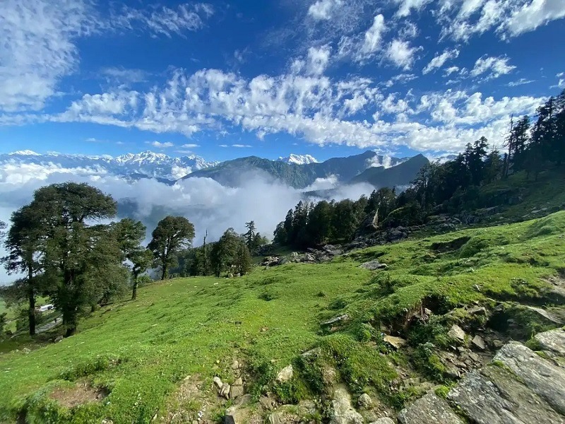
At a distance of 87 Km from Gaurikund, 101 Km from Kedarnath, and 169 Km from Rishikesh, Chopta is a small hill station located in the Rudraprayag District of Uttarakhand State. Situated on the Gopeshwar - Ukhimath road, Chopta is one of the most picturesque places in the entire Garhwal region, and among the must-include places in Uttarakhand tour packages.
Situated at an elevation of 2,700 meters, Chopta is often referred to as the 'mini Switzerland' of Uttarakhand and continues to gain popularity each year. This small hill town, characterized by meadows and evergreen forests, is part of the Kedarnath Wildlife Sanctuary. Chopta remains an untouched natural haven nestled within the Uttarakhand Himalayas, offering breathtaking views of the majestic Himalayan peaks, including Trishul, Nanda Devi, and Chaukhamba. The region is abundant in diverse flora and fauna, featuring numerous Rhododendron and Deodar trees.
Chopta serves as a year-round holiday destination, providing a pleasant atmosphere in summer, a refreshing ambiance during the monsoon, and a picturesque snow-covered landscape in winter. It is centrally located among the Panch Kedar, which comprises the five most revered Shiva temples in the state. To the left are the Kedarnath and Madmaheshwar temples, while to the right are Rudranath and Kalpeshwar, with the Tungnath temple situated above.
Additionally, Chopta is an exceptional trekking location ...
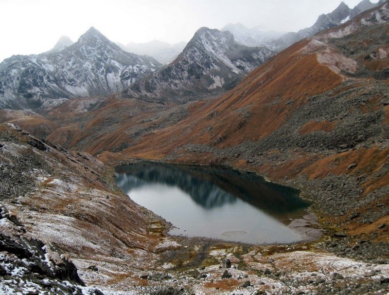
At a distance of 8 km from Kedarnath, Vasuki Tal or Vasuki Lake is an enchanting lake situated at an altitude of 4135 m in the beautiful hills of Kedarnath in Uttarakhand. It is also a famous place among Uttarakhand Treks.
Vasuki Tal is surrounding with very high mountains and provides beautiful view of several peaks of Himalayas. This is the lake where Lord Vishnu is believed to have bathed in ancient times. Crystal clear water flowing through the lake revealing the rock stacks inside is an amazing view in Vasuki Tal. This beautiful lake provides a charming view of the neighboring Chaukhamba peaks. There are several beautiful, colorful flowers around the Vasuki Tal and one of the famous flowers is Brahma Kamal. During winter the lake it is completely frozen.
Vasuki Tal is quite large in size and also the trekking is difficult. The total distance of Vasuki Tal trek is about 8 km from Kedarnath. The trek from Kedarnath to Vasuki Tal is a continuous ascent along a narrow track. To get to the lake one has to cross the Chaturangi Glacier and Vasuki Glacier. These glaciers are filled with ravines and crossing them demands good fitness. Trekking enthusiasts usually form a group of at least six members and start the trek. Trekking guide is must to do Vasuki Tal trek.
The best time to visit Vasuki Tal is from May to October, when the weather is mild and pleasant.
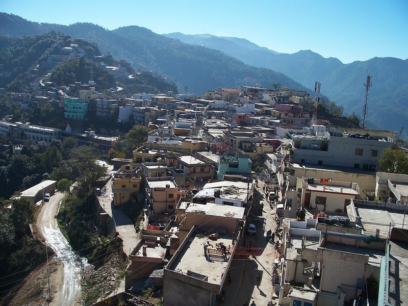
At a distance of 12 Km from New Tehri, 55 Km from Mussoorie, and 58 Km from Rishikesh, Chamba is a tiny hamlet in the Tehri Garhwal district of Uttarakhand. It is one of the must-include places in Mussoorie tour packages.
Nestled within the celestial Garhwal Himalayas, the charming town of Chamba is situated at an elevation of 1,600 meters above sea level, surrounded by dense forests. This hidden gem remains largely unexplored, offering breathtaking views of snow-capped mountains on one side and mist-laden ravines and lush valleys on the other.
Covered with lots of pine and deodar trees, Chamba provides a unique escape from the hustle and bustle of city life. It serves as an ideal location for relaxation and enjoyment, just a short drive from urban chaos. The majestic Himalayan peaks, stunning vistas of verdant gorges, and captivating valleys along the Bhagirathi River are sure to leave visitors in awe, especially amidst the abundant apple orchards.
Renowned for its pristine beauty and scenic excursions, Chamba attracts numerous tourists seeking peace and natural splendor. Trekking is a favored activity here, along with visits to quaint local temples and exploration of the rugged, less-traveled paths of this picturesque haven. For those seeking adventure, Chamba offers thrilling opportunities like rafting, trekking, camping, kayaking, and other outdoor sports. This hidden retreat is conveniently located ...
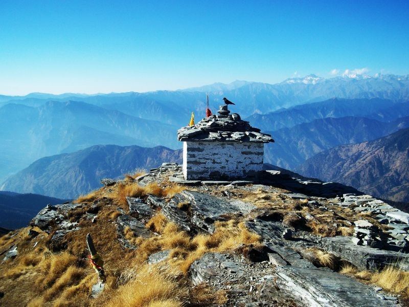
At a distance of 1 km from Tungnath, 4.5 km from Chopta, 32 km from Ukhimath, 74 km from Rudraprayag and 89 km from Kedarnath, Chandrashila is the summit of the Chandranath Parvat on which Tungnath Temple of Panch Kedar is located. It is situated at a height of 4000 m above sea level. This is one of the most popular Tourist places in Uttarakhand.
According to the mythology, Chandrashila peak is believed to be the spot where Lord Rama meditated after killing Raavana. Rama came to Chandrashila to meditate and pray Lord Shiva to cleanse the sins of killing Raavana. Local legend also states that Chandradev, the Moon God, had performed penance at Chandrashila for years.
Chandrashila trek is one of the most popular treks in the region. The trek to the peak is about 4.5 km which starts from Chopta via Tungnath (3 km from Chopta), where the highest Shiva temple is situated. Chandrashila can be reached by a further 1.5 km steep trek from Tungnath and offers mesmerizing views of the grandeur of Himalayan ranges. Though shorter in distance, steep climbing makes this trek a tough task. This trek takes approximately 6-7 hours both ways.
The Chandrashila summit offers the most beautiful view of the Nanda Devi, Trishul, Kedar Peak and Chaukhamba peaks. The 360� panoramic view of the Himalayan peaks covered with glittering snow enchants the trekkers.
Chandrashila trek is undertaken throughout the year in Garhwal Himalayas ...
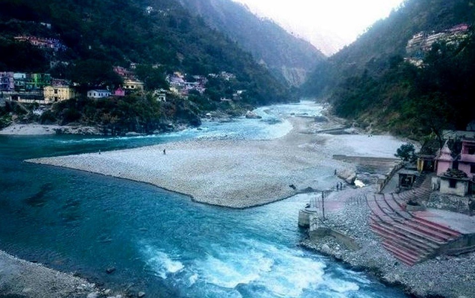
At a distance of 20 Km from Nandaprayag, 36 Km from Gopeshwar, 52 Km from Chopta, 199 Km from Badrinath, and 166 Km from Rishikesh, Karnaprayag is a picturesque town in the Chamoli District in the Indian state of Uttarakhand. It is one of the must-include places in Rishikesh pilgrimage packages.
Named after Karna of the Mahabharata, Karnaprayag is one of the Panch Prayag, or five confluences of the Alaknanda River, where it joins the Pindar River, which originates from the glacial Pindari. Located at an average elevation of 1,451 meters, this quaint town holds significant mythological importance, as it is believed to be the site where Karna worshipped the Sun God. Additionally, it is regarded as a center for meditation for Swami Vivekananda and his followers.
Rich in religious significance, Karnaprayag is also where the Ganga River flows down into the plains. The town is home to numerous ancient temples and shrines, making it a vital pilgrimage destination for worshippers. Notable temples include the Uma Devi Temple, dedicated to Goddess Parvati, and the Karna Temple, thought to be the location where Karna prayed to Lord Surya and received divine blessings.
Nestled among verdant hills and snow-capped mountains, Karnaprayag provides breathtaking views of the Himalayan landscape. The confluence of the Alaknanda and Pindar rivers presents a captivating sight, particularly during the monsoon ...
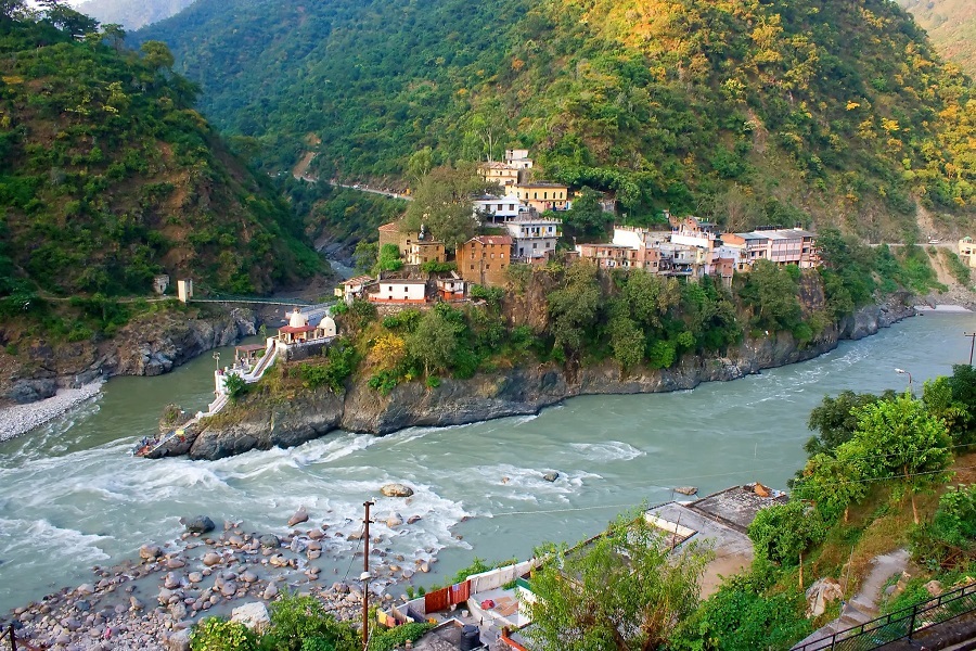
At a distance of 21 Km from Chopta, 32 Km from Karnaprayag, 91 Km from Kedarnath, and 134 Km from Rishikesh, Rudraprayag is a city and a municipality in the Rudraprayag district of Uttarakhand. It is one of the must-include places in Uttarakhand pilgrimage packages.
Located at the junction of the Alaknanda and Mandakini rivers, Rudraprayag represents the fourth of the Panch Prayag, or five confluences of the Alaknanda River, where it merges with the Mandakini. The final confluence occurs at Devprayag, where the Alaknanda joins the Bhagirathi to create the Ganga, which then flows down to the plains. The area was severely impacted by the flash floods of 2013, resulting in significant destruction to both life and property.
Situated at an average altitude of 2,936 feet above sea level, this sacred town in Uttarakhand derives its name from Lord Shiva, who is said to have manifested here in the form of Rudra. According to Hindu mythology, sage Narada performed intense penance to gain the favor of Lord Shiva, who appeared in his Rudra form to grant him blessings. It is also believed that the Pandavas visited this site to atone for the loss of their relatives after the Kurukshetra war.
This location holds great religious importance for Hindus, serving as a vital stop for pilgrims en route to Kedarnath and Badrinath. The region is home to several temples, including Rudranath, Kartik Swami, and ...
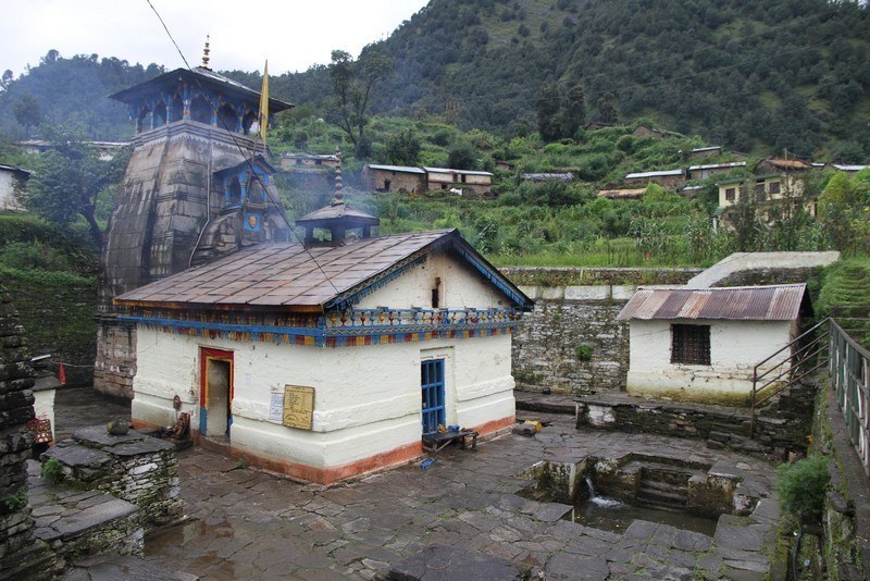
At a distance of 27 km from Kedarnath, 13 km from Gaurikund and 10 km from Sonprayag, Triyugi Narayan Temple is an ancient Hindu temple situated in Triyuginarayan village in Rudraprayag District of Uttarakhand. It lies at an altitude of 1980 m.
Triyugi Narayan Temple is dedicated to Lord Vishnu. The present temple, believed to have been built by Adi Shankaracharya. This temple offers panoramic views of snowcapped mountains with beauty of Garhwal hill region. The word Triyuginarayan is formed of three words tri means three, yugi denotes Yuga and Narayan is another name of Vishnu.
This place is associated with marriage of Lord Shiva and goddess Parvati. According to mythology, Triyuginarayan is the capital of Himavat. It was the venue of the celestial marriage of Shiva and Parvati. Lord Vishnu as Parvati's brother did kanyadaan and Lord Brahma was the priest of the wedding. Brahma Shila in front of the temple also marks the exact place of the wedding.
The architect of this temple resembles Kedarnath Temple. The sanctum houses a 2 feet silver idol of Lord Vishnu accompanied by goddess Lakshmi. There are idols of Badrinarayan, Sita Ramachandra, and Kubera. There is an akhanda jyothi burning inside the sanctum. In front of it there is an idol of Shiva and Parvati blessing devotees in newly wed form. Just outside, there is a saligrama shila of Lord Vishnu in sleeping posture with goddess Lakshmi and Ganesha.
A special feature of this temple is the fire ...
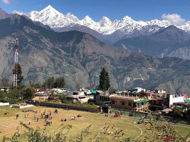
At a distance of 128 Km from Pithoragarh, 197 Km from Almora, and 400 Km from Rishikesh, Munsiyari, or Munsyari is a cozy hamlet located in the Pithoragarh district of Uttarakhand. This pretty little hill town is one of the most scenic offbeat destinations that one must visit as part of the Uttarakhand honeymoon packages.
Situated at an elevation of 2,298 meters, Munsiyari translates to 'place with snow' and is often referred to as Little Kashmir. This charming location is found in the easternmost region of Uttarakhand and lies along the historic salt route from Tibet, serving as the gateway to the Johar Valley. The valley follows the course of the Gori Ganga River, leading to its origin at the Milam Glacier.
Munsiyari is celebrated for its breathtaking views of the snow-covered Himalayan Range, lush forests, tranquil environment, stunning viewpoints, pleasant climate, picturesque trails, and remarkable landscapes. This Kumaon hill town is an ideal destination for those seeking a connection with the mountains and engaging in activities such as trekking, skiing, hiking, and mountaineering, all while immersing themselves in pristine nature.
The town is framed by the majestic Panchachuli range, which stands as its main attraction. In Indian mythology, this cluster of five peaks is believed to be the gateway to heaven for the Pandava brothers. The name Panchachuli translates to 'five hearths,' ...
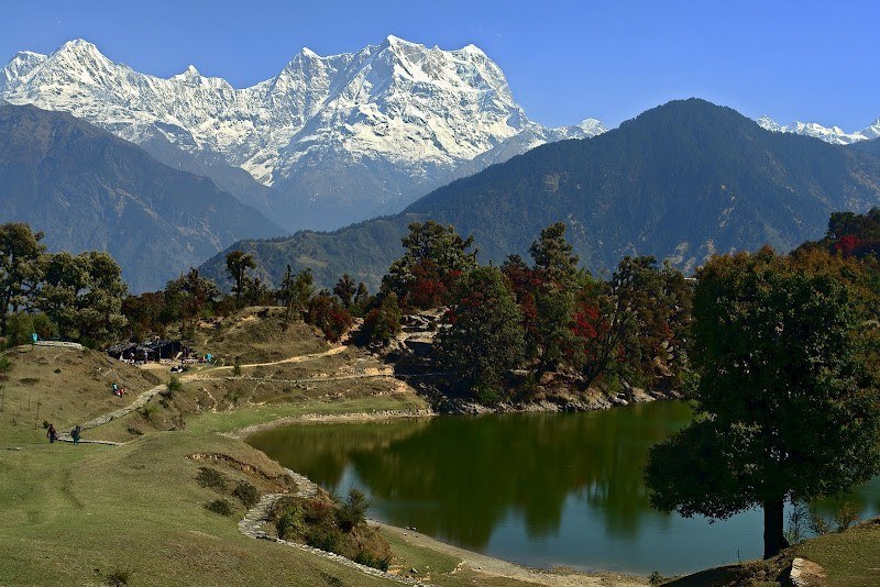
At a distance of 16 km from Ukhimath, 59 km from Gaurikund, 73 km from Kedarnath and 56 km from Rudraprayag, Deoria Tal is a beautiful mountain lake located near Saari village in Uttarakhand. It lies at an altitude of 2438 m about 3 km uphill trek from Saari on Ukhimath-Chopta road. It is a popular destination for trekking near Badrinath and also one of the top Uttarakhand places to visit for trekking.
The lake is surrounded by thick forests and the crystal clear water of this lake offers the reflection of the mighty Chaukhamba peak. It offers a splendid view of Chopta, Tungnath and Chandrashila peak to the right and the breathtaking view of mountains like Chaukhamba, Nilkantha, Bandarpunch, Kedar Range, and Kalanag to the left. It is located in the Nanda Devi Biodiversity Park and has an abundance of colorful birds and mammals.
According to the Hindu mythology, Devas used to bath in this lake hence the name. The lake is also believed to be the Indra Sarovar referred in the Puranas by wandering sages. It is also believed that it was the place from where the Pandavas were asked questions by Yaksha. Deoria Tal serves as a popular trekking destination in the region because of its ease of the trail and soothing scenic beauty. The road is motorable up to Sari, 13 km from Ukhimath and from there one has to trek about 3 km to reach the lake. Jeeps are available from Ukhimath to reach Saari. The path is well marked and passes ...
| Package | Duration | Starting Price | Details |
|---|---|---|---|
| Rishikesh - Haridwar | 4D/3N | ₹ 9950 | View Details |
| Nainital - Jim Corbett | 4D/3N | ₹ 11650 | View Details |
| Mussoorie - Rishikesh - Haridwar | 5D/4N | ₹ 13650 | View Details |
| Nainital - Almora - Ranikhet | 5D/4N | ₹ 14250 | View Details |
| Nainital - Almora - Jim Corbett | 6D/5N | ₹ 16650 | View Details |
Similar Getaways